
Beginner Off-Road Trails
Near Stafford, Oregon
Explore All Beginner Trails Near Stafford, Oregon
Beginner Off-Road Trails Near Stafford, Oregon
Discover the best beginner-friendly off-road trails near you. These easier, lower-rated trails are a great place to start — browse trail maps, check difficulty ratings, and find your next adventure.

Green Mountain Gravel Pits
This route takes you off the main Green Mountain Road, up Green Mountain Middle Road, and to a few gravel pit areas. The route provides a few views of the city of Colton and other cities farther out. The pits are locations with some four-wheeling obstacles and is where a lot of people go to shoot th...
Learn more about Green Mountain Gravel Pits
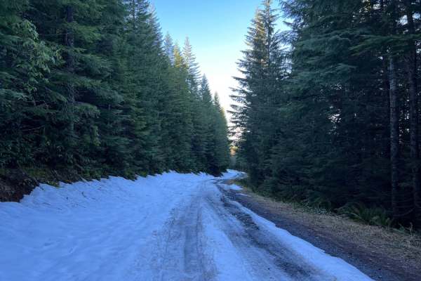
Green Mountain Road
This is one of the main roads heading up to Goat Mountain. There are many spur roads you can take off of Green Mountain Road; just make sure to check the status of gate closures. The area is full of 4x4 and ATV trails. There is snow covering a majority of the road during the winter months.
Learn more about Green Mountain Road
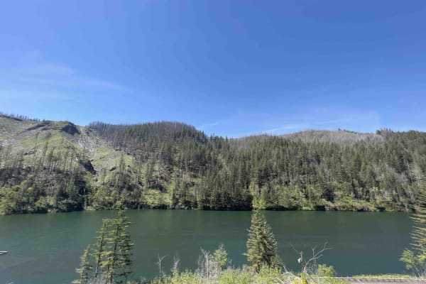
National Forest Development Road 4610
National Forest Development Rd 4610 has changed a lot over the last couple of years as the Riverside forest fire ripped through this area. Be advised that landslides, falling trees, and debris can occur in this area at any time. This road is not at all advised for a car. Road 4610 starts as a paved ...
Learn more about National Forest Development Road 4610
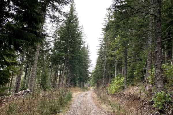
FS 4510
FS 4510 is a generally easy but bumpy gravel trail, characterized by frequent potholes and occasional deep puddles that can make for a rough ride. It can be accessed either from Hillockburn Road or via Green Mountain Road using FS 4510-160. Along the way, several offshoot trails branch out, includi...
Learn more about FS 4510
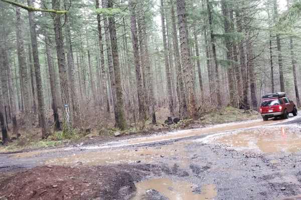
Thoughtful Lunch Trail
This is a super easy, dirt and mud trail that leads to a beautiful viewpoint and camp spot. Gorgeous tree covered hills with large devastating burn patches show the harsh reality of the forest fires. Sit and have lunch while the sun warms your rigs, and you remember how small the problems of home re...
Learn more about Thoughtful Lunch Trail
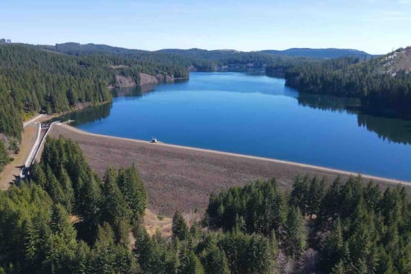
Yamhill Reservoir to Barney Reservoir
Start at the Yamhill Reservoir on Northwest Turner Creek Road, about 8 miles northwest of Yamhill, Oregon. The Yamhill Reservoir is a small body of water on the south side of the road, and just past the Yamhill Reservoir is the water treatment plant. After the water treatment plant is a gate. As wit...
Learn more about Yamhill Reservoir to Barney Reservoir
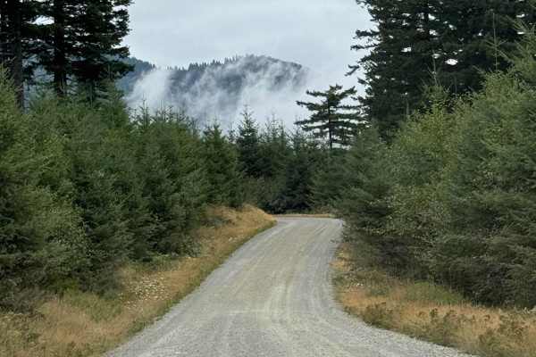
L-1000
This is a point-to-point trail that will connect you between 2 other trails in the area. It will also lead you to the Yacoult Burn Trailhead where you can access the area's hiking trail. There is also access to Cold Creek Campground. The trail is mainly a wide gravel road that is comprised of loose ...
Learn more about L-1000
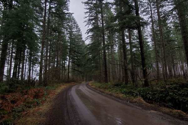
Abbott Road 4610
This road takes you up the mountain past the La Dee Flats staging area out towards the quarries. The staging area has raised loading docks for loading and unloading trailers. It goes past the La Dee Flats OHV play area. Fires have created weak limbs. Avoid when windy. There are tons of spin-off trai...
Learn more about Abbott Road 4610

Abbott Road 6410 Quarry Split
Turn to follow Abbott road towards the quarry. Here the difficulty kicks it up a notch. Deep ruts and pits are hard to judge in the winter months due to puddling. Most are safe;some are not. Snow risk ups dramatically in winter at this point. An awesome short but important trail to join the beginnin...
Learn more about Abbott Road 6410 Quarry Split
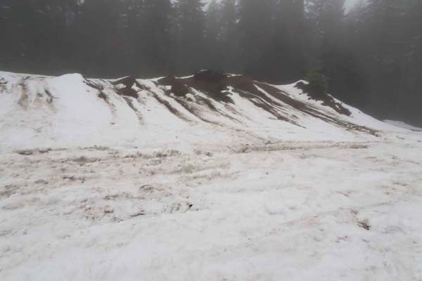
Quarry Head Trail
This is a trail to the small quarry before the main quarry. Rough roads cut by winter snow may make 4x4 a requirement. Winter months bring deeply rutted snowbanks that will force you into potholes. Have quality tires if attempting in winter. At the end of the trail, it opens to the most amazing flat...
Learn more about Quarry Head Trail

Mt. Hood NFSR 4613000
Road 4613 is the back route to get up to the LaDee Flats OHV staging area and the North Fork Quarry OHV Area. This road takes you through the Mount Hood National Forest past waterfalls, creeks, rivers, 60 foot Douglas Fir Trees and gives you stunning views of Mount St. Helens. 4613 is a gravel road...
Learn more about Mt. Hood NFSR 4613000
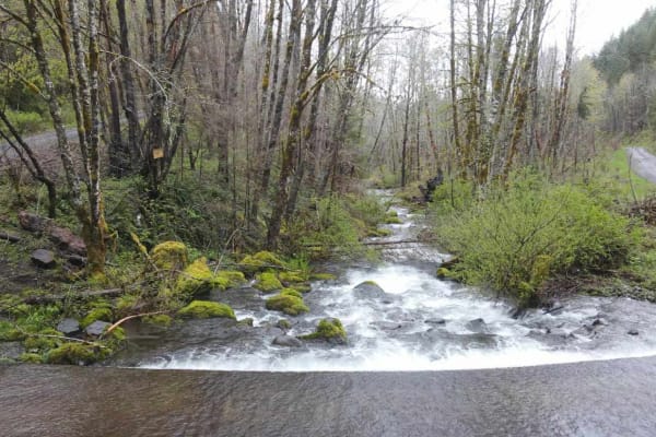
Horse Creek Road
Horse Creek Road connects the Santiam State Forest entrance area with the Molalla River. It starts on South Family Camp Road and goes to the South Fork Molalla River Road. The Santiam State Forest may be closed because of forest fire damage. Horse Creek Road crosses several private properties, so cl...
Learn more about Horse Creek Road

Larch Mountain L-1500
Larch Mountain L-1500 is located in the Yacolt Burn State Forest which encompasses 90,000 acres of forest in Southwest Washington. During the winter and spring, this area isn't advised for vehicle traffic as it is covered in snow. Late spring, summer and fall are the best times to enjoy this area. A...
Learn more about Larch Mountain L-1500
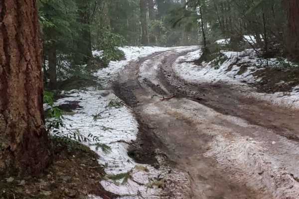
OHV Abbott Road Quarry
This sneaky hidden side trail opens up to another bigger quarry play area. It's short; it's sweet. But it's good to know how to find it since you can pass right over it. There is a hidden trail around to the left; take the calm, easy path. Take the other two paths only if you dare. The end of this p...
Learn more about OHV Abbott Road Quarry
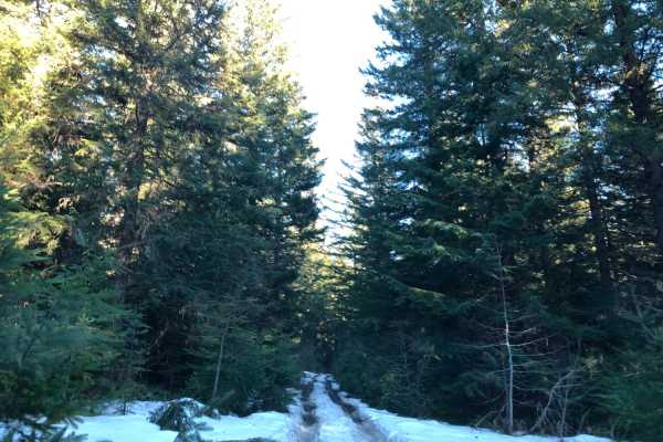
La Dee Flats
Area consisting of many 4x4 and ATV trails that branch off of main roads. The road itself is gravel with many potholes. During the winter, snow will cover a majority of the area allowing for great snow wheeling. Easy to spend a full day exploring all of the local trails.
Learn more about La Dee Flats

Northwest Bacona Road
As you travel this road, you will pass through multiple private timberlands and BLM and you will be met with beautiful views, wildlife (if lucky), bicyclists, and vehicles. This crosses paths with the Banks-Vernonia trail as well. Be on the lookout for log trucks and keep an eye out for pull-outs--t...
Learn more about Northwest Bacona Road
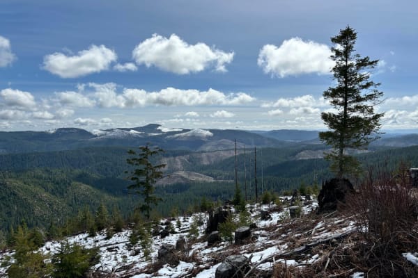
Gobblers Knob
Gobblers Knob is a 3,054-foot hill in the Tillamook State Forest south of the North Fork Trask River. It offers a spectacular view of the surrounding forest and mountains, especially to the south. The trail is not difficult aside from the final climb to the summit. Of course, weather conditions will...
Learn more about Gobblers Knob
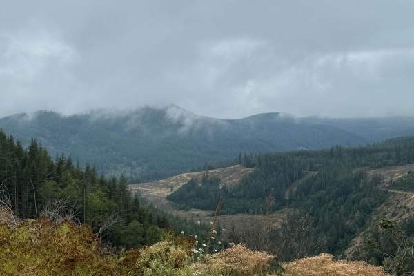
CG 1400 Connecting Trail
This is mainly a loose grave trail but there are short sections where the trail becomes hard pack gravel. The trail has some minor ruts and washouts along the way. The trail is wide enough to allow for passing in most areas there are however a few areas where the trail narrows and passing is not pos...
Learn more about CG 1400 Connecting Trail
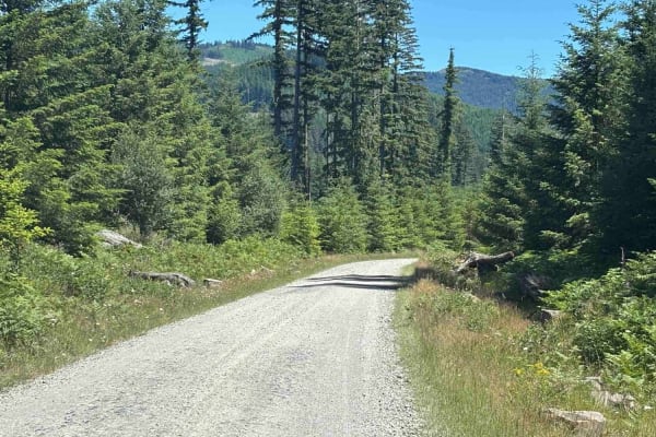
Cold Creek Camp
On this trail, expect a peaceful atmosphere with a well-maintained gravel road. Most vehicles can handle it in dry conditions with no 4WD needed. You'll cruise at 15 to 25 mph, kicking up a bit of dust when there are dry conditions. The campground is open Thursday through Monday and has 9 spots. Ver...
Learn more about Cold Creek Camp

L-1200
L-1200 is located in the Yacolt Burn State Forest. It's an easy gravel road that is well maintained by the state. Once on the trail, you will first cross the West Fork Washougal River where you can stop and enjoy the scenery and the small waterfall and even camp if you'd like. From there you continu...
Learn more about L-1200
Beginner ATV trails near Stafford, Oregon
Explore ATV-friendly trails near you. These trails are accessible for vehicles up to 50 inches wide, perfect for ATVs and smaller off-road machines.
Green Mountain Gravel Pits
This route takes you off the main Green Mountain Road, up Green Mountain Middle Road, and to a few gravel pit areas. The route provides a few views of the city of Colton and other cities farther out. The pits are locations with some four-wheeling obstacles and is where a lot of people go to shoot th...
Learn more about Green Mountain Gravel Pits
Green Mountain Road
This is one of the main roads heading up to Goat Mountain. There are many spur roads you can take off of Green Mountain Road; just make sure to check the status of gate closures. The area is full of 4x4 and ATV trails. There is snow covering a majority of the road during the winter months.
Learn more about Green Mountain Road
National Forest Development Road 4610
National Forest Development Rd 4610 has changed a lot over the last couple of years as the Riverside forest fire ripped through this area. Be advised that landslides, falling trees, and debris can occur in this area at any time. This road is not at all advised for a car. Road 4610 starts as a paved ...
Learn more about National Forest Development Road 4610
Thoughtful Lunch Trail
This is a super easy, dirt and mud trail that leads to a beautiful viewpoint and camp spot. Gorgeous tree covered hills with large devastating burn patches show the harsh reality of the forest fires. Sit and have lunch while the sun warms your rigs, and you remember how small the problems of home re...
Learn more about Thoughtful Lunch Trail
Beginner UTV/side-by-side trails near Stafford, Oregon
Find UTV and side-by-side trails near you. These trails accommodate vehicles up to 60 inches wide, ideal for UTVs, side-by-sides, and wider off-road rigs.
Green Mountain Gravel Pits
This route takes you off the main Green Mountain Road, up Green Mountain Middle Road, and to a few gravel pit areas. The route provides a few views of the city of Colton and other cities farther out. The pits are locations with some four-wheeling obstacles and is where a lot of people go to shoot th...
Learn more about Green Mountain Gravel Pits
Green Mountain Road
This is one of the main roads heading up to Goat Mountain. There are many spur roads you can take off of Green Mountain Road; just make sure to check the status of gate closures. The area is full of 4x4 and ATV trails. There is snow covering a majority of the road during the winter months.
Learn more about Green Mountain Road
National Forest Development Road 4610
National Forest Development Rd 4610 has changed a lot over the last couple of years as the Riverside forest fire ripped through this area. Be advised that landslides, falling trees, and debris can occur in this area at any time. This road is not at all advised for a car. Road 4610 starts as a paved ...
Learn more about National Forest Development Road 4610
Thoughtful Lunch Trail
This is a super easy, dirt and mud trail that leads to a beautiful viewpoint and camp spot. Gorgeous tree covered hills with large devastating burn patches show the harsh reality of the forest fires. Sit and have lunch while the sun warms your rigs, and you remember how small the problems of home re...
Learn more about Thoughtful Lunch Trail
The onX Offroad Difference
onX Offroad combines trail photos, descriptions, difficulty ratings, width restrictions, seasonality, and more in a user-friendly interface. Available on all devices, with offline access and full compatibility with CarPlay and Android Auto. Discover what you're missing today!
Open Trail Map