
Beginner Off-Road Trails
Near Soperton, Georgia
Explore All Beginner Trails Near Soperton, Georgia
Beginner Off-Road Trails Near Soperton, Georgia
Discover the best beginner-friendly off-road trails near you. These easier, lower-rated trails are a great place to start — browse trail maps, check difficulty ratings, and find your next adventure.
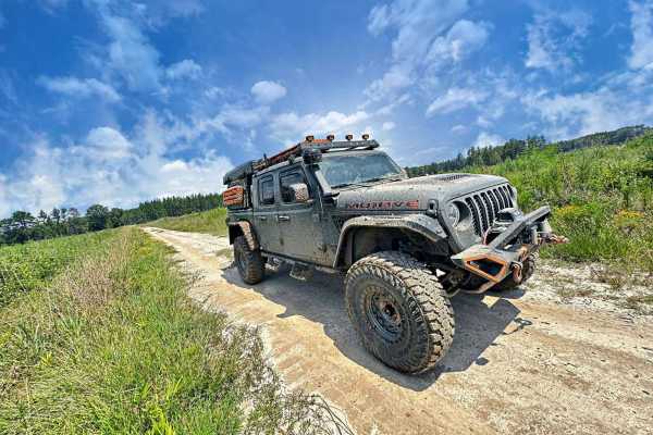
Bullard Altamaha River Loop
Central Georgia woods in country farm land trail that is very scenic with vegetation and animals. This trail follows along the Altamaha River that the World Famous Survivor Man Show couldn't complete. Watch to see Deer, Small Game, Turtles, and Alligators. This trail also crosses the Georgia Overlan...
Learn more about Bullard Altamaha River Loop
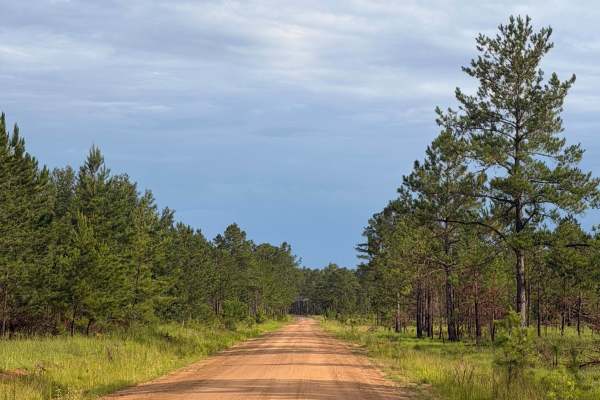
FS 9
FS 9 is a quiet forest road that winds through Fort Stewart’s longleaf pine ecosystem, offering a peaceful drive beneath towering pines and through open forest habitat. The route is primarily composed of sandy roads with gentle curves and occasional puddles after rainfall. Wildlife sightings are com...
Learn more about FS 9
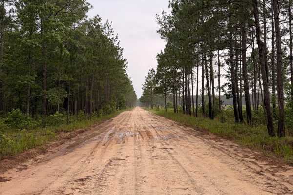
FS 4
FS 4 is a scenic forest road that winds through the longleaf pine ecosystem of Fort Stewart. The route features wide sandy roads, gentle curves, and peaceful stretches beneath towering pines, making it ideal for a relaxing drive through one of Georgia’s largest public recreation areas. Along the rou...
Learn more about FS 4
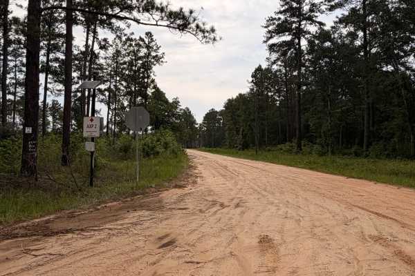
FS 20
FS 20 is an 11-mile forest road located within Fort Stewart that winds through beautiful pine forests with long stretches of sugar sand, seasonal puddles, and occasional rutted sections. The route offers a peaceful drive and provides access to other forest roads, wildlife viewing opportunities, and ...
Learn more about FS 20
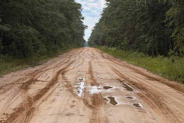
FS 129
FS 129 is a scenic sand road that winds through the longleaf pine forests of Fort Stewart, offering miles of easy overland travel with several creek crossings and forest bridges. The route features wide sandy roads, occasional mud holes after rain, military landmarks, and expansive pine stands that ...
Learn more about FS 129
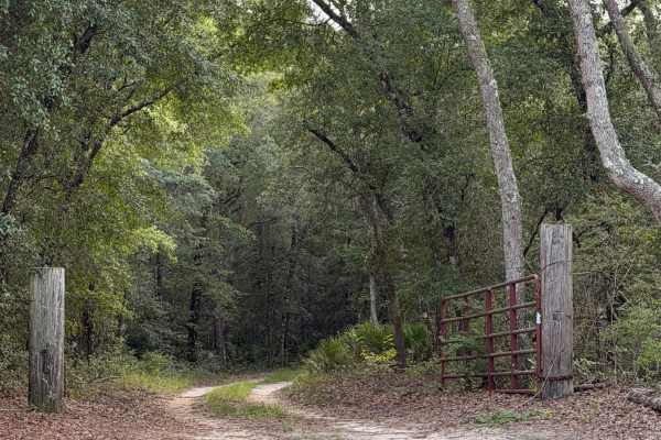
Lower Road
Lower Road branches off Johnson’s Bridge Trail and travels deeper into Griffin Ridge Wildlife Management Area through a mix of sandy two-track, gravel, and seasonal mud. The road winds beneath a dense canopy of oaks and pines, with several shallow mud holes and low-lying areas that can hold water af...
Learn more about Lower Road
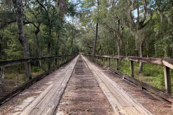
Johnson's Bridge Trail
Johnson’s Bridge Trail is an easy scenic route through Griffin Ridge Wildlife Management Area that begins with a historic wooden bridge crossing low Altamaha River floodplain wetlands. Beyond the bridge, the trail winds through hardwoods, palmettos, and pine forests while providing access to additio...
Learn more about Johnson's Bridge Trail
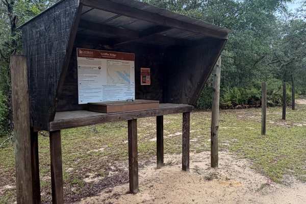
Griffin Ridge WMA
Griffin Ridge Wildlife Management Area (WMA) offers a scenic drive through longleaf pine forests, oak hammocks, and palmetto flats on sandy forest roads. The route is generally suitable for stock 4WD vehicles in dry conditions, but recent rain can create standing water, muddy sections, and soft sand...
Learn more about Griffin Ridge WMA
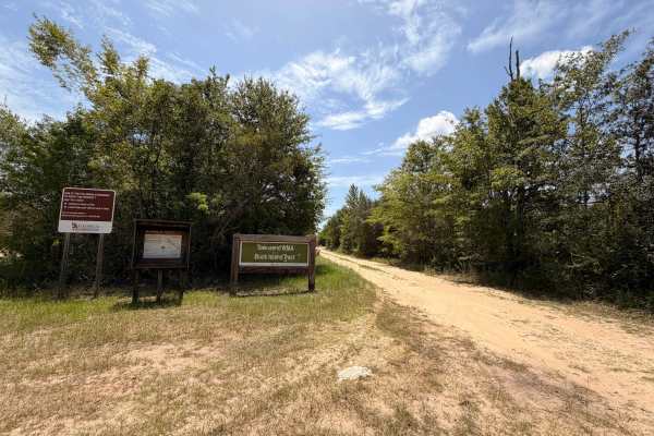
Buck Island Boat Ramp Trail
Buck Island Boat Ramp Road is a 0.8-mile point-to-point dirt trail rated 3 out of 10 located within the Buck Island Tract of Townsend Wildlife Management Area in Long County, Georgia. Access to the Wildlife Management Area requires a valid Georgia hunting license, fishing license, or Georgia Lands P...
Learn more about Buck Island Boat Ramp Trail
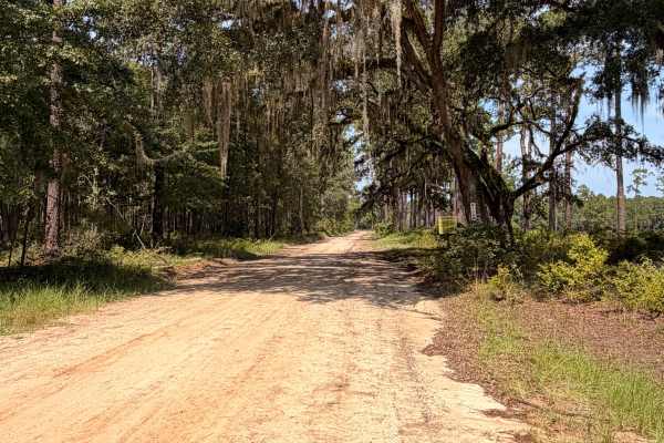
FS 102
FS 102 is a short dirt route on Fort Stewart that provides access to Canoochee River Landing 7 and three managed fishing ponds along the way. The route begins as a wide, maintained sandy road through pine forest before transitioning into a narrower and less-maintained two-track closer to the river. ...
Learn more about FS 102
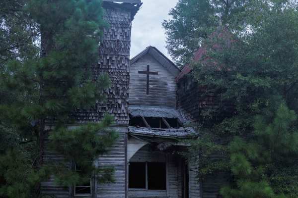
Oak Grove Methodist Church
This route is entirely within the Tuckahoe Wildlife Management Area, a 15,000-acre property bordering the Savannah River. This route spurs from Pine Grove Inn Road and leads to the Old Oak Grove Methodist Church. The church was established in 1876 after the Civil War and was a center of religion for...
Learn more about Oak Grove Methodist Church
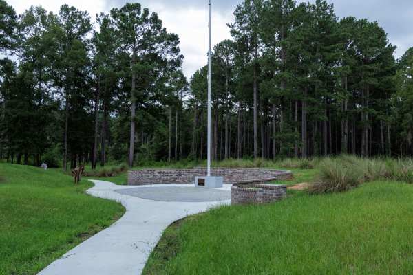
Brier Creek Access
This route is entirely within the Tuckahoe Wildlife Management Area, a 15,000-acre property bordering the Savannah River. A fishing and/or hunting license is required to legally enter the property and can be obtained via georgiawildlife.com/tuckahoe-wma. Camping is only permitted in one of the two d...
Learn more about Brier Creek Access
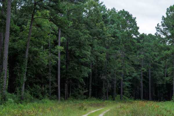
Clay Hill
This route is entirely within the Tuckahoe Wildlife Management Area, a 15,000-acre property bordering the Savannah River. A fishing and/or hunting license is required to legally enter the property and can be obtained via georgiawildlife.com/tuckahoe-wma. Camping is only permitted in one of the two d...
Learn more about Clay Hill
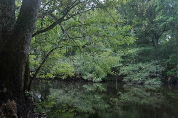
Collard Patch Lake Access
This route is entirely within the Tuckahoe Wildlife Management Area, a 15,000-acre property bordering the Savannah River. A fishing and/or hunting license is required to legally enter the property and can be obtained via georgiawildlife.com/tuckahoe-wma. Camping is only permitted in one of the two d...
Learn more about Collard Patch Lake Access
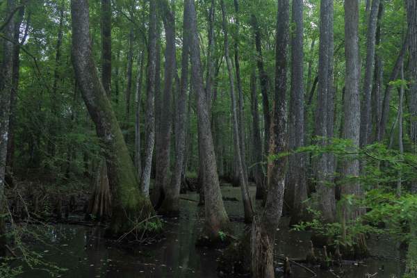
Briarpatch Lake Access
This route is entirely within the Tuckahoe Wildlife Management Area, a 15,000-acre property bordering the Savannah River. A fishing and/or hunting license is required to legally enter the property and can be obtained via georgiawildlife.com/tuckahoe-wma. Camping is only permitted in one of the two d...
Learn more about Briarpatch Lake Access
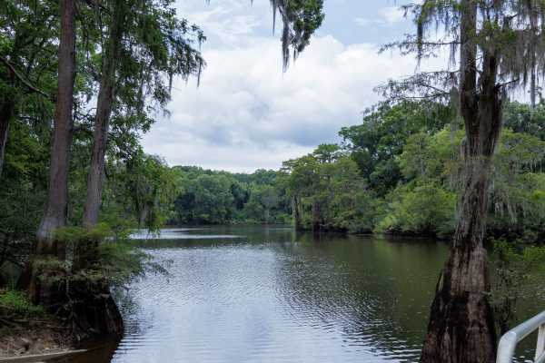
Miller Lake Access
This route is entirely within the Tuckahoe Wildlife Management Area, a 15,000-acre property bordering the Savannah River. A fishing and/or hunting license is required to legally enter the property and can be obtained via georgiawildlife.com/tuckahoe-wma. Camping is only permitted in one of the two d...
Learn more about Miller Lake Access
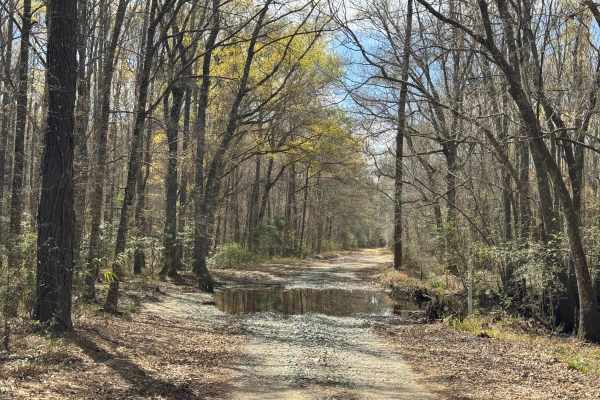
Logging Road
Logging Road is an out-and-back trail and is the primary access trail for a large private southern pine harvest operation on the north end of Townsend WMA, so it gets a fair amount of traffic from logging equipment and worker transport vehicles. The southern portions are primarily packed dirt augmen...
Learn more about Logging Road
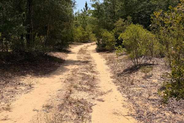
Swamp Camp Trail
Swamp Camp Trail is a scenic forest road located within Townsend Wildlife Management Area. The route winds through dense hardwoods, palmettos, and pine forest over a mixture of packed dirt and sugar sand. Most of the trail is easy to navigate in dry conditions, but several sections contain deep sand...
Learn more about Swamp Camp Trail
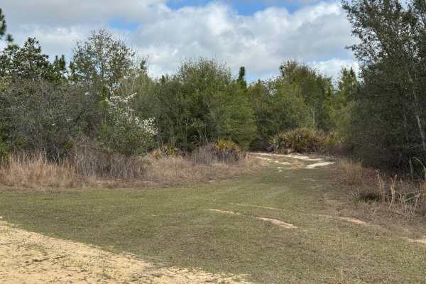
Hunting Road
Hunting Road trail parallels the middle section of Fishing Road trail for just over two miles and is much more primitive and less traveled than Fishing Road trail. The trail is barely one vehicle wide, with few places for two vehicles to pass. Trail pinstripes are guaranteed as the scrub and tree br...
Learn more about Hunting Road
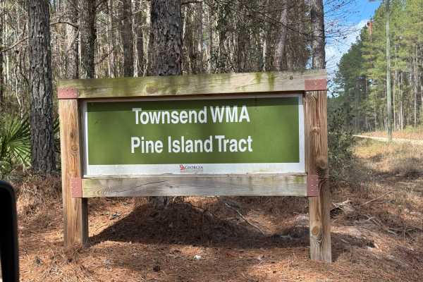
Island Road
Island Road trail is an out-and-back trail due to a closed gate on the northern end. It also provides access to the Logging Road trail and a number of other unmarked spurs in the area. The trail surface is packed dirt with crushed rock as a stabilizer. There are several wet spots and mudholes along ...
Learn more about Island Road
Beginner ATV trails near Soperton, Georgia
Explore ATV-friendly trails near you. These trails are accessible for vehicles up to 50 inches wide, perfect for ATVs and smaller off-road machines.
Brier Creek Access
This route is entirely within the Tuckahoe Wildlife Management Area, a 15,000-acre property bordering the Savannah River. A fishing and/or hunting license is required to legally enter the property and can be obtained via georgiawildlife.com/tuckahoe-wma. Camping is only permitted in one of the two d...
Learn more about Brier Creek Access
Clay Hill
This route is entirely within the Tuckahoe Wildlife Management Area, a 15,000-acre property bordering the Savannah River. A fishing and/or hunting license is required to legally enter the property and can be obtained via georgiawildlife.com/tuckahoe-wma. Camping is only permitted in one of the two d...
Learn more about Clay Hill
Collard Patch Lake Access
This route is entirely within the Tuckahoe Wildlife Management Area, a 15,000-acre property bordering the Savannah River. A fishing and/or hunting license is required to legally enter the property and can be obtained via georgiawildlife.com/tuckahoe-wma. Camping is only permitted in one of the two d...
Learn more about Collard Patch Lake Access
Briarpatch Lake Access
This route is entirely within the Tuckahoe Wildlife Management Area, a 15,000-acre property bordering the Savannah River. A fishing and/or hunting license is required to legally enter the property and can be obtained via georgiawildlife.com/tuckahoe-wma. Camping is only permitted in one of the two d...
Learn more about Briarpatch Lake Access
Beginner UTV/side-by-side trails near Soperton, Georgia
Find UTV and side-by-side trails near you. These trails accommodate vehicles up to 60 inches wide, ideal for UTVs, side-by-sides, and wider off-road rigs.
Bullard Altamaha River Loop
Central Georgia woods in country farm land trail that is very scenic with vegetation and animals. This trail follows along the Altamaha River that the World Famous Survivor Man Show couldn't complete. Watch to see Deer, Small Game, Turtles, and Alligators. This trail also crosses the Georgia Overlan...
Learn more about Bullard Altamaha River Loop
Brier Creek Access
This route is entirely within the Tuckahoe Wildlife Management Area, a 15,000-acre property bordering the Savannah River. A fishing and/or hunting license is required to legally enter the property and can be obtained via georgiawildlife.com/tuckahoe-wma. Camping is only permitted in one of the two d...
Learn more about Brier Creek Access
Clay Hill
This route is entirely within the Tuckahoe Wildlife Management Area, a 15,000-acre property bordering the Savannah River. A fishing and/or hunting license is required to legally enter the property and can be obtained via georgiawildlife.com/tuckahoe-wma. Camping is only permitted in one of the two d...
Learn more about Clay Hill
Collard Patch Lake Access
This route is entirely within the Tuckahoe Wildlife Management Area, a 15,000-acre property bordering the Savannah River. A fishing and/or hunting license is required to legally enter the property and can be obtained via georgiawildlife.com/tuckahoe-wma. Camping is only permitted in one of the two d...
Learn more about Collard Patch Lake Access
The onX Offroad Difference
onX Offroad combines trail photos, descriptions, difficulty ratings, width restrictions, seasonality, and more in a user-friendly interface. Available on all devices, with offline access and full compatibility with CarPlay and Android Auto. Discover what you're missing today!
Open Trail Map