
Beginner Off-Road Trails
Near La Habra Heights, California
Explore All Beginner Trails Near La Habra Heights, California
Beginner Off-Road Trails Near La Habra Heights, California
Discover the best beginner-friendly off-road trails near you. These easier, lower-rated trails are a great place to start — browse trail maps, check difficulty ratings, and find your next adventure.
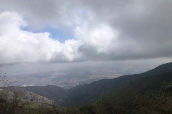
FS 4S03
Scenic trail from the 15 Freeway to Santiago Peak. The dirt road is hard-packed and easy to navigate, but does have a few sections with sharp rocks and a few ruts. The road has multiple stop locations for great views towards Riverside. This area is also popular with dirt bikes and hikers.
Learn more about FS 4S03
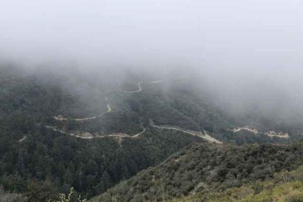
Maple Spring Road
Maple Springs road offers a fun, relatively easy route with scenic views of the Cleveland National Forest. Vehicles should have some ground clearance. At the end of the trail is an elevated patch of asphalt that appears to be a helicopter pad. The trail is shared with dirt bikes, hikers and riders o...
Learn more about Maple Spring Road
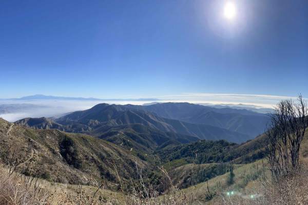
North Main Divide Road
Tucked amidst the hustle and bustle of Southern California's heavily-populated coast is a slice of heaven called the Cleveland National Forest. This mountainous region is undeveloped, save for a few great trails connecting world-class views to cozy campgrounds. The North Main Divide Road enters the ...
Learn more about North Main Divide Road

3S04 Main Divide to Santiago Peak
The Main Divide is composed of 3 sections, all of which are easy going trails that can be done with any high clearance 4x4 or a low clearance AWD vehicle with care. This trail offers some of the most amazing views of the Temescal Valley below and Los Angeles beyond. On a clear day you can see all th...
Learn more about 3S04 Main Divide to Santiago Peak
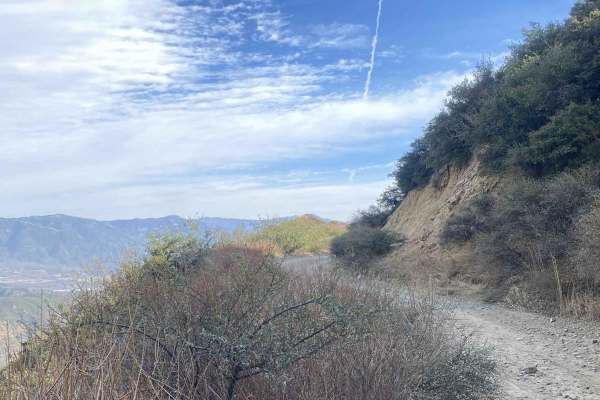
Big Tree Cucamonga - 1N34
This trail is a rough dirt road with mostly hardpack dirt, gravel, and small-sized rocks. There is some overgrowth, so plan to collect some pinstripes! The overgrowth gets worse as the trail progresses and is severe past the campground. This is an out-and-back trail ending just past the Joe Elliot Y...
Learn more about Big Tree Cucamonga - 1N34

4N11
The trail starts as a well-maintained road (Big Rock Creek) from the west, or Angeles Crest if starting from the east. It is a short trail, but is very scenic and has creek crossings during certain times of the year. There are also mature trees that provide shade throughout most of the trail. During...
Learn more about 4N11

3N26
Trail head starts on Angeles Crest Highway at the Vincent Gap Turnout. It is a very short trail that leads to a locked gate at Jackson Flat Camping Area. The scenery during this trail consists of mature trees providing plenty of shade throughout the trail, views of the Antelope Valley from above, an...
Learn more about 3N26
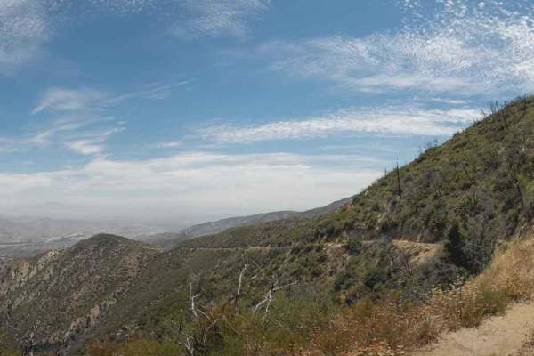
5S01 Indian Truck Trail
5S01 Indian Truck Trail is a 7-mile point-to-point trail rated 3 of 10 located within the Cleveland National Forest, Trabuco Ranger District. Indian Truck Trail ascends 2,500 feet over the 7-mile drive from the Temescal Canyon to the North Main Divide. This is a limited access trail restricted to st...
Learn more about 5S01 Indian Truck Trail
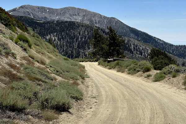
Blue Ridge Truck Trail
This trail is a pretty drive along Blue Ridge in the eastern San Gabriel Mountains. The trail overlooks Mount Baden-Powell, Vincent Gulch, Pine Mountain/Pine Mountain Ridge, the Mountain High ski resort, Wright Mountain, and of course, the towering Mount San Antonio. The trail begins along CA Highwa...
Learn more about Blue Ridge Truck Trail
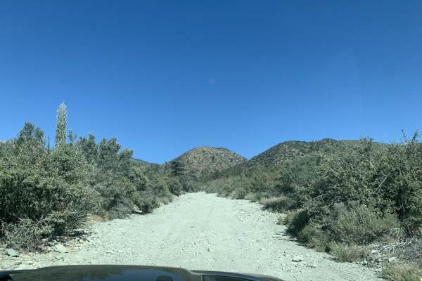
Slade Canyon
Slade Canyon is a short, scenic climb perfect for beginner offroaders looking to escape into the San Bernardino National Forest and enjoy panoramic mountain views above the Lytle Creek area. Stretching approximately 2.8 miles, this route begins near the creek bed at an elevation of 5,228 feet and cl...
Learn more about Slade Canyon
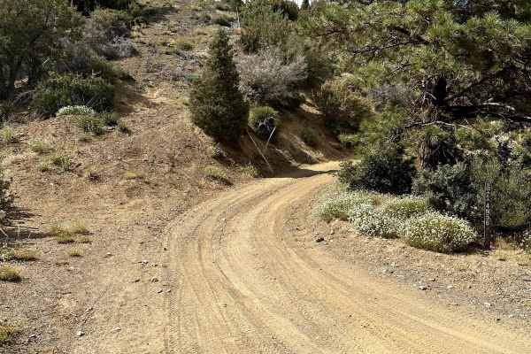
Pinyon Ridge Truck Trail
This is a mellow trail along Pinyon Ridge, which is just west of Vincent Gap and Blue Ridge. The trail itself is mellow and surrounded by - you guessed it - single-leaf/needle Pinyon pine trees, which are the namesake of the ridge and native to only the Western United States. There are no less than ...
Learn more about Pinyon Ridge Truck Trail
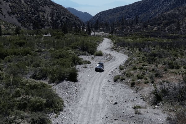
Stockton Flats
Stockton Flats is a scenic and easy-to-moderate off-road trail located in the Lytle Creek area of the San Bernardino National Forest. The trail is generally 2WD-friendly, though it is rocky in some sections, so a vehicle with a bit of ground clearance is recommended for a smooth ride. The trail wind...
Learn more about Stockton Flats
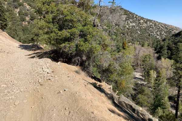
Mescal Canyon Road
Mescal Canyon Road is an ideal trail for beginner offroaders and scenic explorers looking for an accessible dirt route that transitions beautifully between the high desert and the pine-covered slopes near Wrightwood. Spanning approximately 3.1 miles through the San Gabriel Mountains, this point-to-p...
Learn more about Mescal Canyon Road
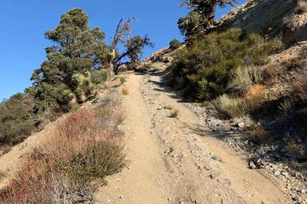
Big John Flat
The trail starts as a well maintained dirt road. About a 3 miles into the trail, the dirt is softer and the trail thins to one vehicle wide. There are two hill climbs that will require 4WD due to softer dirt and deep rutted off camber terrain. If rain or snow occur, the trail will become very diffic...
Learn more about Big John Flat

Old Cc Spur - 2N57
This is a 1.4-mile, well-maintained, easy gravel spur road that connects Lytle Creek Road and Lower Lytle Creek Divide - 3N31. This spur road is a convenient way to access Lower Lytle Creek Divide - 3N31, which is an 8.5-mile fun, scenic ridgeline trail above Lytle Creek.
Learn more about Old Cc Spur - 2N57

Meyers Canyon - 1N33
This trail goes from the East side of Lytle Creek Road up to 3N31. There is a bit of a wash area at the start, and it slowly works its way up in elevation. Starting at Lytle Creek Road, you will come to a Y, stay to the right, and start climbing in elevation. If you go left (straight) you will end ...
Learn more about Meyers Canyon - 1N33
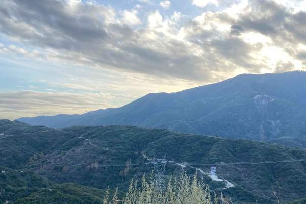
Renstock Ridge Spur A - 2N79A
2N79A takes you from 2N79 to an outlook point looking South, overlooking the city. There are some offshoots and alternative social trails along this route that should not be followed in order to maintain the integrity of this local trail system. The terrain is mostly hardpack dirt and goes past a co...
Learn more about Renstock Ridge Spur A - 2N79A
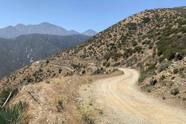
Upper Lytle Creek Divide
The trail consists mainly of dirt, rocks, and some roots. It is wide enough for one vehicle, but there are turnouts for passing throughout the trail. Stock height 2WD SUV and truck-type vehicles are capable of completing this trail. There are some soft and loose dirt areas, but they are not an issue...
Learn more about Upper Lytle Creek Divide
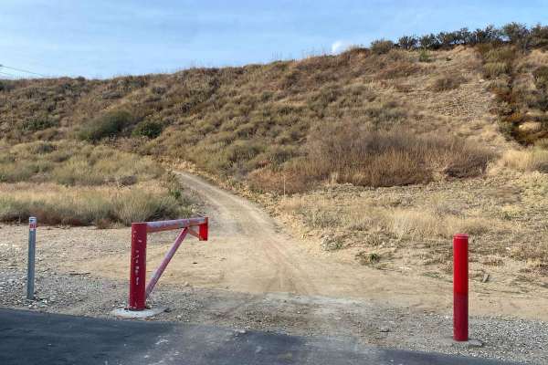
Edison Road Section 3 - 1N32
This trail goes from Gray Pine Pl. up to 3N31. Starting the trail off of Gray Pine Place you will find yourself in a subdivision, the access is between two houses and is marked as such. Please respect the neighborhood, don't make a mess, and keep noise under control. This trail can be best described...
Learn more about Edison Road Section 3 - 1N32
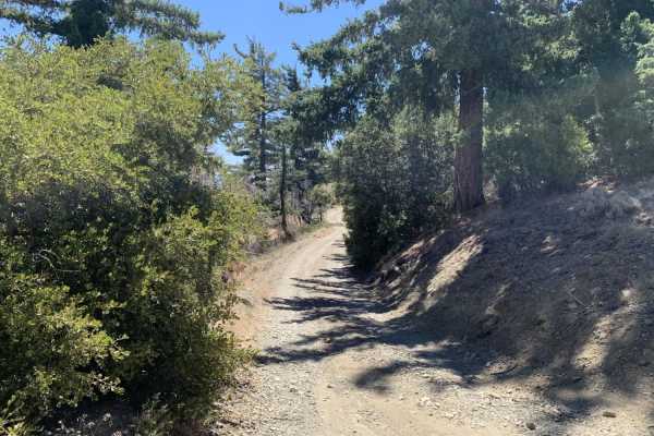
Gobblers Knob Spur A
This is a beautiful trail that leads you to the highest point within the little set of trails in this area. It also connects at the top with the Pacific Crest Trail (PCT). Be careful when you reach the top because it is possible for you to find hikers on the PCT at most times of the year. The road i...
Learn more about Gobblers Knob Spur A
Beginner ATV trails near La Habra Heights, California
Explore ATV-friendly trails near you. These trails are accessible for vehicles up to 50 inches wide, perfect for ATVs and smaller off-road machines.
3N26
Trail head starts on Angeles Crest Highway at the Vincent Gap Turnout. It is a very short trail that leads to a locked gate at Jackson Flat Camping Area. The scenery during this trail consists of mature trees providing plenty of shade throughout the trail, views of the Antelope Valley from above, an...
Learn more about 3N26
Blue Ridge Truck Trail
This trail is a pretty drive along Blue Ridge in the eastern San Gabriel Mountains. The trail overlooks Mount Baden-Powell, Vincent Gulch, Pine Mountain/Pine Mountain Ridge, the Mountain High ski resort, Wright Mountain, and of course, the towering Mount San Antonio. The trail begins along CA Highwa...
Learn more about Blue Ridge Truck Trail
Pinyon Ridge Truck Trail
This is a mellow trail along Pinyon Ridge, which is just west of Vincent Gap and Blue Ridge. The trail itself is mellow and surrounded by - you guessed it - single-leaf/needle Pinyon pine trees, which are the namesake of the ridge and native to only the Western United States. There are no less than ...
Learn more about Pinyon Ridge Truck Trail
Old Cc Spur - 2N57
This is a 1.4-mile, well-maintained, easy gravel spur road that connects Lytle Creek Road and Lower Lytle Creek Divide - 3N31. This spur road is a convenient way to access Lower Lytle Creek Divide - 3N31, which is an 8.5-mile fun, scenic ridgeline trail above Lytle Creek.
Learn more about Old Cc Spur - 2N57
Beginner UTV/side-by-side trails near La Habra Heights, California
Find UTV and side-by-side trails near you. These trails accommodate vehicles up to 60 inches wide, ideal for UTVs, side-by-sides, and wider off-road rigs.
3N26
Trail head starts on Angeles Crest Highway at the Vincent Gap Turnout. It is a very short trail that leads to a locked gate at Jackson Flat Camping Area. The scenery during this trail consists of mature trees providing plenty of shade throughout the trail, views of the Antelope Valley from above, an...
Learn more about 3N26
Blue Ridge Truck Trail
This trail is a pretty drive along Blue Ridge in the eastern San Gabriel Mountains. The trail overlooks Mount Baden-Powell, Vincent Gulch, Pine Mountain/Pine Mountain Ridge, the Mountain High ski resort, Wright Mountain, and of course, the towering Mount San Antonio. The trail begins along CA Highwa...
Learn more about Blue Ridge Truck Trail
Pinyon Ridge Truck Trail
This is a mellow trail along Pinyon Ridge, which is just west of Vincent Gap and Blue Ridge. The trail itself is mellow and surrounded by - you guessed it - single-leaf/needle Pinyon pine trees, which are the namesake of the ridge and native to only the Western United States. There are no less than ...
Learn more about Pinyon Ridge Truck Trail
Old Cc Spur - 2N57
This is a 1.4-mile, well-maintained, easy gravel spur road that connects Lytle Creek Road and Lower Lytle Creek Divide - 3N31. This spur road is a convenient way to access Lower Lytle Creek Divide - 3N31, which is an 8.5-mile fun, scenic ridgeline trail above Lytle Creek.
Learn more about Old Cc Spur - 2N57
The onX Offroad Difference
onX Offroad combines trail photos, descriptions, difficulty ratings, width restrictions, seasonality, and more in a user-friendly interface. Available on all devices, with offline access and full compatibility with CarPlay and Android Auto. Discover what you're missing today!
Open Trail Map