
Beginner Off-Road Trails
Near Kirby, Arkansas
Explore All Beginner Trails Near Kirby, Arkansas
Beginner Off-Road Trails Near Kirby, Arkansas
Discover the best beginner-friendly off-road trails near you. These easier, lower-rated trails are a great place to start — browse trail maps, check difficulty ratings, and find your next adventure.
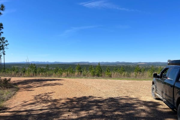
Rock Creek to Pine Ridge
Rock Creek to Pine Ridge is a well graded gravel road two vehicles wide leading to the Rock Creek Camping area along Lake Greeson. This well-maintained road follows along Pine Ridge with incredible views of the Quachita Mountains to the north. This section of road can be driven in a low clearance 2w...
Learn more about Rock Creek to Pine Ridge
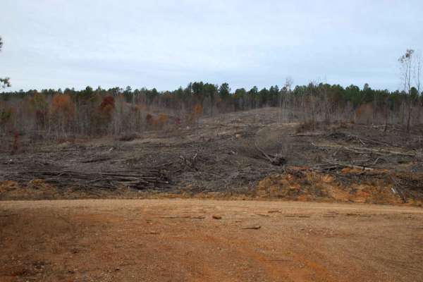
Buck Valley
Lake Greeson WMA is a leased land WMA, meaning hunters, trappers, and campers 16 years of age or older must purchase a Lake Greeson WMA leased lands permit (LLG) along with a free annual General Use Permit (WMP). Permits are available online https://www.agfc.com/wma/lake-greeson-wma/ , by clicking "...
Learn more about Buck Valley
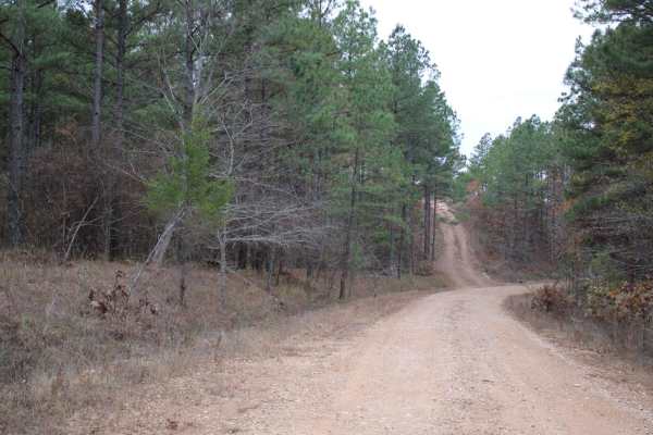
County Roads to Sour Springs
Lake Greeson WMA is a leased land WMA, meaning hunters, trappers and campers 16 years of age or older must purchase a Lake Greeson WMA leased lands permit (LLG) along with a free annual General Use Permit (WMP). Permits are available online https://www.agfc.com/wma/lake-greeson-wma/ , by clicking "B...
Learn more about County Roads to Sour Springs
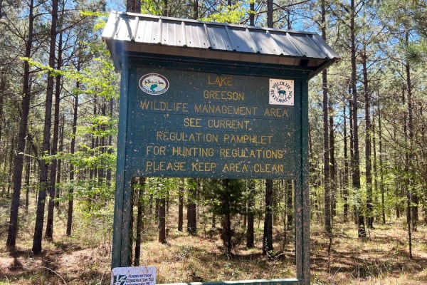
Sour Springs
Sour Springs Road is a well graded gravel road two vehicles wide that is easy to drive even in a low clearance 2wd giving you remote access to Parker Creek campground and boat ramp. Or continue north deeper into the woods towards Rock Creek. This road passes along Arkansas Wildlife Management Area (...
Learn more about Sour Springs
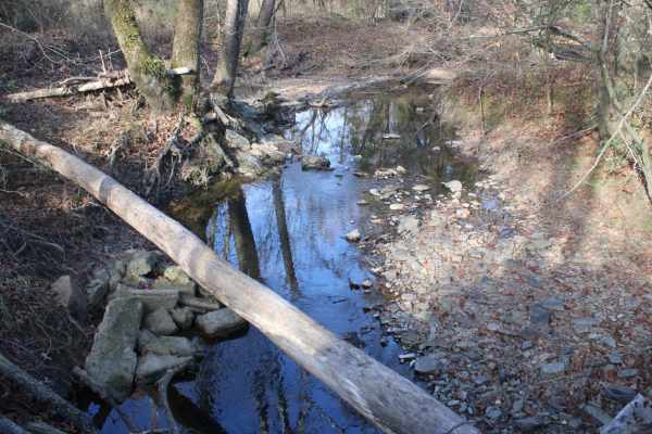
Weyerhaeuser 25500
This gravel road goes to Lake Greeson WMA and Newhope Arkansas. The road surface can be muddy when wet. The road is very dusty while dry. You can access Lake Greeson WMA which is a leased land WMA, meaning hunters, trappers, and campers 16 years of age or older must purchase a Lake Greeson WMA lease...
Learn more about Weyerhaeuser 25500
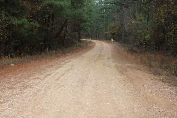
County Road 55
Lake Greeson WMA is a leased land WMA, meaning hunters, trappers, and campers 16 years of age or older must purchase a Lake Greeson WMA leased lands permit (LLG) along with a free annual General Use Permit (WMP). Permits are available online https://www.agfc.com/wma/lake-greeson-wma/ , by clicking "...
Learn more about County Road 55
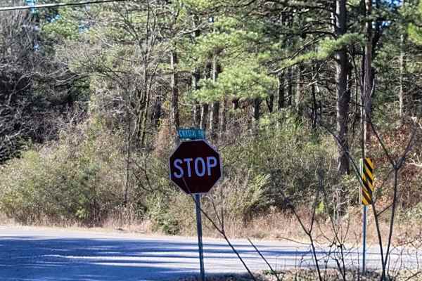
Crystal Park
This is a maintained gravel road that can have some mud when wet and possible water crossings depending on the weather. This trail takes you along beautiful views, creeks, and possible wildlife sightings. This trail passes Crystal Recreation Area. Not to be confused with Crystal Springs State Park t...
Learn more about Crystal Park
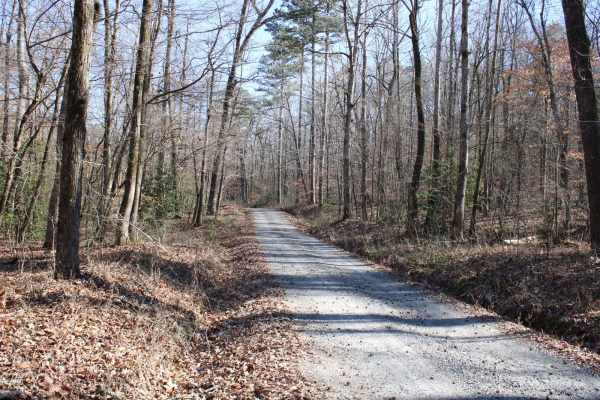
Collier Springs
This gravel road leaves a dispersed campsite. This trail passes several dispersed campsites, including Collier Springs, Crystal Scenic Trail, and Twin Creek Crystal Mine. With huge boulders, many rocks, creeks, and diverse terrain, there is a lot to see on this trail. The Collier Springs Picnic Area...
Learn more about Collier Springs
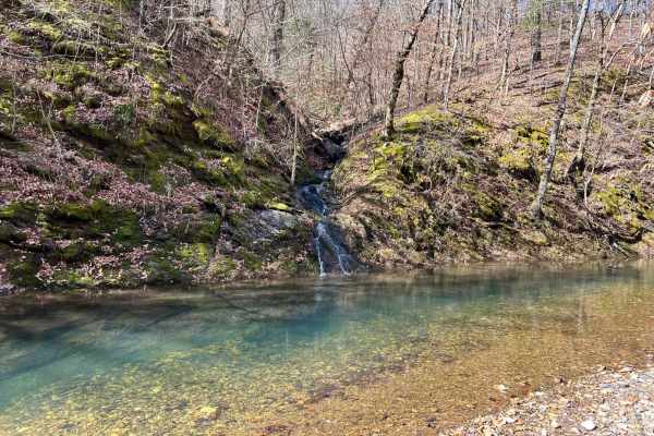
Sugar Creek
The trail is well-maintained gravel, with a few small water crossings. You will find some amazing creek-side camping along the route. The road is blocked due to a washed-out crossing, but there is a large group site at the bottom of the hill. This is a great spot to get to the trail systems, or just...
Learn more about Sugar Creek
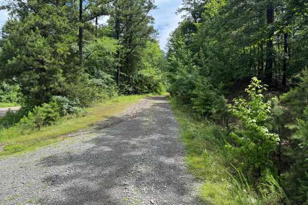
Hamilton Creek
Hamilton Creek is a short out-and-back forest route branching off Gaston Road. The route travels through a dense pine forest with narrow corridors, young timber growth, and thick brush that creates a secluded backcountry feel. While there are no major obstacles or technical challenges, the trail off...
Learn more about Hamilton Creek
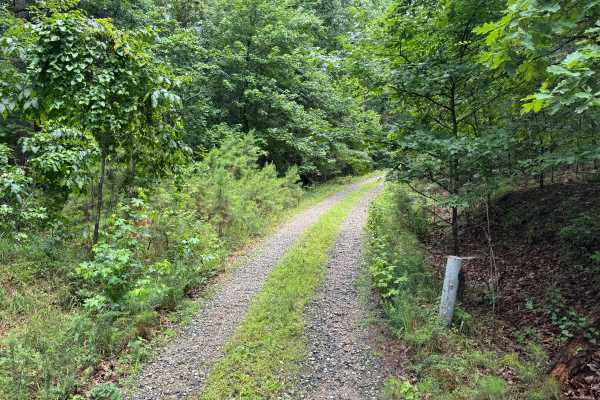
Harvey
This spur route branches off of Hamilton Creek and quickly transitions into a more remote forest setting. Unlike the surrounding gravel roads, this trail is primarily dirt-based with scattered gravel and natural forest debris, giving it a more primitive feel. The route winds through a mixture of har...
Learn more about Harvey
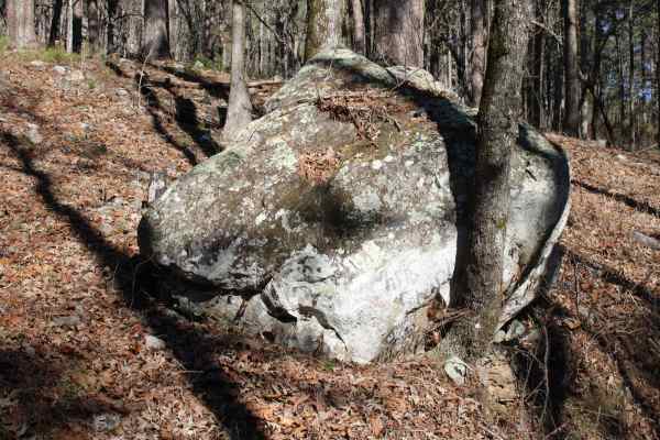
Womble Silver
This is a nice forest road that if headed east, will end at Highway 270. This trail ends at a very nice Group sized, dispersed campsite. East Fork Twin Creek runs alongside this road. There are a few dispersed campsites along this road. Beautiful views are in this area. There are a few side spurs th...
Learn more about Womble Silver
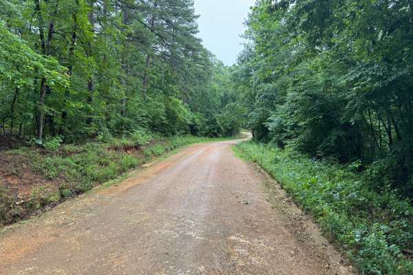
Ly Brand
The road surface consists of maintained gravel and hard-packed dirt with no significant obstacles under normal conditions. While generally in good condition, the route is primarily a single-lane road for much of its length. Passing opportunities exist in wider sections, but drivers should be prepare...
Learn more about Ly Brand
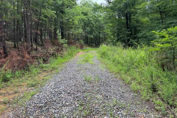
Mullins Loop
This forest road offers a more rugged experience than the surrounding trail network. While still relatively easy to navigate, the route receives less maintenance and has a noticeably more overgrown character. Grass and other vegetation grow between the tire tracks, and brush frequently encroaches on...
Learn more about Mullins Loop
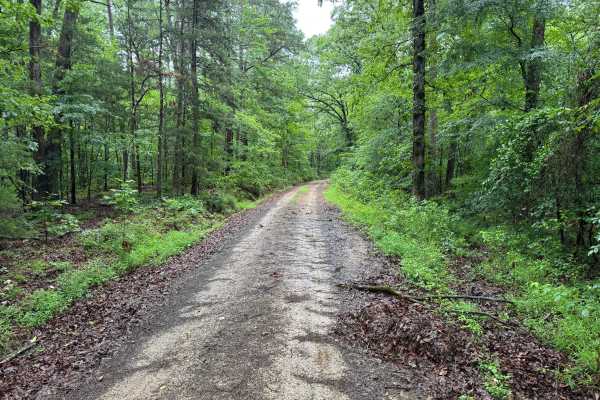
Granville
This scenic forest route winds through a beautiful section of the Ouachita Mountains, combining maintained gravel roads, towering hardwoods and pines, seasonal creek crossings, and impressive rock formations. The drive is easy overall but offers enough variety to keep it interesting, making it a wor...
Learn more about Granville
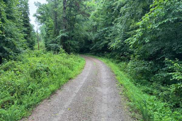
Quachita Cedar
This easy gravel route provides a peaceful drive through a mixture of pine forest, hardwood stands, and regenerating timber areas. The road is generally well maintained and winds through a quiet section of the forest, making it an excellent choice for travelers looking to enjoy the scenery without e...
Learn more about Quachita Cedar
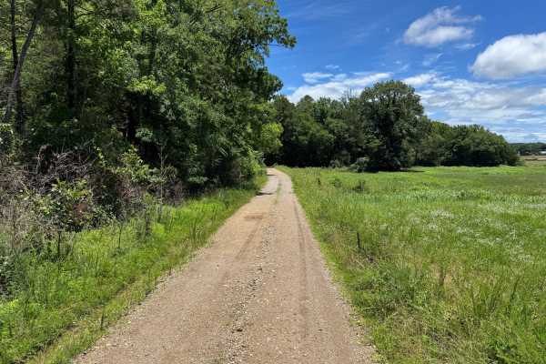
Mauldin
This maintained gravel road provides an easy and relaxing drive through a mix of managed timberland and open clearings. The route winds through dense pine and hardwood forests before transitioning into several open areas that offer a different perspective of the surrounding landscape. Long straighta...
Learn more about Mauldin
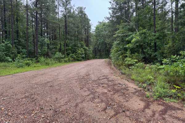
West Gaston
This easy gravel connector route travels through a scenic section of forest between Bear Den Mountain and Granville Lane. The road is regularly maintained and provides a smooth driving experience suitable for virtually any street-legal vehicle. Surrounded by dense pine and hardwood forests, the rout...
Learn more about West Gaston
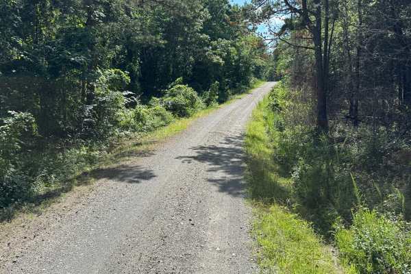
South Fork Road
This route provides an enjoyable drive through a heavily wooded section of forest with minimal obstacles and excellent scenery. The route surface is primarily maintained gravel, making it accessible to most vehicles during normal weather conditions. Drivers will encounter rolling hills, sweeping cur...
Learn more about South Fork Road
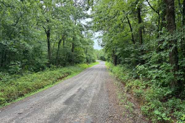
Gaston Road
This scenic gravel route winds through a mix of dense hardwood forest and creek bottoms, while providing a relaxing drive through a quiet rural landscape. The road is generally well maintained and suitable for most high-clearance vehicles, while also being accessible to many passenger vehicles durin...
Learn more about Gaston Road
Beginner ATV trails near Kirby, Arkansas
Explore ATV-friendly trails near you. These trails are accessible for vehicles up to 50 inches wide, perfect for ATVs and smaller off-road machines.
Hamilton Creek
Hamilton Creek is a short out-and-back forest route branching off Gaston Road. The route travels through a dense pine forest with narrow corridors, young timber growth, and thick brush that creates a secluded backcountry feel. While there are no major obstacles or technical challenges, the trail off...
Learn more about Hamilton Creek
Harvey
This spur route branches off of Hamilton Creek and quickly transitions into a more remote forest setting. Unlike the surrounding gravel roads, this trail is primarily dirt-based with scattered gravel and natural forest debris, giving it a more primitive feel. The route winds through a mixture of har...
Learn more about Harvey
Mullins Loop
This forest road offers a more rugged experience than the surrounding trail network. While still relatively easy to navigate, the route receives less maintenance and has a noticeably more overgrown character. Grass and other vegetation grow between the tire tracks, and brush frequently encroaches on...
Learn more about Mullins Loop
Quachita Cedar
This easy gravel route provides a peaceful drive through a mixture of pine forest, hardwood stands, and regenerating timber areas. The road is generally well maintained and winds through a quiet section of the forest, making it an excellent choice for travelers looking to enjoy the scenery without e...
Learn more about Quachita Cedar
Beginner UTV/side-by-side trails near Kirby, Arkansas
Find UTV and side-by-side trails near you. These trails accommodate vehicles up to 60 inches wide, ideal for UTVs, side-by-sides, and wider off-road rigs.
Sugar Creek
The trail is well-maintained gravel, with a few small water crossings. You will find some amazing creek-side camping along the route. The road is blocked due to a washed-out crossing, but there is a large group site at the bottom of the hill. This is a great spot to get to the trail systems, or just...
Learn more about Sugar Creek
Hamilton Creek
Hamilton Creek is a short out-and-back forest route branching off Gaston Road. The route travels through a dense pine forest with narrow corridors, young timber growth, and thick brush that creates a secluded backcountry feel. While there are no major obstacles or technical challenges, the trail off...
Learn more about Hamilton Creek
Harvey
This spur route branches off of Hamilton Creek and quickly transitions into a more remote forest setting. Unlike the surrounding gravel roads, this trail is primarily dirt-based with scattered gravel and natural forest debris, giving it a more primitive feel. The route winds through a mixture of har...
Learn more about Harvey
Mullins Loop
This forest road offers a more rugged experience than the surrounding trail network. While still relatively easy to navigate, the route receives less maintenance and has a noticeably more overgrown character. Grass and other vegetation grow between the tire tracks, and brush frequently encroaches on...
Learn more about Mullins Loop
The onX Offroad Difference
onX Offroad combines trail photos, descriptions, difficulty ratings, width restrictions, seasonality, and more in a user-friendly interface. Available on all devices, with offline access and full compatibility with CarPlay and Android Auto. Discover what you're missing today!
Open Trail Map