
Beginner Off-Road Trails
Near Daisy, Arkansas
Explore All Beginner Trails Near Daisy, Arkansas
Beginner Off-Road Trails Near Daisy, Arkansas
Discover the best beginner-friendly off-road trails near you. These easier, lower-rated trails are a great place to start — browse trail maps, check difficulty ratings, and find your next adventure.
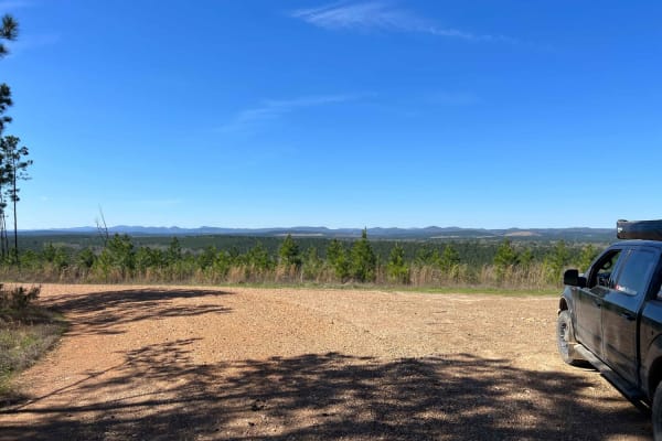
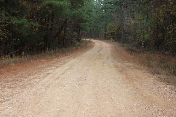
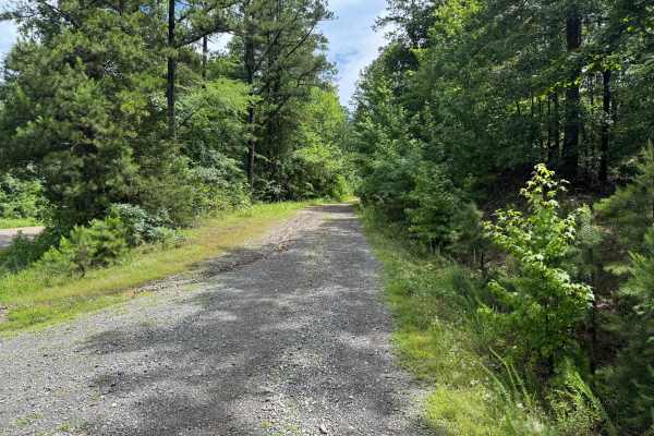
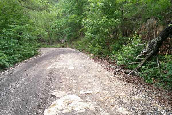
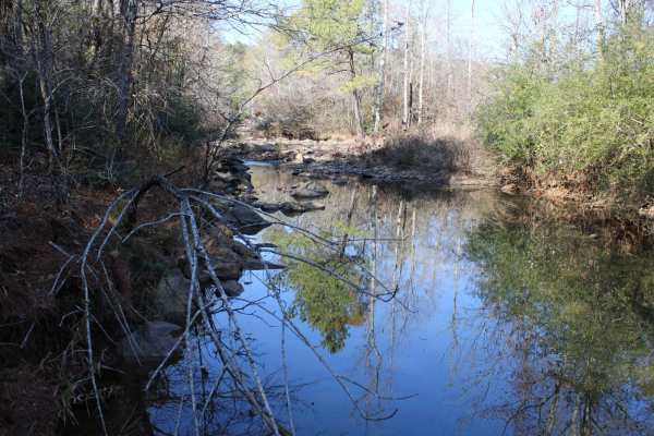
Rock Creek to Pine Ridge
Rock Creek to Pine Ridge is a well graded gravel road two vehicles wide leading to the Rock Creek Camping area along Lake Greeson. This well-maintained road follows along Pine Ridge with incredible views of the Quachita Mountains to the north. This section of road can be driven in a low clearance 2w...
Learn more about Rock Creek to Pine Ridge
County Roads to Sour Springs
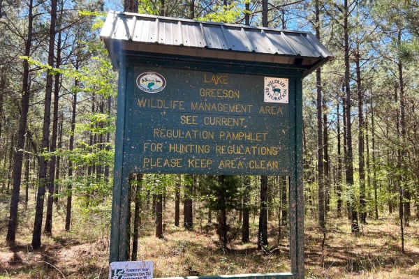
Lake Greeson WMA is a leased land WMA, meaning hunters, trappers and campers 16 years of age or older must purchase a Lake Greeson WMA leased lands permit (LLG) along with a free annual General Use Permit (WMP). Permits are available online https://www.agfc.com/wma/lake-greeson-wma/ , by clicking "B...
Learn more about County Roads to Sour Springs
Buck Valley
Lake Greeson WMA is a leased land WMA, meaning hunters, trappers, and campers 16 years of age or older must purchase a Lake Greeson WMA leased lands permit (LLG) along with a free annual General Use Permit (WMP). Permits are available online https://www.agfc.com/wma/lake-greeson-wma/ , by clicking "...
Learn more about Buck Valley
Weyerhaeuser 25500
This gravel road goes to Lake Greeson WMA and Newhope Arkansas. The road surface can be muddy when wet. The road is very dusty while dry. You can access Lake Greeson WMA which is a leased land WMA, meaning hunters, trappers, and campers 16 years of age or older must purchase a Lake Greeson WMA lease...
Learn more about Weyerhaeuser 25500
County Road 55
Lake Greeson WMA is a leased land WMA, meaning hunters, trappers, and campers 16 years of age or older must purchase a Lake Greeson WMA leased lands permit (LLG) along with a free annual General Use Permit (WMP). Permits are available online https://www.agfc.com/wma/lake-greeson-wma/ , by clicking "...
Learn more about County Road 55
Sour Springs
Sour Springs Road is a well graded gravel road two vehicles wide that is easy to drive even in a low clearance 2wd giving you remote access to Parker Creek campground and boat ramp. Or continue north deeper into the woods towards Rock Creek. This road passes along Arkansas Wildlife Management Area (...
Learn more about Sour Springs
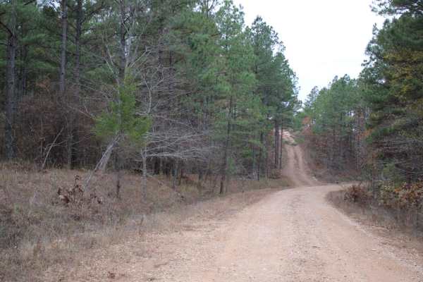
Sugar Creek
The trail is well-maintained gravel, with a few small water crossings. You will find some amazing creek-side camping along the route. The road is blocked due to a washed-out crossing, but there is a large group site at the bottom of the hill. This is a great spot to get to the trail systems, or just...
Learn more about Sugar Creek
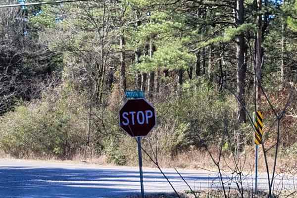
Crystal Park
This is a maintained gravel road that can have some mud when wet and possible water crossings depending on the weather. This trail takes you along beautiful views, creeks, and possible wildlife sightings. This trail passes Crystal Recreation Area. Not to be confused with Crystal Springs State Park t...
Learn more about Crystal Park
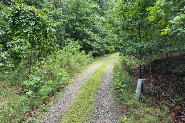
Hamilton Creek
Hamilton Creek is a short out-and-back forest route branching off Gaston Road. The route travels through a dense pine forest with narrow corridors, young timber growth, and thick brush that creates a secluded backcountry feel. While there are no major obstacles or technical challenges, the trail off...
Learn more about Hamilton Creek
Collier Springs
This gravel road leaves a dispersed campsite. This trail passes several dispersed campsites, including Collier Springs, Crystal Scenic Trail, and Twin Creek Crystal Mine. With huge boulders, many rocks, creeks, and diverse terrain, there is a lot to see on this trail. The Collier Springs Picnic Area...
Learn more about Collier Springs
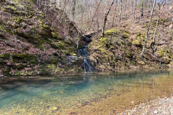
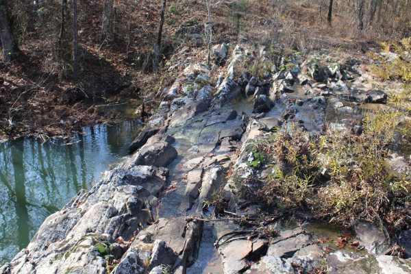
Shady Lake - Crooked Creek Falls
Exploring the Ouachita National Forest offers an exhilarating adventure with its winding rocky roads that carve through the dense woodland. As you navigate the trails, you'll find yourself accompanied by the soothing presence of beautiful streams running parallel to the path at various points. The j...
Learn more about Shady Lake - Crooked Creek Falls
Harvey
This spur route branches off of Hamilton Creek and quickly transitions into a more remote forest setting. Unlike the surrounding gravel roads, this trail is primarily dirt-based with scattered gravel and natural forest debris, giving it a more primitive feel. The route winds through a mixture of har...
Learn more about Harvey
Big Fork Athens Road
Easy Trail to get over on Wolf Pen Gap. Has some areas washed out. Most SUVs should be able to make this with no issue. There is an overlook, and lots of creeks to look at, and 1 small waterfall that is seasonal. Nice spring ride when things are turning green, and a Fall Ride that would have some g...
Learn more about Big Fork Athens Road
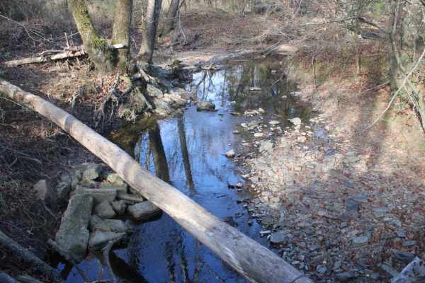
Rock Steps Falls
These dirt and gravel roads can be muddy when wet and very dusty when dry. There are several bridged water crossings if it has recently rained. This is in WEYCO private-owned land. There are gates that may or may not be closed. You can apply for recreation permits at https://recreation.weyerhaeuser....
Learn more about Rock Steps Falls
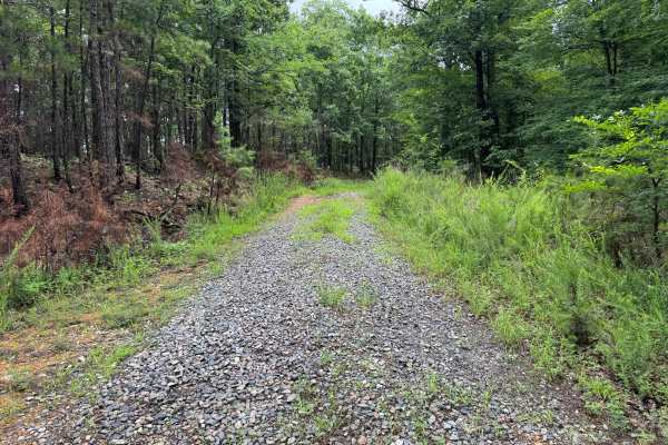
Mullins Loop
This forest road offers a more rugged experience than the surrounding trail network. While still relatively easy to navigate, the route receives less maintenance and has a noticeably more overgrown character. Grass and other vegetation grow between the tire tracks, and brush frequently encroaches on...
Learn more about Mullins Loop
Ly Brand
The road surface consists of maintained gravel and hard-packed dirt with no significant obstacles under normal conditions. While generally in good condition, the route is primarily a single-lane road for much of its length. Passing opportunities exist in wider sections, but drivers should be prepare...
Learn more about Ly Brand
Rock Creek
This dirt and gravel road starts from Highway 70 and will dead end at Rock Creek. The roads can be muddy when wet and very dusty when dry. Most of this area is private property, so stay on the road and get your permits on the website. The ground is rough. This is in WEYCO private-owned land. There a...
Learn more about Rock Creek
514200
This trail is a relatively narrow, unmaintained dual track with a rocky surface, but it is easy and enjoyable to drive as it winds through dense forest. At the end of the trail, there is a possible dispersed campsite, along with a continuation into a tighter, narrower route that is best suited to co...
Learn more about 514200
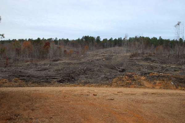
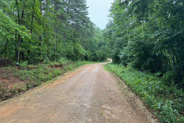
Granville
This scenic forest route winds through a beautiful section of the Ouachita Mountains, combining maintained gravel roads, towering hardwoods and pines, seasonal creek crossings, and impressive rock formations. The drive is easy overall but offers enough variety to keep it interesting, making it a wor...
Learn more about Granville
313 Road
This trail offers a pleasant drive that begins in a healthy, mature forest and gradually climbs into areas of newer forest growth. The route is winding and includes several gentle ascents and descents, with patches of loose gravel that may require careful driving in places. After an intersection, th...
Learn more about 313 Road
Beginner ATV trails near Daisy, Arkansas
Explore ATV-friendly trails near you. These trails are accessible for vehicles up to 50 inches wide, perfect for ATVs and smaller off-road machines.
Hamilton Creek
Hamilton Creek is a short out-and-back forest route branching off Gaston Road. The route travels through a dense pine forest with narrow corridors, young timber growth, and thick brush that creates a secluded backcountry feel. While there are no major obstacles or technical challenges, the trail off...
Learn more about Hamilton Creek
Harvey
This spur route branches off of Hamilton Creek and quickly transitions into a more remote forest setting. Unlike the surrounding gravel roads, this trail is primarily dirt-based with scattered gravel and natural forest debris, giving it a more primitive feel. The route winds through a mixture of har...
Learn more about Harvey
Big Fork Athens Road
Easy Trail to get over on Wolf Pen Gap. Has some areas washed out. Most SUVs should be able to make this with no issue. There is an overlook, and lots of creeks to look at, and 1 small waterfall that is seasonal. Nice spring ride when things are turning green, and a Fall Ride that would have some g...
Learn more about Big Fork Athens Road
Mullins Loop
This forest road offers a more rugged experience than the surrounding trail network. While still relatively easy to navigate, the route receives less maintenance and has a noticeably more overgrown character. Grass and other vegetation grow between the tire tracks, and brush frequently encroaches on...
Learn more about Mullins Loop
Beginner UTV/side-by-side trails near Daisy, Arkansas
Find UTV and side-by-side trails near you. These trails accommodate vehicles up to 60 inches wide, ideal for UTVs, side-by-sides, and wider off-road rigs.
Sugar Creek
The trail is well-maintained gravel, with a few small water crossings. You will find some amazing creek-side camping along the route. The road is blocked due to a washed-out crossing, but there is a large group site at the bottom of the hill. This is a great spot to get to the trail systems, or just...
Learn more about Sugar Creek
Hamilton Creek
Hamilton Creek is a short out-and-back forest route branching off Gaston Road. The route travels through a dense pine forest with narrow corridors, young timber growth, and thick brush that creates a secluded backcountry feel. While there are no major obstacles or technical challenges, the trail off...
Learn more about Hamilton Creek
Harvey
This spur route branches off of Hamilton Creek and quickly transitions into a more remote forest setting. Unlike the surrounding gravel roads, this trail is primarily dirt-based with scattered gravel and natural forest debris, giving it a more primitive feel. The route winds through a mixture of har...
Learn more about Harvey
Big Fork Athens Road
Easy Trail to get over on Wolf Pen Gap. Has some areas washed out. Most SUVs should be able to make this with no issue. There is an overlook, and lots of creeks to look at, and 1 small waterfall that is seasonal. Nice spring ride when things are turning green, and a Fall Ride that would have some g...
Learn more about Big Fork Athens Road
The onX Offroad Difference
onX Offroad combines trail photos, descriptions, difficulty ratings, width restrictions, seasonality, and more in a user-friendly interface. Available on all devices, with offline access and full compatibility with CarPlay and Android Auto. Discover what you're missing today!
Open Trail Map