
Beginner Off-Road Trails
Near Newhope, Arkansas
Explore All Beginner Trails Near Newhope, Arkansas
Beginner Off-Road Trails Near Newhope, Arkansas
Discover the best beginner-friendly off-road trails near you. These easier, lower-rated trails are a great place to start — browse trail maps, check difficulty ratings, and find your next adventure.
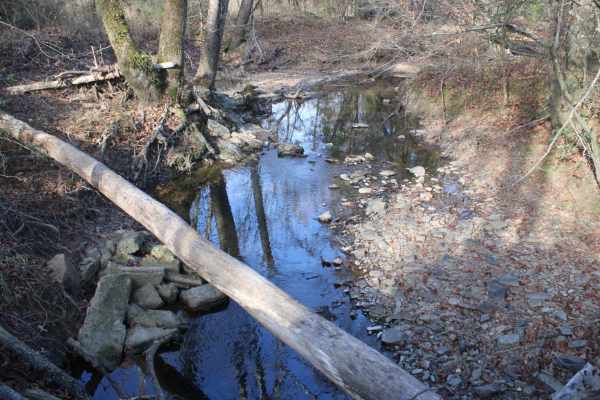
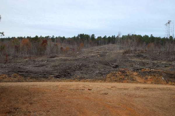
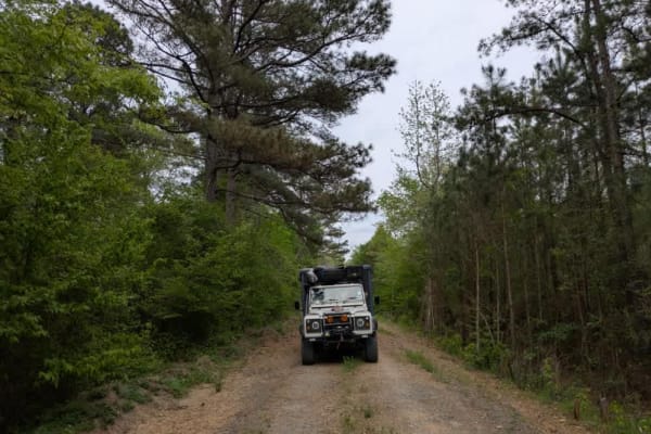
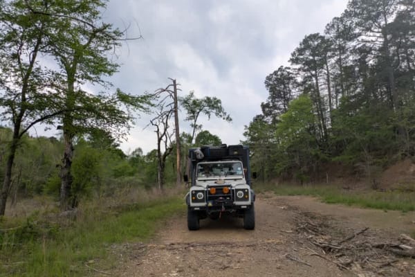
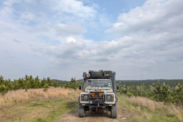
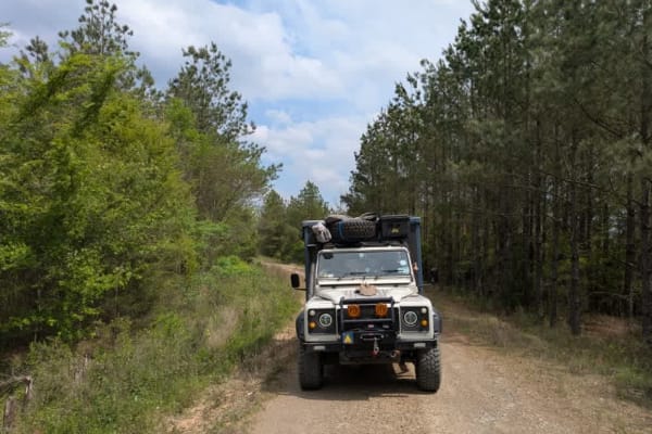
Weyerhaeuser 25500
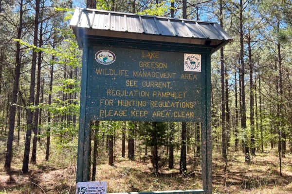
This gravel road goes to Lake Greeson WMA and Newhope Arkansas. The road surface can be muddy when wet. The road is very dusty while dry. You can access Lake Greeson WMA which is a leased land WMA, meaning hunters, trappers, and campers 16 years of age or older must purchase a Lake Greeson WMA lease...
Learn more about Weyerhaeuser 25500
County Road 55
Lake Greeson WMA is a leased land WMA, meaning hunters, trappers, and campers 16 years of age or older must purchase a Lake Greeson WMA leased lands permit (LLG) along with a free annual General Use Permit (WMP). Permits are available online https://www.agfc.com/wma/lake-greeson-wma/ , by clicking "...
Learn more about County Road 55
County Roads to Sour Springs
Lake Greeson WMA is a leased land WMA, meaning hunters, trappers and campers 16 years of age or older must purchase a Lake Greeson WMA leased lands permit (LLG) along with a free annual General Use Permit (WMP). Permits are available online https://www.agfc.com/wma/lake-greeson-wma/ , by clicking "B...
Learn more about County Roads to Sour Springs
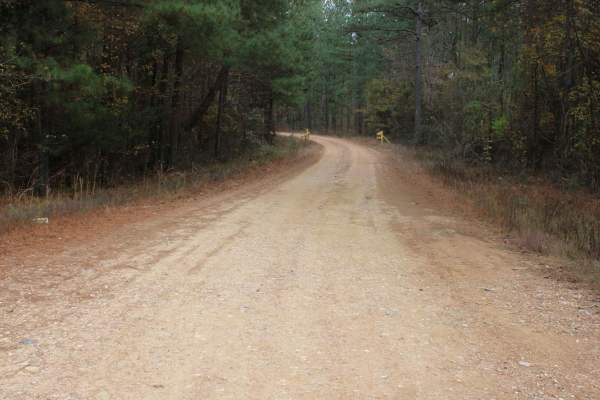
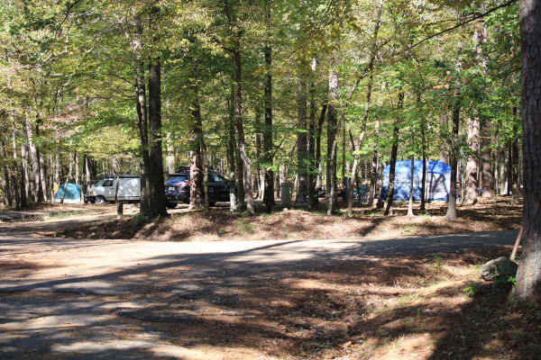
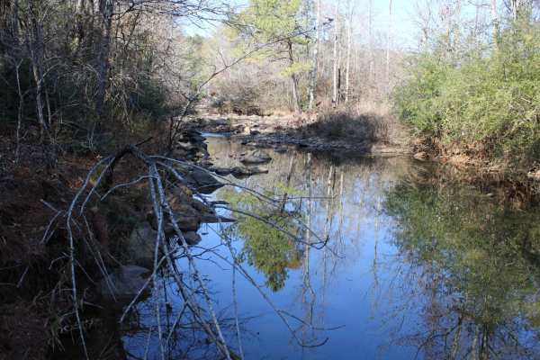
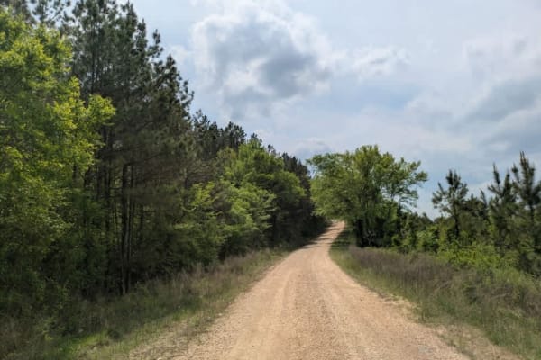
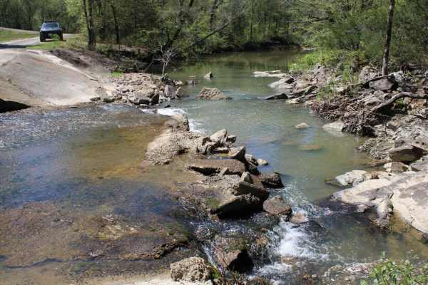
Rock Creek to Pine Ridge
Rock Creek to Pine Ridge is a well graded gravel road two vehicles wide leading to the Rock Creek Camping area along Lake Greeson. This well-maintained road follows along Pine Ridge with incredible views of the Quachita Mountains to the north. This section of road can be driven in a low clearance 2w...
Learn more about Rock Creek to Pine Ridge
Buck Valley
Lake Greeson WMA is a leased land WMA, meaning hunters, trappers, and campers 16 years of age or older must purchase a Lake Greeson WMA leased lands permit (LLG) along with a free annual General Use Permit (WMP). Permits are available online https://www.agfc.com/wma/lake-greeson-wma/ , by clicking "...
Learn more about Buck Valley
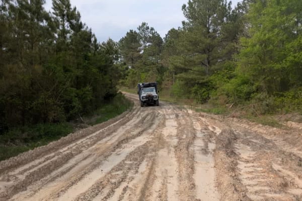
Sugar Creek
The trail is well-maintained gravel, with a few small water crossings. You will find some amazing creek-side camping along the route. The road is blocked due to a washed-out crossing, but there is a large group site at the bottom of the hill. This is a great spot to get to the trail systems, or just...
Learn more about Sugar Creek
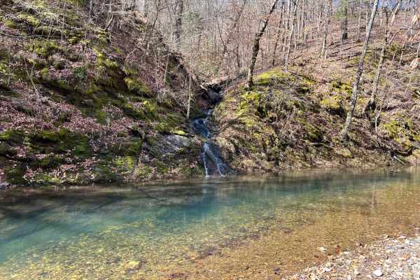
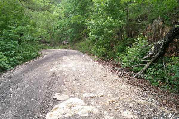
Rock Steps Falls
These dirt and gravel roads can be muddy when wet and very dusty when dry. There are several bridged water crossings if it has recently rained. This is in WEYCO private-owned land. There are gates that may or may not be closed. You can apply for recreation permits at https://recreation.weyerhaeuser....
Learn more about Rock Steps Falls
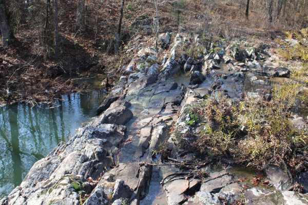
Shady Lake - Crooked Creek Falls
Exploring the Ouachita National Forest offers an exhilarating adventure with its winding rocky roads that carve through the dense woodland. As you navigate the trails, you'll find yourself accompanied by the soothing presence of beautiful streams running parallel to the path at various points. The j...
Learn more about Shady Lake - Crooked Creek Falls
514200
This trail is a relatively narrow, unmaintained dual track with a rocky surface, but it is easy and enjoyable to drive as it winds through dense forest. At the end of the trail, there is a possible dispersed campsite, along with a continuation into a tighter, narrower route that is best suited to co...
Learn more about 514200
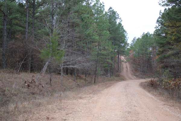
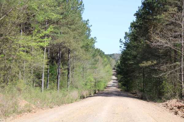
313 Road
This trail offers a pleasant drive that begins in a healthy, mature forest and gradually climbs into areas of newer forest growth. The route is winding and includes several gentle ascents and descents, with patches of loose gravel that may require careful driving in places. After an intersection, th...
Learn more about 313 Road
Rock Creek
This dirt and gravel road starts from Highway 70 and will dead end at Rock Creek. The roads can be muddy when wet and very dusty when dry. Most of this area is private property, so stay on the road and get your permits on the website. The ground is rough. This is in WEYCO private-owned land. There a...
Learn more about Rock Creek
Sour Springs
Sour Springs Road is a well graded gravel road two vehicles wide that is easy to drive even in a low clearance 2wd giving you remote access to Parker Creek campground and boat ramp. Or continue north deeper into the woods towards Rock Creek. This road passes along Arkansas Wildlife Management Area (...
Learn more about Sour Springs
31867
This trail is a scenic dual track that winds through forested terrain and features occasional rocky sections, gentle ascents, and descents. It passes through areas of logged forest and requires multiple stream crossings without bridges, which can become hazardous during or after heavy rain. A single...
Learn more about 31867
31860
This trail begins as a smooth and enjoyable dual track that winds through a peaceful section of forest, offering a scenic and relaxing drive. However, the surroundings quickly change upon entering a logged area, where heavy machinery has left deep mud ruts that can become especially challenging to n...
Learn more about 31860
51000
This trail is a well-maintained gravel road with occasional rocky patches that add some variety to the drive without making it difficult. It winds through forested terrain and appears to be popular with hunters, as deer were spotted along the route. The drive is enjoyable and mostly smooth, offering...
Learn more about 51000
Big Fork Athens Road
Easy Trail to get over on Wolf Pen Gap. Has some areas washed out. Most SUVs should be able to make this with no issue. There is an overlook, and lots of creeks to look at, and 1 small waterfall that is seasonal. Nice spring ride when things are turning green, and a Fall Ride that would have some g...
Learn more about Big Fork Athens Road
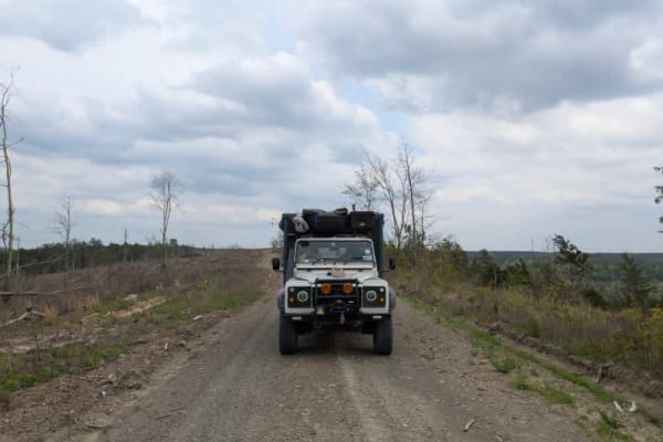
51821
This relatively narrow but well-maintained trail climbs steadily toward a logging area and sections of cleared forest. The ascent is winding, and although the cleared areas can feel stark, the drive becomes more pleasant once deeper into the forest. Traveling downhill is generally easy, though the u...
Learn more about 51821
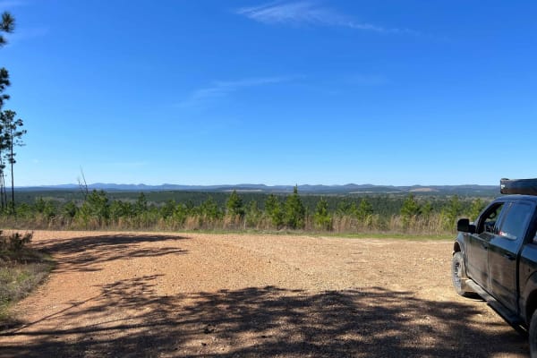
Spectacular View In Howard County WMA
Maintained gravel roads in Howard County WMA make up this trail to a spectacular view. This trail has a gate that can be opened or closed. Beautiful views, tight turns, a running creek, and bridged water crossings are along this trail. Access on the west side is facilitated by crossing Gillham Lake ...
Learn more about Spectacular View In Howard County WMA
Howard County WMA 485RD Circle
Gravel roads that are in the Howard County WMA. These gravel roads are well maintained but can be muddy when wet. This trail ends at a circle turn around. Gates can be closed at times. There is a gate at the beginning of this trail. A free annual General Use Permit (WMP) is required to hunt or trap ...
Learn more about Howard County WMA 485RD Circle
51705
This is a relatively narrow but well-maintained trail that appears to be lightly traveled, gradually ascending into a logging zone and areas of cleared forest. While the initial stretch passes through recently cut sections, the trail becomes more scenic and enjoyable as it winds deeper into the wood...
Learn more about 51705
Beginner ATV trails near Newhope, Arkansas
Explore ATV-friendly trails near you. These trails are accessible for vehicles up to 50 inches wide, perfect for ATVs and smaller off-road machines.
514200
This trail is a relatively narrow, unmaintained dual track with a rocky surface, but it is easy and enjoyable to drive as it winds through dense forest. At the end of the trail, there is a possible dispersed campsite, along with a continuation into a tighter, narrower route that is best suited to co...
Learn more about 514200
313 Road
This trail offers a pleasant drive that begins in a healthy, mature forest and gradually climbs into areas of newer forest growth. The route is winding and includes several gentle ascents and descents, with patches of loose gravel that may require careful driving in places. After an intersection, th...
Learn more about 313 Road
31867
This trail is a scenic dual track that winds through forested terrain and features occasional rocky sections, gentle ascents, and descents. It passes through areas of logged forest and requires multiple stream crossings without bridges, which can become hazardous during or after heavy rain. A single...
Learn more about 31867
31860
This trail begins as a smooth and enjoyable dual track that winds through a peaceful section of forest, offering a scenic and relaxing drive. However, the surroundings quickly change upon entering a logged area, where heavy machinery has left deep mud ruts that can become especially challenging to n...
Learn more about 31860
Beginner UTV/side-by-side trails near Newhope, Arkansas
Find UTV and side-by-side trails near you. These trails accommodate vehicles up to 60 inches wide, ideal for UTVs, side-by-sides, and wider off-road rigs.
Sugar Creek
The trail is well-maintained gravel, with a few small water crossings. You will find some amazing creek-side camping along the route. The road is blocked due to a washed-out crossing, but there is a large group site at the bottom of the hill. This is a great spot to get to the trail systems, or just...
Learn more about Sugar Creek
514200
This trail is a relatively narrow, unmaintained dual track with a rocky surface, but it is easy and enjoyable to drive as it winds through dense forest. At the end of the trail, there is a possible dispersed campsite, along with a continuation into a tighter, narrower route that is best suited to co...
Learn more about 514200
313 Road
This trail offers a pleasant drive that begins in a healthy, mature forest and gradually climbs into areas of newer forest growth. The route is winding and includes several gentle ascents and descents, with patches of loose gravel that may require careful driving in places. After an intersection, th...
Learn more about 313 Road
31867
This trail is a scenic dual track that winds through forested terrain and features occasional rocky sections, gentle ascents, and descents. It passes through areas of logged forest and requires multiple stream crossings without bridges, which can become hazardous during or after heavy rain. A single...
Learn more about 31867
The onX Offroad Difference
onX Offroad combines trail photos, descriptions, difficulty ratings, width restrictions, seasonality, and more in a user-friendly interface. Available on all devices, with offline access and full compatibility with CarPlay and Android Auto. Discover what you're missing today!
Open Trail Map