
Beginner Off-Road Trails
Near Indio, California
Explore All Beginner Trails Near Indio, California
Beginner Off-Road Trails Near Indio, California
Discover the best beginner-friendly off-road trails near you. These easier, lower-rated trails are a great place to start — browse trail maps, check difficulty ratings, and find your next adventure.
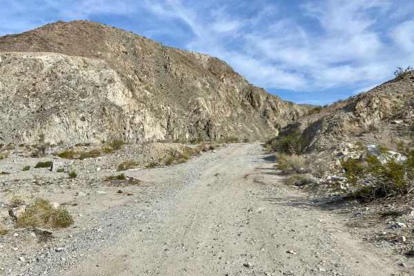
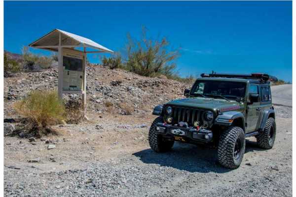
Berdoo Canyon
Wind your way up this canyon that is primarily sand and small rocks. There are a few extra credit options that do have bypasses, except for one or two obstacles at the end. Anything other than a stock SUV can navigate this canyon. The elevation gain is noticeable in the flora once you exit the canyo...
Learn more about Berdoo Canyon
Lower Pinkham Canyon
Pinkham Canyon Road can be accessed from Joshua Tree National Park. To access the Pinkham Canyon Trail from the BLM trailhead. Exit I-10 from either East or West to the Frontage Road off-ramp. Stop at the BLM kiosk to air down, then continue on the California River Aqueduct Road, which is owned by ...
Learn more about Lower Pinkham Canyon
Geology Tour Road
This is a fantastic family adventure. The entire trail is located inside Joshua Tree National Park. It is a long loop trail that is very scenic with beautiful vistas, interesting rock formations, ancient volcanic lava flows, and Joshua Trees. The loop portion of the trail is one-way (clockwise).
Learn more about Geology Tour Road
Painted Canyon Road
Painted Canyon is a gorgeous landmark outside of Mecca, California. At the entrance to the road leading to the canyon, there is a warning sign that says "Passable for 4-Wheel Drive Vehicles Only". At the time of the visit, the road was in very good condition, as long as you stay directly on the grad...
Learn more about Painted Canyon Road
Thermal Canyon Road
Thermal Canyon Road can be accessed from the Frontage Road off-ramp off of I-10, either from the East or West. Stop at the BLM kiosk for the Pinkham Canyon Trail; then continue on the California River Aqueduct Road owned by the Metropolitan Water District. Various private and other agencies have rig...
Learn more about Thermal Canyon Road
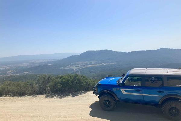
Santa Rosa Truck Trail 7S02
Santa Rosa Truck Trail is an out-and-back well-maintained fire road that climbs to over 8000ft. The lower parts are smooth and wide enough for two vehicles to pass each other. As it rises in elevation the road gets a bit narrower in spots and there are a few sections with small embedded rocks. The s...
Learn more about Santa Rosa Truck Trail 7S02
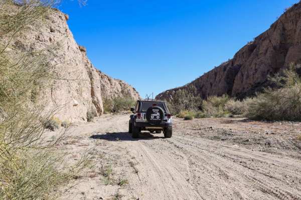
Little Box Canyon Meccacopia Loop
Hidden in the Mecca Hills just South of Joshua Tree National Park is a fun little trail that winds you through tight canyon washes surrounded by high vertical cliffs of up to 40 feet. The Little Box Canyon Trail is like a baby version of the famous Sandstone Canyon Trail in Anza Borrego. There is on...
Learn more about Little Box Canyon Meccacopia Loop
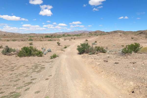
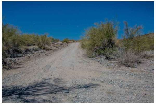
Mecca Orocopia Jeep Trail
This is the Mecca Orocopia Trail, a connection to the Little Box Canyon Meccacopia Loop. This is an easy dirt road trail where you can admire the beautiful views of the Orocopia mountains. There is nothing challenging about this route;it's perfect for dirt bikes, UTVs, and 2WD rides. It's great for ...
Learn more about Mecca Orocopia Jeep Trail
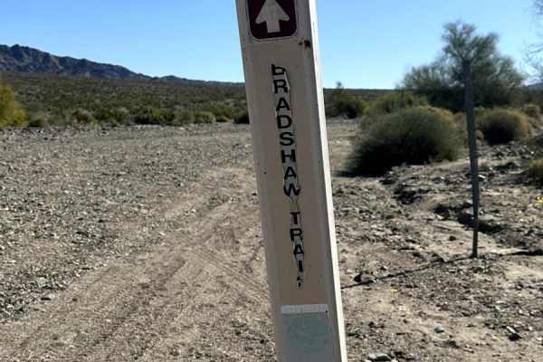
Salton Sea to Bradshaw's Trail
This is an alternate route from the Salton Sea to Bradshaw's Trail. From the 111, take Parkside Drive and make a left on Desert Aire Drive. The road will take you right next to the Coachella Canal. Follow the trail to the trailhead;it's an easy desert ride.
Learn more about Salton Sea to Bradshaw's Trail
6S13 - Thomas Mountain Road
Uneven, rutted dirt trail with loose rocks and sand. Muddy conditions should be expected during the rainy season. The trail is primarily one vehicle wide with some portions wide enough for passing oncoming traffic. Steep cliffs and drop-offs are common throughout the trail, as well as sharp winding ...
Learn more about 6S13 - Thomas Mountain Road
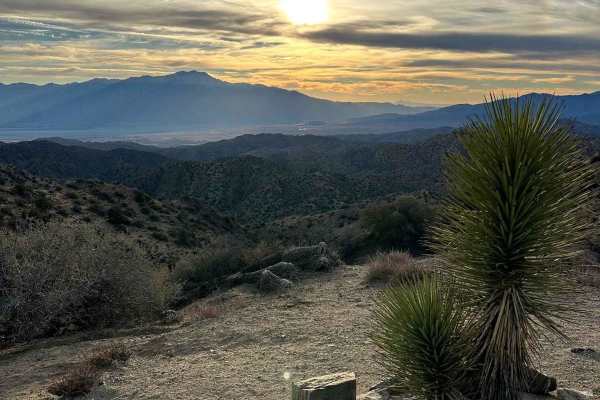
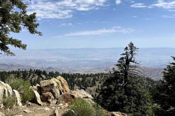
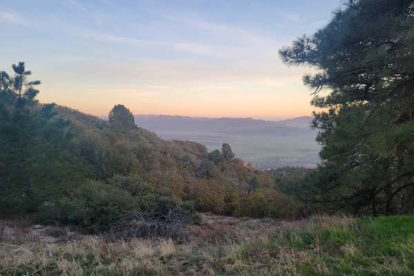
Eureka Peak
This trail takes you to Eureka Peak, which is a mountain top viewpoint allowing you to have a 360-degree view of the area from a high elevation. There are hiking trails throughout this area and one that will take you to the very top of Eureka Peak with just a few hundred feed of walking. There may b...
Learn more about Eureka Peak
Thomas Mountain West Approach
This trail connects the Rouse Ridge via Cottonwood trail to the Thomas Mountain Campground via the western end of Thomas Mountain Road. During dry months, the trail is an easily passable dirt road, requiring only moderate clearance to pass over occasional ruts and drainage control berms running acro...
Learn more about Thomas Mountain West Approach
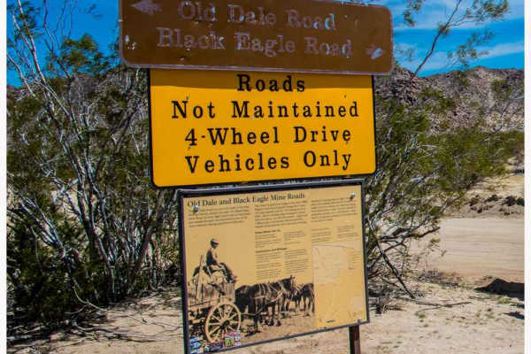
Black Eagle Mine Road
Black Eagle Mine Road is a 9.6-mile road in Joshua Tree National Park. This is an out-and-back road. Along this route, there are turnouts to stop and explore on foot and take photos. The road is easy with washboards here and there. Small wash crossings are dispersed throughout the road; just keep yo...
Learn more about Black Eagle Mine Road
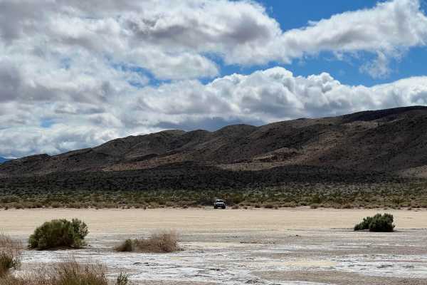
Clark Dry Lake
This hidden gem is part of Anza Borrego Desert State Tark. From the Boreggo Salton Seaway turn into Rockhouse Canyon Road. The sign at the intersection says "no exit" but the road is long and leads to a beautiful hidden dry salt lake bed which is located at an offshoot from the main trail. The road ...
Learn more about Clark Dry Lake
Rockhouse Canyon Road
Rockhouse Canyon Road is a 19.8-mile out-and-back trail rated 3 of 10 within the California Anza-Borrego Desert State Park. The trail is restricted to street-legal vehicles. The trail starts at the end of the Clark Dry Lake featured trail and continues for 9.9 miles, at which point the motorized tra...
Learn more about Rockhouse Canyon Road
Rouse Hill
Rouse Hill is a ridgeline trail with tremendous west and east views. This trail is predominately hard-packed dirt with a loose top layer. It can be a bit sandy in some sections but that will typically only be an issue for 2-wheel vehicles. The trail is only single vehicle wide in some places and som...
Learn more about Rouse Hill
Horse Camp Road
This trail is located in Anza Borrego State Park and features a sand and some gravel surface that's two vehicles wide, providing comfortable navigation. The route is surrounded by mountain views in all directions as you traverse the desert. It cuts through the desert, lined with many desert flora, c...
Learn more about Horse Camp Road
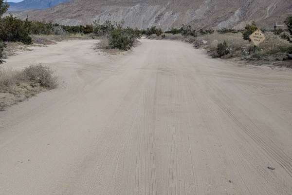
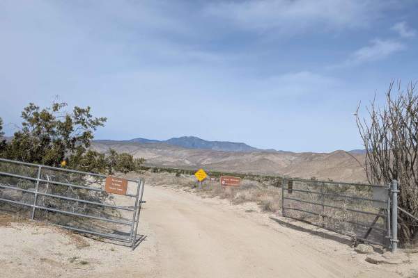
Coyote Canyon Road
This 10-plus-mile out-and-back trail is located in Anza Borrego State Park and is part of the wildflowers tour, taking you into Coyote Canyon. Only highway legal vehicles are allowed on this route. The surface is super fine sand and is 1.5 to 2.5 vehicles wide in most places, providing good room for...
Learn more about Coyote Canyon Road
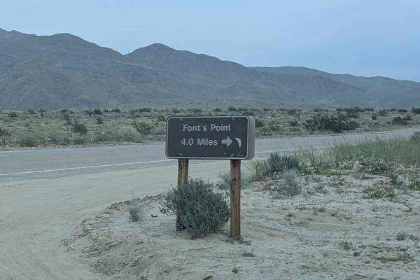
Fonts Point Wash
This very wide, very sandy wash actually starts on the north side of Highway 22, though parts of it can be closed after storms. On the south side, the trail travels 4 miles to reach the scenic overlook of Fonts Point. Parts of the wash can be very deep sand, requiring careful momentum management thr...
Learn more about Fonts Point Wash
San Jacinto Ridge Trail (FS 5S09)
San Jacinto Ridge is a two-way trail running East to West between the Banning-Idyllwild Panoramic Highway (SR 243) and Bee Canyon Road (FS 5S07) in the San Bernardino National Forest. Comprised of mostly hard-pack dirt, the trail weaves through chaparral and pine trees and crosses over the North for...
Learn more about San Jacinto Ridge Trail (FS 5S09)
Beginner ATV trails near Indio, California
Explore ATV-friendly trails near you. These trails are accessible for vehicles up to 50 inches wide, perfect for ATVs and smaller off-road machines.
Mecca Orocopia Jeep Trail
This is the Mecca Orocopia Trail, a connection to the Little Box Canyon Meccacopia Loop. This is an easy dirt road trail where you can admire the beautiful views of the Orocopia mountains. There is nothing challenging about this route;it's perfect for dirt bikes, UTVs, and 2WD rides. It's great for ...
Learn more about Mecca Orocopia Jeep Trail
Salton Sea to Bradshaw's Trail
This is an alternate route from the Salton Sea to Bradshaw's Trail. From the 111, take Parkside Drive and make a left on Desert Aire Drive. The road will take you right next to the Coachella Canal. Follow the trail to the trailhead;it's an easy desert ride.
Learn more about Salton Sea to Bradshaw's Trail
Eureka Peak
This trail takes you to Eureka Peak, which is a mountain top viewpoint allowing you to have a 360-degree view of the area from a high elevation. There are hiking trails throughout this area and one that will take you to the very top of Eureka Peak with just a few hundred feed of walking. There may b...
Learn more about Eureka Peak
Thomas Mountain West Approach
This trail connects the Rouse Ridge via Cottonwood trail to the Thomas Mountain Campground via the western end of Thomas Mountain Road. During dry months, the trail is an easily passable dirt road, requiring only moderate clearance to pass over occasional ruts and drainage control berms running acro...
Learn more about Thomas Mountain West Approach
Beginner UTV/side-by-side trails near Indio, California
Find UTV and side-by-side trails near you. These trails accommodate vehicles up to 60 inches wide, ideal for UTVs, side-by-sides, and wider off-road rigs.
Mecca Orocopia Jeep Trail
This is the Mecca Orocopia Trail, a connection to the Little Box Canyon Meccacopia Loop. This is an easy dirt road trail where you can admire the beautiful views of the Orocopia mountains. There is nothing challenging about this route;it's perfect for dirt bikes, UTVs, and 2WD rides. It's great for ...
Learn more about Mecca Orocopia Jeep Trail
Salton Sea to Bradshaw's Trail
This is an alternate route from the Salton Sea to Bradshaw's Trail. From the 111, take Parkside Drive and make a left on Desert Aire Drive. The road will take you right next to the Coachella Canal. Follow the trail to the trailhead;it's an easy desert ride.
Learn more about Salton Sea to Bradshaw's Trail
Eureka Peak
This trail takes you to Eureka Peak, which is a mountain top viewpoint allowing you to have a 360-degree view of the area from a high elevation. There are hiking trails throughout this area and one that will take you to the very top of Eureka Peak with just a few hundred feed of walking. There may b...
Learn more about Eureka Peak
Thomas Mountain West Approach
This trail connects the Rouse Ridge via Cottonwood trail to the Thomas Mountain Campground via the western end of Thomas Mountain Road. During dry months, the trail is an easily passable dirt road, requiring only moderate clearance to pass over occasional ruts and drainage control berms running acro...
Learn more about Thomas Mountain West Approach
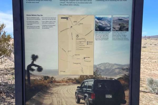
The onX Offroad Difference
onX Offroad combines trail photos, descriptions, difficulty ratings, width restrictions, seasonality, and more in a user-friendly interface. Available on all devices, with offline access and full compatibility with CarPlay and Android Auto. Discover what you're missing today!
Open Trail Map