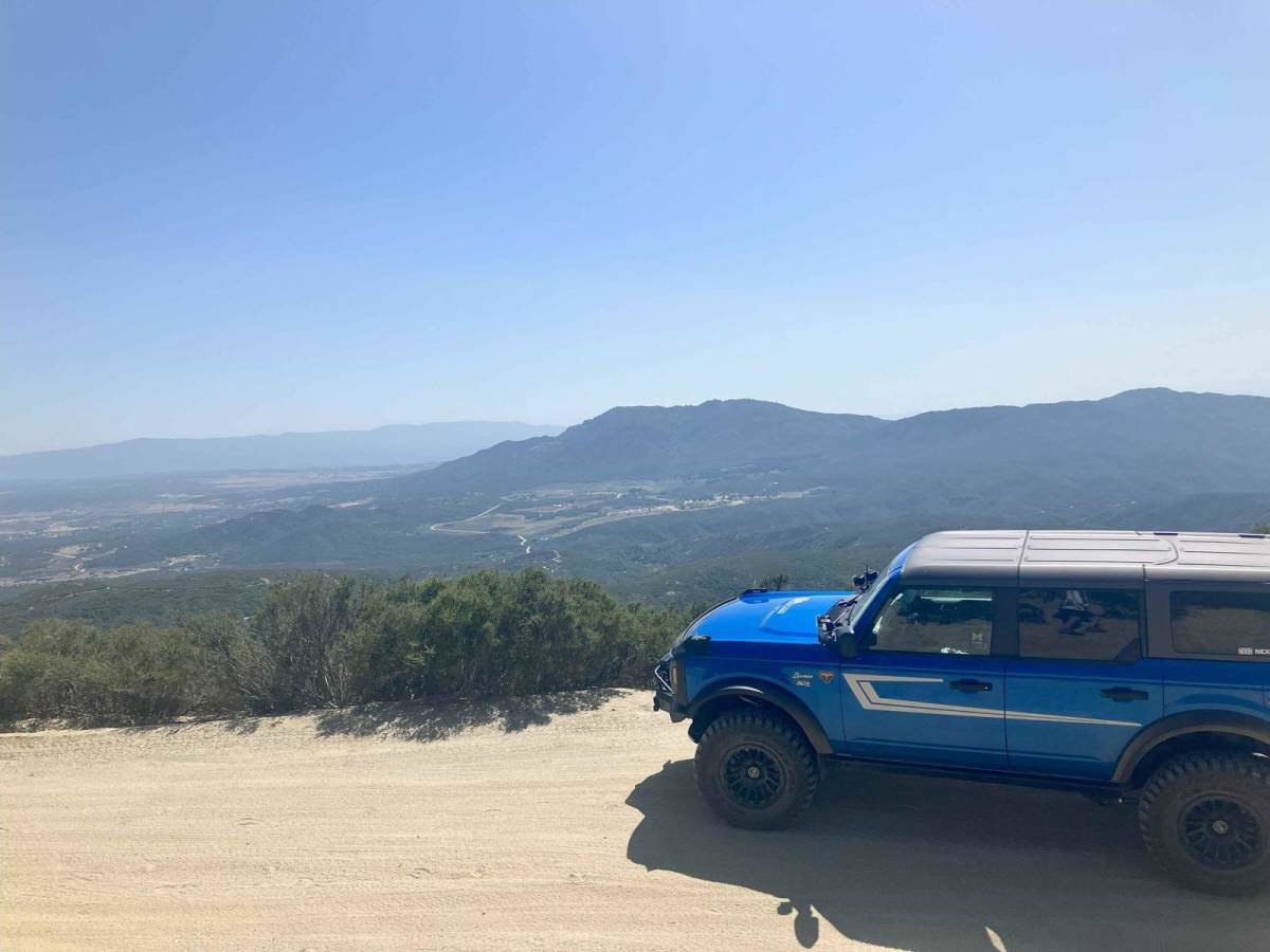
Thomas Mountain West Approach

Total Miles 2.7
Technical Rating
2 Easy
Best Time Spring, Fall, Winter
Trail Type Full-Width Road
Accessible By
Open Trail Map

Trail Overview

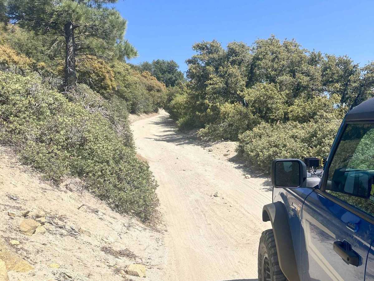
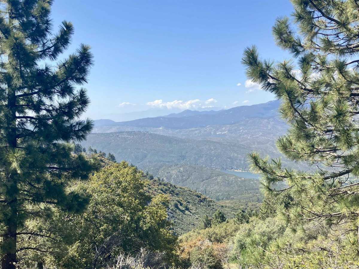
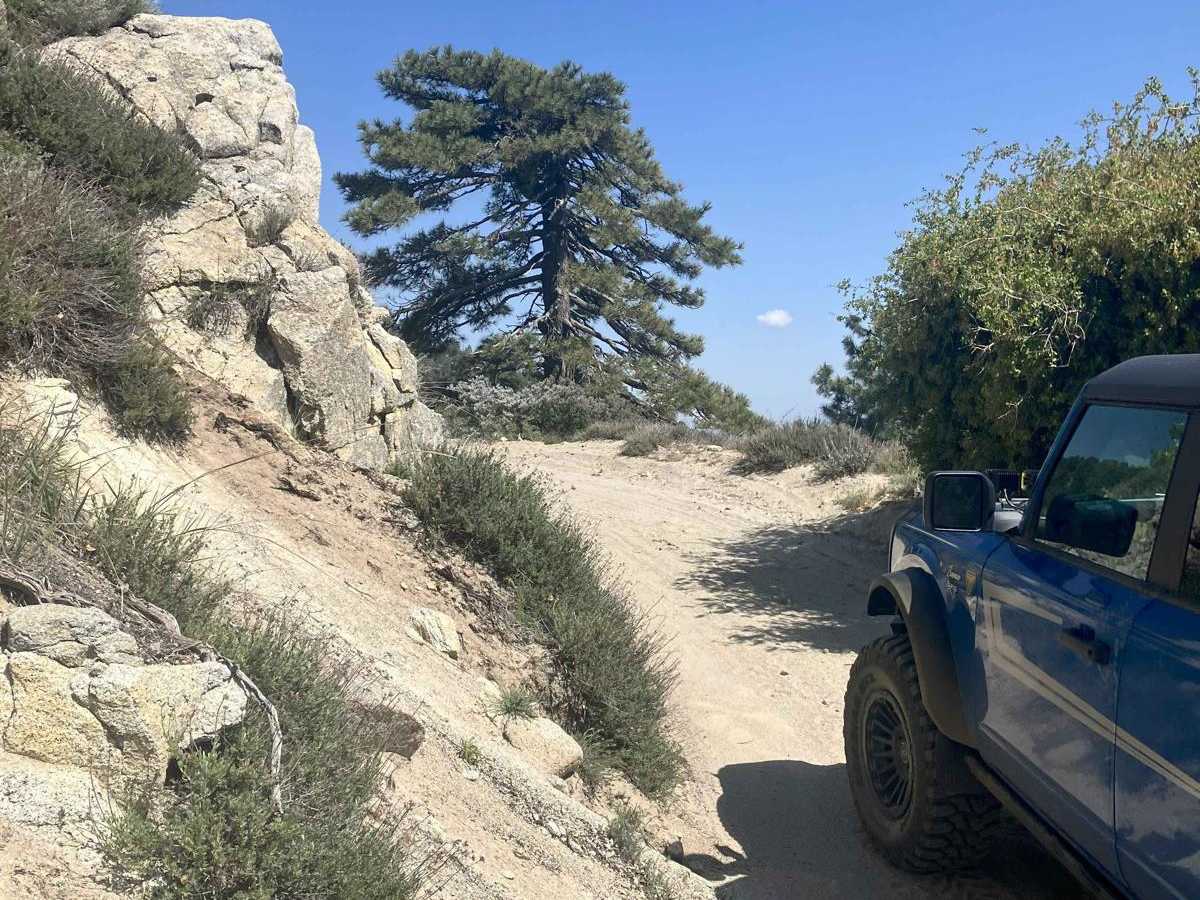
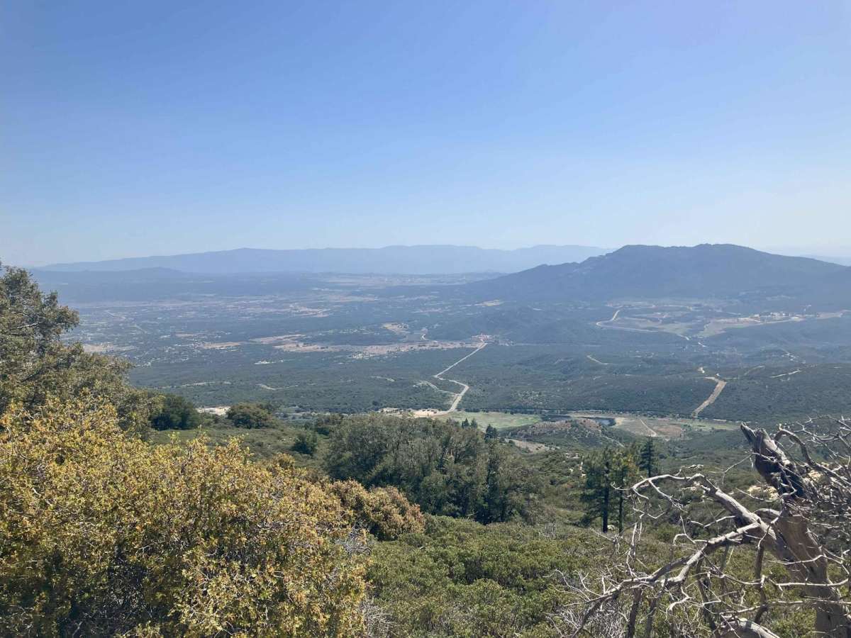
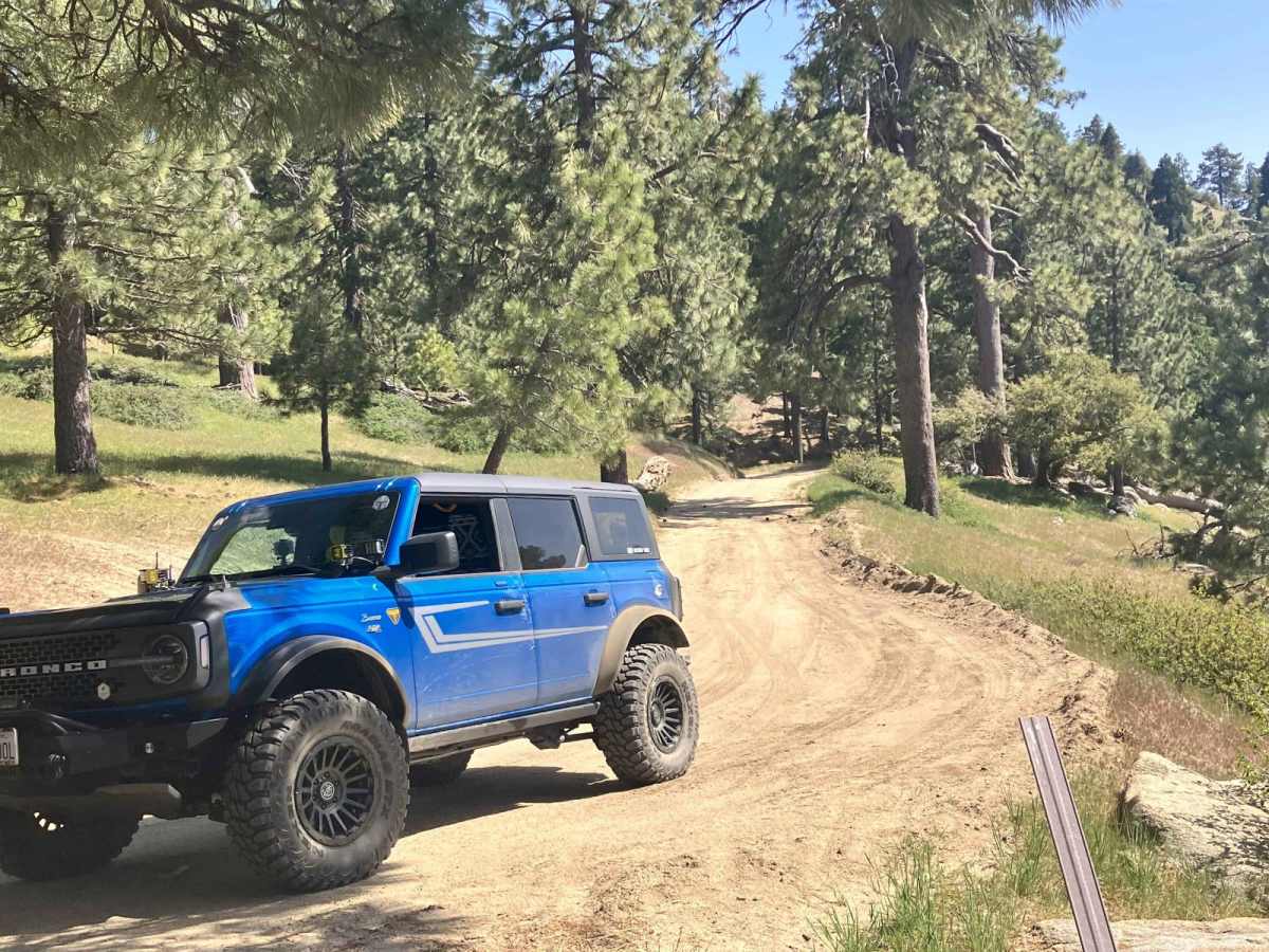
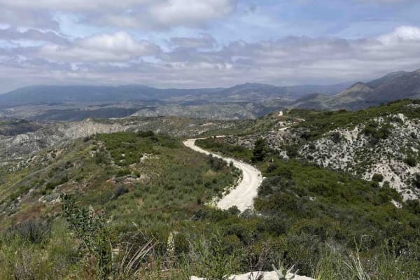
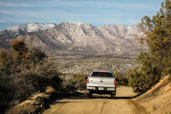
This trail connects the Rouse Ridge via Cottonwood trail to the Thomas Mountain Campground via the western end of Thomas Mountain Road. During dry months, the trail is an easily passable dirt road, requiring only moderate clearance to pass over occasional ruts and drainage control berms running across the road. It runs along the southwestern side of Thomas Mountain, giving scenic elevated views of the valleys below. In several sections, there will be steep drop-offs on one side of the trail, but the trail is wide enough to avoid driving too close to the edge when no oncoming vehicle traffic is present. There is an abundance of turnouts along the trail if oncoming traffic is encountered. There are numerous switchbacks with poor visibility of the upcoming trail, so care should be taken to avoid running into unseen oncoming traffic. If coming from the Rouse Ridge trail, you will end up at the top of Thomas Mountain in the campground area overlooking Lake Hemet. Fire trucks from the Idyllwild FD might be seen in the area occasionally, especially during high fire danger periods.

Photos of Thomas Mountain West Approach

Difficulty

The trail is a graded dirt road with some small to medium-sized scattered rocks. The road will develop occasional ruts due to rain runoff. There are also occasional berms built across the road to control drainage. These obstacles can generally be crossed easily with a moderate clearance vehicle at slower speeds. If the trail is wet or has light snow coverage, 4WD would be necessary.

Technical Rating

2

Status Reports

Add Status Report
Derek Rader
Jan 11, 2026
Open
Overall soft dirt, 2WD is fine, but some sections can be tight for full size trucks due to fallen rocks, but squeezed through with no excitement. A few small puddles of 4-6” water and the trail was damp but not muddy. There are some ruts developing so don’t go too fast.
Peter Schuller
Jun 28, 2025
Open
Craig McVey
Mar 21, 2025
Open
Little slippery getting up to the very top. Still a decent amount of snow/mud up there
Jose Mendez
Jan 12, 2025
Open
I love this trail, it was super easy and fun. For the most part flat, 10 feet wide all the way. Plenty of areas to rest along the way . Looks like it was obstructed by a falling tree before but it got most of it removed. Probably like good 9 feet clearance to past by the down tree with precaution. My can am is approximately 74 wide. You can clearly see in my pictures the difference now from the last report . Let’s keep it clean guys and be safe out there. Watch the speed and respect the incoming traffic. I only see two other trucks tho. Rangers are patrolling so wear a helmet. Thank you
Ryan chambers
Jan 10, 2025
Open
mason godat
Aug 03, 2024
Open

Thomas Mountain West Approach Trail can be accessed by the following ride types:

  • Single Track
  • 50 Inch
  • 60 Inch
  • High Clearance
  • Full Width

Thomas Mountain West Approach Map

The onX Offroad Difference

onX Offroad combines trail photos, descriptions, difficulty ratings, width restrictions, seasonality, and more in a user-friendly interface. Available on all devices, with offline access and full compatibility with CarPlay and Android Auto. Discover what you're missing today!

Open Trail Map