
Beginner Off-Road Trails
Near Garnet, California
Explore All Beginner Trails Near Garnet, California
Beginner Off-Road Trails Near Garnet, California
Discover the best beginner-friendly off-road trails near you. These easier, lower-rated trails are a great place to start — browse trail maps, check difficulty ratings, and find your next adventure.
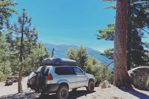
Black Mountain Road
This is an easy trail that most stock vehicles could tackle. There are some really beautiful views, and the high point is the lookout, which gives a breathtaking view of the sunset. There are 5 or 6 yellow post camping sites on the way up.
Learn more about Black Mountain Road
Black Mountain
This well-maintained fire road takes you up to boulder basin group campsite. On the way there, you'll see some turn-outs for rock climbing and overlanding. During the winter months, trails may be impassable due to snow. Almost all vehicles could make the drive. There is cell service if needed. If yo...
Learn more about Black Mountain
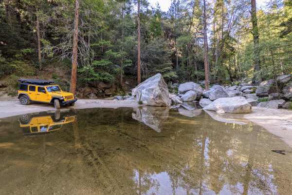
San Jacinto Ridge Trail (FS 5S09)
San Jacinto Ridge is a two-way trail running East to West between the Banning-Idyllwild Panoramic Highway (SR 243) and Bee Canyon Road (FS 5S07) in the San Bernardino National Forest. Comprised of mostly hard-pack dirt, the trail weaves through chaparral and pine trees and crosses over the North for...
Learn more about San Jacinto Ridge Trail (FS 5S09)
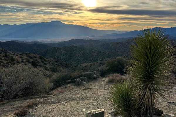
Eureka Peak
This trail takes you to Eureka Peak, which is a mountain top viewpoint allowing you to have a 360-degree view of the area from a high elevation. There are hiking trails throughout this area and one that will take you to the very top of Eureka Peak with just a few hundred feed of walking. There may b...
Learn more about Eureka Peak
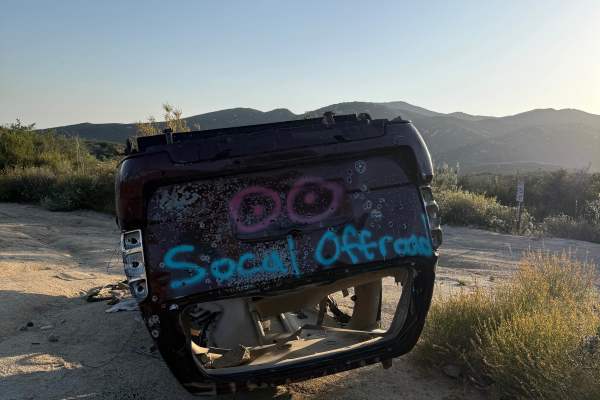
Indian Canyon - FS 4S06
4S06 Indian Canyon is a mellow green-rated trail marked by a flipped scrap car spray-painted with “SoCal Off-Roading.” The route begins as a winding hardpack dirt road with light rutting before entering a shaded wooded section with overhanging trees and a single campsite along the trail. Terrain rem...
Learn more about Indian Canyon - FS 4S06
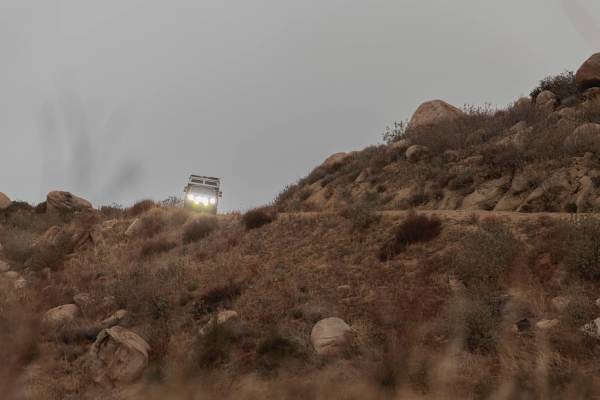
Idyllwild Mountain Road
Beautiful trail overlooking the neighboring town of Banning and the surrounding mountains. The deserted mountainscape is chock-full of secluded camp spots with some wind cover and appears to be used for shooting occasionally. The trail is relatively even in most spots and wide enough for two vehicle...
Learn more about Idyllwild Mountain Road
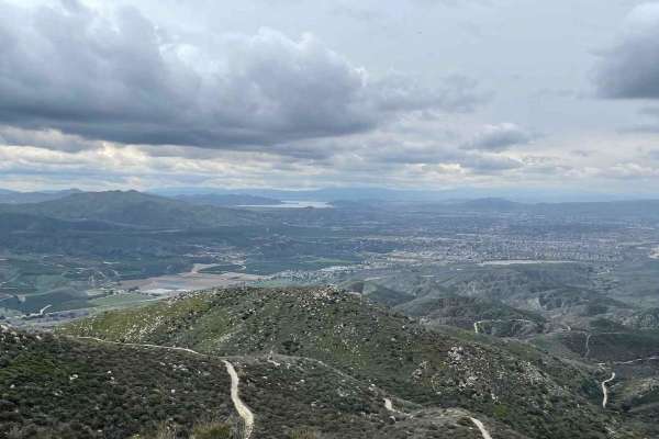
East Indian Canyon 4S10
This is a level 2-rated full-width road back to Highway 243. This is the fastest and safest way back up to Highway 243. The route through Bee Canyon is currently closed. 2 areas had a boulder roll off the hill into the road. Even an H1 Hummer can make it around both of them, so they won't stop you s...
Learn more about East Indian Canyon 4S10
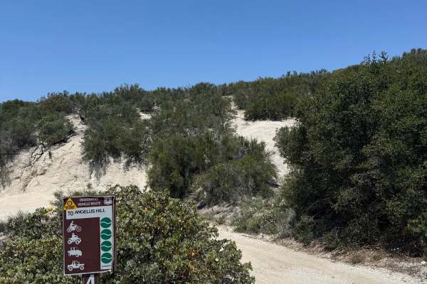
4S19 Angelus Hill
Angelus Hill is an alternative route branching off 4S06 Indian Canyon, featuring mellow terrain and scenic ridgeline riding. The trail follows a hardpack dirt road with light rutting that is shallow and unlikely to trap a tire. Riders can expect gradual hill climbs and sweeping views stretching acro...
Learn more about 4S19 Angelus Hill
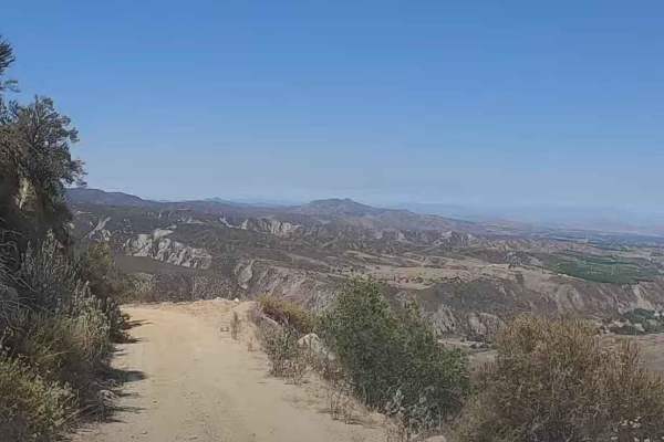
5S06 Idyllwild Control
5S06 Idyllwild Control is a 6-mile point-to-point trail rated 3 of 10 located within the San Bernardino National Forest, San Jacinto Ranger District. 5S06 climbs from Highway 74 nearly 3,000 feet, ending at the intersection with Apple Drive in Idyllwild. The road is open to highway-legal vehicles on...
Learn more about 5S06 Idyllwild Control
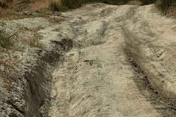
Bee Canyon
Bee Canyon Truck Trail is a solid choice for beginner to intermediate off-roaders looking for a moderate challenge close to Hemet, California. Winding through the San Bernardino National Forest, this trail combines scenic canyon views with varied terrain, making it one of the more accessible dirt tr...
Learn more about Bee Canyon
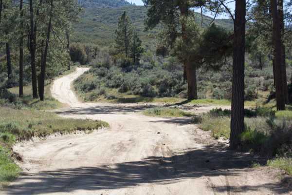
Rouse Hill Road
Rouse Hill Road is for street-legal vehicles only; no green stickers or OHV vehicles. Full-size vehicles are at home here, as the trail is a single track with plenty of room. The beginning of this end of the trail winds through the eastern side of Washburn Ranch which is a large grapefruit grower. T...
Learn more about Rouse Hill Road
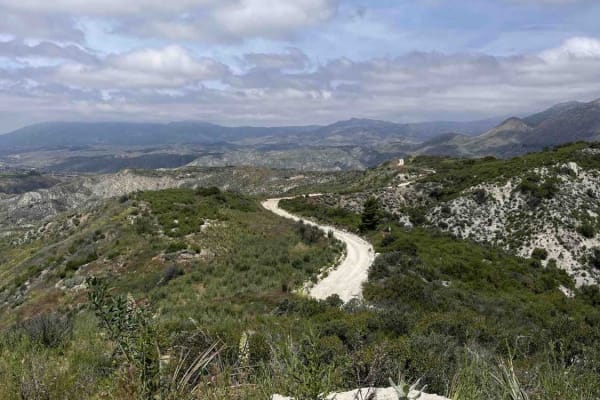
Rouse Hill
Rouse Hill is a ridgeline trail with tremendous west and east views. This trail is predominately hard-packed dirt with a loose top layer. It can be a bit sandy in some sections but that will typically only be an issue for 2-wheel vehicles. The trail is only single vehicle wide in some places and som...
Learn more about Rouse Hill
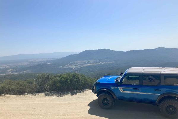
Thomas Mountain West Approach
This trail connects the Rouse Ridge via Cottonwood trail to the Thomas Mountain Campground via the western end of Thomas Mountain Road. During dry months, the trail is an easily passable dirt road, requiring only moderate clearance to pass over occasional ruts and drainage control berms running acro...
Learn more about Thomas Mountain West Approach
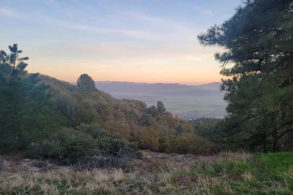
6S13 - Thomas Mountain Road
Uneven, rutted dirt trail with loose rocks and sand. Muddy conditions should be expected during the rainy season. The trail is primarily one vehicle wide with some portions wide enough for passing oncoming traffic. Steep cliffs and drop-offs are common throughout the trail, as well as sharp winding ...
Learn more about 6S13 - Thomas Mountain Road
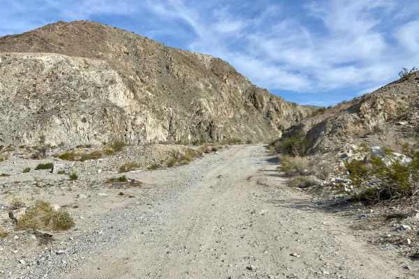
Berdoo Canyon
Wind your way up this canyon that is primarily sand and small rocks. There are a few extra credit options that do have bypasses, except for one or two obstacles at the end. Anything other than a stock SUV can navigate this canyon. The elevation gain is noticeable in the flora once you exit the canyo...
Learn more about Berdoo Canyon
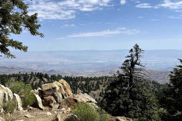
Santa Rosa Truck Trail 7S02
Santa Rosa Truck Trail is an out-and-back well-maintained fire road that climbs to over 8000ft. The lower parts are smooth and wide enough for two vehicles to pass each other. As it rises in elevation the road gets a bit narrower in spots and there are a few sections with small embedded rocks. The s...
Learn more about Santa Rosa Truck Trail 7S02
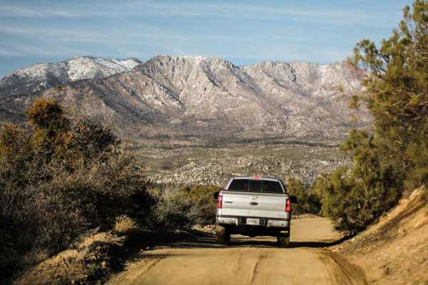
Rouse Ridge via Cottonwood
Rouse Ridge via Cottonwood is a trail that scales Rouse Ridge/Thomas Mountain using Cottonwood (6S18) and Thomas Mountain Rd (6S13). This trail offers stunning views in all directions as you ascend and descend the mountain. While it is possible to complete this trail in either direction, the souther...
Learn more about Rouse Ridge via Cottonwood
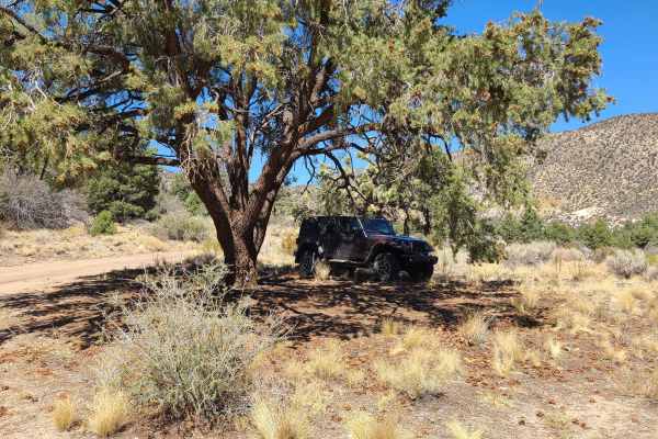
Sleepy Hollow
Sleepy Hollow spur, an out-and-back trail in the San Bernardino National Forest, offers an outstanding spot to find quiet dispersed camping after a day of rough off-roading on Heartbreak Ridge and surrounding trails.
A terrific shaded dispersed campsite is found under a spreading pine tree on level...
Learn more about Sleepy Hollow
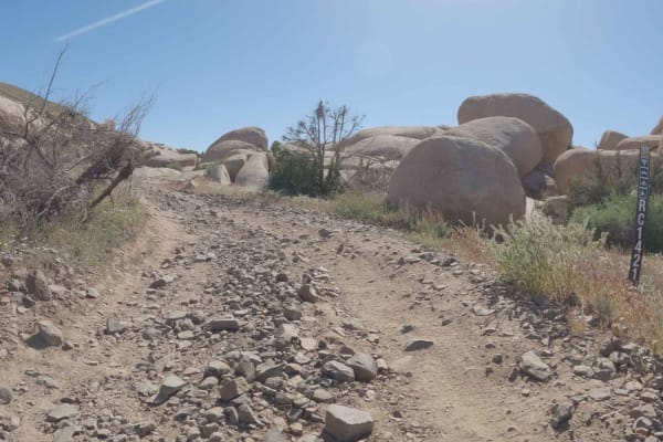
Roadrunner Rut - BLM S1421
Roadrunner Rut is an easy dirt road that climbs into the jumbo boulder gardens and skirts along Black Lava Butte. It changes its name to BLM S1421 as it crosses into BLM lands and descends towards a network of sandy BLM roads in the washes that litter the boulder fields in this area. Roadrunner Rut ...
Learn more about Roadrunner Rut - BLM S1421
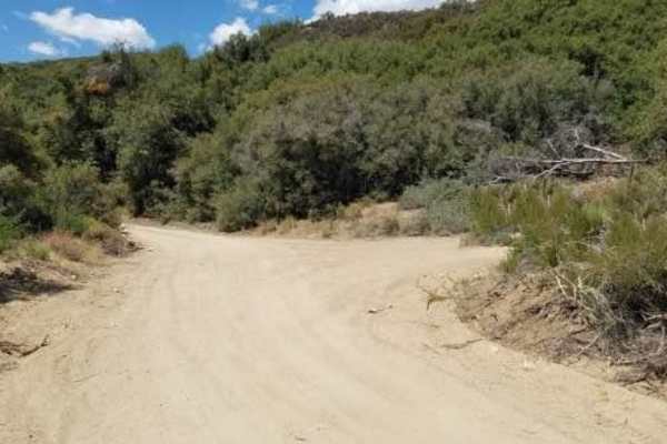
Radford Frontline Road - FS 104
Front Line Road is in the San Bernardino National Forest just south of Big Bear Lake. It provides a casual meandering trail run alongside a shallow canyon formed by the 8,000-foot San Bernardino Mountain Range to the north and the 10,000-foot San Gorgonio Wilderness mountains to the south. There are...
Learn more about Radford Frontline Road - FS 104
Beginner ATV trails near Garnet, California
Explore ATV-friendly trails near you. These trails are accessible for vehicles up to 50 inches wide, perfect for ATVs and smaller off-road machines.
Black Mountain Road
This is an easy trail that most stock vehicles could tackle. There are some really beautiful views, and the high point is the lookout, which gives a breathtaking view of the sunset. There are 5 or 6 yellow post camping sites on the way up.
Learn more about Black Mountain Road
Black Mountain
This well-maintained fire road takes you up to boulder basin group campsite. On the way there, you'll see some turn-outs for rock climbing and overlanding. During the winter months, trails may be impassable due to snow. Almost all vehicles could make the drive. There is cell service if needed. If yo...
Learn more about Black Mountain
San Jacinto Ridge Trail (FS 5S09)
San Jacinto Ridge is a two-way trail running East to West between the Banning-Idyllwild Panoramic Highway (SR 243) and Bee Canyon Road (FS 5S07) in the San Bernardino National Forest. Comprised of mostly hard-pack dirt, the trail weaves through chaparral and pine trees and crosses over the North for...
Learn more about San Jacinto Ridge Trail (FS 5S09)
Eureka Peak
This trail takes you to Eureka Peak, which is a mountain top viewpoint allowing you to have a 360-degree view of the area from a high elevation. There are hiking trails throughout this area and one that will take you to the very top of Eureka Peak with just a few hundred feed of walking. There may b...
Learn more about Eureka Peak
Beginner UTV/side-by-side trails near Garnet, California
Find UTV and side-by-side trails near you. These trails accommodate vehicles up to 60 inches wide, ideal for UTVs, side-by-sides, and wider off-road rigs.
San Jacinto Ridge Trail (FS 5S09)
San Jacinto Ridge is a two-way trail running East to West between the Banning-Idyllwild Panoramic Highway (SR 243) and Bee Canyon Road (FS 5S07) in the San Bernardino National Forest. Comprised of mostly hard-pack dirt, the trail weaves through chaparral and pine trees and crosses over the North for...
Learn more about San Jacinto Ridge Trail (FS 5S09)
Eureka Peak
This trail takes you to Eureka Peak, which is a mountain top viewpoint allowing you to have a 360-degree view of the area from a high elevation. There are hiking trails throughout this area and one that will take you to the very top of Eureka Peak with just a few hundred feed of walking. There may b...
Learn more about Eureka Peak
Indian Canyon - FS 4S06
4S06 Indian Canyon is a mellow green-rated trail marked by a flipped scrap car spray-painted with “SoCal Off-Roading.” The route begins as a winding hardpack dirt road with light rutting before entering a shaded wooded section with overhanging trees and a single campsite along the trail. Terrain rem...
Learn more about Indian Canyon - FS 4S06
Idyllwild Mountain Road
Beautiful trail overlooking the neighboring town of Banning and the surrounding mountains. The deserted mountainscape is chock-full of secluded camp spots with some wind cover and appears to be used for shooting occasionally. The trail is relatively even in most spots and wide enough for two vehicle...
Learn more about Idyllwild Mountain Road
The onX Offroad Difference
onX Offroad combines trail photos, descriptions, difficulty ratings, width restrictions, seasonality, and more in a user-friendly interface. Available on all devices, with offline access and full compatibility with CarPlay and Android Auto. Discover what you're missing today!
Open Trail Map