
Beginner Off-Road Trails
Near Falmouth Foreside, Maine
Explore All Beginner Trails Near Falmouth Foreside, Maine
Beginner Off-Road Trails Near Falmouth Foreside, Maine
Discover the best beginner-friendly off-road trails near you. These easier, lower-rated trails are a great place to start — browse trail maps, check difficulty ratings, and find your next adventure.
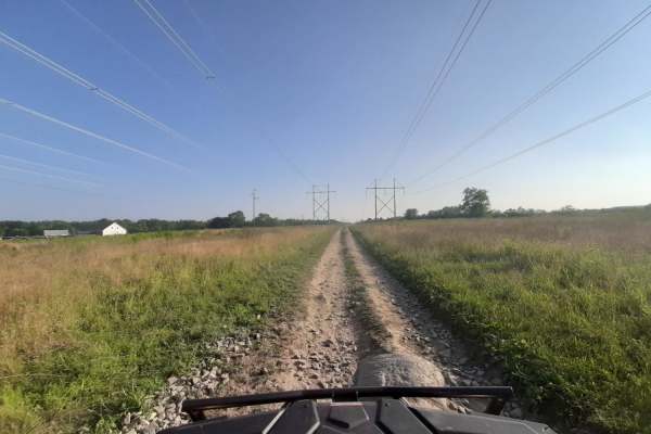
Sanford Maine ATV Club & Rail Trail
Sanford's Rail Trail follows the old Portland and Rochester Railroad Company railbed, passing through many scenic areas in Sanford. This well-maintained, multi-use, flat gravel-topped trail is easily walked and used year round, with stores, ponds and rivers, marshlands, scenic stone bridges and fore...
Learn more about Sanford Maine ATV Club & Rail Trail
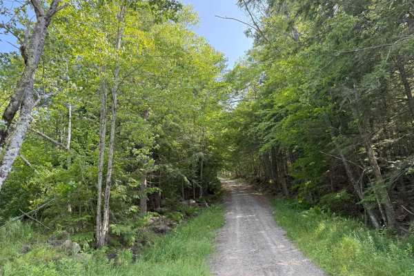
Caverly Road to Devil's Den Road
This route travels across two portions of two Class 6 roads that travel around Caverly Mountain, then between Devil's Den Mountain and Mount Molly. The route is stock four-wheel drive friendly and can be run in either direction. This route starts on Caverly Road and heads West for approximately 1 mi...
Learn more about Caverly Road to Devil's Den Road
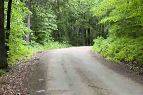
Slippery Brook
This is a gravel road with many camping spots with some hiking trailheads. It is easily accessible by suv and maybe even a car. It is a great scenic view of the river both on the way to the trail and while on the trail. There are multiple gates that are closed depending on snow levels. It is not mai...
Learn more about Slippery Brook
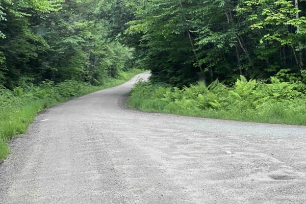
East Branch Saco River
This is a well-maintained dirt gravel road with lots of pull-off spots to pop up camp and trailheads. It dead ends at a hiking trail. There are a lot of scenic views and a bridge crossing over the river. A campsite is next to the river and a small beaver pond are great locations.
Learn more about East Branch Saco River
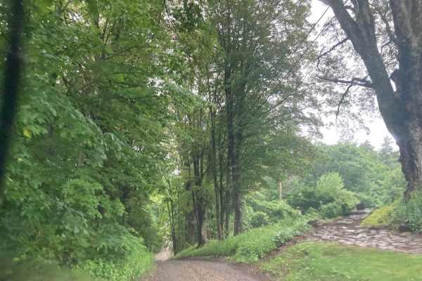
Natty's Route
This public and maintained dirt/gravel route starts in Farmington, New Hampshire, and ends in Strafford. Please be considerate of the residents and stick to the public throughways. Full-width tracks branching off the main throughway are more than likely private property and should never be traversed...
Learn more about Natty's Route
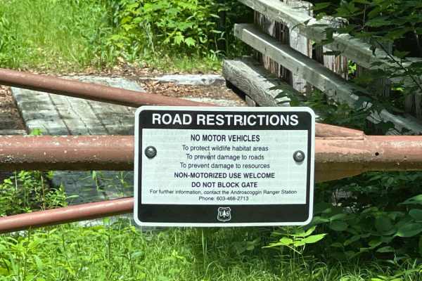
Little Larry Road
This is a well-maintained in-and-out gravel road in the White Mounts National Forest's Hastings Campground. It doubles as part of the Gilead snowmobile trail system in the winter months. Lots of campsites and a few hiking trails. It is family-friendly and campground reservations are made online for...
Learn more about Little Larry Road
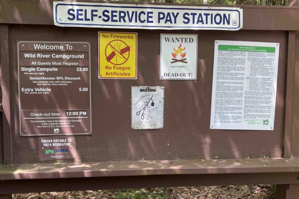
Wild River Road
This is a beautiful in-and-out following the Wild River along a seasonally closed gravel road. There are a lot of scenic views to enjoy of the river and gorge. The road dead ends at the Wild River Campground managed by the White Mountains National Forest. There are lots of hiking trailheads on the s...
Learn more about Wild River Road
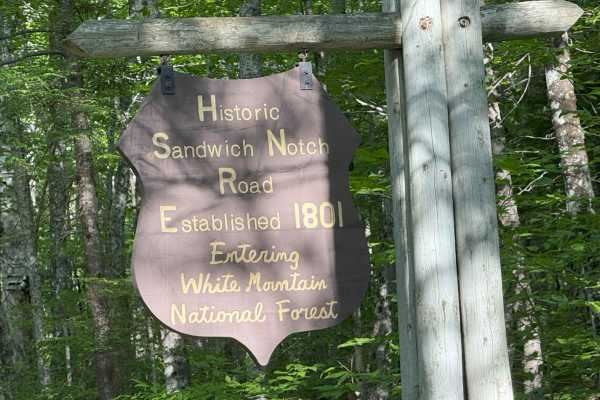
Sandwich Notch Road
Sandwich Notch Road is a well-maintained dirt forest road that runs between Thornton and Sandwich, New Hampshire, in the White Mountain National Forest. This iconic NH scenic byway was first established in 1801. This easy route has a lot of bang for your buck, as the scenery and views are breathtaki...
Learn more about Sandwich Notch Road
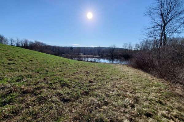
Quarry Road Trail
Designed for intermediate riders, the Quarry Road Trail offers a convenient and scenic escape that seamlessly connects Waterville's commercial hub to the rural trail systems of Fairfield. Starting directly behind the Waterville Home Depot, this 2.4-mile route winds through the scenic Quarry Road Rec...
Learn more about Quarry Road Trail
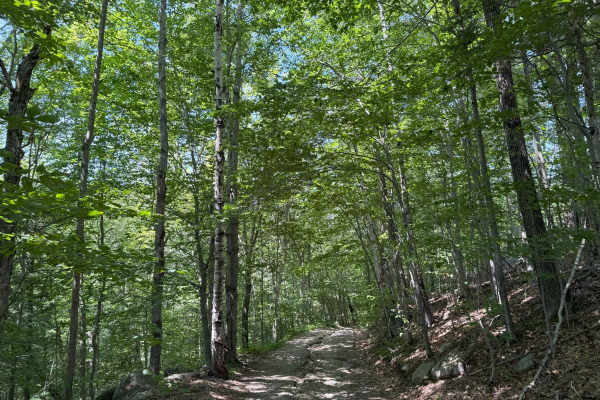
Thompson Road
Thompson Road is a "Class VI" public road in Sandwich, New Hampshire. The route is fairly easy and can be done in a stock 4WD vehicle. This route is an out-and-back, and is supposed to be longer, but was blocked by a gate at about 1.5 miles into the trail. This trail will take you up and down severa...
Learn more about Thompson Road
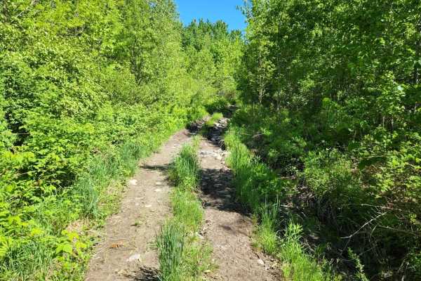
Center Trail
This is a winding trail through mostly woods and fields. This trail is quite smooth with a few small rocks and rocky areas. A few rough exposed roots and a lot of ditches to keep the trail erosion under control. A couple of sharp turns and uneven terrain. No mud but may have mud puddles with a hard ...
Learn more about Center Trail
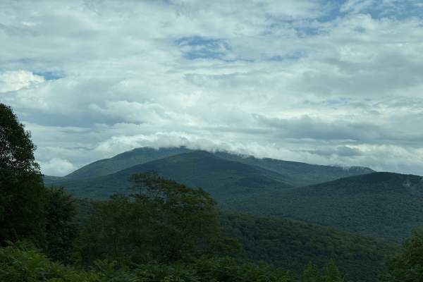
Tripoli Road
Tripoli Road is a well-maintained forest road that connects the Town of Waterville Valley to Thornton via a pass between Mt. Tecumseh and Mt. Osceola. This road is easily passable by any vehicle and is a popular road for access to hiking trails on Mt. Tecumseh and Mt. Osceola, as well as numerous ca...
Learn more about Tripoli Road
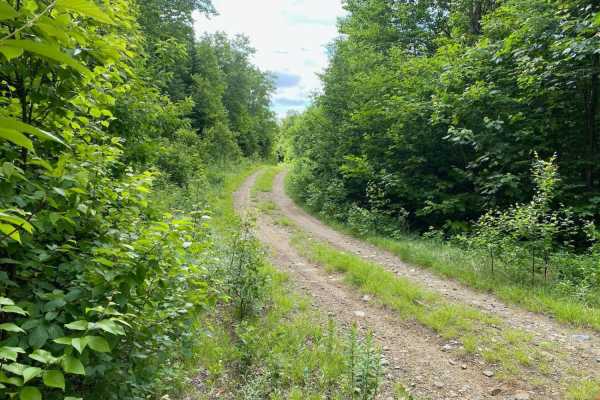
Edes Brook Trail
Edes Brook Trail is a scenic 3.7-mile route near Temple, Maine that serves as a perfect cruising path for beginners or those seeking smooth access to nearby scenic vistas and connecting trail networks. Starting at Intervale Road, the trail winds westward, climbing steadily from an elevation of about...
Learn more about Edes Brook Trail
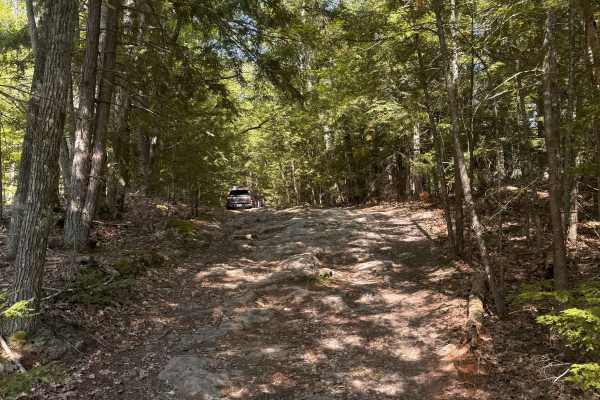
Mountain Road
Mountain Road is a New Hampshire Class VI road. Coming from the south, the route stays right, indicated by a Class VI sign, as Swamp Road goes left. Cow Pastures can be seen to the right as you begin your first climb onto Mountain Road. You will come back down to an intersection for Mountain View Sp...
Learn more about Mountain Road
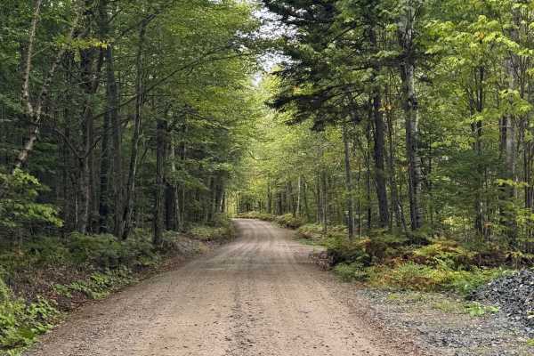
Pine Mountain Notch (Dolly Copp Rd)
Pine Mountain Notch – Dolly Copp Road is a well-maintained forest road situated within the White Mountain National Forest. Typically closed during the winter months, the road provides a scenic connection between Randolph, New Hampshire, and Route 16 just south of Gorham. The route also affords acces...
Learn more about Pine Mountain Notch (Dolly Copp Rd)
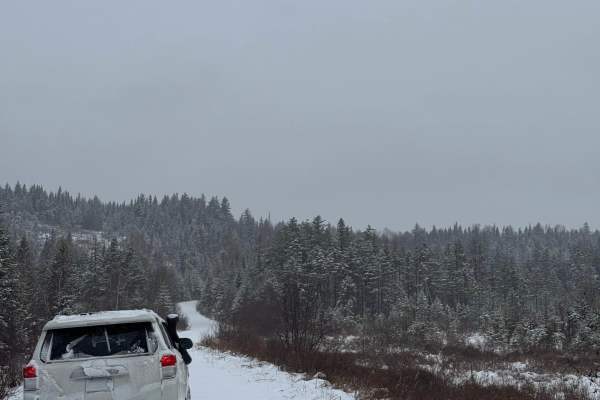
North Pond Road
North Pond Road extends northeast from Success Pond Road and eventually connects with Maine Route 26/Bear River Road, just north of Grafton Notch State Park. The road is a well-maintained dirt and gravel route that can be traveled comfortably by most vehicles. Running through the valley between Red ...
Learn more about North Pond Road
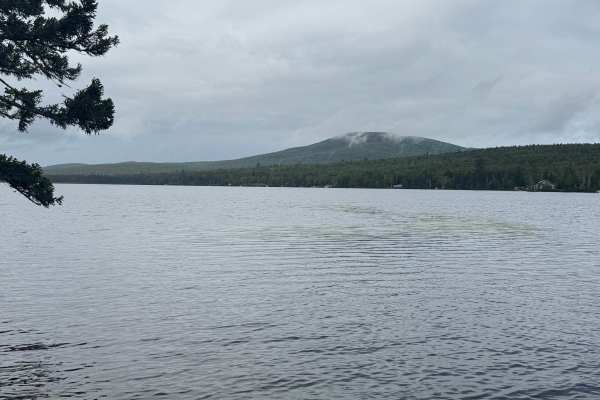
Success Pond Road
Success Pond Road is a maintained gravel and dirt road extending northeast from Berlin, New Hampshire. Shortly after leaving Berlin, the road provides access to several OHV trailheads and staging areas. Continuing northeast, it crosses into Maine before reaching Success Pond, where a small parking a...
Learn more about Success Pond Road
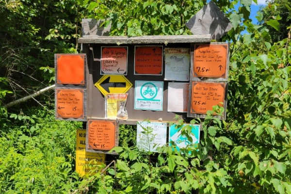
Frye Mountain - High Ridge to Getchell
The Frye Mountain - High Ridge to Getchell trail is a West to East crossing through the Frye Mountain State Game Management Area. This trail is just over 8 miles passing by the Carter Cemetery and includes a small 3 mile (out and back) to another private Cemetery, where the trail becomes a turnarou...
Learn more about Frye Mountain - High Ridge to Getchell
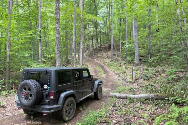
Cass Road
Cass Road is a Class 6 road in Bridgewater, NH. This route can be driven in either direction. From East to West, it runs uphill for nearly the entire route with approximately 600 feet of elevation gain. This route is a good access road into the main part of the Class 6 road system in Bridgewater, as...
Learn more about Cass Road
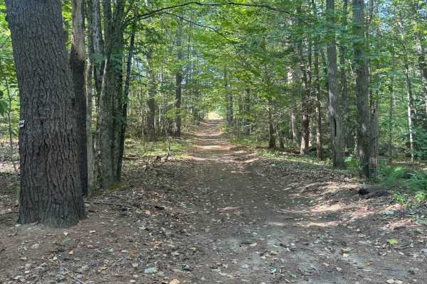
Hersey Road
This is a Class VI road in Danville, New Hampshire. You can access the trail from the east off of State Route 111A, turning onto the Hersey Road paved section. Trail access is to the left at the split (GH Carter Drive goes right), up into the woods. Follow signage for Beehive Hut at the split for th...
Learn more about Hersey Road
Beginner ATV trails near Falmouth Foreside, Maine
Explore ATV-friendly trails near you. These trails are accessible for vehicles up to 50 inches wide, perfect for ATVs and smaller off-road machines.
Sanford Maine ATV Club & Rail Trail
Sanford's Rail Trail follows the old Portland and Rochester Railroad Company railbed, passing through many scenic areas in Sanford. This well-maintained, multi-use, flat gravel-topped trail is easily walked and used year round, with stores, ponds and rivers, marshlands, scenic stone bridges and fore...
Learn more about Sanford Maine ATV Club & Rail Trail
Caverly Road to Devil's Den Road
This route travels across two portions of two Class 6 roads that travel around Caverly Mountain, then between Devil's Den Mountain and Mount Molly. The route is stock four-wheel drive friendly and can be run in either direction. This route starts on Caverly Road and heads West for approximately 1 mi...
Learn more about Caverly Road to Devil's Den Road
Quarry Road Trail
Designed for intermediate riders, the Quarry Road Trail offers a convenient and scenic escape that seamlessly connects Waterville's commercial hub to the rural trail systems of Fairfield. Starting directly behind the Waterville Home Depot, this 2.4-mile route winds through the scenic Quarry Road Rec...
Learn more about Quarry Road Trail
Center Trail
This is a winding trail through mostly woods and fields. This trail is quite smooth with a few small rocks and rocky areas. A few rough exposed roots and a lot of ditches to keep the trail erosion under control. A couple of sharp turns and uneven terrain. No mud but may have mud puddles with a hard ...
Learn more about Center Trail
Beginner UTV/side-by-side trails near Falmouth Foreside, Maine
Find UTV and side-by-side trails near you. These trails accommodate vehicles up to 60 inches wide, ideal for UTVs, side-by-sides, and wider off-road rigs.
Sanford Maine ATV Club & Rail Trail
Sanford's Rail Trail follows the old Portland and Rochester Railroad Company railbed, passing through many scenic areas in Sanford. This well-maintained, multi-use, flat gravel-topped trail is easily walked and used year round, with stores, ponds and rivers, marshlands, scenic stone bridges and fore...
Learn more about Sanford Maine ATV Club & Rail Trail
Caverly Road to Devil's Den Road
This route travels across two portions of two Class 6 roads that travel around Caverly Mountain, then between Devil's Den Mountain and Mount Molly. The route is stock four-wheel drive friendly and can be run in either direction. This route starts on Caverly Road and heads West for approximately 1 mi...
Learn more about Caverly Road to Devil's Den Road
Quarry Road Trail
Designed for intermediate riders, the Quarry Road Trail offers a convenient and scenic escape that seamlessly connects Waterville's commercial hub to the rural trail systems of Fairfield. Starting directly behind the Waterville Home Depot, this 2.4-mile route winds through the scenic Quarry Road Rec...
Learn more about Quarry Road Trail
Center Trail
This is a winding trail through mostly woods and fields. This trail is quite smooth with a few small rocks and rocky areas. A few rough exposed roots and a lot of ditches to keep the trail erosion under control. A couple of sharp turns and uneven terrain. No mud but may have mud puddles with a hard ...
Learn more about Center Trail
The onX Offroad Difference
onX Offroad combines trail photos, descriptions, difficulty ratings, width restrictions, seasonality, and more in a user-friendly interface. Available on all devices, with offline access and full compatibility with CarPlay and Android Auto. Discover what you're missing today!
Open Trail Map