
Beginner Off-Road Trails
Near Austin, Nevada
Explore All Beginner Trails Near Austin, Nevada
Beginner Off-Road Trails Near Austin, Nevada
Discover the best beginner-friendly off-road trails near you. These easier, lower-rated trails are a great place to start — browse trail maps, check difficulty ratings, and find your next adventure.
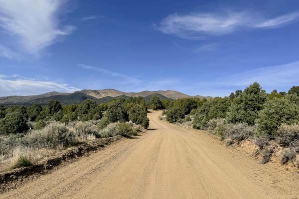
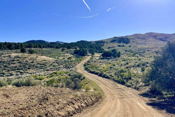
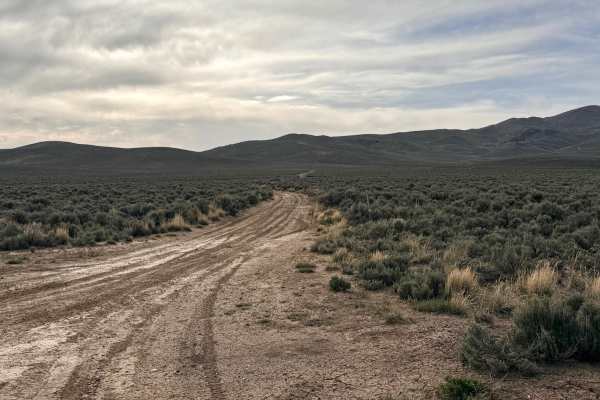
Yankee Blade Loop (FS43184)
The Yankee Blade Loop is a premier scenic adventure that climbs deep into the Toiyabe Range, offering a comprehensive look at the numerous mining claims that once fueled the region's economy. The journey begins at the Austin Ranger District Station, a recommended stop during the open season to gathe...
Learn more about Yankee Blade Loop (FS43184)
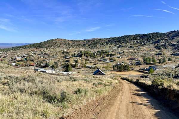
A Mountain - FS 43240
Named for the massive "A" on the hillside representing the town of Austin, this trail offers a high-vantage tour of the community’s most recognizable landmark. Curiously, the trail doesn't lead to a specific peak, nor does it provide a clear view of the "A" from the very bottom; instead, you get a c...
Learn more about A Mountain - FS 43240
Apex Mine Alternate FS43238
This is a fantastic, "as easy as it gets" trail that serves as a perfect introduction to the rugged terrain surrounding Austin. The route begins at the edge of the local fairgrounds on a wide, inviting two-track before transitioning into an engaging single-track path that hugs the base of the mounta...
Learn more about Apex Mine Alternate FS43238
Marshall Canyon - FS 43241
Marshall Canyon is a scenic, narrow, and well-graded trail that loops around the "backside" of the mountains, cradling the town of Austin. This route provides a sense of deep mountain isolation despite its proximity to town, offering constant views of the rugged Toiyabe Range and the expansive valle...
Learn more about Marshall Canyon - FS 43241
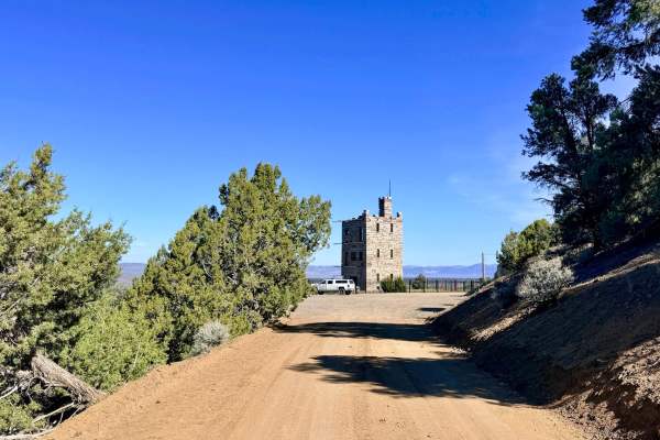
Stokes Castle
Stokes Castle is perhaps the most famous landmark in central Nevada, standing as a silent, stone sentinel overlooking the Reese River Valley. This trail offers an incredibly accessible way to experience Nevada’s "Gilded Age" history. Starting right from the local gas station—where you can easily res...
Learn more about Stokes Castle
Yankee Blade (FS43184E)
Yankee Blade FS43184E is a narrow out-and-back trail that climbs steeply into the rugged hills of the historic Yankee Blade district. This route hasn't seen maintenance in quite some time, making it a true "explorer's" track. As you ascend, the trail is flanked by low-hanging Utah Juniper and Pinyon...
Learn more about Yankee Blade (FS43184E)
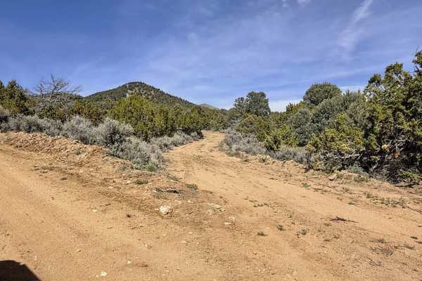
New York Canyon
New York Canyon is a scenic, slightly traveled cut-over trail that offers a classic "shelf road" experience as it clings to the canyon side. The trail provides a beautiful transition in flora, moving from the sagebrush-heavy valley floor into higher elevations lined with dense stands of aromatic Uta...
Learn more about New York Canyon
Mount Prometheus - FS 43225
This is a lightly traveled cut-over route that serves as a beautiful transition from the high-elevation ridges of Austin Summit down to the paved Reese River Road on the valley floor. The trail’s namesake peak, Mount Prometheus, is famously elusive; even with an extensive search, the mountain remain...
Learn more about Mount Prometheus - FS 43225
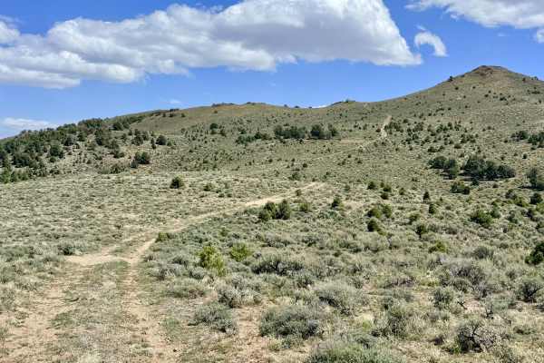
Crow Canyon - FS 43242
Crow Canyon is a well-maintained, graded route that offers a scenic ascent to ridgelines overlooking the historic town of Austin. This trail is an excellent choice for those looking for a relatively low-stress climb into the hills. The lower portion of the canyon, near the valley floor, features sev...
Learn more about Crow Canyon - FS 43242
Amador Canyon
Amador Canyon is a captivating loop that climbs into the rugged mountains north of Austin, transporting you from the valley floor into the heart of Nevada’s silver-mining heyday. The trail leads to the legendary Yankee Blade mine complex, a long-forgotten camp that once bustled with prospectors. Tod...
Learn more about Amador Canyon
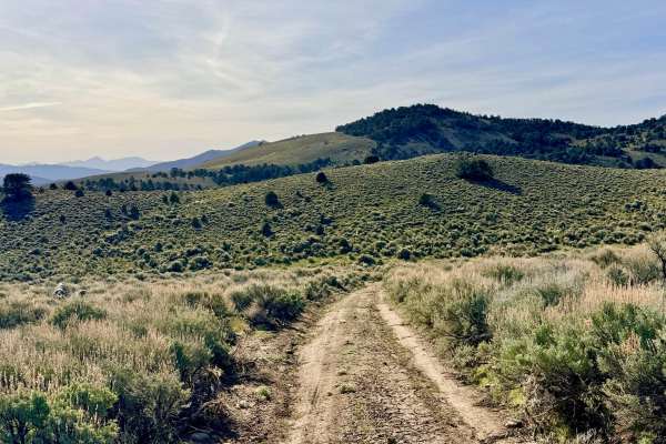
Austin Summit - FS 43233
This is an incredibly engaging and dynamic trail that feels like a natural rollercoaster through the high-altitude terrain of the Toiyabe Range. The route is a constant series of twists and turns, rises and falls, as it dances along the ridgelines and through the canyons of this rugged "sky island."...
Learn more about Austin Summit - FS 43233
North Silver King Mine - FS 43182
North Silver King Mine - FS 43182 is a secluded out-and-back trail that takes you deep into the heart of the historic mining landscape just north of Austin. While the route initially appears to connect through to the Old Highway trail, it ultimately terminates at a massive, towering tailings pile at...
Learn more about North Silver King Mine - FS 43182
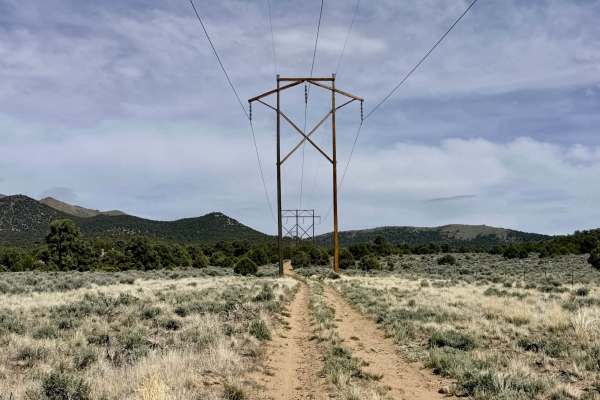
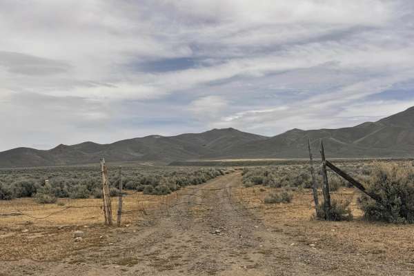
Substation Cutover
The Substation Cutover is a short but essential connector trail that bridges the gap between the valley floor and the more rugged interior of the Humboldt-Toiyabe National Forest. This route is perfect for those looking to bypass the main paved highways and maintain a continuous off-road journey as ...
Learn more about Substation Cutover
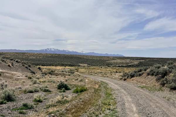
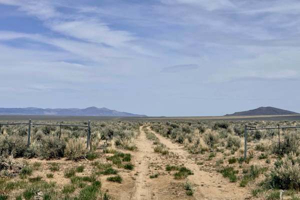
South Old Highway Road
South Old Highway Road offers a classic Nevada high-desert driving experience, tracing a path through the wide-open Reese River Valley. This dirt route serves as a historical bypass between the legendary town of Austin and the northern valleys. For much of the trip, the road is wide with ample room ...
Learn more about South Old Highway Road
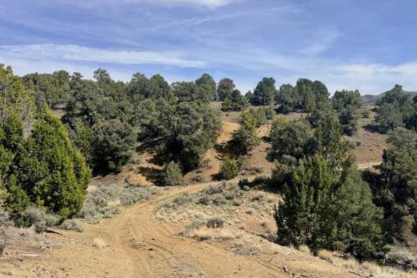
Dry Canyon Alternate - FS 43231
Dry Canyon Alternate is a "spicy" and engaging route that offers a more technical experience than the primary canyon roads. Right from the start, the trail demands your attention with a series of quick drops, sharp climbs, and tight, narrow turns. The environment is beautifully varied; you will tran...
Learn more about Dry Canyon Alternate - FS 43231
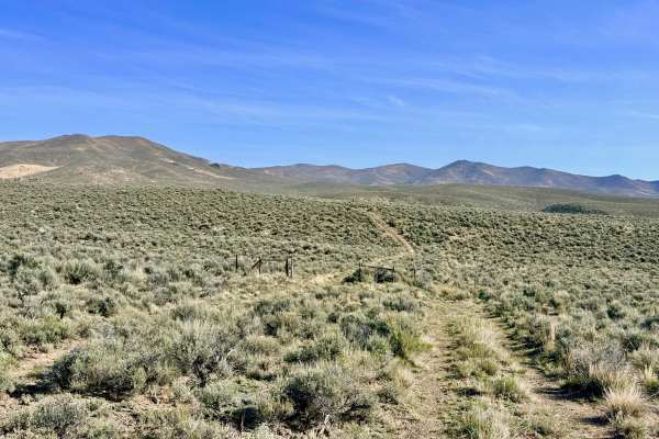
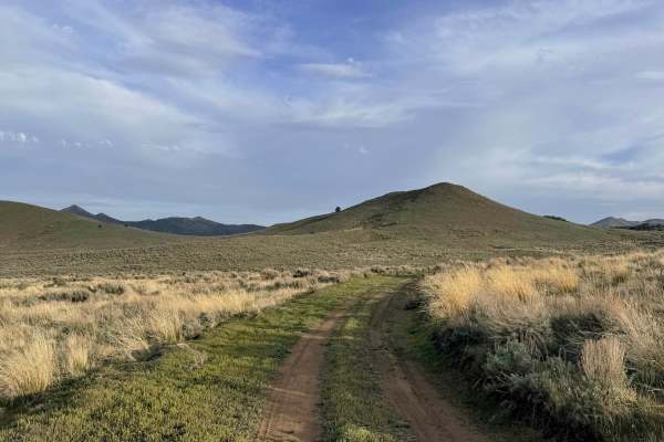
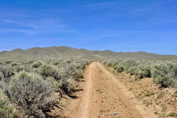
Bade Creek Bypass - FS 43224
Bade Creek Bypass is a classic "fence-line" road that provides a direct north-south corridor across the rolling high-desert meadows. This trail serves a critical role in local navigation: since the historic Willow Creek trail no longer offers direct access to the paved Reese River Road, this bypass ...
Learn more about Bade Creek Bypass - FS 43224
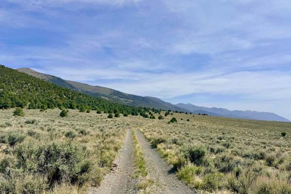
Emigrant Canyon - FS 43222
Emigrant Canyon is a historic and scenic passage that crests at Emigrant Pass (elevation 7,182 feet). This trail is a significant segment of the Emigrant Trails West network, offering modern explorers a chance to trace the exact path taken by pioneers during the 19th century. As you reach the summit...
Learn more about Emigrant Canyon - FS 43222
Blackbird Spring Loop - FS 43250
Blackbird Spring Loop is a fun, physically engaging trail that offers a more technical alternative for crossing the ridges southeast of Austin. The route begins near the Bob Scott Campground and winds its way toward Highway 50, offering a diverse range of high-desert environments. The northwestern s...
Learn more about Blackbird Spring Loop - FS 43250
Cottonwood Canyon
Cottonwood Canyon is a rugged out-and-back trail that follows the winding path of Cottonwood Creek, a rare and vital desert waterway fed by natural springs higher up in the range. The journey begins relatively easily, with a few minor washouts that most high-clearance vehicles can handle without iss...
Learn more about Cottonwood Canyon
Willow Creek Connector/Bypass - FS 43497+98
This combined route of FS 43497 and FS 43498 serves as the modern, essential connector for explorers heading toward the Barton Creek and Willow Creek loop systems. Navigation in this area has changed significantly over time; the far eastern end of the original bypass route no longer exists and has b...
Learn more about Willow Creek Connector/Bypass - FS 43497+98
Beginner ATV trails near Austin, Nevada
Explore ATV-friendly trails near you. These trails are accessible for vehicles up to 50 inches wide, perfect for ATVs and smaller off-road machines.
Yankee Blade Loop (FS43184)
The Yankee Blade Loop is a premier scenic adventure that climbs deep into the Toiyabe Range, offering a comprehensive look at the numerous mining claims that once fueled the region's economy. The journey begins at the Austin Ranger District Station, a recommended stop during the open season to gathe...
Learn more about Yankee Blade Loop (FS43184)
A Mountain - FS 43240
Named for the massive "A" on the hillside representing the town of Austin, this trail offers a high-vantage tour of the community’s most recognizable landmark. Curiously, the trail doesn't lead to a specific peak, nor does it provide a clear view of the "A" from the very bottom; instead, you get a c...
Learn more about A Mountain - FS 43240
Apex Mine Alternate FS43238
This is a fantastic, "as easy as it gets" trail that serves as a perfect introduction to the rugged terrain surrounding Austin. The route begins at the edge of the local fairgrounds on a wide, inviting two-track before transitioning into an engaging single-track path that hugs the base of the mounta...
Learn more about Apex Mine Alternate FS43238
Marshall Canyon - FS 43241
Marshall Canyon is a scenic, narrow, and well-graded trail that loops around the "backside" of the mountains, cradling the town of Austin. This route provides a sense of deep mountain isolation despite its proximity to town, offering constant views of the rugged Toiyabe Range and the expansive valle...
Learn more about Marshall Canyon - FS 43241
Beginner UTV/side-by-side trails near Austin, Nevada
Find UTV and side-by-side trails near you. These trails accommodate vehicles up to 60 inches wide, ideal for UTVs, side-by-sides, and wider off-road rigs.
Yankee Blade Loop (FS43184)
The Yankee Blade Loop is a premier scenic adventure that climbs deep into the Toiyabe Range, offering a comprehensive look at the numerous mining claims that once fueled the region's economy. The journey begins at the Austin Ranger District Station, a recommended stop during the open season to gathe...
Learn more about Yankee Blade Loop (FS43184)
A Mountain - FS 43240
Named for the massive "A" on the hillside representing the town of Austin, this trail offers a high-vantage tour of the community’s most recognizable landmark. Curiously, the trail doesn't lead to a specific peak, nor does it provide a clear view of the "A" from the very bottom; instead, you get a c...
Learn more about A Mountain - FS 43240
Apex Mine Alternate FS43238
This is a fantastic, "as easy as it gets" trail that serves as a perfect introduction to the rugged terrain surrounding Austin. The route begins at the edge of the local fairgrounds on a wide, inviting two-track before transitioning into an engaging single-track path that hugs the base of the mounta...
Learn more about Apex Mine Alternate FS43238
Marshall Canyon - FS 43241
Marshall Canyon is a scenic, narrow, and well-graded trail that loops around the "backside" of the mountains, cradling the town of Austin. This route provides a sense of deep mountain isolation despite its proximity to town, offering constant views of the rugged Toiyabe Range and the expansive valle...
Learn more about Marshall Canyon - FS 43241
The onX Offroad Difference
onX Offroad combines trail photos, descriptions, difficulty ratings, width restrictions, seasonality, and more in a user-friendly interface. Available on all devices, with offline access and full compatibility with CarPlay and Android Auto. Discover what you're missing today!
Open Trail Map