
Beginner Off-Road Trails
Near Kingston, Nevada
Explore All Beginner Trails Near Kingston, Nevada
Beginner Off-Road Trails Near Kingston, Nevada
Discover the best beginner-friendly off-road trails near you. These easier, lower-rated trails are a great place to start — browse trail maps, check difficulty ratings, and find your next adventure.
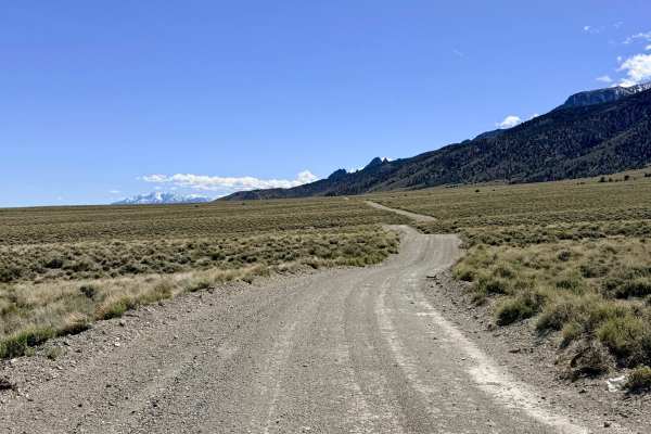
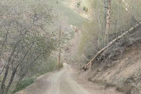
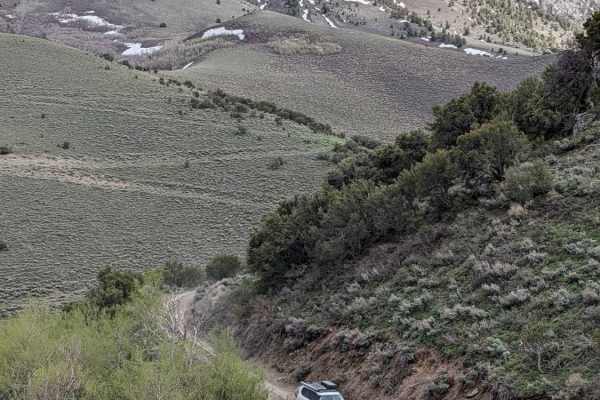
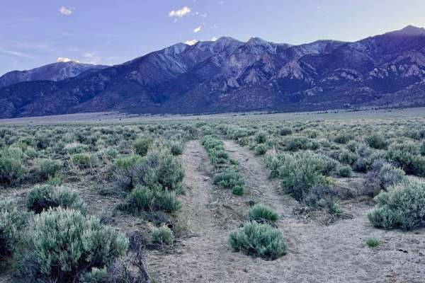
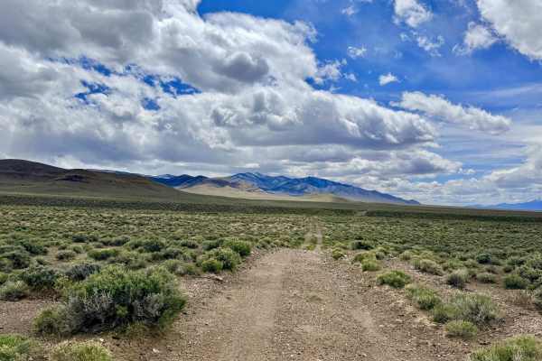
Broad Canyon Bypass FS43307A
The Broad Canyon Bypass is a delightful trail that traverses the mid-elevation foothills of the Toiyabe Range. This route is exceptionally well-maintained, with a wide, graded dirt surface that provides a smooth, comfortable cruising experience. As the road rolls up and over the undulating foothills...
Learn more about Broad Canyon Bypass FS43307A
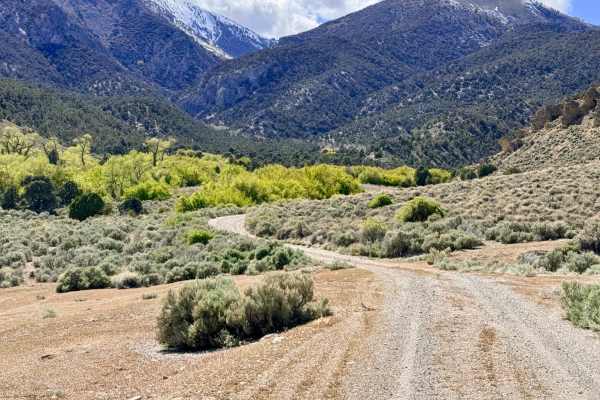
Kingston Canyon Road
Kingston Canyon Road is a 10-mile gravel Forest Service road that climbs up into the Toiyabe Mountains from Kingston, Nevada. It accesses numerous campgrounds, Grove Lake, and is the northernmost access point for the Toiyabe Crest National Recreation Trail. This road is a part of the Nevada Backcoun...
Learn more about Kingston Canyon Road
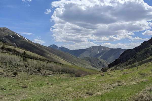
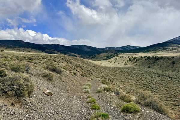
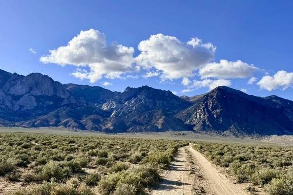
Foothill Loop
This trail is an engaging mountain ascent that climbs directly from the valley floor along Highway 376 into the undulating hills of the Toiyabe Range. This trail offers a spirited driving experience, characterized by a series of "big dips" and several deep, dry wash crossings that will keep you focu...
Learn more about Foothill Loop
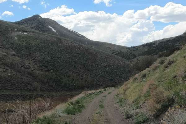
Bowman Creek FS43307
The journey begins with a technical, rocky ascent, with the trail composed of sharp volcanic rock. Drivers should focus on careful line selection to protect their tire sidewalls. As you progress, the trail enters a scenic, twisty canyon that crosses through Clear Creek twice. These water crossings a...
Learn more about Bowman Creek FS43307
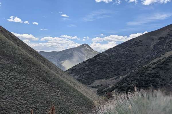
Big Creek Road - NF-012
From its junction with Kingston Canyon Road at 8,740' at Kinston Summit, Big Creek drops steeply into Big Creek Canyon and follows its namesake to the North down out of the Toiyabe mountains. Portions of this road are steep enough that a low range is needed for traction on climbs and for braking on ...
Learn more about Big Creek Road - NF-012
Clipper Gap Canyon Access - FS 43274
Clipper Gap Canyon Access begins much like many of the other primitive foothill tracks in the region, rocky, lightly traveled, and etched with the scars of desert erosion. Several unexpected washouts appear suddenly along the route; these obstacles, combined with light off-camber sections, require a...
Learn more about Clipper Gap Canyon Access - FS 43274
North Fork Big Creek Road - NF43012
The North Fork Big Creek Road climbs 2,700' up out of Big Creek Canyon onto a hilltop summit at 8,800'. It is a little-used, unmaintained gravel road that gets steep at times, and low range is necessary. There are numerous spots where there can be significant exposure. It appears to dead-end on Fore...
Learn more about North Fork Big Creek Road - NF43012
Slippin N Scramblin
This unmaintained, two-mile mining road connects from the top of North Fork Big Creek to South Fork Birch Creek in the Toiyabe Mountains. It sees little use other than the occasional hunter or oddball explorer. It is steep in sections and has some sidehill exposure. Use low range. This high country ...
Learn more about Slippin N Scramblin
South Fork Birch Creek Road - NF43243
Climbing up out of Birch Creek Canyon to join Dry Canyon Road at almost 9,000 feet, this road is a well-maintained gravel Forest Service road. It features a small number of level dispersed camping spots with incredible views of nearby North Toiyabe Peak, which rises to 10,699 feet. It is also part o...
Learn more about South Fork Birch Creek Road - NF43243
Clipper Gap Canyon - FS 43286
Clipper Gap Canyon Loop is a lightly used, primitive trail that provides a rugged tour of the Toiyabe foothills. This route is defined by its isolation and its varied terrain, offering outstanding panoramic views of the high peaks to the east and the sprawling Reese River Valley to the west. As you ...
Learn more about Clipper Gap Canyon - FS 43286

Bronco Mine - FS 43273
Bronco Mine is a scenic trail that skirts the expansive valley floor and climbs into the rugged interior foothills of the Toiyabe Range. The route offers a fantastic vantage point for experiencing the vastness of the Great Basin; as you climb, you are treated to spectacular, wide-angle views of the ...
Learn more about Bronco Mine - FS 43273
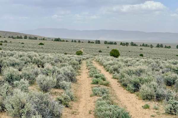
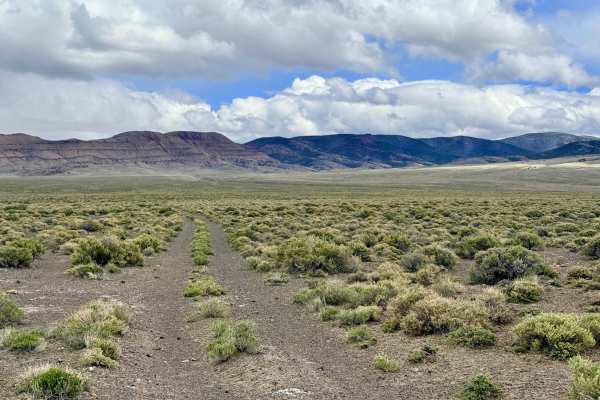
Goodyear Spring - FS 43252
Goodyear Spring is a solid choice for those looking to traverse the lower foothills on a route that is less technical than the high-elevation ridgelines but still provides an engaging backcountry experience. The trail carries you through a vast field of sagebrush, where the rugged peaks of the Toiya...
Learn more about Goodyear Spring - FS 43252
McLeod Bypass - FS 43340
While the map may initially suggest a promising loop through the foothills, the McLeod Bypass is best described as a rugged "trail to nowhere." This route is ideal for those seeking total solitude and a front-row seat to some of the most impressive geology in the range. As you head deeper into the b...
Learn more about McLeod Bypass - FS 43340
South Trail McLeod Bypass - FS 43340
The South Trail McLeod Bypass is a primitive, seldom-traveled two-track that offers a true sense of solitude as it traverses the rugged hillsides of the Toiyabe Range. This route is an excellent choice for those looking to escape the more popular valley trails and immerse themselves in the "Sky Isla...
Learn more about South Trail McLeod Bypass - FS 43340
McLeod Creek - FS 43336
Despite its name, McLeod Creek serves primarily as a breathtaking approach through a rugged canyon rather than a direct route to the water. The landscape here is characterized by a complex array of older, reclaimed trails that speak to the area’s long history of exploration. As you navigate the trac...
Learn more about McLeod Creek - FS 43336
McLeod Bypass - FS 43481
While this segment of the McLeod trail system is relatively uneventful in terms of technical obstacles, it is an essential and pleasant "well-traveled" route for navigating the Toiyabe foothills. This trail provides a smooth, easy drive into the hills, serving as one of the primary bypasses for the ...
Learn more about McLeod Bypass - FS 43481
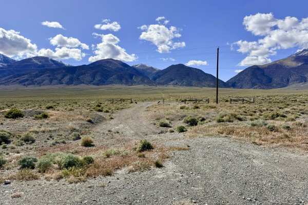
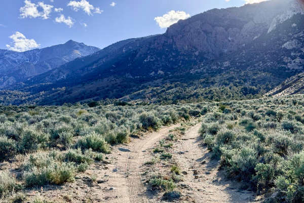
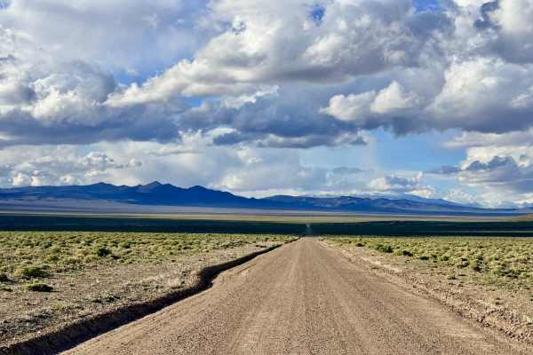
Lower Canyon Cutover Trail - BLM 288
As the name suggests, the Lower Canyon Cutover Trail is a pleasant and efficient way to traverse the lower slopes of the canyon network, providing vital access to the various technical trails that branch off into the Toiyabe Range. This route is a popular "highway" for more than just off-roaders; th...
Learn more about Lower Canyon Cutover Trail - BLM 288
Bronco Mine Bypass - FS 43289
This trail offers a quintessential Nevada backcountry experience, where the "sagebrush sea" meets the looming shadows of the high peaks. The scenery here is spectacular, providing wide-angle views of the mountain range to the west and the expansive, sun-bleached valley floor to the east. While much ...
Learn more about Bronco Mine Bypass - FS 43289
Goodyear Bypass - FS 43254
The Goodyear Bypass is a spirited and scenic trail that cuts diagonally across the foothills, serving as a primary link between the higher mountain tracks and the expansive valley floor. The route offers an engaging drive through vast "sagebrush seas" and tall desert grasses, providing unobstructed,...
Learn more about Goodyear Bypass - FS 43254
South Hot Springs Rd - BLM 206
This trail serves as the southern gateway to the Spencer Hot Springs area, especially convenient for travelers descending from the Toiyabe Range via Pete’s Summit Pass. This route offers a quicker and significantly smoother alternative to the more heavily trafficked northern access roads. Because it...
Learn more about South Hot Springs Rd - BLM 206
Beginner ATV trails near Kingston, Nevada
Explore ATV-friendly trails near you. These trails are accessible for vehicles up to 50 inches wide, perfect for ATVs and smaller off-road machines.
Broad Canyon Bypass FS43307A
The Broad Canyon Bypass is a delightful trail that traverses the mid-elevation foothills of the Toiyabe Range. This route is exceptionally well-maintained, with a wide, graded dirt surface that provides a smooth, comfortable cruising experience. As the road rolls up and over the undulating foothills...
Learn more about Broad Canyon Bypass FS43307A
Foothill Loop
This trail is an engaging mountain ascent that climbs directly from the valley floor along Highway 376 into the undulating hills of the Toiyabe Range. This trail offers a spirited driving experience, characterized by a series of "big dips" and several deep, dry wash crossings that will keep you focu...
Learn more about Foothill Loop
Bowman Creek FS43307
The journey begins with a technical, rocky ascent, with the trail composed of sharp volcanic rock. Drivers should focus on careful line selection to protect their tire sidewalls. As you progress, the trail enters a scenic, twisty canyon that crosses through Clear Creek twice. These water crossings a...
Learn more about Bowman Creek FS43307
Clipper Gap Canyon Access - FS 43274
Clipper Gap Canyon Access begins much like many of the other primitive foothill tracks in the region, rocky, lightly traveled, and etched with the scars of desert erosion. Several unexpected washouts appear suddenly along the route; these obstacles, combined with light off-camber sections, require a...
Learn more about Clipper Gap Canyon Access - FS 43274
Beginner UTV/side-by-side trails near Kingston, Nevada
Find UTV and side-by-side trails near you. These trails accommodate vehicles up to 60 inches wide, ideal for UTVs, side-by-sides, and wider off-road rigs.
Broad Canyon Bypass FS43307A
The Broad Canyon Bypass is a delightful trail that traverses the mid-elevation foothills of the Toiyabe Range. This route is exceptionally well-maintained, with a wide, graded dirt surface that provides a smooth, comfortable cruising experience. As the road rolls up and over the undulating foothills...
Learn more about Broad Canyon Bypass FS43307A
Foothill Loop
This trail is an engaging mountain ascent that climbs directly from the valley floor along Highway 376 into the undulating hills of the Toiyabe Range. This trail offers a spirited driving experience, characterized by a series of "big dips" and several deep, dry wash crossings that will keep you focu...
Learn more about Foothill Loop
Bowman Creek FS43307
The journey begins with a technical, rocky ascent, with the trail composed of sharp volcanic rock. Drivers should focus on careful line selection to protect their tire sidewalls. As you progress, the trail enters a scenic, twisty canyon that crosses through Clear Creek twice. These water crossings a...
Learn more about Bowman Creek FS43307
Clipper Gap Canyon Access - FS 43274
Clipper Gap Canyon Access begins much like many of the other primitive foothill tracks in the region, rocky, lightly traveled, and etched with the scars of desert erosion. Several unexpected washouts appear suddenly along the route; these obstacles, combined with light off-camber sections, require a...
Learn more about Clipper Gap Canyon Access - FS 43274
The onX Offroad Difference
onX Offroad combines trail photos, descriptions, difficulty ratings, width restrictions, seasonality, and more in a user-friendly interface. Available on all devices, with offline access and full compatibility with CarPlay and Android Auto. Discover what you're missing today!
Open Trail Map