
Public Fishing Access
Find Public Boat Launches and Shore Fishing Access
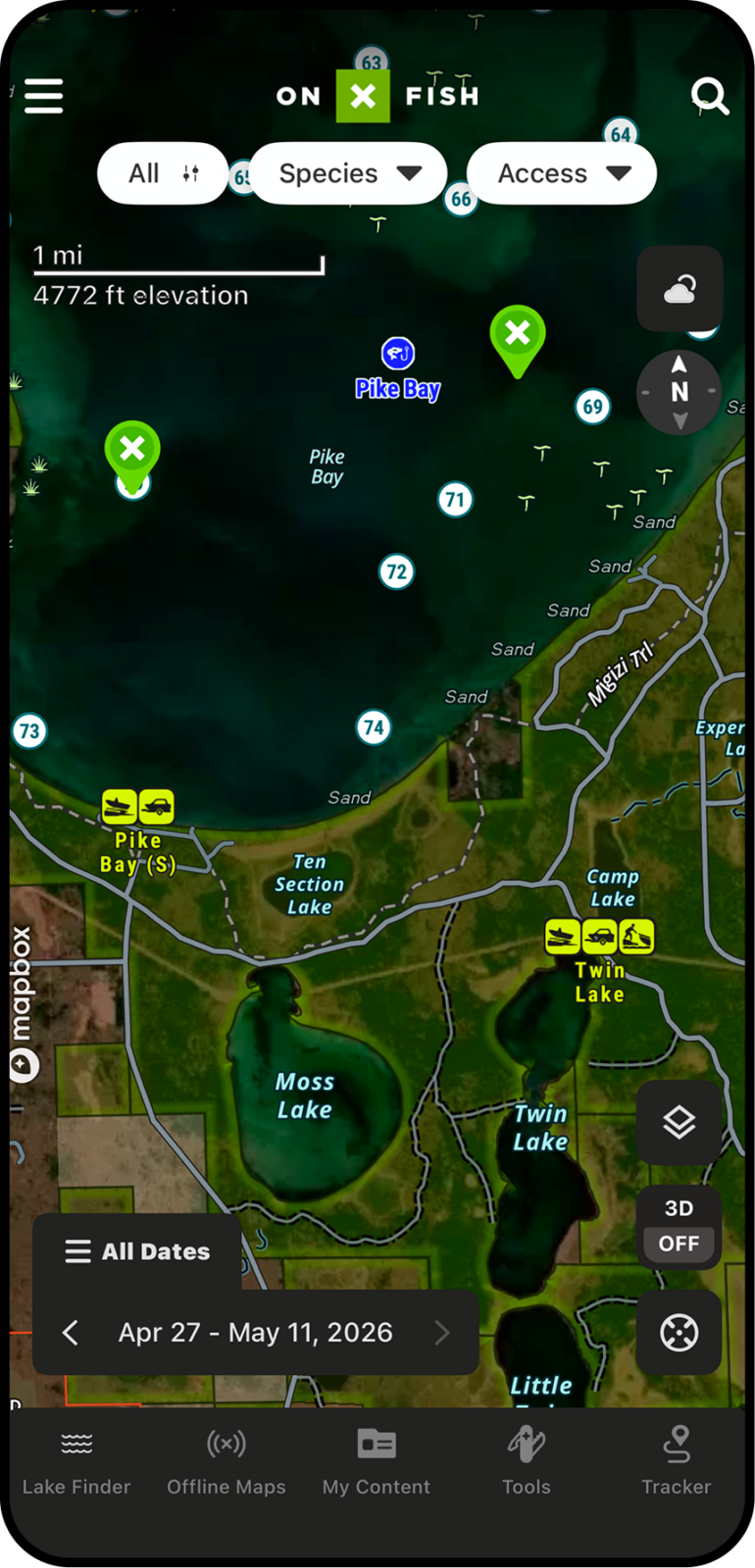
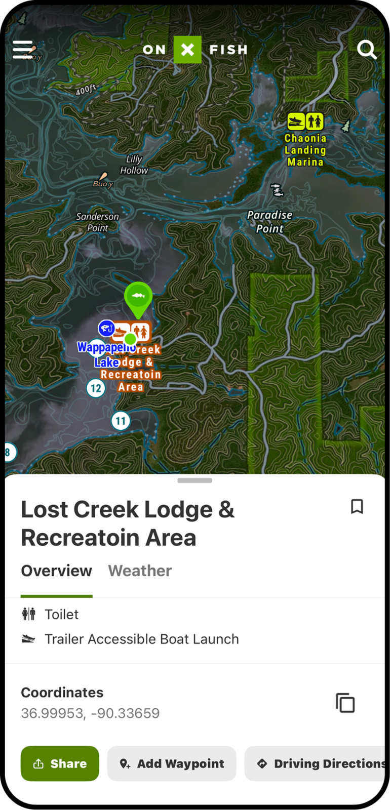
A good fishing plan starts with knowing where to launch. With Public Access Points in onX Fish, anglers can find public boat ramps, launches, and water access areas before they leave home. Scout the right access point, plan your drive, and spend less time searching for a place to put in.
Find Public Boat Launches and Shore Fishing Access
A good fishing plan starts with knowing where to launch. With Public Access Points in onX Fish, anglers can find public boat ramps, launches, and water access areas before they leave home. Scout the right access point, plan your drive, and spend less time searching for a place to put in.
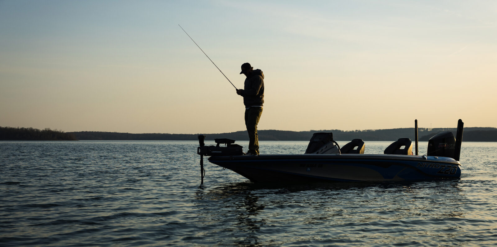
Find Boat Ramps Before You Leave Home
Public Access Points help anglers quickly locate places to get on the water. Whether you are towing a boat, launching a kayak, or putting in a canoe, onX Fish helps you identify access options around your target lake so you can plan your day with confidence.
With detailed access information built directly into the map, anglers can spend less time searching and more time fishing. Discover nearby launch ramps, shore fishing access, carry-in spots, and alternate entry points that make it easier to adapt when conditions change or popular launches are crowded. Whether you are exploring a new lake or revisiting a familiar one, Public Access Points help simplify trip planning from start to finish.
Choose the Best Launch for Your Fishing Plan
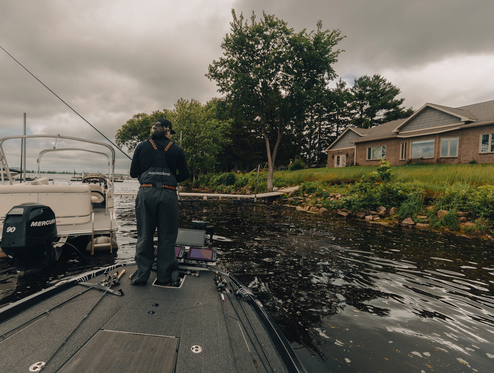
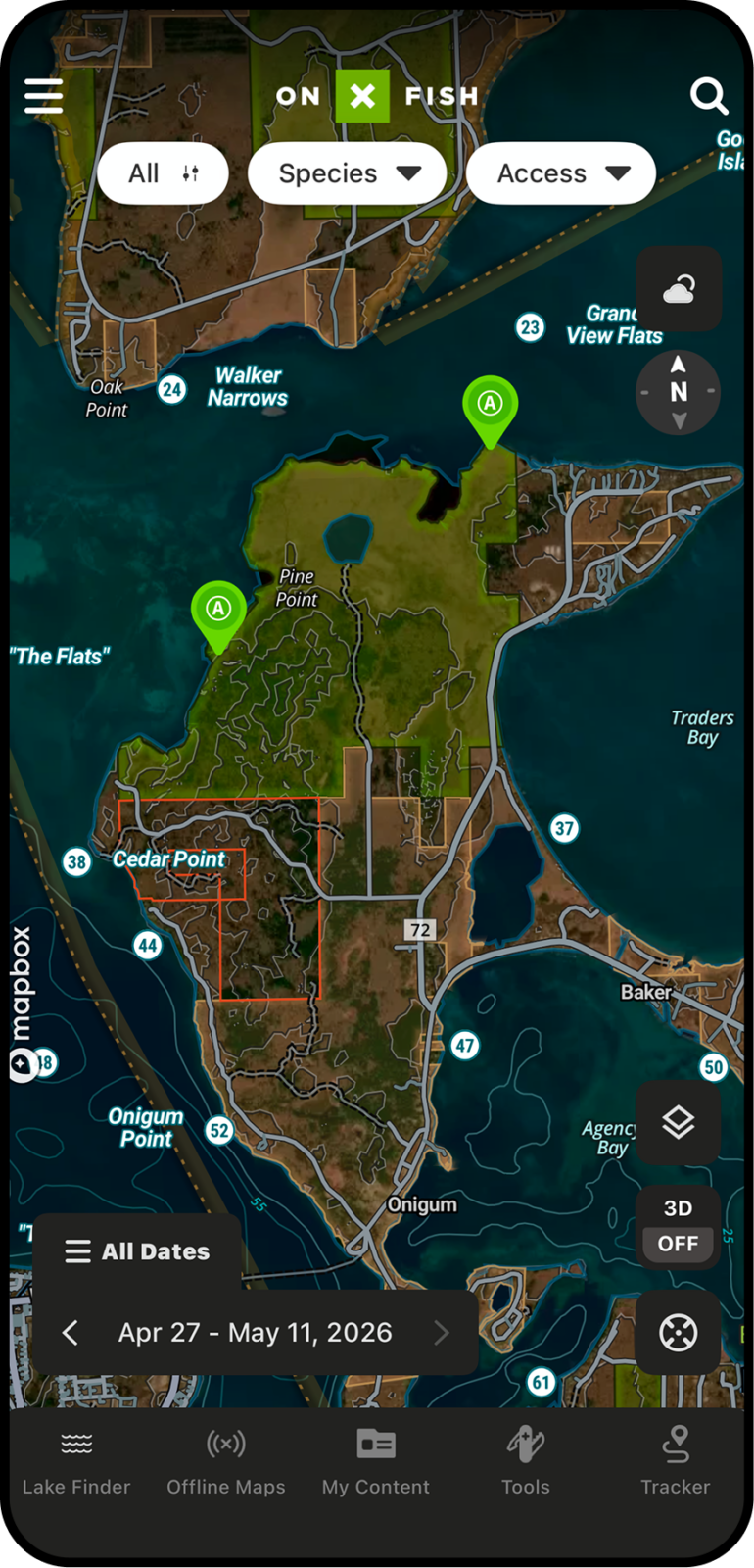
Not every access point is the right one for the day. Public Access Points help anglers compare launch locations based on where they want to fish, nearby roads, wind direction, distance to structure, or proximity to their first Waypoint. Instead of defaulting to the closest ramp, anglers can make smarter decisions about where to launch based on current conditions, target species, boat traffic, or the part of the lake they plan to focus on. This makes it easier to shorten long runs across open water, stay protected from changing weather, and spend more time fishing productive areas instead of navigating around the lake.
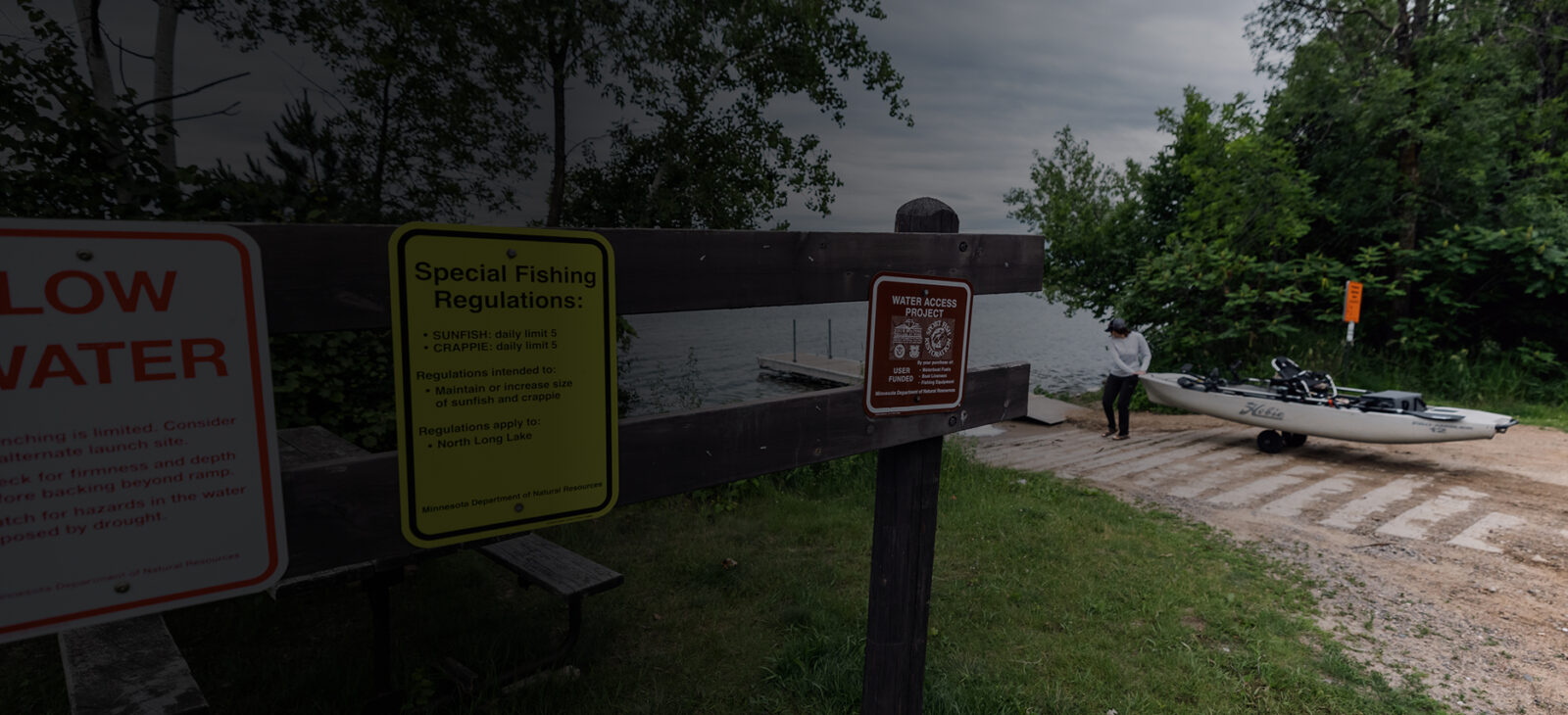
See Where You Can Legally Shore Fish Around Lakes
Finding a good shore fishing spot starts with knowing where you can legally access the water. With Public Land Access in onX Fish, anglers can view public land around lakes and identify areas where public property connects to the shoreline. This helps you scout bank fishing opportunities before you go, understand where private land begins, and choose access points with more confidence.
Use Public Land Access to look for public shoreline near points, bays, inlets, outlets, weed edges, docks, fishing piers, and deeper water within casting distance. Once you find a promising area, save it as a Waypoint, add notes about parking or walking routes, and download the map for offline use before heading out.
Dori Sell
Central Wisconsin Angler / onX Fish Ambassador
“onX Fish has been a game-changer for scouting boat launches in northern Wisconsin. Knowing exactly where we can access a lake—and whether we’re rolling up to a paved ramp or a rough gravel launch—saves so much time and hassle. It’s a must-have tool for any angler heading into new waters!”
How to Find Public Boat Launches in onX Fish
In App
- Open the onX Fish App on your mobile device.
- Search for or zoom into the lake you want to fish.
- Look for Public Access Points around the lake.
- Tap an access point to review location details.
- Compare access points based on proximity to roads, parking, and fishing areas.
- Save your chosen launch as a Waypoint.
- Download the area for Offline Maps before heading out.
On Desktop
- Log in to your account at webmap.onxmaps.com/fish/login.
- Search for the lake you want to scout.
- Review Public Access Points around the lake.
- Choose the launch that best fits your trip plan.
- Save the launch and nearby fishing areas with Waypoints.
- Open the mobile app when you head to the lake.
Know Where to Launch Before You Go
Find public boat launches, scout access, and plan your route to the water with onX Fish.
Frequently Asked Questions
Public Access Points show places where anglers can access the water, including public boat launches, ramps, and other fishing access locations.
Yes. onX Fish helps anglers find public boat launches and water access points so they can plan where to launch before heading to the lake.
They help anglers save time, compare launch options, plan their route, and start closer to productive fishing areas.
You can. Public Access Points can help kayak and canoe anglers identify potential put-ins, plan shorter paddles, and scout access before a trip.
Sure. Saving a launch as a Waypoint makes it easier to return to that location, navigate to it, and keep your trip plan organized.
Yes. Public Access Points pair well with Offline Maps so anglers can view saved access information when cell service is limited or unavailable.
Absolutely. When fishing unfamiliar water, public access information helps you understand where to launch and how that launch connects to your fishing plan.