The Ultimate Adventure App
Powered by Hiking Project
Discover and navigate trails with confidence using onX Backcountry, crafted for the trailblazers and powered by the rich, reliable data of Hiking Project. Your journey into the wild is now half the price!
Limited time 67% off your first year for Hiking Project users
Only $29.99 $9.90 for your first year
Trail Mode
Memberships
- Free: Topo, Satellite, Hybrid Map Layers, and Pinpoint Weather
- Premium: Full Offline Access, Guidebook-Quality Data, Route Building Tools, and Tracking.
- Elite: Private Lands Layer with Full Offline Access, Guidebook-Quality Data, Route Building Tools, and Tracking
Discount does not apply

We Have A Mode For That
The onX Backcountry App is the ultimate tool for your next adventure. No matter how you’re exploring the outdoors — whether it’s skiing down a snowy mountain this spring, escaping to the desert for some early season mountain biking, itching for the rock to dry out and go climbing, or planning a summer backpacking trip — use onX Backcountry to find routes, navigate terrain, save maps, find public land, and access thousands of recreation points all year long.
Hiking
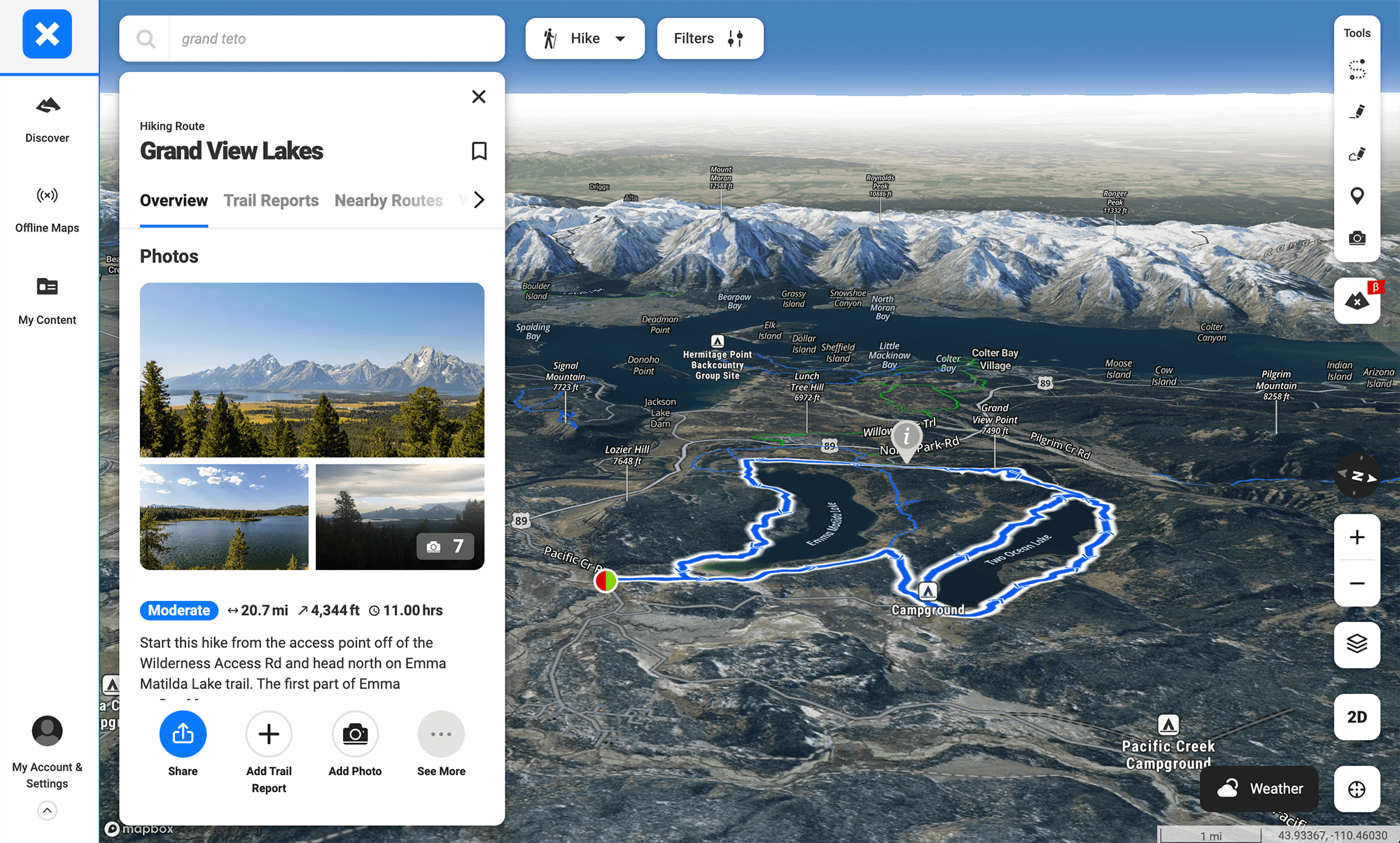
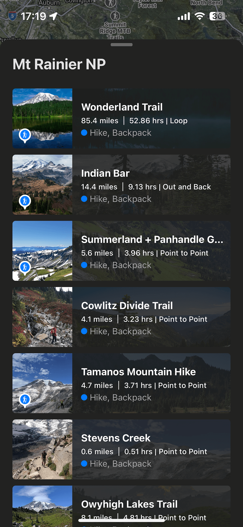
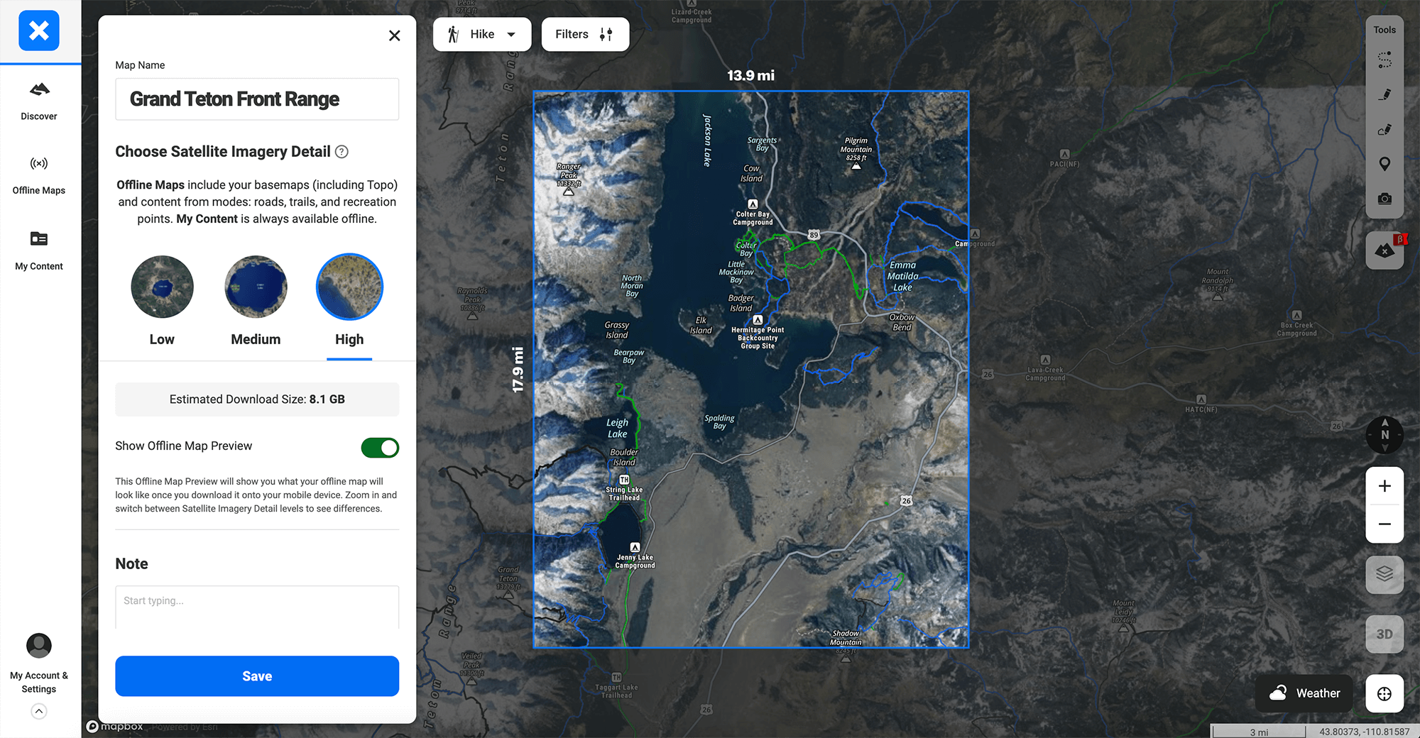
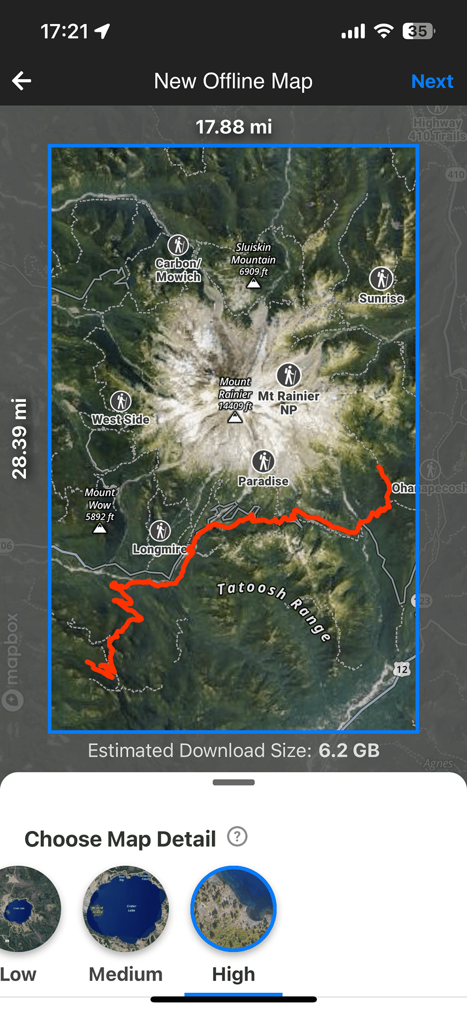
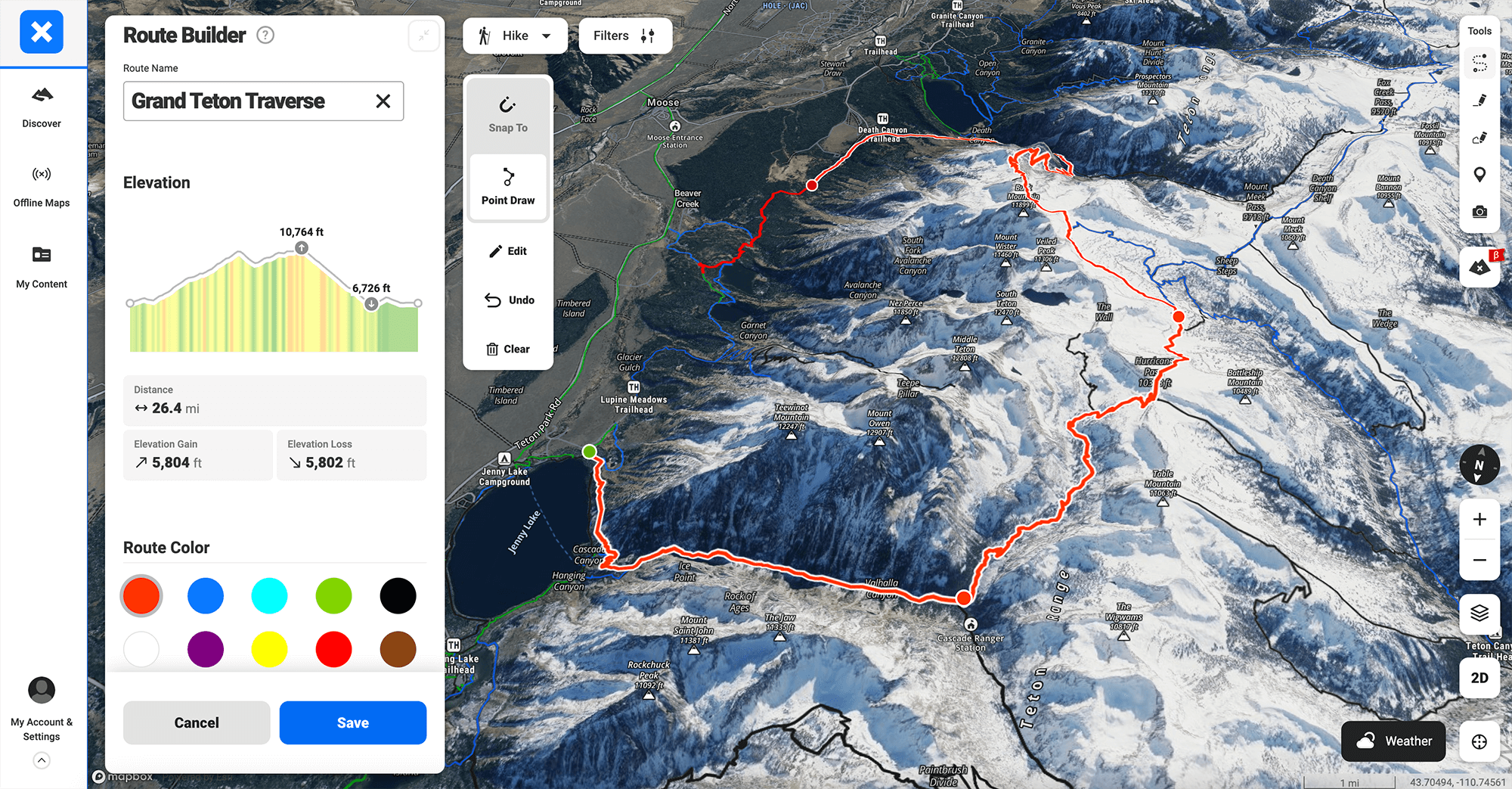
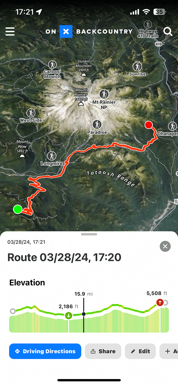
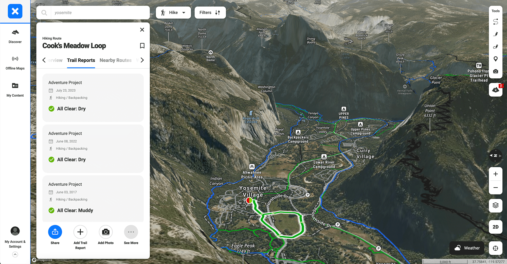
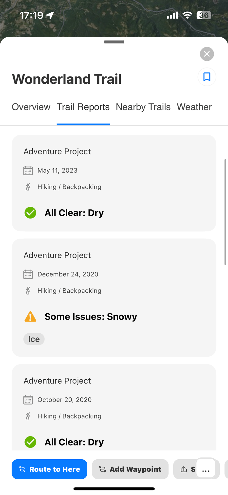
onX Backcountry features an extensive database of hiking trails, offering users access to detailed information on trail lengths, difficulty levels, and elevation profiles. The app provides real-time GPS tracking and offline maps, ensuring hikers can navigate with confidence and always know exactly where they are on the map, even in areas without cell service. onX Backcountry helps adventurers discover new trails and plan their hiking adventures with a comprehensive understanding of what to expect on their journey.
Backcountry Skiing
The Snow Mode feature in onX Backcountry is specifically designed for backcountry skiing enthusiasts, providing critical information such as slope angles, avalanche forecasts, and guidebook quality backcountry routes. It enables skiers to assess the safety and suitability of ski routes with precision, thanks to real-time GPS tracking and offline map access for navigation in remote areas. This mode enhances the skiing experience by offering insights into terrain features, helping skiers make informed decisions for a safe and enjoyable adventure in the snow.

Mountain Biking
onX Backcountry’s dedicated section for mountain bike trails delivers a comprehensive guide to biking paths, featuring detailed descriptions of trail lengths, difficulty ratings, and elevation changes. It equips riders with GPS tracking capabilities and offline maps, ensuring seamless navigation through diverse terrains, from serene forest paths to challenging mountain trails. The app also incorporates MTB Project data, including reviews and photos, allowing bikers to explore and select trails that best match their skill level and adventure spirit, making it an essential tool for planning exhilarating mountain biking experiences.
Rock Climbing
onX Backcountry integrates Mountain Project data and offers an in-depth look at climbing routes with detailed information on location, difficulty, and type of climb (e.g., bouldering, sport, or traditional). The app provides climbers with offline access to maps and GPS tracking, ensuring they can find their way to the crag or boulder, even in remote areas without cell reception. Additionally, it integrates user reviews and photos, allowing climbers to gauge the quality and current conditions of routes, making onX Backcountry an invaluable tool for planning and executing climbing adventures safely and efficiently.


What the Community is Saying
Easy and invaluable tool for trip planning
Absolutely love the super easy interface and tools available for planning a trip into the backcountry. Highly recommend.
Absolutely love the super easy interface and tools available for planning a trip into the backcountry. Highly recommend.
This app saved my toes!
Tried this out when backpacking Big Bend for the first time. Ended up getting snowed into a mountaintop campsite with a historic amount of snow. This app gave us the confidence we were going the right way to return to th…
Read more
Tried this out when backpacking Big Bend for the first time. Ended up getting snowed into a mountaintop campsite with a historic amount of snow. This app gave us the confidence we were going the right way to return to the base when we couldn’t see any trail or tracks at all and needed to get down in time to prevent frostbite. The tracking works remarkably well and the UI is fairly intuitive. Also seeing the difficulty gradient along the trails is very useful for planning and decision making. My only suggestion would be to make it easier to access and view stats on previously tracked hikes. The only way I could find to access
onX Backcountry
Incredible app that allows me to explore with more information at my fingertips . Weather and offline maps assist me with planning safely and insuring our adventures go as planned. Tracking allows me to revisit our favor…
Read more
Incredible app that allows me to explore with more information at my fingertips . Weather and offline maps assist me with planning safely and insuring our adventures go as planned. Tracking allows me to revisit our favorite hikes and to show others some of our amazing finds outdoors.
The integration of Hiking Project’s extensive trail data into onX Backcountry will offer hikers a comprehensive navigation solution. onX Backcountry is equipped with extremely useful features that Hiking Project lacks.
onX Backcountry users will have access to Hiking Project’s rich database of trails, including detailed trail and route descriptions, user-submitted photos, conditions, reviews, and difficulty ratings, providing a full spectrum of information for hiking enthusiasts.
Access to Hiking Project content is included with any active onX Backcountry Premium or Elite subscription, offering an expanded set of tools and information.
Hiking Project content will remain freely accessible through the Hiking Project website and mobile app, so you can choose the platform that works best for your outdoor planning.
Currently, Hiking Project accounts are not automatically linked to onX Backcountry. Users interested in taking full advantage of the integrated features can create a new account on onX Backcountry and explore the combined strengths of both platforms.
Absolutely. onX Backcountry stands alone as a versatile outdoor navigation app, complete with features that cater to various outdoor activities beyond hiking. Whether it’s for planning, navigation, or tracking, onX Backcountry supports all your outdoor adventures.
Yes, Hiking Project data has been seamlessly integrated into the onX Backcountry app and is accessible across web, iOS, and Android platforms, ensuring you have reliable data wherever you plan or embark on your hikes.

Before your next hike, use onX Backcountry to help plan your next adventure