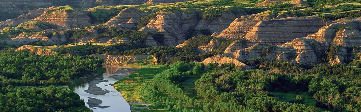
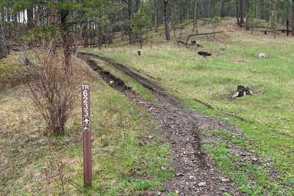
Off-Road Trails in South Dakota
Discover off-road trails in South Dakota
Off-Road Trails in South Dakota
Discover the best off-road trails in South Dakota. Browse trail maps, check difficulty ratings, and find your next adventure — whether you're looking for a quick ride or an all-day expedition.
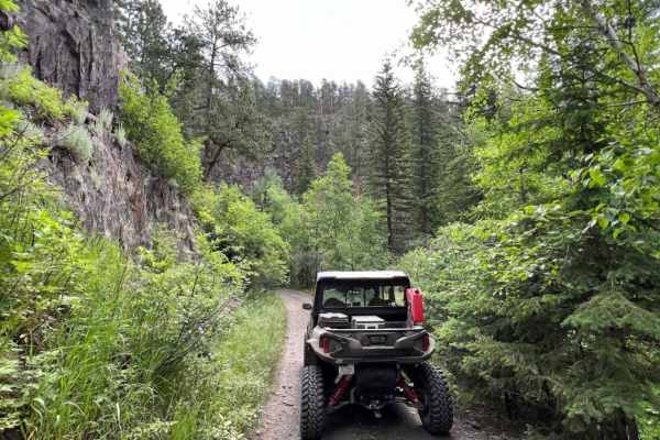
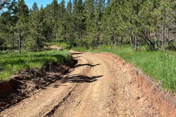
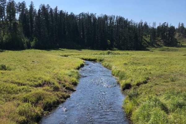
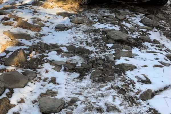
Castle Creek
Castle Creek Forest Service road is very scenic and travels along Castle Creek which runs through a gulch in almost the middle of the Black Hills National Forest. There are several locations where you cross the creek on small bridges. This road is the only way to access Castle Peak Campground whic...
Learn more about Castle Creek
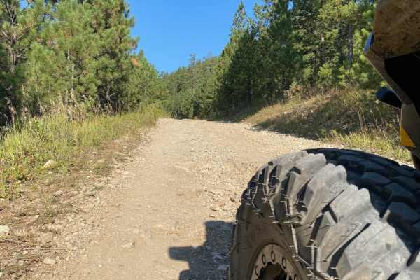
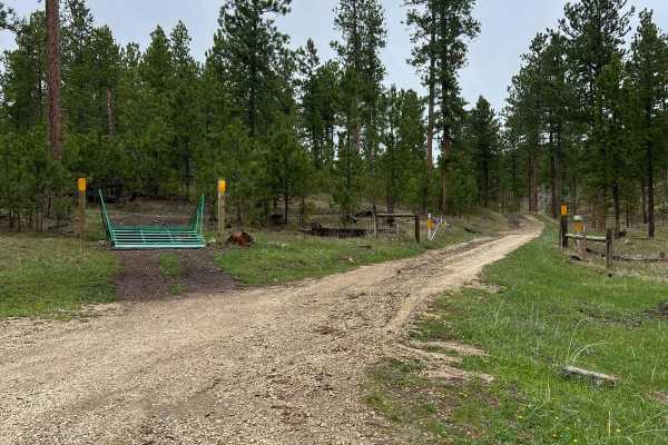
China Gulch - FSR #249
China Gulch takes you on a range of road types, from a two-vehicle wide gravel road near Hill City to a single vehicle road that travels adjacent to rock walls. The road at the north end can be muddy after recent rain, but any high clearance vehicle will be able to take the route.
Learn more about China Gulch - FSR #249
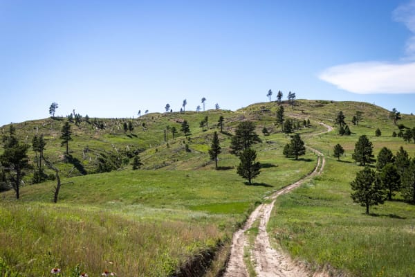
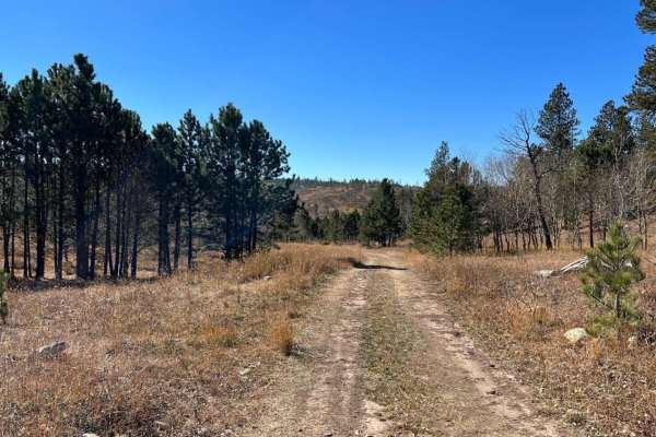
Windmill Draw to Hell Canyon to Alkali Ridge
Travel from Windmill Draw - (FSR 681) to Hell Canyon - (FSR 284.2L) to Alkali Ridge (FSR 284.2C). This 7.7-mile route, from Custer Limestone Road in the north to US Highway 16 in the south, covers a wide variety of terrain and is one of the highlights of what the Black Hills offers to offroad enthus...
Learn more about Windmill Draw to Hell Canyon to Alkali Ridge
Flat Nastys
This an easier very scenic trail that takes you from Nemo Road over to Highway 44. Some smaller rock-rutted uneven road that can be messy in the rain. One major obstacle that has a steep drop down and a narrow steep grade out. Does get narrow when you are running beside the harder section of Flat Na...
Learn more about Flat Nastys
Little Wolves
The three trails that comprise this route are all at or just under 3 miles long. The first two-thirds (Little Wolf East and Highline) are well-maintained gravel;most of the last third is dirt - a portion of which washes out and creates deep, wide ruts. Several areas of the trail also collect runoff ...
Learn more about Little Wolves
South Boxelder Creek Overpass
This dirt bike only trail features some excellent views of water, bluffs, and forests. The trail has a small water crossing at the beginning or end depending on where you enter. Following the water crossing, there are some switchbacks with dense forests. I rode this trail a previous time when branch...
Learn more about South Boxelder Creek Overpass
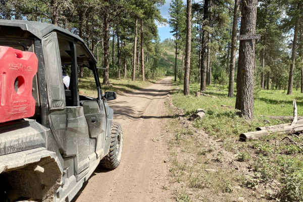
Experimental Forest Road
This is a snapshot of the much longer Experimental Forest Road on the map. This trail appears to be a major access road for all sorts of other trails and potentially dispersed camping if allowed. The forest road must be groomed on occasion. The surface is primarily gravel and not major water puddles...
Learn more about Experimental Forest Road
Bear Mountain Lookout to Pactola Reservoir
From Bear Mountain Lookout to Pactola Reservoir, this gravel road will show you the best the Black Hills National Forest offers. Take your time along the expansive alpine meadows & while driving along Lightening Creek, as you'll have many chances to spot deer and other wildlife along this route.
Learn more about Bear Mountain Lookout to Pactola Reservoir
Ditch Creek Br & Long Canyon
This route runs from Six Mile (north end) along Odakota Mountain, through Long Draw, and down to Ditch Creek (south end). On the east side of the Ditch Creek trailhead lies one of the scenic Black Hills mountain ranges. It's a highly recommended route if traveling north/south along the mountain rang...
Learn more about Ditch Creek Br & Long Canyon
Crystal Cave Trail
Crystal Cave is a very easy ride to the end of the trail where you will find an overlook to what many call the "Mini Grand Canyon" of the Black Hills. The trail is a two lane maintained gravel road that passes through a residential area for approximately 2.5 miles and towards the end of the residen...
Learn more about Crystal Cave Trail
Merritt Peak SE Leg
This is a dirt-bike-only route with lots of loose rock (rounded and shale-like), roots, and sharp rock stuck in the ground yet protruding out of the ground. There are some sharp rock climbs and descents that can kick you around and technical inclines/declines through rock formations. Beautiful looko...
Learn more about Merritt Peak SE Leg
Rocky Gulch
This trail is fun during all seasons of the year but is best enjoyed during the spring through fall months. During the winter months this rocky, and narrow trail can quickly become challenging to those who are unprepared. Expect tight corners and a narrow single-track trail with a heavily wooded are...
Learn more about Rocky Gulch
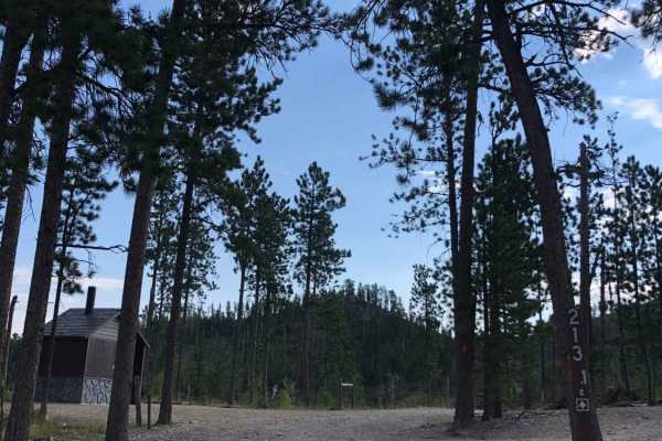
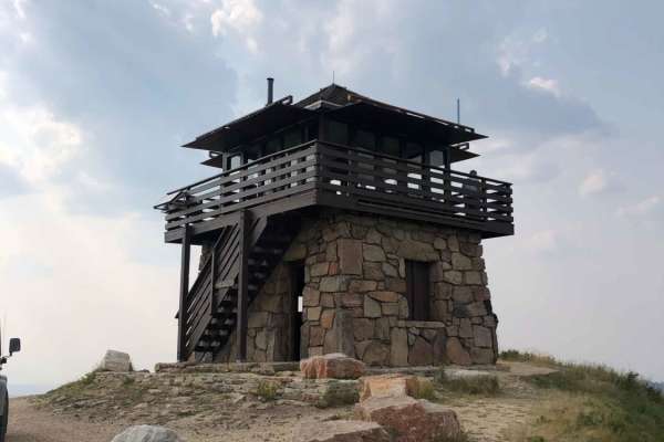
Custer Peak Fire Lookout
The trail up to Custer Peak Fire Lookout offers riders views of the Black Hills National Forest that are second to none. The lookout was first built in 1911 and replaced in 1935 with the Cupola Building. Finally, in 1941, the Civilian Conservation Corps rebuilt the lookout with local materials to wh...
Learn more about Custer Peak Fire Lookout
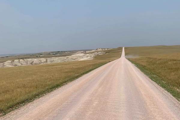
Sagecreek Rim Road
Sage Creek Rim Road is an accessible, scenic dirt and gravel route ideal for stock vehicles, overland rigs, and passenger cars seeking sweeping vistas of Badlands National Park. Running along the rim of the Sage Creek Basin, this well-maintained corridor offers stunning overlooks of rugged sandstone...
Learn more about Sagecreek Rim Road
Spaw Gulch - FSR#606
This road is an easy 4.6-mile one-way road that leads to a popular Black Hill spot, Flannigan's Cabin, aka Miner's Hotel. The road traverses through various terrain and is wider on the south end and just wide enough for a side-by-side or Jeep on the north end. There are a couple of cattle gates that...
Learn more about Spaw Gulch - FSR#606
Mud Springs Road
Mud Springs Road is a scenic route that runs North/South from Custer Limestone road to US Highway 16 just West of Jewel Cave National Monument. This does take you through cattle grazing areas so expect to see some cattle on or just off the road in the spring/summer. On the South portion of the road ...
Learn more about Mud Springs Road
Alkali Spring
This road is a good way to run North or South from Ditch Creek to Custer Limestone. This road runs along some private land and there is a cattle gate at the South end about a 1/4 mile in from Custer Limestone and one cattle fence about 3/4 mile South of Ditch Creek. This road does lead down through ...
Learn more about Alkali Spring
Merritt Peak Central Pass Through
This is a dirt bike only trail with nice views. There is typical loose rock, sticks, roots, and some sharp rock. Overall this was a smooth trail that winds through the forest. One region of the trail has narrow dense bush areas but overall the trail is more open and quite a smooth-flowing ride.
Learn more about Merritt Peak Central Pass Through
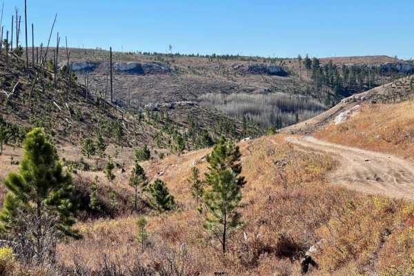
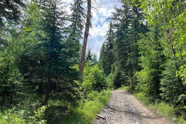
Cement Ridge Fire Lookout
Leaving Spearfish Canyon from Savoy, you'll find yourself on Roughlock Falls Road, a well-maintained gravel road that leads you up to Cement Ridge Fire Lookout, which boasts expansive views of the Black Hills Forest and surrounding area. If you decide to take the trail down to Grand Canyon Road, bew...
Learn more about Cement Ridge Fire Lookout
East Gimlet Trail
This dirt road is a pretty typical unmaintained road for the black hills. Some surfaces are gravel while others can be a mixture of dirt. This does not require high clearance, most vehicles could easily travel unless there was a significant washout of some kind. It is a great scenic Black Hills For...
Learn more about East Gimlet Trail
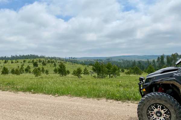
ATV trails in South Dakota
Explore ATV-friendly trails in South Dakota. These trails are accessible for vehicles up to 50 inches wide, perfect for ATVs and smaller off-road machines.
Castle Creek
Castle Creek Forest Service road is very scenic and travels along Castle Creek which runs through a gulch in almost the middle of the Black Hills National Forest. There are several locations where you cross the creek on small bridges. This road is the only way to access Castle Peak Campground whic...
Learn more about Castle Creek
China Gulch - FSR #249
China Gulch takes you on a range of road types, from a two-vehicle wide gravel road near Hill City to a single vehicle road that travels adjacent to rock walls. The road at the north end can be muddy after recent rain, but any high clearance vehicle will be able to take the route.
Learn more about China Gulch - FSR #249
Windmill Draw to Hell Canyon to Alkali Ridge
Travel from Windmill Draw - (FSR 681) to Hell Canyon - (FSR 284.2L) to Alkali Ridge (FSR 284.2C). This 7.7-mile route, from Custer Limestone Road in the north to US Highway 16 in the south, covers a wide variety of terrain and is one of the highlights of what the Black Hills offers to offroad enthus...
Learn more about Windmill Draw to Hell Canyon to Alkali Ridge
Flat Nastys
This an easier very scenic trail that takes you from Nemo Road over to Highway 44. Some smaller rock-rutted uneven road that can be messy in the rain. One major obstacle that has a steep drop down and a narrow steep grade out. Does get narrow when you are running beside the harder section of Flat Na...
Learn more about Flat Nastys
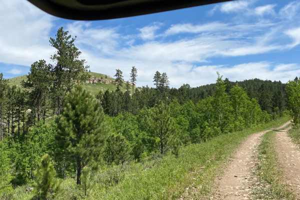
UTV/side-by-side trails in South Dakota
Find UTV and side-by-side trails in South Dakota. These trails accommodate vehicles up to 60 inches wide, ideal for UTVs, side-by-sides, and wider off-road rigs.
Castle Creek
Castle Creek Forest Service road is very scenic and travels along Castle Creek which runs through a gulch in almost the middle of the Black Hills National Forest. There are several locations where you cross the creek on small bridges. This road is the only way to access Castle Peak Campground whic...
Learn more about Castle Creek
China Gulch - FSR #249
China Gulch takes you on a range of road types, from a two-vehicle wide gravel road near Hill City to a single vehicle road that travels adjacent to rock walls. The road at the north end can be muddy after recent rain, but any high clearance vehicle will be able to take the route.
Learn more about China Gulch - FSR #249
Windmill Draw to Hell Canyon to Alkali Ridge
Travel from Windmill Draw - (FSR 681) to Hell Canyon - (FSR 284.2L) to Alkali Ridge (FSR 284.2C). This 7.7-mile route, from Custer Limestone Road in the north to US Highway 16 in the south, covers a wide variety of terrain and is one of the highlights of what the Black Hills offers to offroad enthus...
Learn more about Windmill Draw to Hell Canyon to Alkali Ridge
Flat Nastys
This an easier very scenic trail that takes you from Nemo Road over to Highway 44. Some smaller rock-rutted uneven road that can be messy in the rain. One major obstacle that has a steep drop down and a narrow steep grade out. Does get narrow when you are running beside the harder section of Flat Na...
Learn more about Flat Nastys
The onX Offroad Difference
onX Offroad combines trail photos, descriptions, difficulty ratings, width restrictions, seasonality, and more in a user-friendly interface. Available on all devices, with offline access and full compatibility with CarPlay and Android Auto. Discover what you're missing today!
Open Trail Map