
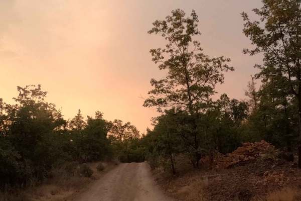
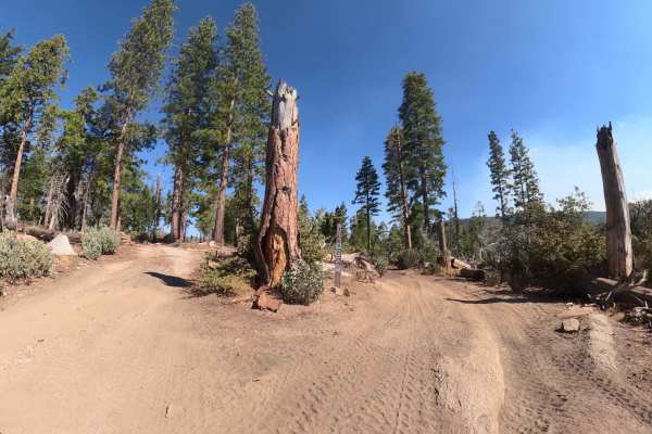
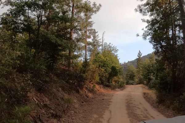
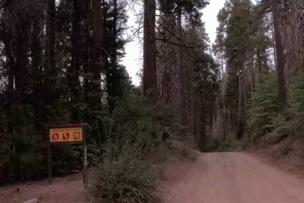
Off-Road Trails
Near Bass Lake, California
Off-Road Trails Near Bass Lake, California
Discover the best offroad trails near you. Browse trail maps, check difficulty ratings, and find your next adventure — whether you're looking for a quick ride or an all-day expedition.
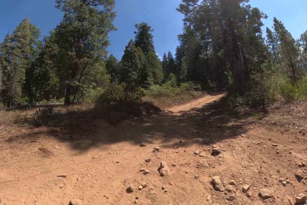
McLeod Flat - FS 5S007Z
McCleod Flat (5S007Z) might be short on mileage, but it is high on utility, acting as the dusty red carpet to a playground of Sierra adventures. This quick, quarter-mile spur is the definition of "short and sweet," serving primarily as the access road to the Mac Flat Staging Area. It is here that th...
Learn more about McLeod Flat - FS 5S007Z

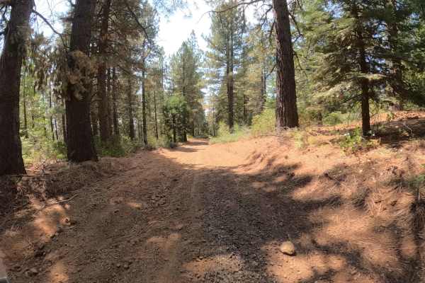
Vista Dome - FS 6S088
Vista Dome (FS 6S088) is the kind of forest road that makes you want to roll down the windows and cruise. Unlike its rocky neighbors, this smooth, fast dirt and gravel road is a relaxing connector that prioritizes views over suspension travel. The trail kicks off at the stunning Bass Lake Vista, off...
Learn more about Vista Dome - FS 6S088
Vista Dome Spur - FS 22E347
This is an extremely short, easy 0.6-mile spur above the forest service road of the same name (6S088 -Vista Dome) that provides direct access to high-elevation viewpoints, climbing approximately 290 feet to a granite summit. The road is a narrow two-track composed entirely of natural, ungraded dirt ...
Learn more about Vista Dome Spur - FS 22E347
Annex Sale - FS 7S062Y
Annex Sale (FS 7S062Y) is a short, sweet, and incredibly useful out-and-back trail for anyone looking to escape the crowds near Bass Lake. Branching off the paved Highland Drive, this easy dirt two-track climbs gently through a mixed conifer forest, serving essentially as a mile-long driveway to som...
Learn more about Annex Sale - FS 7S062Y
Soquel Meadow - FS 6S040
Soquel Meadow (FS 6S040) is more than just a bumpy ride in the woods; it is a strategic and scenic link in the local network. This 1.7-mile forest service road serves as a vital connector bridging the gap between the paved sections of Sky Ranch Road (6S010) and Beasore Road (FS 5S07). It allows expl...
Learn more about Soquel Meadow - FS 6S040
Mill Creek - FS 6S040X
Mill Creek (FS 6S040X) is not your average shortcut; it's a slow-motion rumble through a granite rock garden. This 2.8-mile forest road serves as a rugged connector between Beasore Road (FS 5S07) and Soquel Meadow Road (FS 6S040), dropping you out just south of Greys Mountain Campground. The definin...
Learn more about Mill Creek - FS 6S040X

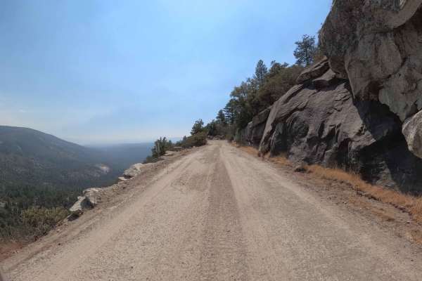
Bluff Road - FS 6S011X
If you are looking for a shortcut between Greys Mountain Road and the Sivils Ranch Loop, Bluff (FS 6S011X) is your ticket, but don't expect to get there quickly. This trail is a slow-speed "granite grinder" defined by a roadbed heavily embedded with sharp, fixed rocks that will keep your suspension ...
Learn more about Bluff Road - FS 6S011X
Francis Junction - FS 6S006
This 4.6-mile forest connector is the definition of a "Sunday drive" in the woods—easy, breezy, and scenic. Francis Junction serves as a vital artery connecting two sections of Central Camp Road (FS 6S042), offering a smooth and surprisingly fast transit through a beautiful, healthy mixed-conifer fo...
Learn more about Francis Junction - FS 6S006
Greys Mountain - FS 6S008
This 5.5-mile route is a rough-and-tumble forest road that feels like a backcountry highway cut through granite. Connecting Soquel Meadow Road (FS 6S040) to the Beasore Loop (FS 6S010X), Greys Mountain offers a distinct change of pace from the smoother roads nearby. The trail is defined by its embed...
Learn more about Greys Mountain - FS 6S008
West Malum Ridge - FS 7S075
West Malum Ridge (FS 7S075) is a relaxed, scenic cruiser that invites you to roll down the windows and breathe in the Sierra air. This easy dirt road serves primarily as an access route to some prime real estate for dispersed campers. The trail meanders through a mixed forest of oak and pine, offeri...
Learn more about West Malum Ridge - FS 7S075
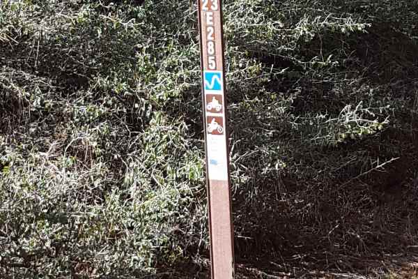
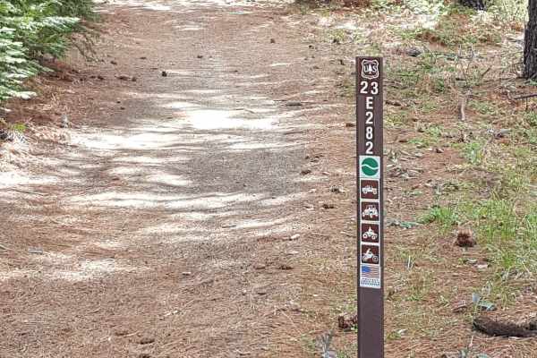
Browns Trail - FS 23E285
This is a short, narrow point-to-point trail through a wooded area on the side of Peckinpah Mountain. The trail surface primarily consists of packed dirt with embedded small rocks. There are also ruts and rock garden areas along the route. Depending on the season and weather, there may be several sh...
Learn more about Browns Trail - FS 23E285
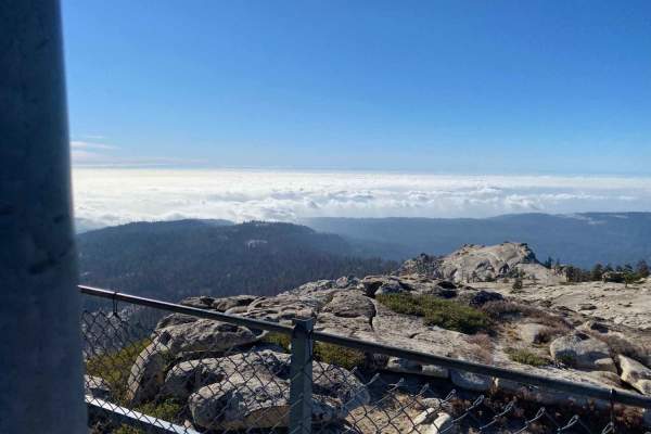
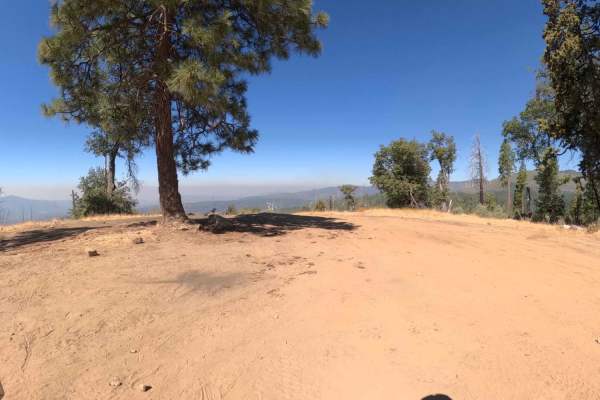
Shuteye Peak
4WD section starts at 8.1 miles from the Start of Central Camp Road. There are some off-camber areas and a little "crawling". Water crossings, steep switchbacks, moderate rock obstacles, and amazing views at the Shuteye Peak fire watchtower. In the Bass Lake Ranger District of the Sierra National Fo...
Learn more about Shuteye Peak
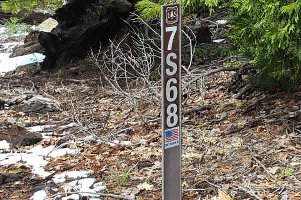
Pierce Mill - FS 7S68
This is a point-to-point trail that runs from Peckinpah Road to 23E284 and 23E285 Browns Trail. The route is at least as wide as a full-size vehicle and has a few wider sections to allow vehicles to pass each other. In some stretches, the trail runs along a steep slope on the western side of the rou...
Learn more about Pierce Mill - FS 7S68
Sivils Mountain - FS 6S011C
Sivils Mountain (FS 6S011C) is a short but spicy spur that feels less like a road and more like a tight path cut through the jungle. This trail is defined by its narrowness; it is a tight, twisty two-track that barely offers enough width for a standard Jeep to pass. Drivers will find themselves "suc...
Learn more about Sivils Mountain - FS 6S011C
Texas Flat - FS 6S038
Texas Flat (FS 6S038) is a trail with a split personality, luring drivers in with a gentle start before revealing its true colors. Beginning near the popular Texas Flat Campground, the route starts as a wide, easy forest service road off of Greys Mountain Road (FS 6S028). It starts off as suitable f...
Learn more about Texas Flat - FS 6S038
Little Poison Meadow A Spur - FS 6S099A
If Little Poison Meadow (6S099) is the main course of rugged driving in this pocket of the forest, then A Spur (6S099A) is the spicy side dish. Branching off the main 6S099 trail, this .5-mile connector trail wastes no time getting vertical. The route is characterized by loose, rough rock scattered ...
Learn more about Little Poison Meadow A Spur - FS 6S099A
Little Poison Meadow - FS 6S099
Little Poison Meadow (FS 6S099) might sound like a warning label, and for stock vehicles, it absolutely is. This trail serves as a rugged spur off the main forest road network, acting as the gateway to the Lumberjack Trailhead and some excellent, secluded dispersed camping. But don't let the word "M...
Learn more about Little Poison Meadow - FS 6S099
Chipmunk - FS 6S018
Chipmunk (FS 6S018) is a scruffy, spirited little side-quest located in the high country above Bass Lake. Accessed via Beasore Road and a short hop along Central Camp Road, this 1.3-mile unmaintained two-track is the definition of a "bumpy little" adventure. The tread is primarily natural dirt, whic...
Learn more about Chipmunk - FS 6S018
Central Camp - FS 6S042
Central Camp (FS 6S042) is the bustling, dusty artery of the Bass Lake high country. This wide two-lane dirt road serves as a critical link, climbing steadily from Malum Ridge Road on the east side of Bass Lake, passing through the historic (and still active) residential community of Central Camp, a...
Learn more about Central Camp - FS 6S042
Sivils Ranch - FS 6S011
This is a wide, fast, and thoroughly entertaining forest loop that branches off the paved section of Sky Ranch Road (FS 6S010). Sivils Ranch isn't your standard boring fire road; it keeps drivers engaged with a constantly changing surface that shifts between loose gravel, deep silky "moondust" dirt,...
Learn more about Sivils Ranch - FS 6S011
ATV trails near Bass Lake, California
Explore ATV-friendly trails near you. These trails are accessible for vehicles up to 50 inches wide, perfect for ATVs and smaller off-road machines.
Browns Trail - FS 23E285
This is a short, narrow point-to-point trail through a wooded area on the side of Peckinpah Mountain. The trail surface primarily consists of packed dirt with embedded small rocks. There are also ruts and rock garden areas along the route. Depending on the season and weather, there may be several sh...
Learn more about Browns Trail - FS 23E285
Pierce Mill - FS 7S68
This is a point-to-point trail that runs from Peckinpah Road to 23E284 and 23E285 Browns Trail. The route is at least as wide as a full-size vehicle and has a few wider sections to allow vehicles to pass each other. In some stretches, the trail runs along a steep slope on the western side of the rou...
Learn more about Pierce Mill - FS 7S68
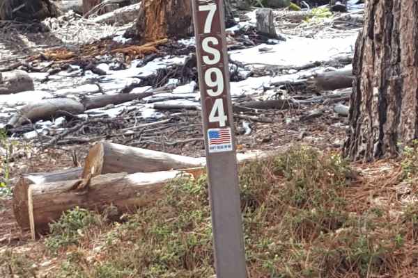
Seven Rocks - FS 7S94
This trail winds along the side of Peckinpah Mountain and is generally only single vehicle-width at best in most places. The surface consists primarily of packed dirt with embedded small and larger rocks. There are a few short rocky ledge sections, and ruts and mud holes can be present along the rou...
Learn more about Seven Rocks - FS 7S94
China Wells - FS 6S015
China Wells (FS 6S015) serves as the primary "spinal cord" of the Miami Mountain OHV system. This wide, well-graded forest service road runs north-south through the network, connecting the popular Kamook Staging Area to the southern reaches of the trail system. Unlike the tight, twisty spurs that br...
Learn more about China Wells - FS 6S015
UTV/side-by-side trails near Bass Lake, California
Find UTV and side-by-side trails near you. These trails accommodate vehicles up to 60 inches wide, ideal for UTVs, side-by-sides, and wider off-road rigs.
Pierce Mill - FS 7S68
This is a point-to-point trail that runs from Peckinpah Road to 23E284 and 23E285 Browns Trail. The route is at least as wide as a full-size vehicle and has a few wider sections to allow vehicles to pass each other. In some stretches, the trail runs along a steep slope on the western side of the rou...
Learn more about Pierce Mill - FS 7S68
Seven Rocks - FS 7S94
This trail winds along the side of Peckinpah Mountain and is generally only single vehicle-width at best in most places. The surface consists primarily of packed dirt with embedded small and larger rocks. There are a few short rocky ledge sections, and ruts and mud holes can be present along the rou...
Learn more about Seven Rocks - FS 7S94
China Wells - FS 6S015
China Wells (FS 6S015) serves as the primary "spinal cord" of the Miami Mountain OHV system. This wide, well-graded forest service road runs north-south through the network, connecting the popular Kamook Staging Area to the southern reaches of the trail system. Unlike the tight, twisty spurs that br...
Learn more about China Wells - FS 6S015
Peckin - FS 23E232
This is a short, narrow and fun point-to-point trail that connects Peckinpah Road with Peckinpah Meadow. It winds down the slope on the mountainside through a wooded area and a section with some forest fire damage. The surface is primarily dirt, but also has several rock garden sections with obstacl...
Learn more about Peckin - FS 23E232
The onX Offroad Difference
onX Offroad combines trail photos, descriptions, difficulty ratings, width restrictions, seasonality, and more in a user-friendly interface. Available on all devices, with offline access and full compatibility with CarPlay and Android Auto. Discover what you're missing today!
Open Trail Map