
Off-Road Trails in Coahuila de Zaragoza
Discover off-road trails in Coahuila de Zaragoza
Off-Road Trails in Coahuila de Zaragoza
Discover the best off-road trails in Coahuila de Zaragoza. Browse trail maps, check difficulty ratings, and find your next adventure — whether you're looking for a quick ride or an all-day expedition.
Old Ore Road
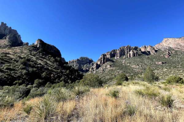
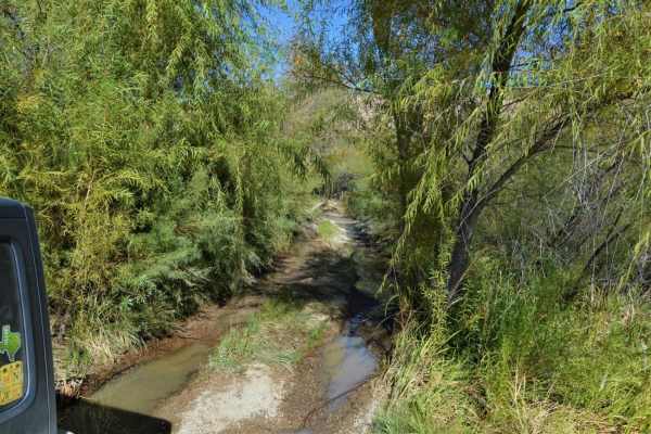
Old Ore Road is located within the remote wilderness of Big Bend National Park. Old Ore is one of the only trails (if not the only) within Big Bend where cell service is somewhat available, except for a few valleys and canyons. This trail is great for beginners, as it traverses many types of terrain...
Learn more about Old Ore Road
Old Mines Road
Old Mines Road is a 44-mile unmaintained dirt road that connects Laredo to El Indio, just south of Eagle Pass. This trail contains sections with uneven ruts, potential mud pits, and small ledges. If conditions are dry, this road can be completed in a 2WD with moderate clearance. Airing down is recom...
Learn more about Old Mines Road
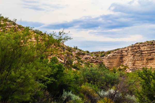
Glenn Springs Road
The Glenn Springs Road runs North to South through Big Bend National Park in Texas. This is a very scenic drive with several campsites which require a permit. This road has some very rutted and washed-out strips, so speed should be monitored. Big Bend is extremely remote so come prepared. Cell servi...
Learn more about Glenn Springs Road
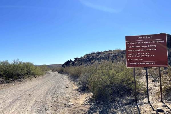
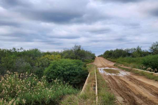
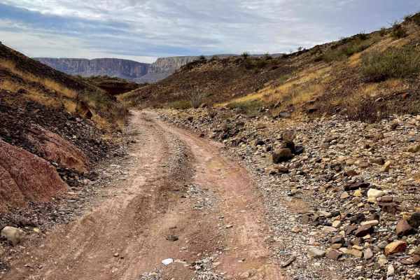
River Road East
River Road East is a route spanning the length of the southern half of Big Bend National Park from Talley Road east to Park Route 12. It is the access route for several campsites and popular points of interest such as Black Gap Road and the Mariscal Mine. It is primarily loose rock, with washboards,...
Learn more about River Road East
Terlingua Abaja
A short, but beautifully scenic route to the ghost town of Terlingua Abaja. This is an out-and-back trail with minor off-camber, switchbacks, and rough, rocky areas. There are three campsites available at the end of this trail;TA 1 being furthest West;TA 2 middle;TA3 furthest East. There is ample ro...
Learn more about Terlingua Abaja
Paint Gap Road
This is a trail off of Maverick Road (one of the main roads going through Big Bend National Park). You begin on gravel for the first portion of the trail. About halfway through you enter a more rocky terrain. Though the trail is only 7.3 miles in and out you are going pretty slow because it is a bit...
Learn more about Paint Gap Road
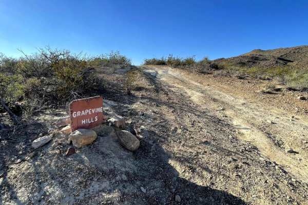
Grapevine Hills Road
Grapevine Hills Road is an out-and-back route providing access to five campsites, and the famous Balanced Rock at Big Bend National Park. It starts as a mostly washboarded, wide gravel road. Contents change to a narrower trail, looser materials, chunkier rocks, and washouts as the trail progresses. ...
Learn more about Grapevine Hills Road
Old Maverick Road
Old Maverick Road is a more direct alternative from Panther Junction Road to Santa Elena Canyon. It is also the route to access Rattlesnake Mountain, Ocotillo Grove, and Terlingua Abaja campsites. It is primarily a washboard, gravel road providing fantastic views of the Chisos and desert flora. Plea...
Learn more about Old Maverick Road
Pine Canyon Road
Pine Canyon Road is an out-and-back route accessing the Pine Canyon Trail in Big Bend National Park. Characteristics include loose and chunky rock, rolling hills, blind corners and dry bed water crossings. There are five campsites available on this route. Sites 1&2 are combined, and more suitable fo...
Learn more about Pine Canyon Road
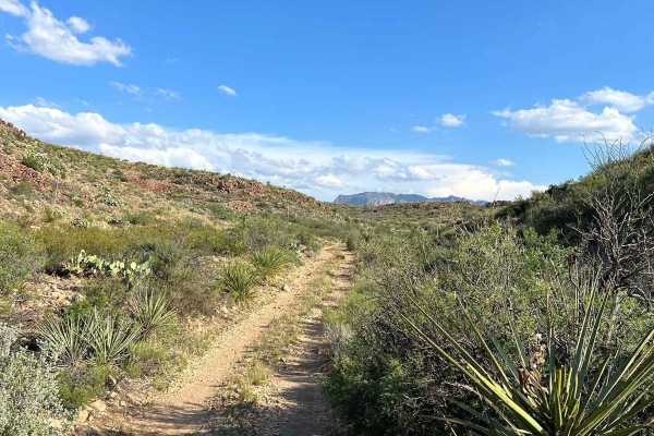
Javelin Road
This is a meandering dirt road through the high desert and hills of Big Bend Ranch State Park. This is the most direct route to Madrid Falls Overlook & Chorro Vista Campground. One of, if not the most, scenic views in the park. The road is not heavily traveled and relatively unmaintained, and narrow...
Learn more about Javelin Road
Juniper Canyon
The Juniper Canyon Trail is an out-and-back at Big Bend National Park in Texas. It's a very scenic drive that offers access to a trailhead and 2 campsites with 360-degree views. The Twisted Shoe campsite is highly recommended. All campsites in the park require a permit. This trail is rocky the entir...
Learn more about Juniper Canyon
River Road East
The River Road East Trail runs east to west through Big Bend National Park in Texas. After heavy rain, it's very likely the gate will be closed at the west end of this trail. This is a very scenic drive with several campsites which require a permit. This trail is easy other than one obstacle that re...
Learn more about River Road East
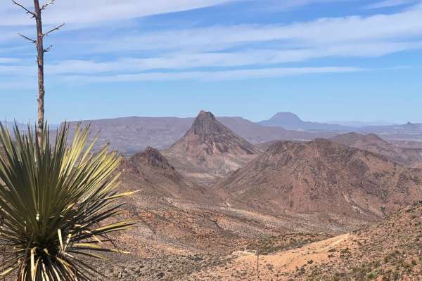
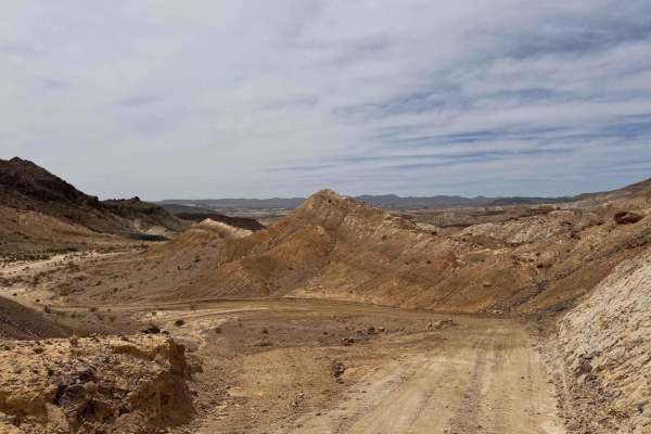
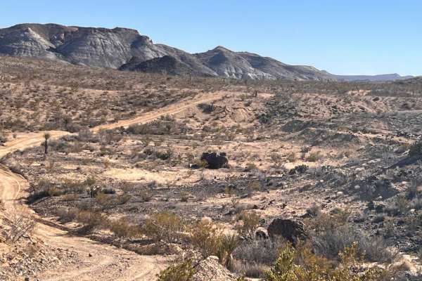
Black Gap 4x4 Trail
The Black Gap 4x4 Trail is located within the remote Big Bend National Park, which provides amazing wide open views of Texas and Mexico. The trail, if done during summer when it is very hot, will be empty and it's possible to drive for hours and not see another person. It should not be taken lightly...
Learn more about Black Gap 4x4 Trail
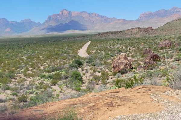
River Road West
River Road West follows the Rio Grande in the southwestern area of the Big Bend National Park backcountry. Along the trail, you will find various established backcountry camping sites. These sites do require reservations, so please check with park staff or online at recreation.gov. This trail primar...
Learn more about River Road West
Texas Hill Country Tour
Texas is known for many things, but mountainous terrain isn't one of them. Endless miles of plains and prairies seem to stretch in all directions, yet tucked away in the heart of state is an exception. It's called the Hill Country, and while it's no Colorado, it certainly earns its name. The land he...
Learn more about Texas Hill Country Tour
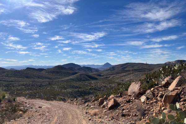
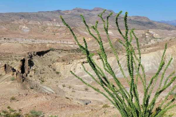
Canyon Road
Canyon Road is a maintained dirt road in the Christmas Mountains area of Big Bend. Canyon Road travels through scenic desert landscapes with mountains and plenty of cactus and brush along the way. There are no challenges on this road, so enjoy it for the scenery and the fact that it's one of the fe...
Learn more about Canyon Road
Christmas Mountain Trail
Christmas Mountain is the premier 4x4 trail in the Big Bend area! You start at the Terlingua Ranch Lodge and traverse up the mountain with numerous switchbacks and steep drop-offs. There's nothing technical about this trail, but there are some rocky areas and steep sections with loose gravel that mi...
Learn more about Christmas Mountain Trail
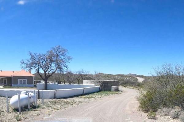
North County Road
North County Road is one of only a few publicly accessible roads in the magnificent Terlingua Ranch Subdivision. Being a county road, it is fairly well-maintained and smooth with no need for 4WD or high clearance. North County Road, however, has some spectacular desert scenery and follows along Terl...
Learn more about North County Road
South County Road
South County Road is one of only a few public dirt roads through the Terlingua Ranch Subdivision. It is a mostly smooth road without any obstacles but excellent desert scenery. All of the property along South County Road is private property, so please do not get out and trespass.
Learn more about South County Road
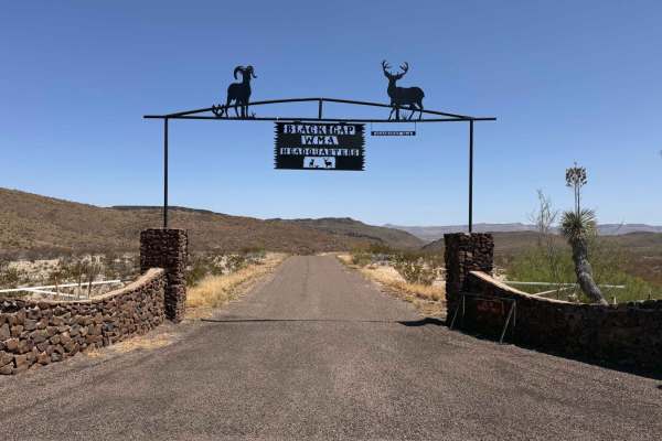
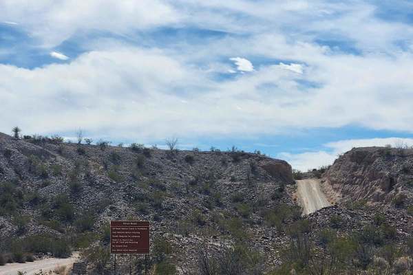
Black Gap Wildlife Management Area Road
Black Gap Wildlife Management Area Road is a well-graded dirt road through one of the most remote portions of West Texas. This management area is home to the first reintroduction of big horn sheep in Texas and continues to be an area of wildlife management research. The scenery on this road is incre...
Learn more about Black Gap Wildlife Management Area Road
ATV trails in Coahuila de Zaragoza
Explore ATV-friendly trails in Coahuila de Zaragoza. These trails are accessible for vehicles up to 50 inches wide, perfect for ATVs and smaller off-road machines.
Javelin Road
This is a meandering dirt road through the high desert and hills of Big Bend Ranch State Park. This is the most direct route to Madrid Falls Overlook & Chorro Vista Campground. One of, if not the most, scenic views in the park. The road is not heavily traveled and relatively unmaintained, and narrow...
Learn more about Javelin Road
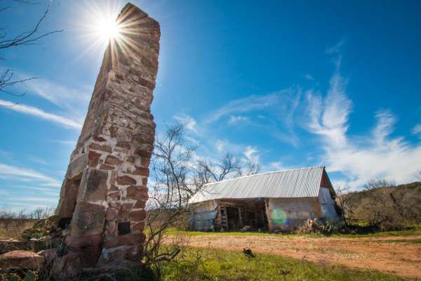
Abandoned Resort
This is an amazing drive in the Terlingua ranch area. This public road takes you deep in to the desert where there's a hidden gem. The remnants of an abandoned Resort and what looks like a 100-year-old dam. The journey will be a slow and steady one on this gravel, rocky desert mountain road. With a ...
Learn more about Abandoned Resort
Dagger Flats
The trail starts off as a gravel road that will quickly turn into a washboard-style road. The washboard ruts will come and go, the majority of them being at the beginning and end of the route. This is an out-and-back trail, so everything that you go over, you will drive over again. After the first m...
Learn more about Dagger Flats
UTV/side-by-side trails in Coahuila de Zaragoza
Find UTV and side-by-side trails in Coahuila de Zaragoza. These trails accommodate vehicles up to 60 inches wide, ideal for UTVs, side-by-sides, and wider off-road rigs.
Javelin Road
This is a meandering dirt road through the high desert and hills of Big Bend Ranch State Park. This is the most direct route to Madrid Falls Overlook & Chorro Vista Campground. One of, if not the most, scenic views in the park. The road is not heavily traveled and relatively unmaintained, and narrow...
Learn more about Javelin Road
Dagger Flats
The trail starts off as a gravel road that will quickly turn into a washboard-style road. The washboard ruts will come and go, the majority of them being at the beginning and end of the route. This is an out-and-back trail, so everything that you go over, you will drive over again. After the first m...
Learn more about Dagger Flats
The onX Offroad Difference
onX Offroad combines trail photos, descriptions, difficulty ratings, width restrictions, seasonality, and more in a user-friendly interface. Available on all devices, with offline access and full compatibility with CarPlay and Android Auto. Discover what you're missing today!
Open Trail Map