
Dirt Bike Trails
Near West Fork, Arkansas
Explore All Dirt Bike Trails Near West Fork, Arkansas
Dirt Bike Trails Near West Fork, Arkansas
Discover the best dirt bike trails near you. Browse trail maps, check difficulty ratings, and find your next adventure — whether you're looking for a quick ride or an all-day expedition.
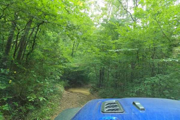
Frog Bayou
The west end of this trail has recently been rerouted to ensure that it avoids private property. This trail follows FS1705/Kenney Road and runs along Frog Bayou, the main tributary for Lake Fort Smith, and features Frog Bayou Falls. Frog Bayou can be traveled either from Bidville Rd on the west side...
Learn more about Frog Bayou
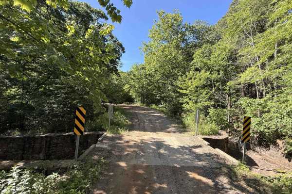
Cove Creek Crossing
Cove Creek Crossing is a scenic forest route that follows the creek through a narrow mountain valley surrounded by towering hardwoods, rock bluffs, and rolling ridgelines. The road is primarily gravel and generally easy to navigate, though scattered embedded rock and occasional rough patches keep it...
Learn more about Cove Creek Crossing
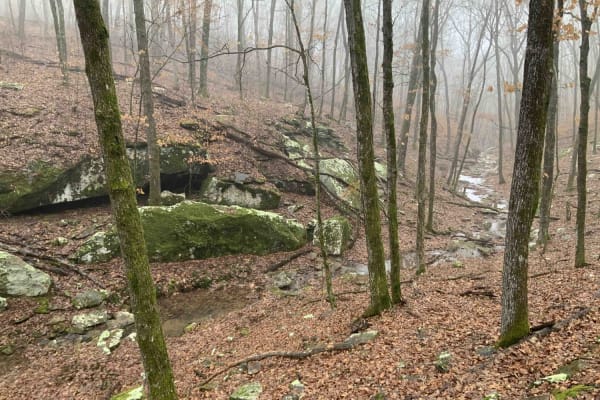
Bradford Easy Loop 1720B/2509
This is a great loop trail off Freedom Road. Along the trail, there are a few more loop and side road options that would make the path longer or more difficult. Due to narrow and tight turns, it is not currently suitable for full-size 4x4 pickups. Your 4x4 Jeep, Bronco, or midsize truck should be fi...
Learn more about Bradford Easy Loop 1720B/2509
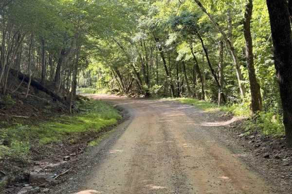
Old Cove City Road
Old Cove City Road is an easy scenic gravel road that winds through dense hardwood forest and rolling mountain terrain within the National Forest. The route is generally wide and well-maintained, making it suitable for most highway-registered vehicles in dry conditions. Long stretches of tree canopy...
Learn more about Old Cove City Road
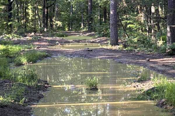
Crawley Ridge
Crawley Ridge is a rugged forest trail known for its deep mud holes, rocky climbs, and remote backwoods feel. Unlike smoother Ozark gravel routes, this trail quickly turns rough with uneven rock ledges, loose embedded stone, exposed roots, and heavily rutted sections that demand careful tire placeme...
Learn more about Crawley Ridge
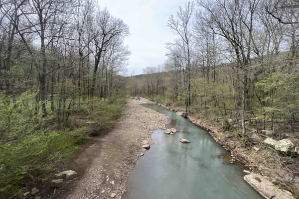
White Rock Mountain West
White Rock Mountain is magnificent. Sitting at an elevation of 2,309 feet the hiking trails with their views and caves to explore are a sight to see. There are three ways to get to White Rock Mountain, however one of which (Road 1003 in certain sections) is closed due to a landslide. This route is t...
Learn more about White Rock Mountain West
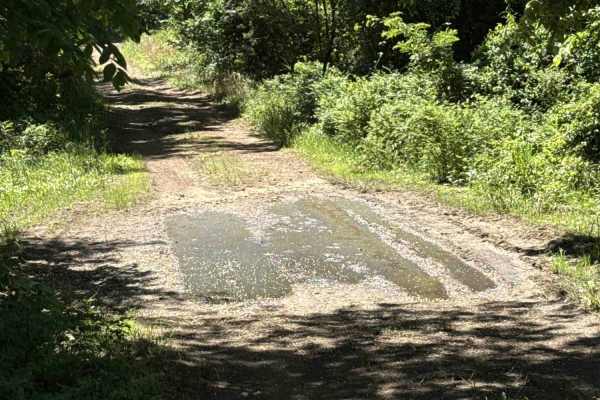
Elmo Creek
Elmo Creek Trail is an out-and-back National Forest route that offers a mix of easy forest driving with a few moderately rough sections scattered throughout. The trail begins as a relatively smooth gravel and dirt road beneath a dense tree canopy before gradually becoming narrower and more uneven de...
Learn more about Elmo Creek
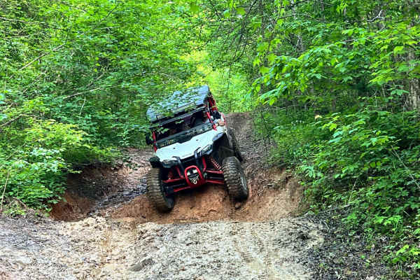
Delaney Creek Trail FS1517
Delaney Creek trail FS1517 is located in the Boston Mountains. The trail is filled with a few off-camber spots with mud and creek crossings. It also has a couple of narrow spots with low-hanging trees that you should be able to get under with ATVs, SxSs, and vehicles that are not lifted too high. Th...
Learn more about Delaney Creek Trail FS1517
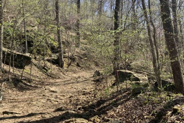
Warloop Road - 1567a
This road starts out as a maintained road and then changes to an unmaintained "right of way" road through private land. It then changes back to a maintained dirt road. There is a sign where the unmaintained section starts that lists the names of the families who own land along the road. It is fairly...
Learn more about Warloop Road - 1567a
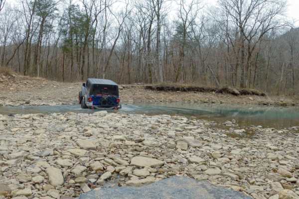
Alexander Mountain
Alexander Mountain, or Forest Service Road 1703, runs between Locke, on the southwest end near Devil's Canyon, to Hurricane Creek Rd, near White Rock on the northeast end. It can be run either direction. This trail offers beautiful scenery with a mix of challenging and easy trail sections. The road ...
Learn more about Alexander Mountain
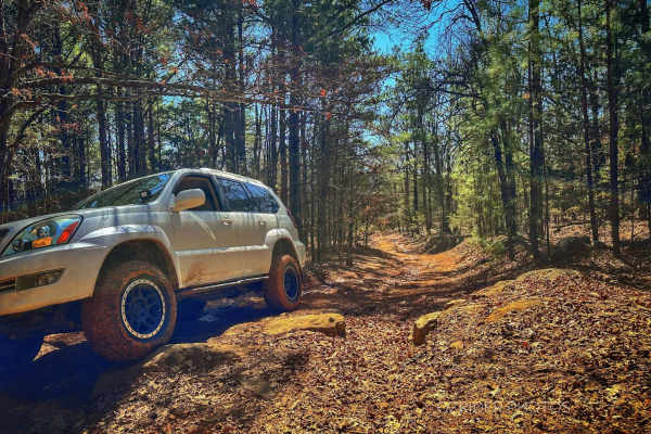
Pannell Road
On each end of this trail is a lovely, winding, gravel/dirt road, but in the middle, for a little over a mile, is a rocky and rutted trail with rocky, vertical ledges as high as 28 inches tall. Several bypass routes are the most challenging obstacles, but 32" tires and rock sliders are recommended. ...
Learn more about Pannell Road
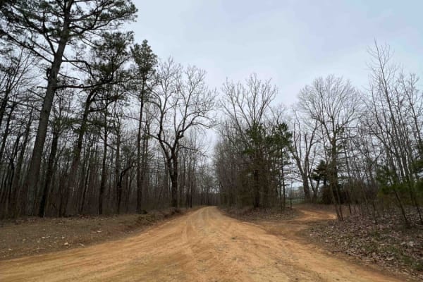
White Rock Mountain East
White Rock Mountain is an amazing place to explore in the Ozarks because it's absolutely magnificent. Sitting at an elevation of 2,309 feet, it provides some of the most breathtaking views in Arkansas. It's also one of the highest elevations in the state. The road to get there is an easy gravel road...
Learn more about White Rock Mountain East
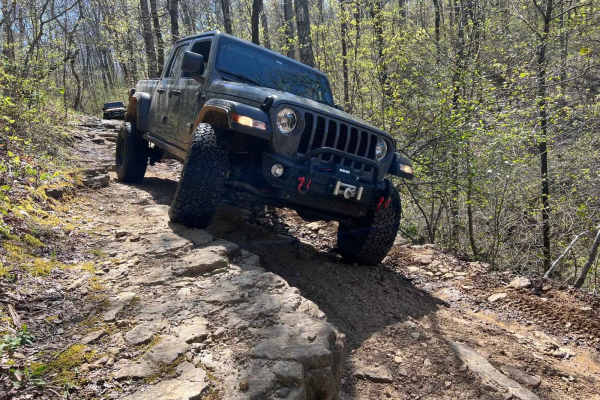
Eureka Springs Hollow 95472B
This is a fun challenging trail that can be used to connect to other nearby trails. Traveling from west to east, it is mostly downhill. It starts as an easy trail with a few large mud holes that are about 2 feet deep. You will find that it will soon turn to an off-camber descent with a 3-foot ledge ...
Learn more about Eureka Springs Hollow 95472B
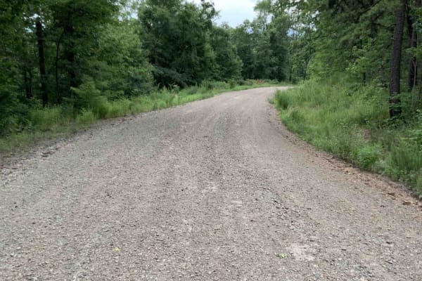
Bliss Ridge / 1505-1
This is a wide, well-maintained, dirt road from the White Rock Mountain Area to Shores Lake. Shores Lake is an 82-acre lake and has hiking, camping, swim areas, restrooms, and a boat ramp. It is a clear lake and has good fishing. ATVs are not allowed in the lake area. There are also a few campsites...
Learn more about Bliss Ridge / 1505-1
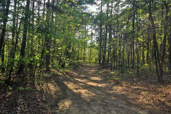
Ford Ridge
Ford Ridge is an easy dirt trail that leads to private property. The private property is gated off. This is a pretty mild trail that leads through some neat pine trees. A bit of loose rocks and mild inclines. A fun, quick trail to run down if you're in the area.
Learn more about Ford Ridge
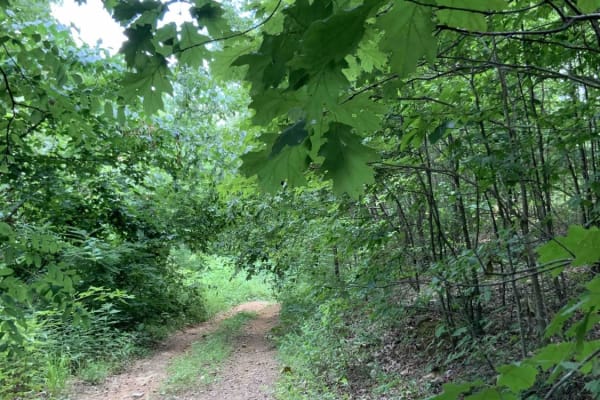
Deer Trap - 1776
This trail (1776) is near White Rock Mountain. Many of the harder trails around White Rock are currently closed, so this is a challenging trail that takes you south and allows you to hook up with a trail that eventually ends up at Shores Lake. This road currently will only take narrow vehicles becau...
Learn more about Deer Trap - 1776
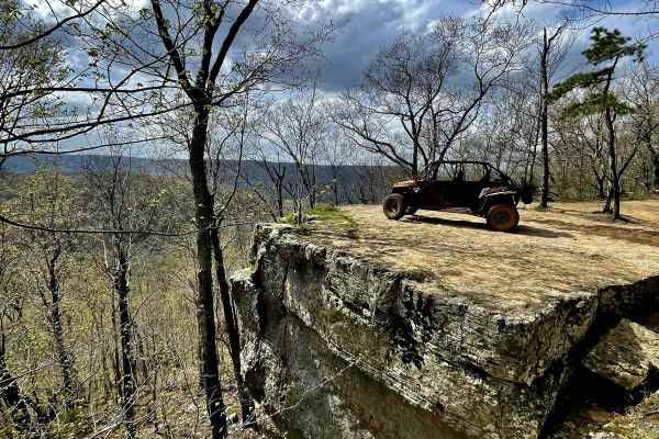
Mill Creek Blue Loop
This trail leads the rider through remote areas of the Ozark National Forest and features challenging mountainous terrain through a lush upland hardwood forest with unique rock outcrops, clear mountain streams, waterfalls, and spectacular scenic views. The trail is clearly marked. $3 day-use fee. Fe...
Learn more about Mill Creek Blue Loop
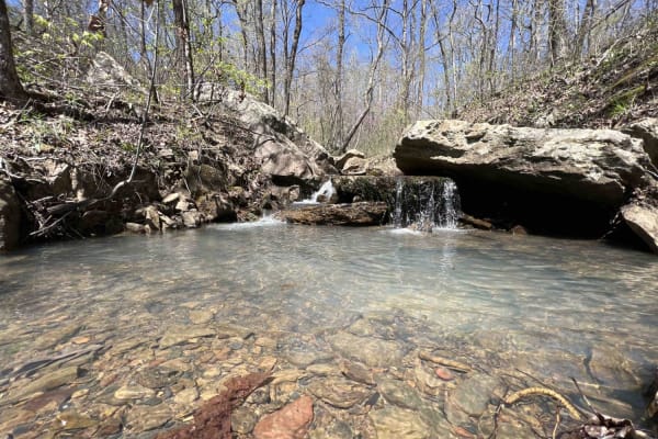
Fanes Creek 1520
Fanes Creek is a really beautiful area to explore with several areas to play in the water, it's a great way to cool off during the summer. It's an easy gravel road with both Fanes Creek and Cove Creek passing alongside this route. There are dispersed campsites right next to these creeks along with w...
Learn more about Fanes Creek 1520
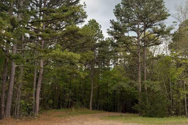
Fern Spring Trail
This trail is right off Highway 215. You will go through the Piney Woods section, and some parts of this trail can be tight for full-size vehicles. This will be an extremely tight trail during late spring and all summer. About 1/4th of the way through the trail, washed-out areas start showing up. .9...
Learn more about Fern Spring Trail
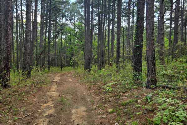
River Ridge
This trail is mostly dirt and ends on private property. This trail has several obstacles and needs to be cleared. There are lots of ruts and some shallow mud. The trail gets narrow with some tight trees. This trail does have some deeper mud holes, but they do have a bypass around those mud holes.
Learn more about River Ridge
ATV trails near West Fork, Arkansas
Explore ATV-friendly trails near you. These trails are accessible for vehicles up to 50 inches wide, perfect for ATVs and smaller off-road machines.
Frog Bayou
The west end of this trail has recently been rerouted to ensure that it avoids private property. This trail follows FS1705/Kenney Road and runs along Frog Bayou, the main tributary for Lake Fort Smith, and features Frog Bayou Falls. Frog Bayou can be traveled either from Bidville Rd on the west side...
Learn more about Frog Bayou
Cove Creek Crossing
Cove Creek Crossing is a scenic forest route that follows the creek through a narrow mountain valley surrounded by towering hardwoods, rock bluffs, and rolling ridgelines. The road is primarily gravel and generally easy to navigate, though scattered embedded rock and occasional rough patches keep it...
Learn more about Cove Creek Crossing
Bradford Easy Loop 1720B/2509
This is a great loop trail off Freedom Road. Along the trail, there are a few more loop and side road options that would make the path longer or more difficult. Due to narrow and tight turns, it is not currently suitable for full-size 4x4 pickups. Your 4x4 Jeep, Bronco, or midsize truck should be fi...
Learn more about Bradford Easy Loop 1720B/2509
Old Cove City Road
Old Cove City Road is an easy scenic gravel road that winds through dense hardwood forest and rolling mountain terrain within the National Forest. The route is generally wide and well-maintained, making it suitable for most highway-registered vehicles in dry conditions. Long stretches of tree canopy...
Learn more about Old Cove City Road
UTV/side-by-side trails near West Fork, Arkansas
Find UTV and side-by-side trails near you. These trails accommodate vehicles up to 60 inches wide, ideal for UTVs, side-by-sides, and wider off-road rigs.
Cove Creek Crossing
Cove Creek Crossing is a scenic forest route that follows the creek through a narrow mountain valley surrounded by towering hardwoods, rock bluffs, and rolling ridgelines. The road is primarily gravel and generally easy to navigate, though scattered embedded rock and occasional rough patches keep it...
Learn more about Cove Creek Crossing
Bradford Easy Loop 1720B/2509
This is a great loop trail off Freedom Road. Along the trail, there are a few more loop and side road options that would make the path longer or more difficult. Due to narrow and tight turns, it is not currently suitable for full-size 4x4 pickups. Your 4x4 Jeep, Bronco, or midsize truck should be fi...
Learn more about Bradford Easy Loop 1720B/2509
Old Cove City Road
Old Cove City Road is an easy scenic gravel road that winds through dense hardwood forest and rolling mountain terrain within the National Forest. The route is generally wide and well-maintained, making it suitable for most highway-registered vehicles in dry conditions. Long stretches of tree canopy...
Learn more about Old Cove City Road
Crawley Ridge
Crawley Ridge is a rugged forest trail known for its deep mud holes, rocky climbs, and remote backwoods feel. Unlike smoother Ozark gravel routes, this trail quickly turns rough with uneven rock ledges, loose embedded stone, exposed roots, and heavily rutted sections that demand careful tire placeme...
Learn more about Crawley Ridge
The onX Offroad Difference
onX Offroad combines trail photos, descriptions, difficulty ratings, width restrictions, seasonality, and more in a user-friendly interface. Available on all devices, with offline access and full compatibility with CarPlay and Android Auto. Discover what you're missing today!
Open Trail Map