
Dirt Bike Trails
Near Virginia Lakes, California
Explore All Dirt Bike Trails Near Virginia Lakes, California
Dirt Bike Trails Near Virginia Lakes, California
Discover the best dirt bike trails near you. Browse trail maps, check difficulty ratings, and find your next adventure — whether you're looking for a quick ride or an all-day expedition.
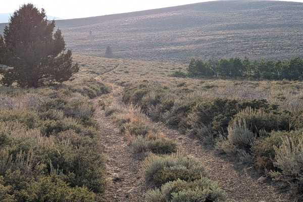
Dog Creek Loop
This trail is composed of packed dirt and sand with lots of small rocks embedded in the surface. Near the top, vegetation is sparse, likely due to high winds, but the views of the Virginia Lakes area, surrounding mountains, the Bodie Mountains, and Highway 395 below are spectacular. The trail quickl...
Learn more about Dog Creek Loop
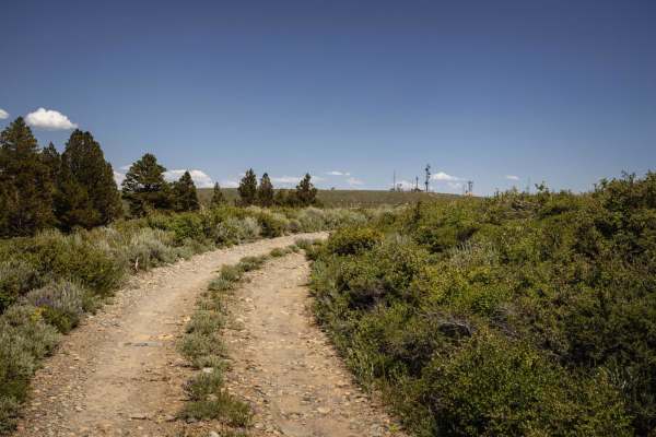
Copper Mountain
The Copper Mountain trail is an exceptional high-country route designed for scenic-minded offroaders looking for a peaceful escape with sweeping panoramic views of the Sierra Nevada. This roughly 8-mile journey begins off Virginia Lakes Road and ascends from 8,285 feet to a peak elevation of 9,816 f...
Learn more about Copper Mountain
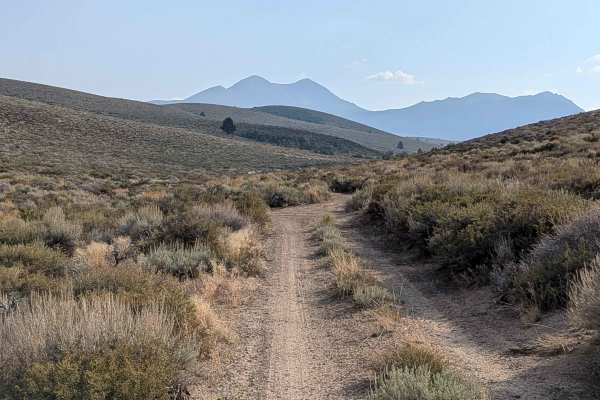
Dog Creek Valley
This rugged 6-mile trail drops about 700 feet before climbing nearly 1,600 feet, offering a dynamic ride through the historic Gold Rush area called Dog Town. It begins off Dunderberg Mill Road, traveling below Dunderberg Mill Road. The trail is mostly sandy and about a vehicle and a half wide, lined...
Learn more about Dog Creek Valley

Pole Line Cutoff
This is a simple route of hard-packed dirt and sand that follows the line of power poles as it cuts through Dog Creek Valley. The track is a single-vehicle width, with a few mild ruts but nothing technical. Along the way, you’ll be treated to wide-open views of the Eastern Sierra and the Bodie Mount...
Learn more about Pole Line Cutoff
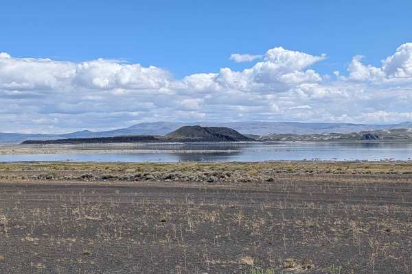
Black Point - FS 2N42
This route is accessed off Cemetery Road, just east of Highway 395, and offers some of the best views of Mono Lake and its islands, along with great views of the Eastern Sierras and the Bodie Mountains. The area is open to bicycles and vehicles, but you cannot go off-road or drive on any hiking trai...
Learn more about Black Point - FS 2N42
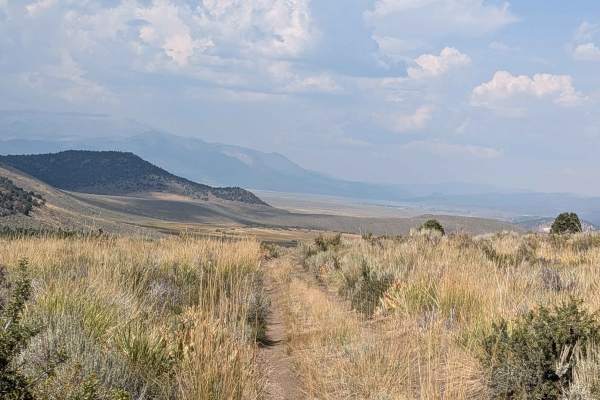
Cameron Canyon
This route is a dirt and sand trail with lots of rocks embedded along the path. The trail climbs over 700 feet in just more than 1.5 miles and is just over one vehicle wide throughout most of the journey. It's lined with heavy brush and heavy grass, offering beautiful views of the surrounding hills,...
Learn more about Cameron Canyon
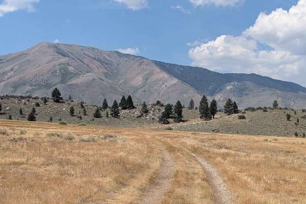
Meadows Way - FS 32144A
This challenging route cuts through wide open grassy meadows for the first 1.3 miles, then enters an area of large bushes and some trees with a small creek crossing. After 1.5 miles of traversing the big open meadow, the trail climbs almost 300 feet in less than half a mile. This section is full of ...
Learn more about Meadows Way - FS 32144A
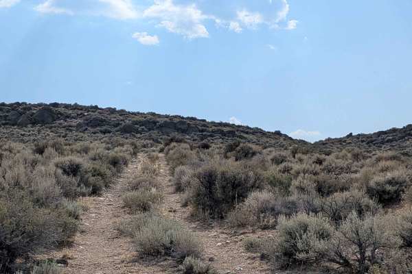
Dogtown Spur B
This rugged trail climbs nearly 300 feet and then drops back down in under 2 miles. The track is very narrow, with a mix of packed sand and embedded rocks. It begins as a slight shelf road running alongside a river, parallel to Highway 395, before turning away from the highway and climbing into the ...
Learn more about Dogtown Spur B
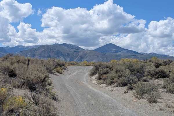
FS 2N19
This route runs parallel to Mono Lake, providing 360-degree views of all the surrounding mountains. You can see the peaks of the Sierra Nevadas, including Mount Dana, Mount Gibbs, and Tioga Peak, which form the Sierra Crest to the west. You can also see the volcanic features of the Mono Craters to t...
Learn more about FS 2N19
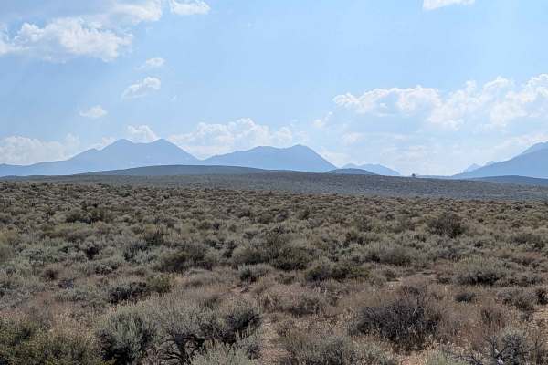
Dogtown Spur A
Scenic Eastern Sierra route beginning 1.4 miles off Highway 395 via Dunderberg Mill Road. The trail features a packed sand and dirt surface with embedded rocks throughout. It traverses varied terrain, including dry wash crossings, off-camber sections, and interesting rock formations with excellent m...
Learn more about Dogtown Spur A
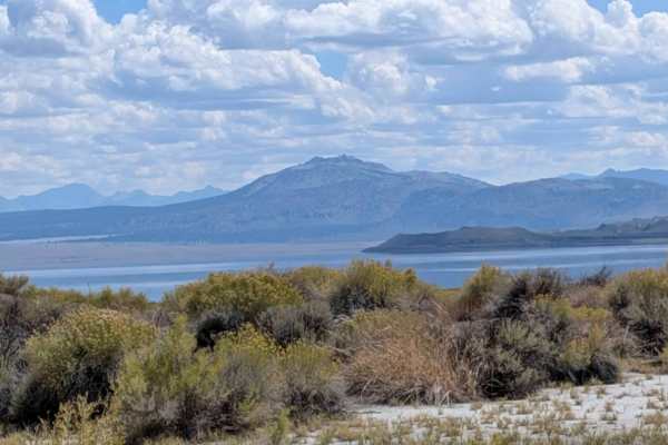
Wadford Springs Cutoff - FS 2N47
This route runs parallel to Mono Lake, starting on Forest Service Road 2N43 and ending on Highway 167. The trail offers 360-degree views of all the surrounding mountains and Mono Lake throughout the journey. At 0.75 miles from the southwest entrance, the terrain features deeper sand, and at 1 mile i...
Learn more about Wadford Springs Cutoff - FS 2N47
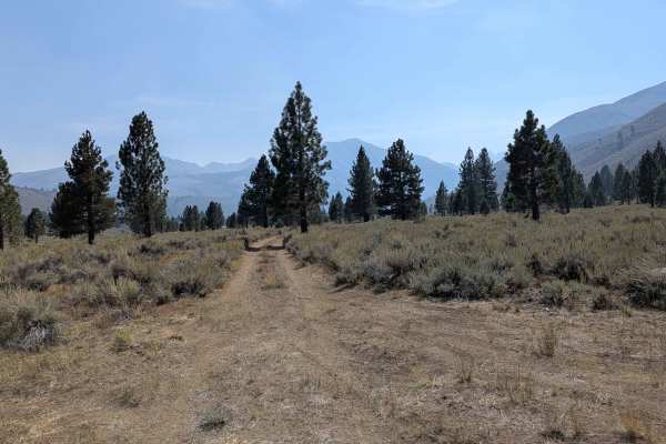
LaBrosse Creek Road - FS 32176
This scenic 3-mile out-and-back trail climbs nearly 300 feet in just over 2 miles and runs parallel to Twin Lakes Road, offering a quiet dirt alternative to the pavement. The route begins just past the Twin Lakes area within the Twin Lakes Recreation Area. The trail is sandy and one vehicle wide, li...
Learn more about LaBrosse Creek Road - FS 32176
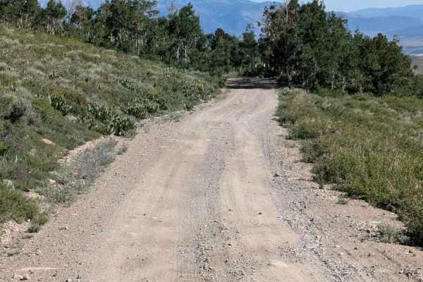
Dunderberg Meadows
This twelve-mile sandy graded road travels from north to south from Hwy 395, near Bridgeport, down to the Virginia Lakes Road. It is an easy trail that offers beautiful views of the Eastern Sierras to the West and Bodie Mountain and Mount Biedeman to the East. It's a great easy day.
Learn more about Dunderberg Meadows
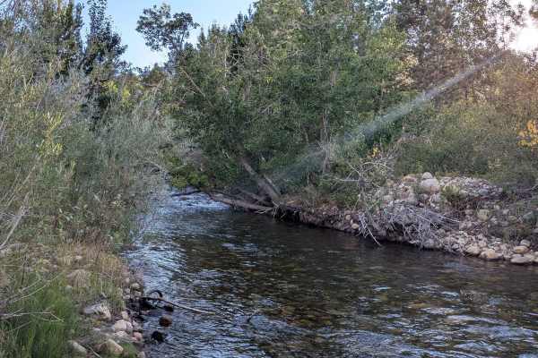
Picnic Grounds Road
This scenic route climbs 130 feet and drops almost 500 feet over just over 5.4 miles, running parallel to Mono Lake along its shoreline. The trail offers stunning views of the lake, the Eastern Sierras, and other surrounding peaks throughout the journey. Views include Mono Lake and its islands as w...
Learn more about Picnic Grounds Road
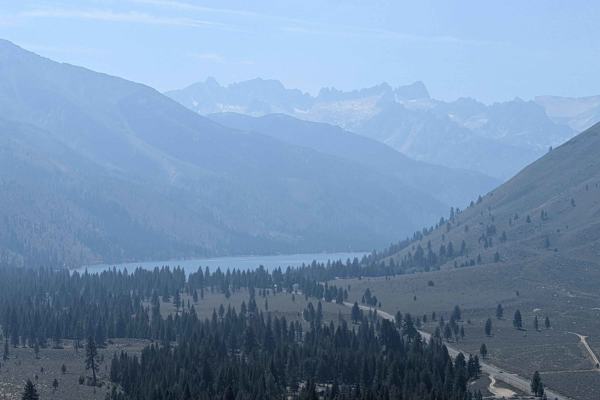
El Camino Estate Road - FS 32150
This short but steep out-and-back trail climbs over 600 feet in less than a mile and a half, making it a quick route to big views. The road is a mix of sand and gravel with embedded rocks, lined with thick sagebrush as it follows a power line corridor. It is only one vehicle wide, so be prepared to ...
Learn more about El Camino Estate Road - FS 32150
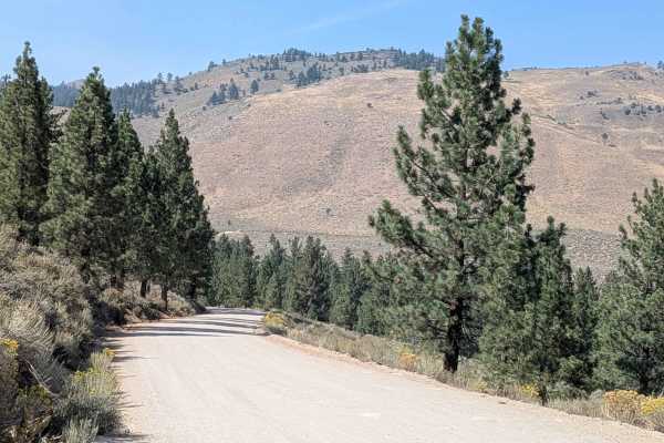
Buckeye Robinson Creek South
The trail starts as a paved road but quickly turns into a hard-packed dirt and gravel road that is about two and a half vehicles wide. It climbs high above the valley below, gaining over 350 feet and dropping about 175 feet in just over three miles. Along the way, you get great views of the town of ...
Learn more about Buckeye Robinson Creek South
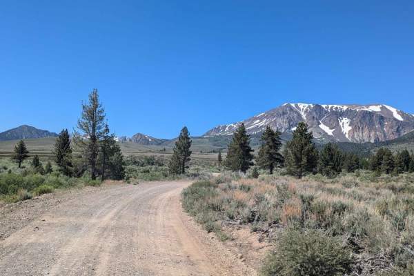
Farrington Siphon South
This gravel trail is well-graded for most of the year. It takes you on a scenic journey through Sawmill Canyon. It offers beautiful views of Mt. Gibbs, Mt. Lewis, Parker Peak, Blacktop Peak, Mono Lake, and Crater Mountain. Gains the traveler access to Walker Lake Trailhead and Parker Lake Trailhead.
Learn more about Farrington Siphon South
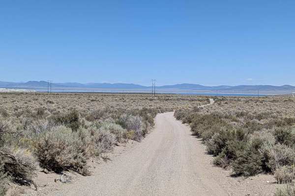
Oil Plant Road - FS 01N18
This descent drops over 250 feet in just 2.5 miles as it approaches Mono Lake through scenic open terrain. The sand and gravel trail makes its way down towards the lake through an open meadow lined with brush, offering excellent views of Mono Lake, the Eastern Sierra, and Crater Mountain throughout ...
Learn more about Oil Plant Road - FS 01N18
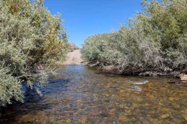
Rush Creek Road
This scenic route climbs just under 100 feet and drops over 200 feet as it approaches Mono Lake, descending into a canyon lined with bushes. The trail offers continual views of Mono Lake below as well as Crater Mountain and the Eastern Sierras throughout the journey. Various unnamed spur trails bran...
Learn more about Rush Creek Road
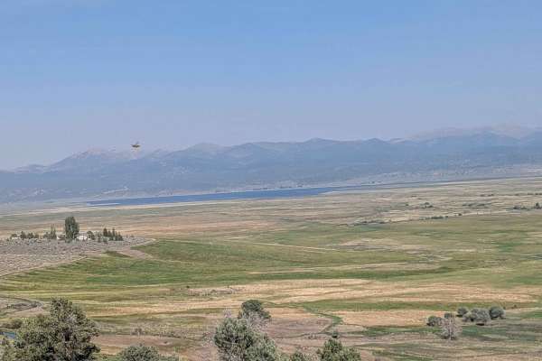
Buckeye Robinson Creek North
This route climbs more than 500 feet and drops about 80 feet in under 5 miles, making it a scenic but slightly longer way into Buckeye Hot Springs. The trail alternates between about one and a half vehicles wide, so you’ll likely need to use the pull-outs to let oncoming traffic pass. The surface is...
Learn more about Buckeye Robinson Creek North
ATV trails near Virginia Lakes, California
Explore ATV-friendly trails near you. These trails are accessible for vehicles up to 50 inches wide, perfect for ATVs and smaller off-road machines.
Dog Creek Loop
This trail is composed of packed dirt and sand with lots of small rocks embedded in the surface. Near the top, vegetation is sparse, likely due to high winds, but the views of the Virginia Lakes area, surrounding mountains, the Bodie Mountains, and Highway 395 below are spectacular. The trail quickl...
Learn more about Dog Creek Loop
Copper Mountain
The Copper Mountain trail is an exceptional high-country route designed for scenic-minded offroaders looking for a peaceful escape with sweeping panoramic views of the Sierra Nevada. This roughly 8-mile journey begins off Virginia Lakes Road and ascends from 8,285 feet to a peak elevation of 9,816 f...
Learn more about Copper Mountain
Dog Creek Valley
This rugged 6-mile trail drops about 700 feet before climbing nearly 1,600 feet, offering a dynamic ride through the historic Gold Rush area called Dog Town. It begins off Dunderberg Mill Road, traveling below Dunderberg Mill Road. The trail is mostly sandy and about a vehicle and a half wide, lined...
Learn more about Dog Creek Valley
Pole Line Cutoff
This is a simple route of hard-packed dirt and sand that follows the line of power poles as it cuts through Dog Creek Valley. The track is a single-vehicle width, with a few mild ruts but nothing technical. Along the way, you’ll be treated to wide-open views of the Eastern Sierra and the Bodie Mount...
Learn more about Pole Line Cutoff
UTV/side-by-side trails near Virginia Lakes, California
Find UTV and side-by-side trails near you. These trails accommodate vehicles up to 60 inches wide, ideal for UTVs, side-by-sides, and wider off-road rigs.
Dog Creek Loop
This trail is composed of packed dirt and sand with lots of small rocks embedded in the surface. Near the top, vegetation is sparse, likely due to high winds, but the views of the Virginia Lakes area, surrounding mountains, the Bodie Mountains, and Highway 395 below are spectacular. The trail quickl...
Learn more about Dog Creek Loop
Copper Mountain
The Copper Mountain trail is an exceptional high-country route designed for scenic-minded offroaders looking for a peaceful escape with sweeping panoramic views of the Sierra Nevada. This roughly 8-mile journey begins off Virginia Lakes Road and ascends from 8,285 feet to a peak elevation of 9,816 f...
Learn more about Copper Mountain
Dog Creek Valley
This rugged 6-mile trail drops about 700 feet before climbing nearly 1,600 feet, offering a dynamic ride through the historic Gold Rush area called Dog Town. It begins off Dunderberg Mill Road, traveling below Dunderberg Mill Road. The trail is mostly sandy and about a vehicle and a half wide, lined...
Learn more about Dog Creek Valley
Pole Line Cutoff
This is a simple route of hard-packed dirt and sand that follows the line of power poles as it cuts through Dog Creek Valley. The track is a single-vehicle width, with a few mild ruts but nothing technical. Along the way, you’ll be treated to wide-open views of the Eastern Sierra and the Bodie Mount...
Learn more about Pole Line Cutoff
The onX Offroad Difference
onX Offroad combines trail photos, descriptions, difficulty ratings, width restrictions, seasonality, and more in a user-friendly interface. Available on all devices, with offline access and full compatibility with CarPlay and Android Auto. Discover what you're missing today!
Open Trail Map