
Dirt Bike Trails
Near Lee Vining, California
Explore All Dirt Bike Trails Near Lee Vining, California
Dirt Bike Trails Near Lee Vining, California
Discover the best dirt bike trails near you. Browse trail maps, check difficulty ratings, and find your next adventure — whether you're looking for a quick ride or an all-day expedition.
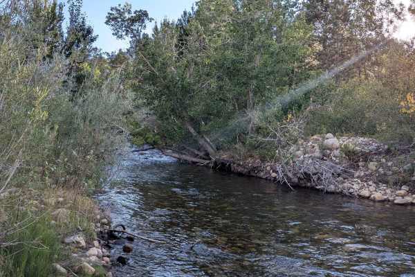
Picnic Grounds Road
This scenic route climbs 130 feet and drops almost 500 feet over just over 5.4 miles, running parallel to Mono Lake along its shoreline. The trail offers stunning views of the lake, the Eastern Sierras, and other surrounding peaks throughout the journey. Views include Mono Lake and its islands as w...
Learn more about Picnic Grounds Road
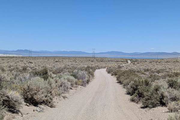
Oil Plant Road - FS 01N18
This descent drops over 250 feet in just 2.5 miles as it approaches Mono Lake through scenic open terrain. The sand and gravel trail makes its way down towards the lake through an open meadow lined with brush, offering excellent views of Mono Lake, the Eastern Sierra, and Crater Mountain throughout ...
Learn more about Oil Plant Road - FS 01N18
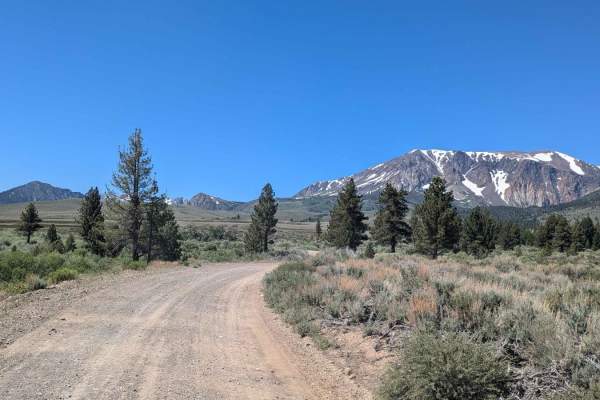
Farrington Siphon South
This gravel trail is well-graded for most of the year. It takes you on a scenic journey through Sawmill Canyon. It offers beautiful views of Mt. Gibbs, Mt. Lewis, Parker Peak, Blacktop Peak, Mono Lake, and Crater Mountain. Gains the traveler access to Walker Lake Trailhead and Parker Lake Trailhead.
Learn more about Farrington Siphon South
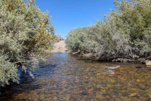
Rush Creek Road
This scenic route climbs just under 100 feet and drops over 200 feet as it approaches Mono Lake, descending into a canyon lined with bushes. The trail offers continual views of Mono Lake below as well as Crater Mountain and the Eastern Sierras throughout the journey. Various unnamed spur trails bran...
Learn more about Rush Creek Road
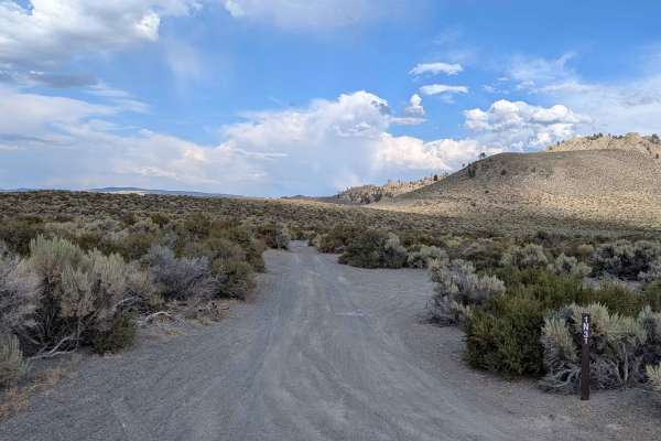
Panum Crater Pit - FS 1N30
This scenic descent drops 380 feet over 1.7 miles as it approaches the South Tufa area at Mono Lake. The trail leads from the Panum Crater area down to near Mono Lake, winding slowly into a canyon with high walls on both sides. The route is very narrow, barely one car wide, and features very thick b...
Learn more about Panum Crater Pit - FS 1N30
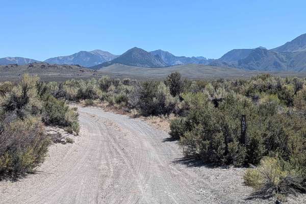
Pumice Valley - FS1N36
This route drops around 150 feet in elevation as it heads toward Mono Lake, cutting through the scenic pumice Valley. The sand and pumice trail follows power lines and is surrounded by impressive views of Crater Mountain, the Eastern Sierras, and Mono Lake. As you approach the lake, the trail narrow...
Learn more about Pumice Valley - FS1N36
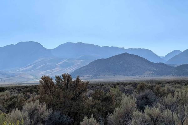
Panum Crater Road - FS 1S28
This relatively flat trail takes you to the historic Panum Crater, offering an educational and scenic journey through volcanic terrain. The route provides beautiful views of the Eastern Sierras and Crater Mountain area, as well as excellent vantage points of Panum Crater itself. This trail offers vi...
Learn more about Panum Crater Road - FS 1S28
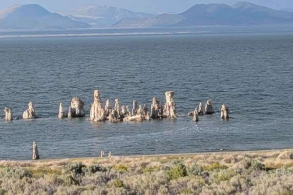
Test Station Road
This scenic route runs parallel to the south side of Mono Lake, taking you past the historic South Tufa formations where you can learn about the area's geological history. The trail climbs just under 100 feet and drops over 200 feet over under 4.5 miles, offering many beautiful views of Mono Lake an...
Learn more about Test Station Road
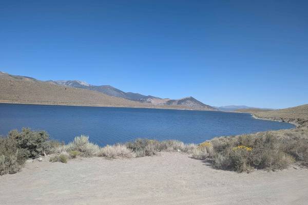
Grant Lake Road - FS 1S30
This 8-mile out-and-back trail starts at the June Lake Scenic Loop and wraps around the east side of Grant Lake, offering a chance to experience the beauty of Grant Lake up close. You'll pass two open gates within the first mile that are typically unlocked unless utility work is being done. The trac...
Learn more about Grant Lake Road - FS 1S30
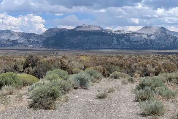
Forest Service Road 1S52
This trail begins on the east side of Highway 395 just south of Highway 120 and ends at West Portal Road. It is a sandy, dusty, and relatively narrow trail, approximately one vehicle wide, with sharp brush along the edges that can easily scratch vehicles. The trail is less traveled than nearby route...
Learn more about Forest Service Road 1S52
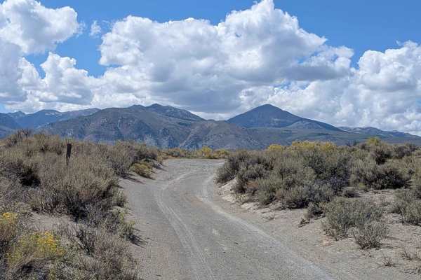
FS 2N19
This route runs parallel to Mono Lake, providing 360-degree views of all the surrounding mountains. You can see the peaks of the Sierra Nevadas, including Mount Dana, Mount Gibbs, and Tioga Peak, which form the Sierra Crest to the west. You can also see the volcanic features of the Mono Craters to t...
Learn more about FS 2N19
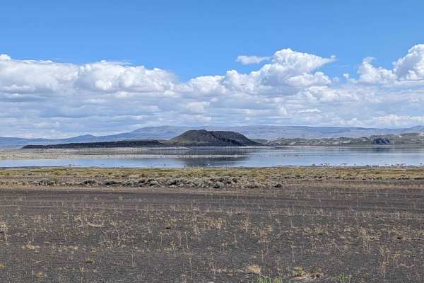
Black Point - FS 2N42
This route is accessed off Cemetery Road, just east of Highway 395, and offers some of the best views of Mono Lake and its islands, along with great views of the Eastern Sierras and the Bodie Mountains. The area is open to bicycles and vehicles, but you cannot go off-road or drive on any hiking trai...
Learn more about Black Point - FS 2N42
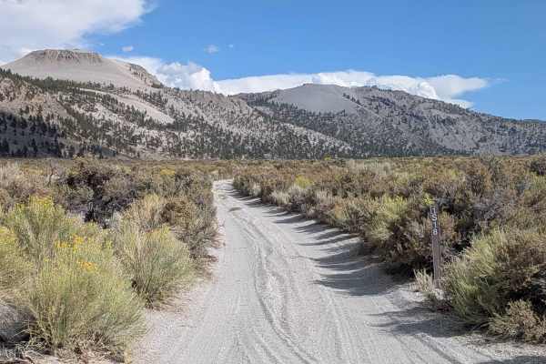
Crater Mountain - FS 1S18
This 3-mile in-and-out trail leads to the base of Crater Mountain, offering pretty views of the Eastern Sierras and Crater Mountain throughout the journey. The route climbs over 400 feet in just over 1.4 miles, transitioning to a shelf road near the end of the trail that provides elevated perspectiv...
Learn more about Crater Mountain - FS 1S18
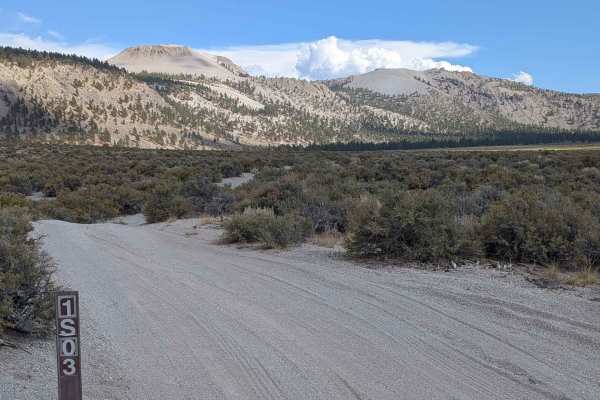
Crater Mountain Flats - FS 1S03
This diverse route drops 338 feet over just over 3 miles, transitioning through multiple terrain types and ecosystems. Starting in an open meadow lined with lots of hardy low bushes, the trail steps into a sparse tall pine forest after about a mile. The route features sand and pumice surfaces throug...
Learn more about Crater Mountain Flats - FS 1S03
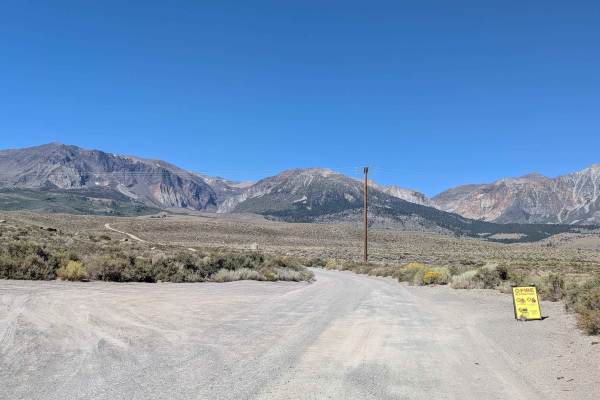
Grant Lake Cutoff
This trail starts on Highway 395 between the north and south entrances to the June Lake Scenic Loop, providing a direct route to Grant Lake. The wide, sandy track features a few patches of gravel and is typically maintained by the LA water district. The route offers stunning views of the Eastern Sie...
Learn more about Grant Lake Cutoff
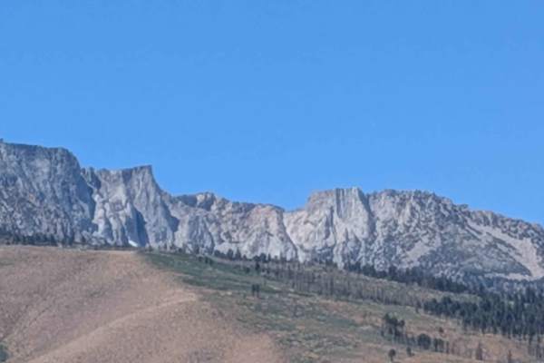
Old State Highway - FS1S29D
This route runs parallel to Highway 395, passing by the June Lake utility district and offering beautiful views of Crater Mountain, the Eastern Sierras, and Mono Lake throughout the journey. The trail is one vehicle wide, lined with brush and wildflowers that add natural beauty to the corridor. Fish...
Learn more about Old State Highway - FS1S29D
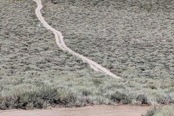
FS 1S104
This route climbs 800 feet and drops 200 feet within 2.5 miles, offering good views of the Eastern Sierra, Mono Lake, and Crater Lake throughout the journey. The very dusty trail can have deep sand at times, and the very beginning of the south section features a very steep climb on a very sandy trac...
Learn more about FS 1S104
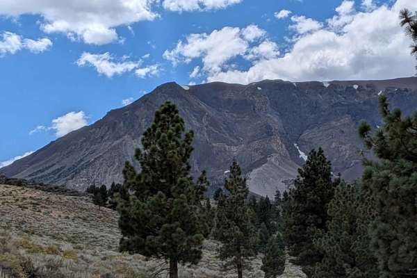
Parker Lake Road - NF1S25
This 5-mile out-and-back trail cuts through open meadows lined with sage and brush, offering stunning views of the Eastern Sierra mountains as well as Mono Lake and Crater Mountain. Note, although this trail has the Park Lake namesake, it actually goes to Parker Creek. The actual trail to the Park ...
Learn more about Parker Lake Road - NF1S25
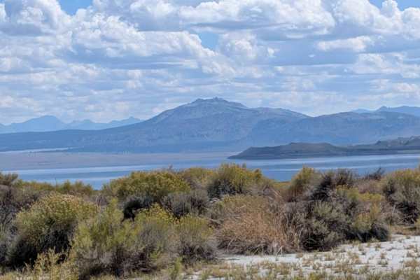
Wadford Springs Cutoff - FS 2N47
This route runs parallel to Mono Lake, starting on Forest Service Road 2N43 and ending on Highway 167. The trail offers 360-degree views of all the surrounding mountains and Mono Lake throughout the journey. At 0.75 miles from the southwest entrance, the terrain features deeper sand, and at 1 mile i...
Learn more about Wadford Springs Cutoff - FS 2N47
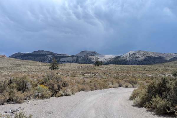
Punch Bowl - FS 1S38
This trail descends over 700 feet in just under 4 miles as it approaches Mono Lake. The route is sandy and dusty with pumice and is heavily used by side-by-side vehicles, creating lots of whoops and washboards. There are sections of deep sand that require a 4x4 vehicle. Rocky areas exist but can gen...
Learn more about Punch Bowl - FS 1S38
ATV trails near Lee Vining, California
Explore ATV-friendly trails near you. These trails are accessible for vehicles up to 50 inches wide, perfect for ATVs and smaller off-road machines.
Picnic Grounds Road
This scenic route climbs 130 feet and drops almost 500 feet over just over 5.4 miles, running parallel to Mono Lake along its shoreline. The trail offers stunning views of the lake, the Eastern Sierras, and other surrounding peaks throughout the journey. Views include Mono Lake and its islands as w...
Learn more about Picnic Grounds Road
Oil Plant Road - FS 01N18
This descent drops over 250 feet in just 2.5 miles as it approaches Mono Lake through scenic open terrain. The sand and gravel trail makes its way down towards the lake through an open meadow lined with brush, offering excellent views of Mono Lake, the Eastern Sierra, and Crater Mountain throughout ...
Learn more about Oil Plant Road - FS 01N18
Rush Creek Road
This scenic route climbs just under 100 feet and drops over 200 feet as it approaches Mono Lake, descending into a canyon lined with bushes. The trail offers continual views of Mono Lake below as well as Crater Mountain and the Eastern Sierras throughout the journey. Various unnamed spur trails bran...
Learn more about Rush Creek Road
Panum Crater Pit - FS 1N30
This scenic descent drops 380 feet over 1.7 miles as it approaches the South Tufa area at Mono Lake. The trail leads from the Panum Crater area down to near Mono Lake, winding slowly into a canyon with high walls on both sides. The route is very narrow, barely one car wide, and features very thick b...
Learn more about Panum Crater Pit - FS 1N30
UTV/side-by-side trails near Lee Vining, California
Find UTV and side-by-side trails near you. These trails accommodate vehicles up to 60 inches wide, ideal for UTVs, side-by-sides, and wider off-road rigs.
Picnic Grounds Road
This scenic route climbs 130 feet and drops almost 500 feet over just over 5.4 miles, running parallel to Mono Lake along its shoreline. The trail offers stunning views of the lake, the Eastern Sierras, and other surrounding peaks throughout the journey. Views include Mono Lake and its islands as w...
Learn more about Picnic Grounds Road
Oil Plant Road - FS 01N18
This descent drops over 250 feet in just 2.5 miles as it approaches Mono Lake through scenic open terrain. The sand and gravel trail makes its way down towards the lake through an open meadow lined with brush, offering excellent views of Mono Lake, the Eastern Sierra, and Crater Mountain throughout ...
Learn more about Oil Plant Road - FS 01N18
Rush Creek Road
This scenic route climbs just under 100 feet and drops over 200 feet as it approaches Mono Lake, descending into a canyon lined with bushes. The trail offers continual views of Mono Lake below as well as Crater Mountain and the Eastern Sierras throughout the journey. Various unnamed spur trails bran...
Learn more about Rush Creek Road
Panum Crater Pit - FS 1N30
This scenic descent drops 380 feet over 1.7 miles as it approaches the South Tufa area at Mono Lake. The trail leads from the Panum Crater area down to near Mono Lake, winding slowly into a canyon with high walls on both sides. The route is very narrow, barely one car wide, and features very thick b...
Learn more about Panum Crater Pit - FS 1N30
The onX Offroad Difference
onX Offroad combines trail photos, descriptions, difficulty ratings, width restrictions, seasonality, and more in a user-friendly interface. Available on all devices, with offline access and full compatibility with CarPlay and Android Auto. Discover what you're missing today!
Open Trail Map