
Dirt Bike Trails
Near Silver City, Nevada
Explore All Dirt Bike Trails Near Silver City, Nevada
Dirt Bike Trails Near Silver City, Nevada
Discover the best dirt bike trails near you. Browse trail maps, check difficulty ratings, and find your next adventure — whether you're looking for a quick ride or an all-day expedition.
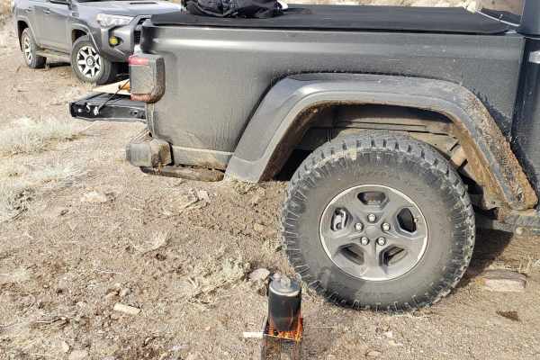
Old Como Road
This road begins at Dayton, Nevada, and gradually rises in elevation from 4367'' to 7128' into the Pine Nut Mountains and is located on mostly BLM lands. The trail starts off over a flat alluvial plain and then climbs out of the wash into the mountains. Sage, Juniper, and Pine trees are abundant as ...
Learn more about Old Como Road
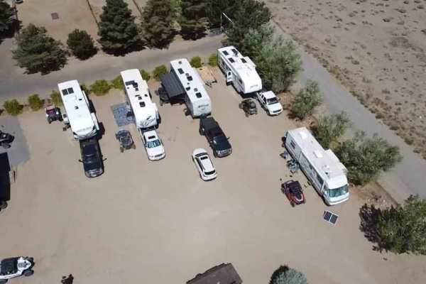
Virginia City Loop
The Virginia City Loop is an exceptional offroad adventure designed for four-wheel-drive vehicles, SxSs, and dirt bikes looking to experience the rugged beauty and wild horse populations of the historic Virginia Range. Spanning approximately 46 miles, this moderate loop begins and ends near historic...
Learn more about Virginia City Loop
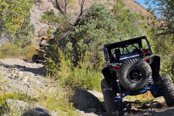
El Dorado Canyon OHV Trail
The route takes you from the Dayton area to Sunrise Pass. The canyon can be challenging with dirt, sand, and rock crawling sections. There is a creek that has seasonal water flow but does not make the trail undoable for high-clearance vehicles. It has cottonwood trees, pinon pine trees, and other ve...
Learn more about El Dorado Canyon OHV Trail
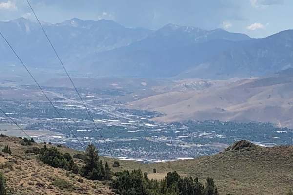
Jumbo Grade
This is a delightful trail that runs up a canyon from Washoe Lake to Virginia City. There are several creek crossings. Since the creek drains into a rather large area, it is probably not wise to attempt this after rain or when the snowpack is still melting above. 31-inch tires should be adequate. Th...
Learn more about Jumbo Grade
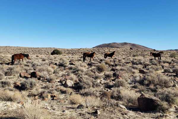
Wild Horse Trail
This route takes you from the outskirts of Dayton, Nevada to Clifton Flats. The trail head starts at the unlocked wild horse protection gate. Make sure to properly close and latch the gate. The trail begins on a graded dirt road. As you ascend, the road narrows to a double track trail. The surface v...
Learn more about Wild Horse Trail
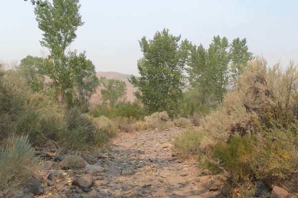
Brunswick Canyon
Brunswick Canyon Road is fairly easy;85% of the trail is single vehicle wide with tight switchbacks. Mostly packed gravel trail with areas of loose rocks and a couple of water crossings. The Northern end of the trail transitions into soft sand with a steep grade to reach the trail's end if you're tr...
Learn more about Brunswick Canyon
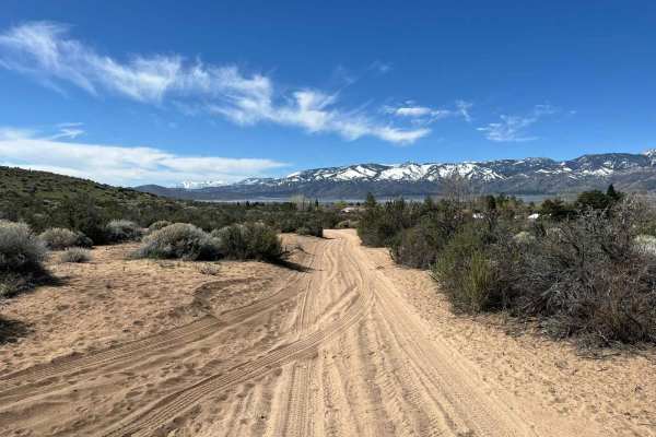
Silver Queen
This trail offers a little bit of everything. It starts as a dirt/gravel road with some washouts and a couple of steep climbs. You will pass through a sand pit that can be quite soft in the summertime. After the sand, there are approximately 2 miles of rock garden. If you end up joining Jumbo Grade ...
Learn more about Silver Queen
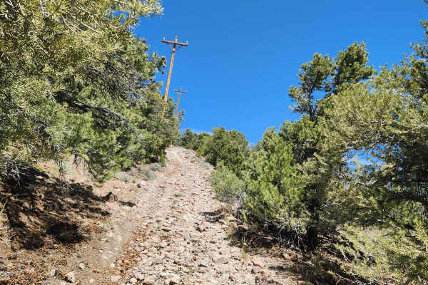
Rawe Peak West Trail
This trail leads to the top of Rawe Peak and is the Western half of a loop which is accessed from Old Como Road. It is a steep, rocky, narrow climb, with off-camber sections, ruts, and small fallen boulders narrowing the trail. On the upper section, oncoming traffic is a concern as it is a narrow ...
Learn more about Rawe Peak West Trail
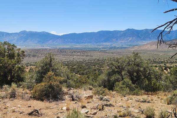
Fiddlers Green Trail
Fiddlers Green trail starts in a wooded area, then heads up and down steep, rocky stretches and trenches with noticeable off-camber sections. Some of the trail, especially the steep parts, is very narrow, so watch for oncoming traffic. Along the way, you climb in altitude and have views of Carson ...
Learn more about Fiddlers Green Trail
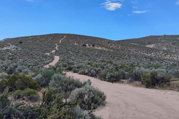
Ridgeline
This trail heads up from one of the vista points on the south side and shortcuts the "East Summit Loop" trail to get you up to the Prison Hill summit a bit quicker. The trail is a bit steep running up the ridge and has some loose rocks that can break your traction, but it is on the same level as mos...
Learn more about Ridgeline
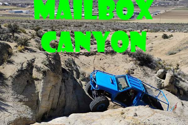
Mailbox Canyon
Mailbox Canyon is a short but brutal trail that will put your off-road skills to the test with two major obstacles that demand precision driving. The first obstacle throws a couple of big line choices your way, with a big ledge to climb on the left or a V-crack to climb on the right. The second obst...
Learn more about Mailbox Canyon
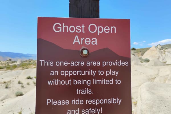
Ghost Open Area
Ghost is a 1-acre open riding area where you are not required to stay on a trail. This area provides the opportunity to pick your own lines and hone in your skills. The area is small at just 1 acre, but there are obstacles for everyone, from mild to wild. Even the best-built buggies will find crack...
Learn more about Ghost Open Area

D5
D5 starts off pretty soft and sandy as it heads up the hill. There are a few different routes for D5, and they all have signs telling you that you are on the trail. The trail is confusing to navigate, but the trail itself is fairly easy with not much more than sand and bumps to negotiate. There are...
Learn more about D5
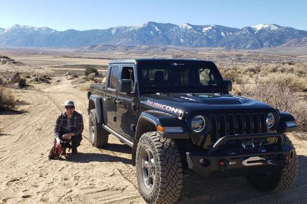
Indiana Bones Trail
The Indiana Bones Trail is an exciting, moderately challenging double-track route designed for four-wheel-drive vehicles, SxSs, and offroad enthusiasts seeking scenic panoramic vistas high above Carson Valley. Located within the popular Prison Hill Recreation Area, this 1.6-mile trail climbs from th...
Learn more about Indiana Bones Trail

Cable Road
Named for the remnants of old cable wire scattered along its path and its original purpose, the Cable Road is a fun and fast-paced off-road trail within the Prison Hill OHV Area. Starting just off Golden Eagle Lane, it provides access to a network of trails in the area. The west end of the trail sta...
Learn more about Cable Road

D1
D1 has moved a bit due to erosion from the way it was originally shown on the Prison Hill map. The trail starts at the same trailhead as "Rubber Side Up" but heads off to the left to what looks like the easier path. Once you get up the trail a bit, what started off as a sandy dirt road quickly star...
Learn more about D1

Rubber Side Up
Rubber Side Up is a short, Fun trail perfect for the off-roader looking to step up from the medium-rated trails and looking for a manageable challenge. Rated as the easiest of the black-label trails on the Prison Hill map, this route offers a great introduction to more advanced terrain. After you ha...
Learn more about Rubber Side Up

Death Walls
Death Walls is a jaw-dropping canyon trail that’s a must-see for any off-road enthusiast, even if your rig isn’t up to the challenge of running it. If you can’t drive it, it’s still worth the hike to witness the incredible rock features that make this trail a standout. Known for offering some of the...
Learn more about Death Walls

Easy Rider Trail
"Easy Rider Trail" starts off heading up from "Cable Road" onto a sandy trail. This is a great access point to watch the action on the harder trails. "Double Waterfall" ends in "Easy Rider Trail" and if someone is struggling with the waterfall at the top of "Double Waterfall" this is a great way to ...
Learn more about Easy Rider Trail

Headlight
"Headlight" is a 6-acre open riding area where you are not required to stay on a designated trail. This is an open play area where you can practice your skills and push your rig into whatever challenge you're looking for. Expect to find cracks and climbs with a variety of challenges for most rigs. W...
Learn more about Headlight
ATV trails near Silver City, Nevada
Explore ATV-friendly trails near you. These trails are accessible for vehicles up to 50 inches wide, perfect for ATVs and smaller off-road machines.
Old Como Road
This road begins at Dayton, Nevada, and gradually rises in elevation from 4367'' to 7128' into the Pine Nut Mountains and is located on mostly BLM lands. The trail starts off over a flat alluvial plain and then climbs out of the wash into the mountains. Sage, Juniper, and Pine trees are abundant as ...
Learn more about Old Como Road
Virginia City Loop
The Virginia City Loop is an exceptional offroad adventure designed for four-wheel-drive vehicles, SxSs, and dirt bikes looking to experience the rugged beauty and wild horse populations of the historic Virginia Range. Spanning approximately 46 miles, this moderate loop begins and ends near historic...
Learn more about Virginia City Loop
El Dorado Canyon OHV Trail
The route takes you from the Dayton area to Sunrise Pass. The canyon can be challenging with dirt, sand, and rock crawling sections. There is a creek that has seasonal water flow but does not make the trail undoable for high-clearance vehicles. It has cottonwood trees, pinon pine trees, and other ve...
Learn more about El Dorado Canyon OHV Trail
Jumbo Grade
This is a delightful trail that runs up a canyon from Washoe Lake to Virginia City. There are several creek crossings. Since the creek drains into a rather large area, it is probably not wise to attempt this after rain or when the snowpack is still melting above. 31-inch tires should be adequate. Th...
Learn more about Jumbo Grade
UTV/side-by-side trails near Silver City, Nevada
Find UTV and side-by-side trails near you. These trails accommodate vehicles up to 60 inches wide, ideal for UTVs, side-by-sides, and wider off-road rigs.
Virginia City Loop
The Virginia City Loop is an exceptional offroad adventure designed for four-wheel-drive vehicles, SxSs, and dirt bikes looking to experience the rugged beauty and wild horse populations of the historic Virginia Range. Spanning approximately 46 miles, this moderate loop begins and ends near historic...
Learn more about Virginia City Loop
El Dorado Canyon OHV Trail
The route takes you from the Dayton area to Sunrise Pass. The canyon can be challenging with dirt, sand, and rock crawling sections. There is a creek that has seasonal water flow but does not make the trail undoable for high-clearance vehicles. It has cottonwood trees, pinon pine trees, and other ve...
Learn more about El Dorado Canyon OHV Trail
Jumbo Grade
This is a delightful trail that runs up a canyon from Washoe Lake to Virginia City. There are several creek crossings. Since the creek drains into a rather large area, it is probably not wise to attempt this after rain or when the snowpack is still melting above. 31-inch tires should be adequate. Th...
Learn more about Jumbo Grade
Wild Horse Trail
This route takes you from the outskirts of Dayton, Nevada to Clifton Flats. The trail head starts at the unlocked wild horse protection gate. Make sure to properly close and latch the gate. The trail begins on a graded dirt road. As you ascend, the road narrows to a double track trail. The surface v...
Learn more about Wild Horse Trail
The onX Offroad Difference
onX Offroad combines trail photos, descriptions, difficulty ratings, width restrictions, seasonality, and more in a user-friendly interface. Available on all devices, with offline access and full compatibility with CarPlay and Android Auto. Discover what you're missing today!
Open Trail Map