
Dirt Bike Trails
Near Ouray, Colorado
Explore All Dirt Bike Trails Near Ouray, Colorado
Dirt Bike Trails Near Ouray, Colorado
Discover the best dirt bike trails near you. Browse trail maps, check difficulty ratings, and find your next adventure — whether you're looking for a quick ride or an all-day expedition.
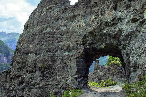
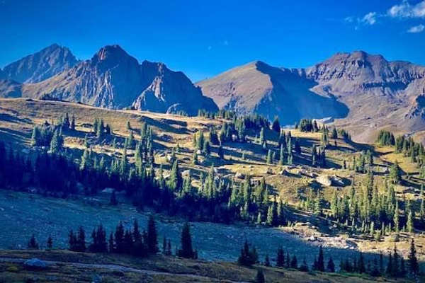
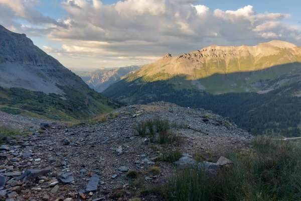
Yankee Boy Basin
You'll be treated to breathtaking views and unique history on this popular nature trail. Points of interest include the Drinking Cup, Twin Falls, Atlas Mill, Camp Bird Mine, and the rock overhang. There are designated camping areas available, and it is open to all vehicles from May 1 to November 11.
Learn more about Yankee Boy Basin
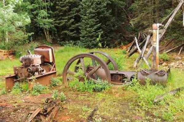
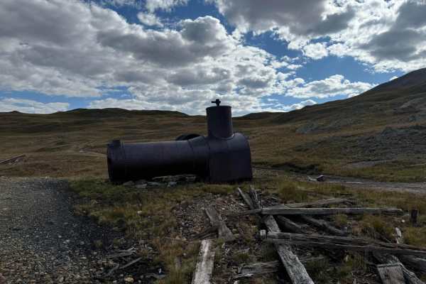
Cutler Mine
Just off of Imogene Pass lies a hidden trail that promises an adventure steeped in mystery. The trail meanders through the rugged landscape, eventually leading you to a locked gate that hints at tales long forgotten. Outside the gate, the remnants of an old cabin stand as silent witnesses to a bygon...
Learn more about Cutler Mine
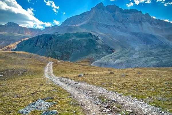
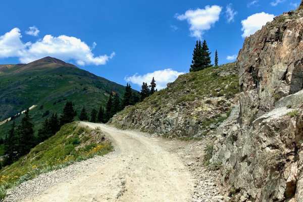
Culver Creek - County Road 14A
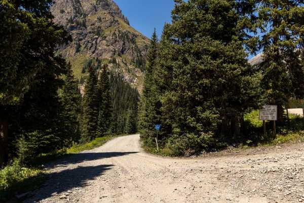
Culver Creek (County Road 14A) is an approachable 2.5-mile off-road route near Ouray, Colorado, that is perfect for stock high-clearance 4WD vehicles and SUVs looking to escape the crowded highway and access the scenic backcountry of the Uncompahgre National Forest. Branching off Dexter Creek Road (...
Learn more about Culver Creek - County Road 14A
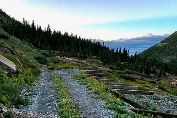
Cty Rd 14. - Dexter Creek Rd
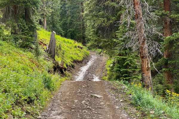
Dexter Creek Road leads you to national forest land with a few dispersed camping sites starting about one mile in. The road starts out a graded, gravel road which very quickly gets to a steep hill with a one-lane road. Uphill traffic has the right-of-way. The road passes through residential areas i...
Learn more about Cty Rd 14. - Dexter Creek Rd
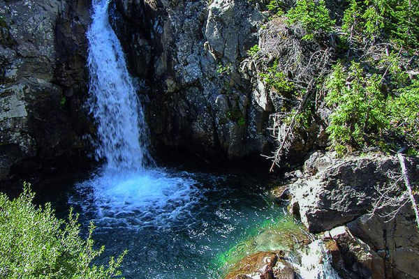
Mineral Creek
Mineral Creek is a popular but challenging road that delivers a fun climb up a thin canyon to Poughkeepsie Gulch and Mineral Point. Look for hidden waterfalls at the entrance to Poughkeepsie. There is not a lot of parking at the trailhead, and it can get really packed on the weekends.
Learn more about Mineral Creek
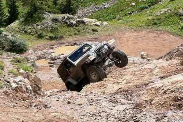
Poughkeepsie Gulch
Poughkeepsie Gulch is just about the only challenging Jeep trail in the San Juans. The reason for the 7-rating is the one major obstacle, called "The Wall." When most people talk about this trail, they focus on this obstacle. That is important, but the scenery in the gulch is also worthy of mention ...
Learn more about Poughkeepsie Gulch
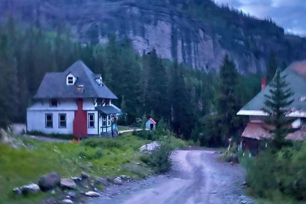
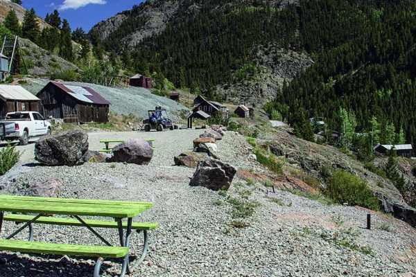
Camp Bird Mining Road - Cr 361
Camp Bird Mining Rd - Cr 361 is an easy, scenic historical route near Ouray, Colorado, perfect for beginner offroaders and history buffs looking to explore the region's rich mining heritage. This short 1-mile trail branches off Imogine Pass Road and descends into the historic Camp Bird Mine area. Th...
Learn more about Camp Bird Mining Road - Cr 361
Imogene Pass
Imogene Pass is a challenging and rewarding off-roading trail and stands as the second-highest drivable mountain pass in Colorado, peaking at 13,114 feet. This route is nestled within the stunning San Juan Mountains, stretching between Ouray and Telluride in the Uncompahgre National Forest, and has ...
Learn more about Imogene Pass
Silver Basin Trail
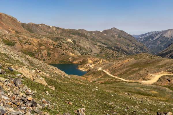
This road connects to Yankee Boy Basin Road at the same place as Imogene Pass. Take a right to go to Silver Basin. There are two beautiful emerald green lakes. The road after the first lake is much rougher, yet worth the drive. Wildflowers abound in spring and summer. Views are incredible. There is ...
Learn more about Silver Basin Trail
Governors Basin
The Governors Basin Trail is a rugged alpine route that climbs steadily into the high country above Ouray. The road is narrow and primarily one lane, with uphill shelf-road exposure for roughly 90% of its length. Conditions are rocky throughout, with some rougher sections that demand careful tire pl...
Learn more about Governors Basin
Hurricane Pass and Corkscrew Gulch
The Hurricane Pass and Corkscrew Gulch Trail is a well-traveled high-country route that offers a mix of terrain and conditions. The lower sections wind through forested areas where the trail can be bumpy, wet, and rutted, with dust common in drier stretches. As the route climbs, it becomes steeper a...
Learn more about Hurricane Pass and Corkscrew Gulch
Mineral Point
Mineral Point has a series of Jeep trails through the tundra at almost 12,000', one small lake that is a good spot for lunch, and the remains of the San Juan Chief Mill. Mineral Point was a town founded in 1873 and was named for a quartz deposit in the area. The town was located southwest of this t...
Learn more about Mineral Point
Sidney Basin
Short trail off of Governors Basin trail in Ouray. It leads to some open meadows, some nice views and an old abandoned mine. Be aware there is another trail to the east on the map indicated with dotted lines. It is a VERY narrow trail with no areas to pass another vehicle and areas washing out, so b...
Learn more about Sidney Basin
Brown Mountain
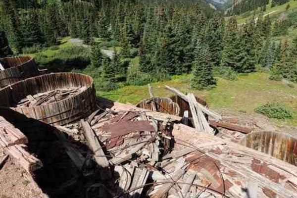
Brown Mountain is a short, but fun, Jeep trail that can be done in a couple of hours. The easy trip up through the trees ends in the alpine at 12,000'. There are a few short trails you can explore. Part way up you come to the Silver Mountain Mine. There are a couple of buildings remaining, as well a...
Learn more about Brown Mountain
Wrights Lake Trail
This is a short fun trail connected to the end of Yankee Boy Basin Trail. If you've come to the end of Yankee Boy, you owe it to yourself to do this trail as well. It is a short fun loop with a couple of nice climbs and views. From the right angle, the beautiful blue lake looks heart-shaped.
Learn more about Wrights Lake Trail
Old mine roads off of Imogene Pass Rd
These are some old mine roads you can take off the Imogene Pass and will loop back, whether going up or down Imogene Pass Road. There is a closed mine tunnel with rails, old housing mine structures and a nice view of the valley at High Point Road. Some other short roads branch off of it to other poi...
Learn more about Old mine roads off of Imogene Pass Rd
Chicago Tunnel Trail
This steep, loose, rutted, and often off-camber trail with tight switchbacks that climbs up to the Chicago Tunnel Mine--is not recommended for novice or inexperienced drivers. This out-and-back trail has one turnaround at the top. If you don't make it you will have to back down in a 4-wheel vehicle....
Learn more about Chicago Tunnel Trail
Adelia Mine
Nestled within the Mineral Point Mining District, this trail takes you on a journey up a scenic hill, offering a glimpse into the region's rich mining heritage. As you ascend, you'll encounter the historic Adelia mine, renowned for its extraction of lead, zinc, and copper. Located in San Juan County...
Learn more about Adelia Mine
Engineer Pass
Engineer Pass is a legendary high-altitude offroad route for intermediate drivers seeking breathtaking San Juan Mountain vistas and deep historical roots along Colorado's famous Alpine Loop. Connecting Lake City with the high country near Silverton and Ouray, this iconic trail offers a classic Rocky...
Learn more about Engineer Pass
County Road 2 Connector - Silverton to Animas Forks and Engineer Pass
County Road 2 out of Silverton is part of the Alpine Loop Scenic Byway. It is an historic mining road that connects to many side trails, while following part of an old railroad grade and mines. The road itself is almost three different trails, as it changes in terrain and difficulty. The first secti...
Learn more about County Road 2 Connector - Silverton to Animas Forks and Engineer Pass
ATV trails near Ouray, Colorado
Explore ATV-friendly trails near you. These trails are accessible for vehicles up to 50 inches wide, perfect for ATVs and smaller off-road machines.
Yankee Boy Basin
You'll be treated to breathtaking views and unique history on this popular nature trail. Points of interest include the Drinking Cup, Twin Falls, Atlas Mill, Camp Bird Mine, and the rock overhang. There are designated camping areas available, and it is open to all vehicles from May 1 to November 11.
Learn more about Yankee Boy Basin
Cutler Mine
Just off of Imogene Pass lies a hidden trail that promises an adventure steeped in mystery. The trail meanders through the rugged landscape, eventually leading you to a locked gate that hints at tales long forgotten. Outside the gate, the remnants of an old cabin stand as silent witnesses to a bygon...
Learn more about Cutler Mine
Mineral Creek
Mineral Creek is a popular but challenging road that delivers a fun climb up a thin canyon to Poughkeepsie Gulch and Mineral Point. Look for hidden waterfalls at the entrance to Poughkeepsie. There is not a lot of parking at the trailhead, and it can get really packed on the weekends.
Learn more about Mineral Creek
Poughkeepsie Gulch
Poughkeepsie Gulch is just about the only challenging Jeep trail in the San Juans. The reason for the 7-rating is the one major obstacle, called "The Wall." When most people talk about this trail, they focus on this obstacle. That is important, but the scenery in the gulch is also worthy of mention ...
Learn more about Poughkeepsie Gulch
UTV/side-by-side trails near Ouray, Colorado
Find UTV and side-by-side trails near you. These trails accommodate vehicles up to 60 inches wide, ideal for UTVs, side-by-sides, and wider off-road rigs.
Yankee Boy Basin
You'll be treated to breathtaking views and unique history on this popular nature trail. Points of interest include the Drinking Cup, Twin Falls, Atlas Mill, Camp Bird Mine, and the rock overhang. There are designated camping areas available, and it is open to all vehicles from May 1 to November 11.
Learn more about Yankee Boy Basin
Cutler Mine
Just off of Imogene Pass lies a hidden trail that promises an adventure steeped in mystery. The trail meanders through the rugged landscape, eventually leading you to a locked gate that hints at tales long forgotten. Outside the gate, the remnants of an old cabin stand as silent witnesses to a bygon...
Learn more about Cutler Mine
Mineral Creek
Mineral Creek is a popular but challenging road that delivers a fun climb up a thin canyon to Poughkeepsie Gulch and Mineral Point. Look for hidden waterfalls at the entrance to Poughkeepsie. There is not a lot of parking at the trailhead, and it can get really packed on the weekends.
Learn more about Mineral Creek
Poughkeepsie Gulch
Poughkeepsie Gulch is just about the only challenging Jeep trail in the San Juans. The reason for the 7-rating is the one major obstacle, called "The Wall." When most people talk about this trail, they focus on this obstacle. That is important, but the scenery in the gulch is also worthy of mention ...
Learn more about Poughkeepsie Gulch
The onX Offroad Difference
onX Offroad combines trail photos, descriptions, difficulty ratings, width restrictions, seasonality, and more in a user-friendly interface. Available on all devices, with offline access and full compatibility with CarPlay and Android Auto. Discover what you're missing today!
Open Trail Map