County Road 2 Connector - Silverton to Animas Forks and Engineer Pass

Total Miles 11.9
Technical Rating
4 Moderate
Best Time Spring, Summer, Fall
Trail Type Full-Width Road
Accessible By
Open Trail Map

Trail Overview

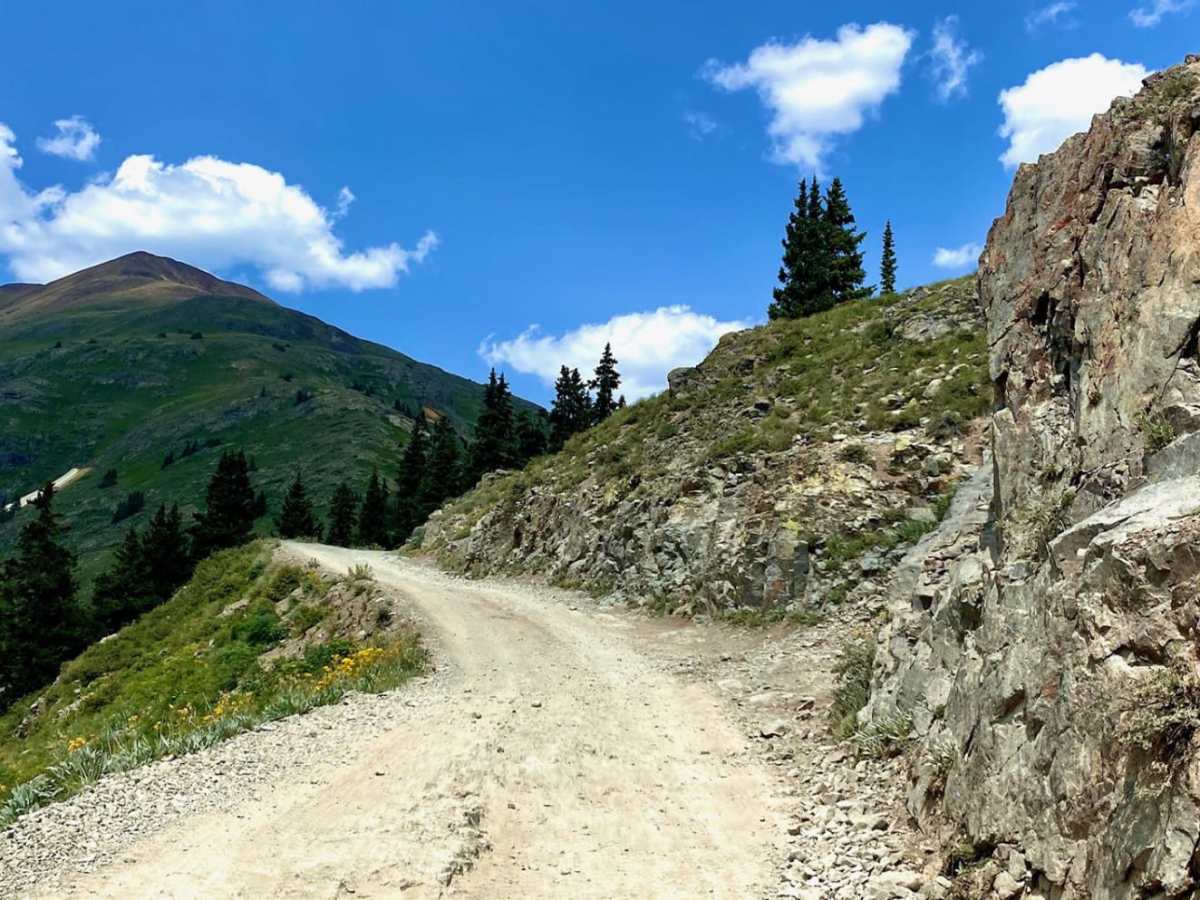
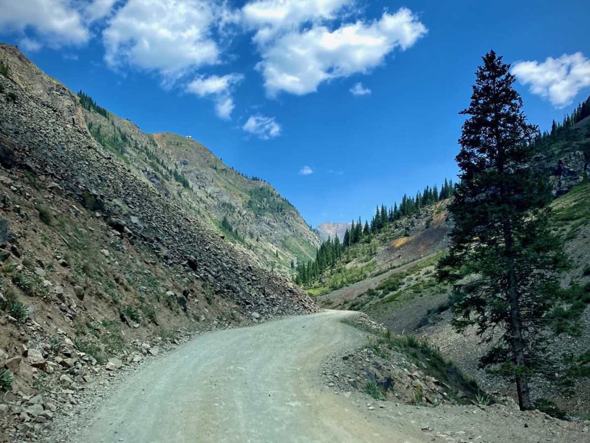
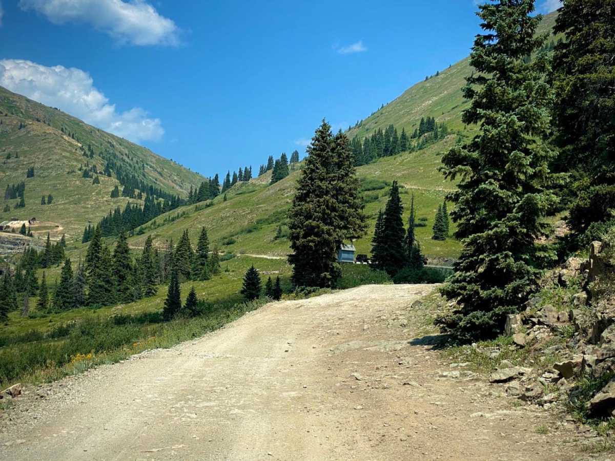
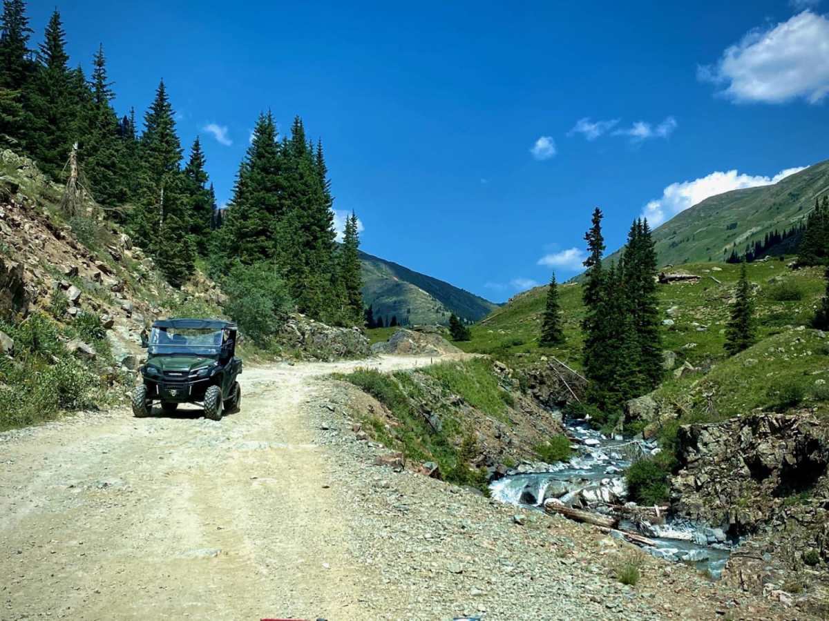
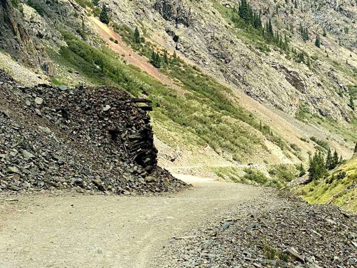
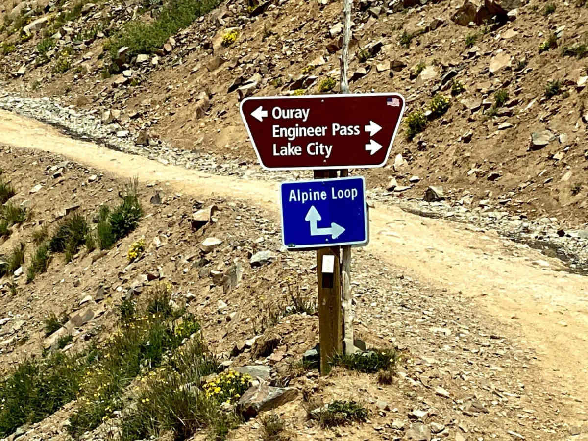
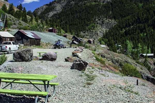
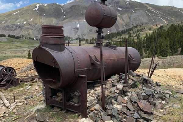
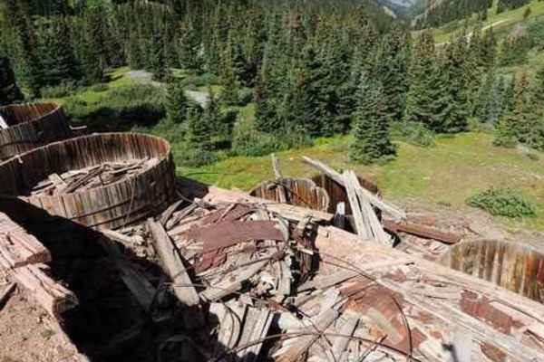
County Road 2 out of Silverton is part of the Alpine Loop Scenic Byway. It is an historic mining road that connects to many side trails, while following part of an old railroad grade and mines. The road itself is almost three different trails, as it changes in terrain and difficulty. The first section runs from Silverton to Eureka, the Sunnyside Mine and Eureka Gulch trail, as well as an RV park. This road is graded gravel, and suitable for any vehicle. The second section runs from Eureka to Animas Forks ghost town. The sign here warns of the need for high clearance, 4WD vehicles. If your vehicle allows the trip, Animas Forks is considered one of the best ghost towns in Colorado with its collection of preserved structures. The third section runs from Animas Forks to Engineer Pass, and is part of The Alpine Loop. From here on, you will need high-clearance 4WD vehicles. Some refer to this section as the North Fork Cutoff. It is much rockier with steeper hill climbs, and leads you to Cinnamon Pass and Engineer Pass. California Gulch and Mineral Creek trails also connect into this section.

Photos of County Road 2 Connector - Silverton to Animas Forks and Engineer Pass

Difficulty

The road is easy to Eureka. From Eureka to Animas Forks, it is more difficult.

History

This road connects many of the mining towns from Silverton to Eureka, to Animas Forks. Part of it follows the old Silverton Northern Railroad line. You will pass many revenants of mines, boarding houses, RR structures and more. The towns go back to the late 1800s, with the mining rush for Silver. It is part of the Alpine Scenic Byway along with the Mineral Creek, Engineer Pass and Cinnamon Pass trails. The later two make up the famous Alpine Loop.

Technical Rating

4

Status Reports

Add Status Report
Lewis Fell
Jun 13, 2026
Open
Road is rough and dusty, no snow. Open to Engineer Pass and upper Mineral Creek
sidnei Garringer
Sep 22, 2025
Open
Wide Open Roams
Sep 13, 2025
Open
We recently explored the Animas Forks Trail from Silverton to Animas Forks Ghost Town in our EarthRoamer, and it was an incredible drive. The trail was mostly dry with some small rocky sections, but nothing particularly challenging for a capable off-road vehicle. The scenery was stunning—trees were just starting to turn, painting the mountains with early fall colors. It made for a very picturesque drive, especially with the crisp weather on a busy Sunday. Arriving at Animas Forks Ghost Town was a highlight. Most of the historic buildings are open to explore, giving a real sense of the town’s past. Walking through the structures and imagining life here decades ago was a unique experience that really brought the history to life. Overall, this trail is a beautiful and accessible off-road route with a rewarding destination. Highly recommended for anyone wanting a mix of scenic driving and a touch of Colorado history. Check out our video on YouTube! @WideOpenRoams
Justin Richardson
Sep 06, 2025
Open
Read a report from someone doing it yesterday saying it was temporary closed by a gate. We never saw a gate closed or anything. Plenty of people out riding today! I will say the road to the summit from the lake city side was was probably a 2 but once you get to the other side that connects with cinnamon pass it becomes a lot more difficult giving the rating of a good 4
Josh Blythe
Sep 05, 2025
Open
Jared Simpkins
Aug 30, 2025
Open
I highly recommend taking this trail clockwise, or West to East. I believe going up the switchbacks was way better than going down them. The switch backs aren't as bad as what we thought they were going to be, we had a buddy do it on an Honda XR 150 and he made it up! Beautiful trail!
John P
Aug 12, 2025
Open
Not a fan of this trail strictly for comfort. Although it earns a 3 for difficulty the trail is lumpy and bumpy from Animas Forks to Eureka. Encountered more traffic than expected. Quite a few SXSs and dirt bikes running around. Plenty of spots to allow traffic by. If your setup can handle continuous cheese grater surfaces you will be fine. For me I wish I had aired down more to help smooth out the ride.
Steel Turner
Jun 24, 2025
Open
Dusty on lake city side but lots of snow melt up top. More erosion than the last few years but made for some good rides.
Patrick Baldwin
Jun 22, 2025
Open
Went from Silverton to Lake City. Melting snow and runoff at higher elevations, but the trail is clear. Some mud, not bad. Windy.
Chris Vos
Jun 18, 2025
Open
We went clockwise (Animas Forks -> Engineer -> Lake City). Still some snow in places making the steep rocky sections between Animas Forks and the pass more challenging than when snow free due to steep approach angle - 4 Lo needed. Otherwise a fun day out!
Thomas Elliott
Jun 06, 2025
Open
Had an amazing trip up Engineer from the Mineral side. A few big obstacles one of which took me an hour to decide on my line. The snow banks were amazing!
Nikki Nichole
May 28, 2025
Open
beautiful amount of snow, a few water crossings, big rocks and obstacles. overall great trail
Levi Perrine
May 14, 2025
Open
Open to Animas Forks from Silverton on CR2. California Gulch closed beyond Animas Forks because it’s blocked by snow. Might be able to get to Cinnamon Pass but didn’t reach that point.
Trent Tillett
Sep 18, 2024
Open
Agree with a 4 here. There is one spot that gets you off camber a bit (pictured) and can be slightly challenging. But a good line choice and it’s no big deal
Dave Woodson
Aug 28, 2024
Open
North end of trail where connecting to Engineer has some technical spots, needing 4x4 lo range 33" and 2" lift. Couple steep switchbacks. Agree with a 4 on this one

County Road 2 Connector - Silverton to Animas Forks and Engineer Pass Trail can be accessed by the following ride types:

  • Single Track
  • 50 Inch
  • High Clearance
  • Full Width

County Road 2 Connector - Silverton to Animas Forks and Engineer Pass Map

The onX Offroad Difference

onX Offroad combines trail photos, descriptions, difficulty ratings, width restrictions, seasonality, and more in a user-friendly interface. Available on all devices, with offline access and full compatibility with CarPlay and Android Auto. Discover what you're missing today!

Open Trail Map