
Dirt Bike Trails
Near Okolona, Arkansas
Explore All Dirt Bike Trails Near Okolona, Arkansas
Dirt Bike Trails Near Okolona, Arkansas
Discover the best dirt bike trails near you. Browse trail maps, check difficulty ratings, and find your next adventure — whether you're looking for a quick ride or an all-day expedition.
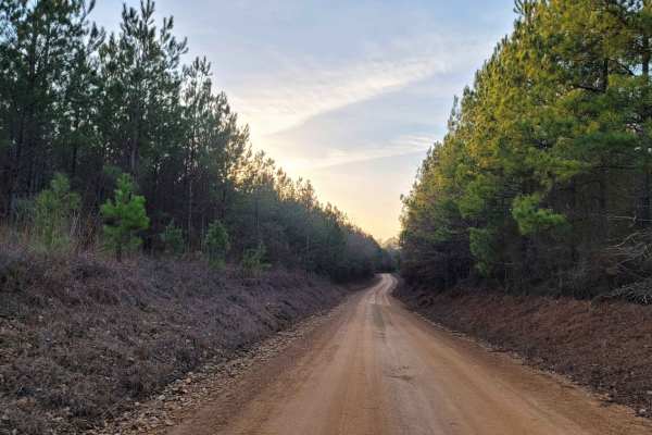
Country Route to White Oak Lake Group Campsite
This is a gravel and dirt road that leads to an awesome group campsite on White Oak Lake. A permit can be found online to camp in this free Poison Springs Forest. There are several campsites in this area. This particular campsite is on a hill right beside White Oak Lake. The later part of this route...
Learn more about Country Route to White Oak Lake Group Campsite
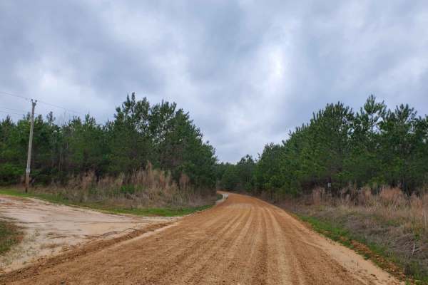
Highway 24 to Poison Springs WMA
This is a dirt and gravel road south of Highway 24. This road goes into the Poison Spring WMA. A camping permit is required and is free at the Poison Springs WMA website. This road can be slippery when wet. Some mild water crossings can be present during and after rains. Watch for wildlife crossing ...
Learn more about Highway 24 to Poison Springs WMA

Poison Springs WMA - Campsite C-10 to C-29 and C-54
This dirt and gravel road takes you to dispersed campsites within the Poison Springs WMA area. Camping permits are required and are free at Poison Springs WMA website. Roads can be slick, and water crossing can be found after rains. Watch for wildlife to cross roads. There are creeks in the area.
Learn more about Poison Springs WMA - Campsite C-10 to C-29 and C-54
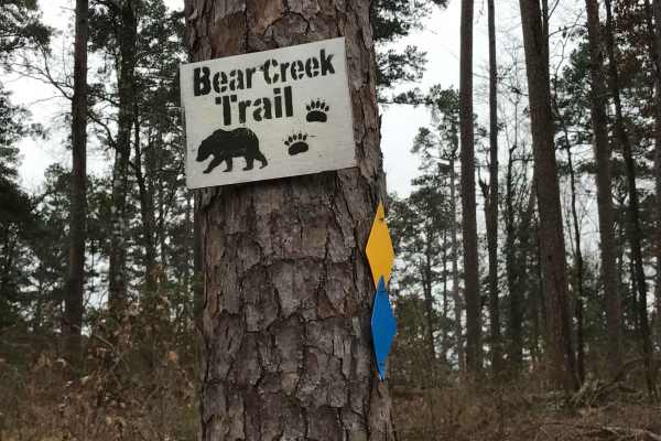
Bear Creek Trail
Bear Creek Trail is an exceptional offroad trail designed primarily for ATVs and dirt bikes looking to tackle rugged shoreline terrain with scenic views of Lake Greeson and the Ouachita Mountains. This specific 6.3-mile point-to-point segment begins at Daisy State Park and winds along the pine and o...
Learn more about Bear Creek Trail
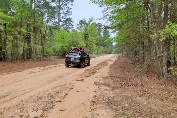
Primitive Camp and Shooting Range in Poison Springs WMA
White Oak State Park is a great place to stay while you explore the Poison Springs WMA. If you want full hookups and restrooms while you camp. While at White Oak State Park, ask the visitor center for a map to "The Little Grand Canyon." A must-see while in the area. You are close to the state park h...
Learn more about Primitive Camp and Shooting Range in Poison Springs WMA
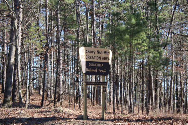
Hickory Nut Mountain
This maintained Gravel road goes up to Hickory Nut Vista Lookout. As you travel to the vista you will pass Hickory Nut Campground on the left side of the road. This is a dispersed campground with a pit toilet, picnic tables, and a fire ring. Awesome views of Lake Ouachita can be seen. This road does...
Learn more about Hickory Nut Mountain
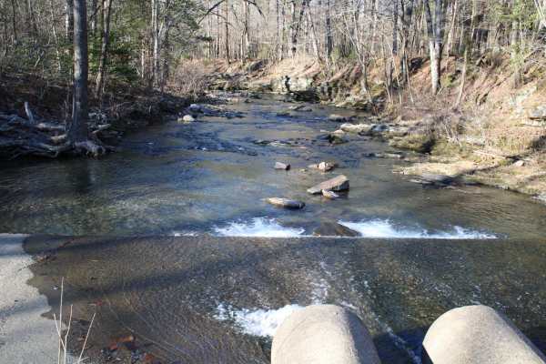
Pipe Spring
This road leaves Hickory Nut Road at the west end and the east end stops at Crystal Springs Resort entrance. Across the main road is a public boat ramp with restrooms and great views of Lake Ouachita. There are nice dispersed campsites along this road. Awesome creek-side camping and group-sized disp...
Learn more about Pipe Spring
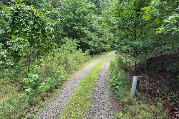
Harvey
This spur route branches off of Hamilton Creek and quickly transitions into a more remote forest setting. Unlike the surrounding gravel roads, this trail is primarily dirt-based with scattered gravel and natural forest debris, giving it a more primitive feel. The route winds through a mixture of har...
Learn more about Harvey
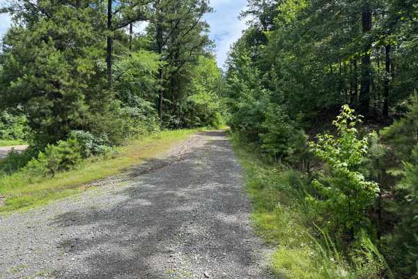
Hamilton Creek
Hamilton Creek is a short out-and-back forest route branching off Gaston Road. The route travels through a dense pine forest with narrow corridors, young timber growth, and thick brush that creates a secluded backcountry feel. While there are no major obstacles or technical challenges, the trail off...
Learn more about Hamilton Creek
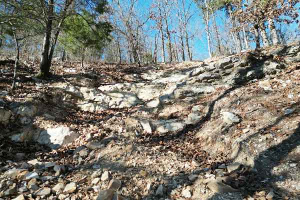
D4 Impossible
D4 Impossible is one of the extreme one-way trails that climbs up the mountain from D1 Rubicon Ridge up to the main Arkansas-5 trail on the ridge. D4 begins with a slight descent on loose rock, but quickly turns uphill near the power lines. The grade is near vertical in many places, with a combinati...
Learn more about D4 Impossible
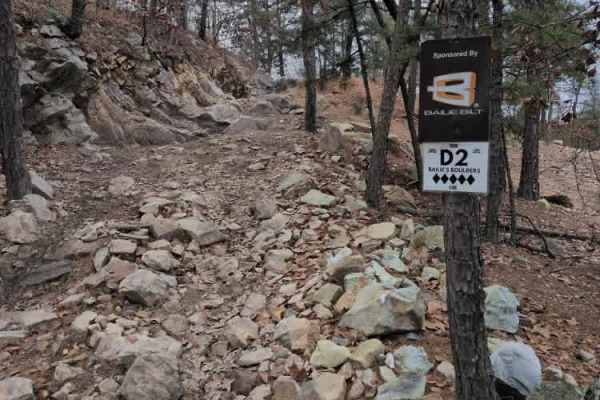
D2 Bailie's Boulders
D2 Bailie's Boulders is a short series of difficult rock obstacles located at the beginning of D1 Rubicon Ridge. The first obstacle is about 3-4 feet high, with a V-notch, and usually has water at the bottom of it. The second is closer to 10-12 ft near vertical. The third and final obstacle is a ver...
Learn more about D2 Bailie's Boulders
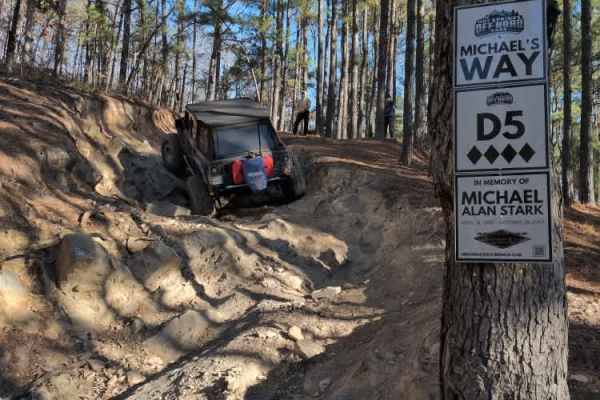
D5 Michael's Way
D5 Michael's way is a very short optional obstacle off of D1 Rubicon Ridge. It is a steep rock ledge that can get you off camber quickly, especially if it's wet. The park rating for this trail is 4 diamonds.
A Park Day-Use Trail Pass is required to access this system of trails. Cell service is spot...
Learn more about D5 Michael's Way
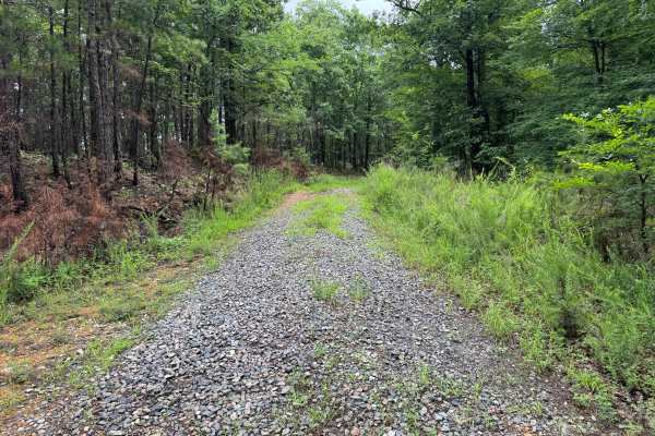
Mullins Loop
This forest road offers a more rugged experience than the surrounding trail network. While still relatively easy to navigate, the route receives less maintenance and has a noticeably more overgrown character. Grass and other vegetation grow between the tire tracks, and brush frequently encroaches on...
Learn more about Mullins Loop
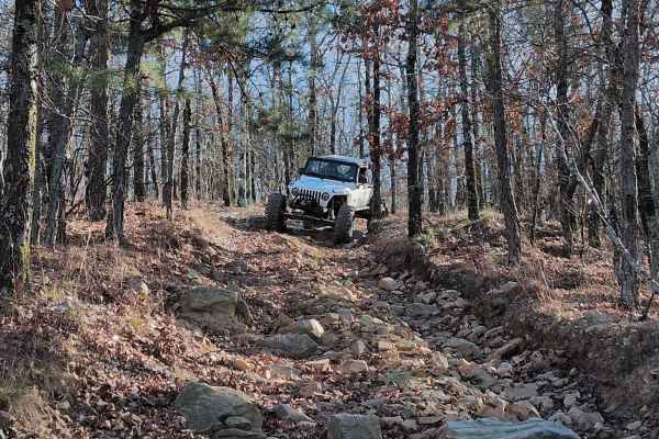
C16
C16 is a one-way steep descent with a few large ledges to drop off. One particular spot is very rough with jagged rocks that can cause issues with vehicle undercarriages. There is also an off-camber turn that will lean your vehicle into a large tree. Body & mechanical damage is a real possibility on...
Learn more about C16
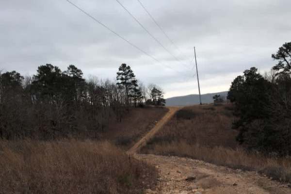
C18 Tanner's Hatchet
C18 Tanner's Hatchet is a relatively mild trail that meanders through the trees and along the power lines. There are a few small obstacles like roots and rocks, and one spot can be a bit off camber near the entrance for C16. C16 connects C4 Power Wagon Point up to Trail 5 and the beginning of D1 Rub...
Learn more about C18 Tanner's Hatchet
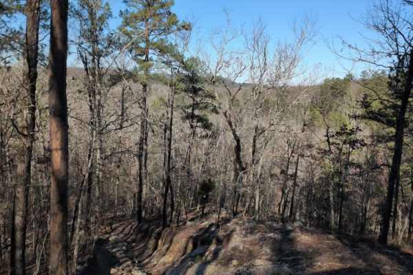
C8 Back Porch
This trail provides an exit at the ends of C5 Humdinger and C6 Ingrid's Revenge. You can either travel north back down the hill to the beginning or south to go uphill towards C4 Power Wagon. It is a steep descent on a wooded trail with only a few off-camber spots and drops to watch out for. The park...
Learn more about C8 Back Porch
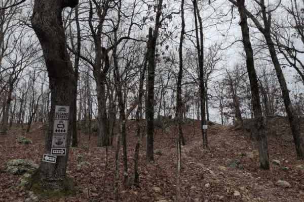
C3 Sesame Street
C3 Sesame Street is a fun, optional hill climb obstacle that you can do while on C4 Power Wagon Point. It is a relatively steep rocky climb with small ledges, then a quick downhill descent back to Power Wagon.
The park rating for this trail is 4 diamonds. A Park Day-Use Trail Pass is required to ac...
Learn more about C3 Sesame Street
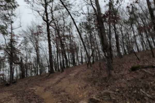
C9 Ingrid's Early Exit
This trail is an early exit that branches off to the left of C6 Ingrid's Revenge and connects to C12 The Zappasodi. It is a steep hill through the trees that avoids some of the final obstacles on C6.
The park rating for this trail is 4 diamonds. A Park Day-Use Trail Pass is required to access this ...
Learn more about C9 Ingrid's Early Exit
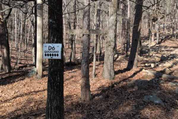
D6 Quicksand
D6 Quicksand is one of the extreme one-way trails that climbs up the mountain from D1 Rubicon Ridge up to the main Arkansas-5 trail on the ridge. The grade is near vertical in many places, with a combination of loose rock and solid rock ledges. The park rating for this trail is a maximum 6 diamonds....
Learn more about D6 Quicksand
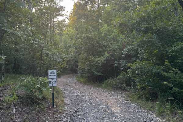
B22 Waterfall
B22 Waterfall is a 1-Diamond, two-way trail located in the B-section of Hot Springs Off-Road Park—an area designed with beginners in mind. At 0.2 miles long, this easy, scenic route is perfect for starting the day slow and soaking in the beauty of nature. The trail winds through tall wooded creek be...
Learn more about B22 Waterfall
ATV trails near Okolona, Arkansas
Explore ATV-friendly trails near you. These trails are accessible for vehicles up to 50 inches wide, perfect for ATVs and smaller off-road machines.
Country Route to White Oak Lake Group Campsite
This is a gravel and dirt road that leads to an awesome group campsite on White Oak Lake. A permit can be found online to camp in this free Poison Springs Forest. There are several campsites in this area. This particular campsite is on a hill right beside White Oak Lake. The later part of this route...
Learn more about Country Route to White Oak Lake Group Campsite
Bear Creek Trail
Bear Creek Trail is an exceptional offroad trail designed primarily for ATVs and dirt bikes looking to tackle rugged shoreline terrain with scenic views of Lake Greeson and the Ouachita Mountains. This specific 6.3-mile point-to-point segment begins at Daisy State Park and winds along the pine and o...
Learn more about Bear Creek Trail
Hickory Nut Mountain
This maintained Gravel road goes up to Hickory Nut Vista Lookout. As you travel to the vista you will pass Hickory Nut Campground on the left side of the road. This is a dispersed campground with a pit toilet, picnic tables, and a fire ring. Awesome views of Lake Ouachita can be seen. This road does...
Learn more about Hickory Nut Mountain
Pipe Spring
This road leaves Hickory Nut Road at the west end and the east end stops at Crystal Springs Resort entrance. Across the main road is a public boat ramp with restrooms and great views of Lake Ouachita. There are nice dispersed campsites along this road. Awesome creek-side camping and group-sized disp...
Learn more about Pipe Spring
UTV/side-by-side trails near Okolona, Arkansas
Find UTV and side-by-side trails near you. These trails accommodate vehicles up to 60 inches wide, ideal for UTVs, side-by-sides, and wider off-road rigs.
Country Route to White Oak Lake Group Campsite
This is a gravel and dirt road that leads to an awesome group campsite on White Oak Lake. A permit can be found online to camp in this free Poison Springs Forest. There are several campsites in this area. This particular campsite is on a hill right beside White Oak Lake. The later part of this route...
Learn more about Country Route to White Oak Lake Group Campsite
Bear Creek Trail
Bear Creek Trail is an exceptional offroad trail designed primarily for ATVs and dirt bikes looking to tackle rugged shoreline terrain with scenic views of Lake Greeson and the Ouachita Mountains. This specific 6.3-mile point-to-point segment begins at Daisy State Park and winds along the pine and o...
Learn more about Bear Creek Trail
Hickory Nut Mountain
This maintained Gravel road goes up to Hickory Nut Vista Lookout. As you travel to the vista you will pass Hickory Nut Campground on the left side of the road. This is a dispersed campground with a pit toilet, picnic tables, and a fire ring. Awesome views of Lake Ouachita can be seen. This road does...
Learn more about Hickory Nut Mountain
Pipe Spring
This road leaves Hickory Nut Road at the west end and the east end stops at Crystal Springs Resort entrance. Across the main road is a public boat ramp with restrooms and great views of Lake Ouachita. There are nice dispersed campsites along this road. Awesome creek-side camping and group-sized disp...
Learn more about Pipe Spring
The onX Offroad Difference
onX Offroad combines trail photos, descriptions, difficulty ratings, width restrictions, seasonality, and more in a user-friendly interface. Available on all devices, with offline access and full compatibility with CarPlay and Android Auto. Discover what you're missing today!
Open Trail Map