
Dirt Bike Trails
Near Luttrell, Tennessee
Explore All Dirt Bike Trails Near Luttrell, Tennessee
Dirt Bike Trails Near Luttrell, Tennessee
Discover the best dirt bike trails near you. Browse trail maps, check difficulty ratings, and find your next adventure — whether you're looking for a quick ride or an all-day expedition.
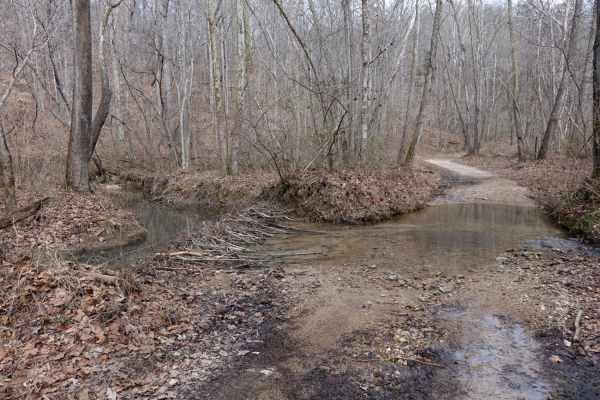
Lost Creek & Clear Creek
This route provides a bit more challenge and adrenaline than the majority of the roads in Chuck Swan WMA, but still keeps it well within the capabilities of most stock and slightly modified 4x4s. Along Clear Creek Rd. there are three water crossings that vary greatly depending on recent rains. All t...
Learn more about Lost Creek & Clear Creek
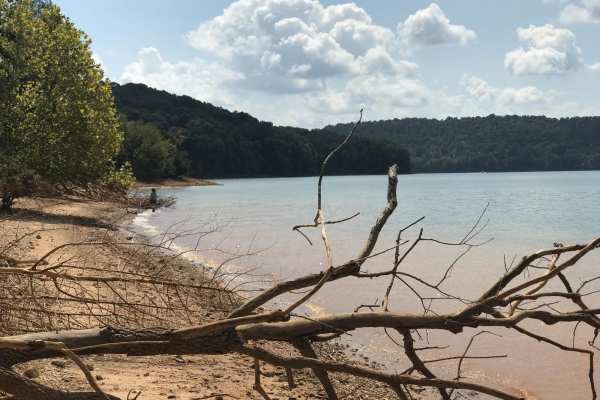
Mossy Springs
This route traverses from the southern portions of Chuck Swan WMA to one of the more remote areas on the northern border. Along this route you'll find some easy but fun roads, a natural freshwater spring, and if you time your visit right ample opportunities to pick fresh blackberries. In the summer ...
Learn more about Mossy Springs
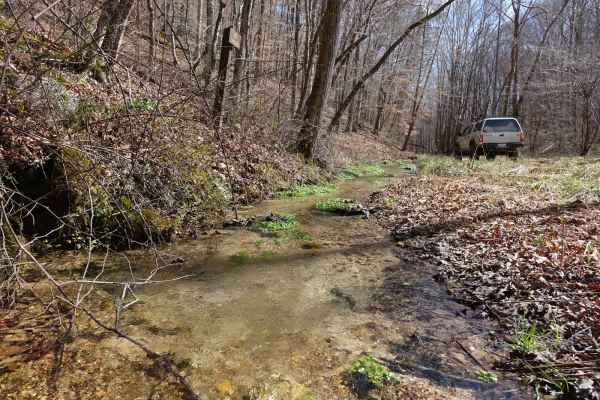
Big Loop & Big Springs
This loop gives you a bit of everything there is to see in Chuck Swan WMA. This route is slightly rougher than Main Forest Rd, but still passable by capable 2WD vehicles except during the wettest times of the year. You'll have opportunities to see natural springs just off of the road, visit some old...
Learn more about Big Loop & Big Springs
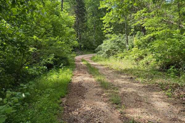
Crumely Loop
Crumely Loop is a mellow 2.6-mile forest road tucked into the heart of Chuck Swan State Forest. Like all the roads here, it's an active logging route, so keep an eye out for trucks and yield when needed. Several old roads branch off along the way, but most are closed to motorized vehicles; just foll...
Learn more about Crumely Loop
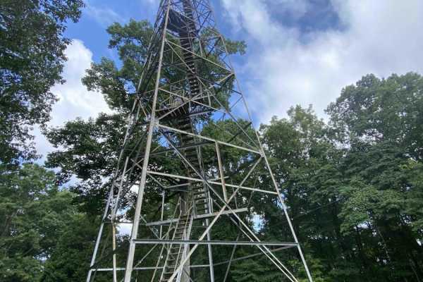
Main Forest Road
Main Forest Road offers an easy, highly scenic 13.2-mile cruise through Chuck Swan State Forest that is perfect for beginners, families, and anyone looking to enjoy a relaxing drive with gorgeous lake views and deep historical significance. This unpaved route serves as the primary artery of the fore...
Learn more about Main Forest Road
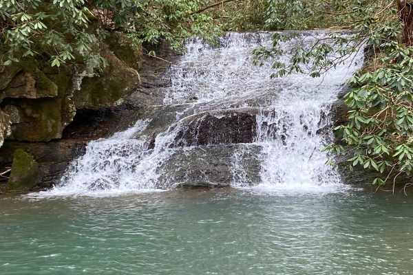
Sandlick Trail
The Sandlick Trail is an easy trail ride that navigates through thick Tennessee mountain laurel, crosses several small streams along the way, and has a beautiful waterfall called No Business. This trail is one of the biggest feeder trails in the Tackett Creek area, with several trails branching off ...
Learn more about Sandlick Trail
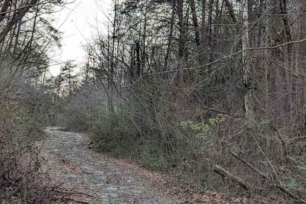
G54
This is the beginning of the recommended route to the Caryville Flats (G54, 62,66). All trails have moderate washouts and ledges. and rocks. It's a nice drive with a few spots for scenic views. The view of Caryville lit up at night is fun to see. We have also seen the elk herd running around late at...
Learn more about G54
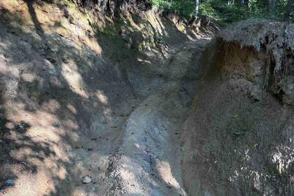
Ivydell Trail
Ivydell Trail is an access road intended for experienced riders seeking a more technical challenge within the Sundquist Unit of North Cumberland Wildlife Management Area. Connecting Flatwoods Road with Ollis Creek Trail, this trail serves as a demanding entry into the interior trail network while t...
Learn more about Ivydell Trail
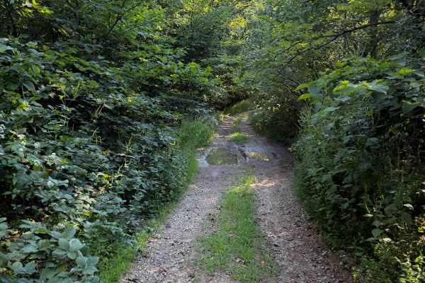
Hunter Access Pond Road
This short hunter’s access road is an unmarked and more primitive Off- Highway Vehicle trail in the Sundquist Unit of the North Cumberland Off- Highway Vehicle Riding Area. The trail starts off from the south end as a single-lane gravel road, lined with locust trees and river birch trees. Watch out ...
Learn more about Hunter Access Pond Road
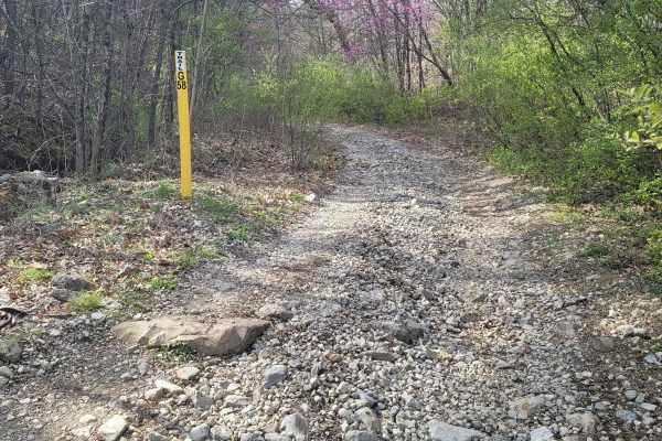
G58 - Cambria Hollow
G58 - Cambria Hollow is a mud-hole-ridden trail with hard bottoms. There is no fear of sinking a vehicle in these puddles, but they can give you a good splash. This trail can lead you outside of the park as well as in so be aware of property boundary signs. During the springtime, the brush overgrowt...
Learn more about G58 - Cambria Hollow
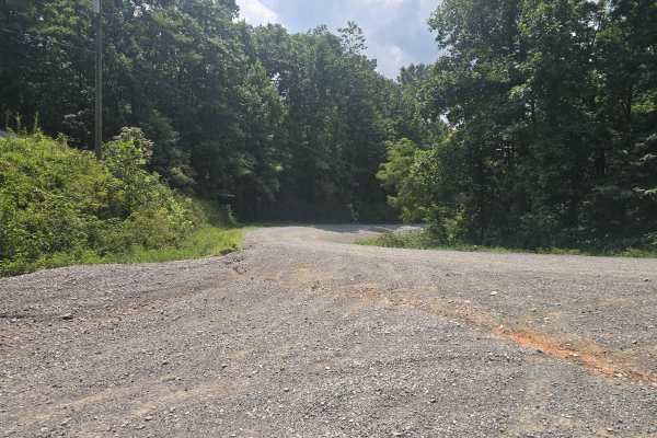
Ivydell Road
This is an easy two lane gravel road to the the trail system at the North Cumberland Wildlife Management Area. There is plenty of room to pass and has a 685 foot elevation gain in a short period. This road is just one of the ways to get to the Elk viewing tower. A North Cumberland Off-Highway Vehicl...
Learn more about Ivydell Road
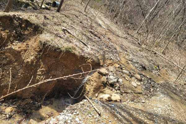
G59
Trail G59 is like many other "green" gravel trails at Windrock park, in the fact they can seem like a good trail to rip up at faster speeds just to see where it goes, but like all trails can be degraded past the normal standards. This trail is easy all around, but even the easiest trails can wash ou...
Learn more about G59
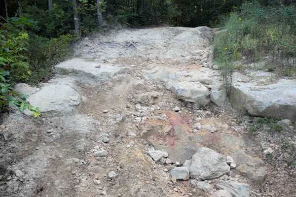
Jamie’s Loop
Jamie’s Loop is a moderately challenging OHV route in the North Cumberland Wildlife Management Area’s Sundquist Unit, designed for riders who want a short but engaging detour off McCormick Cemetery Road. The route branches from McCormick Cemetery Road and reconnects roughly 1.8 miles later, creating...
Learn more about Jamie’s Loop
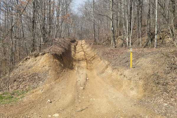
52 - Cold Gap Shortcut
Trail 52 is a more direct route to the Cold Gap Waterfall from easier green trails such as G50 and G53 to G52. This small section still provides some small technical challenges as Windrock Park considers it an easy "blue" trail, but it prevents the longer route through Trail 53. Expect loose rock wi...
Learn more about 52 - Cold Gap Shortcut
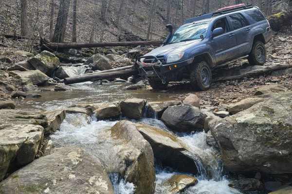
70 - Disney Hollow
Trail 70 - Disney Hollow is the perfect day cruise into lunchtime. This trail shows two different traits- the first being a flat cruising style trail composed of hard-packed dirt and the latter being a drop off of the side of the mountain onto a short section of rock tables. There is little loose ro...
Learn more about 70 - Disney Hollow
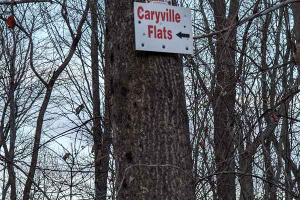
62
Trail 62 in Windrock Park offers offroaders an engaging, scenic climb that serves as a key connecting route to the expansive Caryville Flats. This 1.1-mile trail is ideal for drivers of stock four-wheel-drive vehicles and SxSs looking for a moderate challenge without extreme risks. Starting at an el...
Learn more about 62
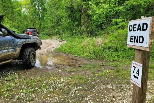
74 - Middle Ridge
Trail 74 - Middle Ridge winds through to complete Trail G67 to exit you out of the park or bring you in for an adventure from HWY 116. This easy "Blue" trail, as Windrock Park identifies it, is spot on, as washouts and ruts could cause problems for those with low ground clearance but is no harder th...
Learn more about 74 - Middle Ridge
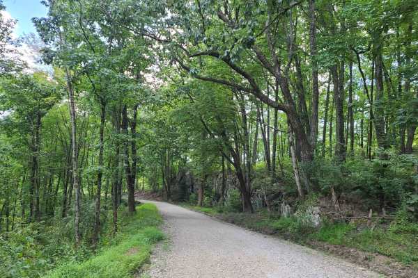
Elk Viewing Tower Road - Trail 25
This is a well-maintained gravel road that goes from Highway 25W to the elk viewing tower at Hatfield Knob. There are several viewing areas and lookouts on the way up as well, so keep an eye out for elk and deer. September is the best time to view elk, as they tend to gather into large herds during ...
Learn more about Elk Viewing Tower Road - Trail 25
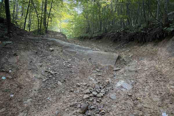
Thompson Hollow 35
Thompson Hollow is a short connector trail within the Sundquist Unit of the North Cumberland OHV Riding Area, north of the town of LaFollette, Tennessee. The .6 mile route is a steep descent off of the Overlook Trail down a narrow quad track with several embedded boulders right away that makes it mo...
Learn more about Thompson Hollow 35
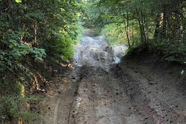
Campbell’s Split
Campbell’s Split is a short Off- Highway Vehicle trail within the North Cumberland Wildlife Management Area, in the Sundquist Unit north of LaFollette, Tennessee. At just under a mile long, the trail connects Ivydell Road (a full-width 4x4 trail) to the Ivydell Off- Highway Vehicle trail. The trail ...
Learn more about Campbell’s Split
ATV trails near Luttrell, Tennessee
Explore ATV-friendly trails near you. These trails are accessible for vehicles up to 50 inches wide, perfect for ATVs and smaller off-road machines.
Lost Creek & Clear Creek
This route provides a bit more challenge and adrenaline than the majority of the roads in Chuck Swan WMA, but still keeps it well within the capabilities of most stock and slightly modified 4x4s. Along Clear Creek Rd. there are three water crossings that vary greatly depending on recent rains. All t...
Learn more about Lost Creek & Clear Creek
Mossy Springs
This route traverses from the southern portions of Chuck Swan WMA to one of the more remote areas on the northern border. Along this route you'll find some easy but fun roads, a natural freshwater spring, and if you time your visit right ample opportunities to pick fresh blackberries. In the summer ...
Learn more about Mossy Springs
Big Loop & Big Springs
This loop gives you a bit of everything there is to see in Chuck Swan WMA. This route is slightly rougher than Main Forest Rd, but still passable by capable 2WD vehicles except during the wettest times of the year. You'll have opportunities to see natural springs just off of the road, visit some old...
Learn more about Big Loop & Big Springs
Crumely Loop
Crumely Loop is a mellow 2.6-mile forest road tucked into the heart of Chuck Swan State Forest. Like all the roads here, it's an active logging route, so keep an eye out for trucks and yield when needed. Several old roads branch off along the way, but most are closed to motorized vehicles; just foll...
Learn more about Crumely Loop
UTV/side-by-side trails near Luttrell, Tennessee
Find UTV and side-by-side trails near you. These trails accommodate vehicles up to 60 inches wide, ideal for UTVs, side-by-sides, and wider off-road rigs.
Crumely Loop
Crumely Loop is a mellow 2.6-mile forest road tucked into the heart of Chuck Swan State Forest. Like all the roads here, it's an active logging route, so keep an eye out for trucks and yield when needed. Several old roads branch off along the way, but most are closed to motorized vehicles; just foll...
Learn more about Crumely Loop
Sandlick Trail
The Sandlick Trail is an easy trail ride that navigates through thick Tennessee mountain laurel, crosses several small streams along the way, and has a beautiful waterfall called No Business. This trail is one of the biggest feeder trails in the Tackett Creek area, with several trails branching off ...
Learn more about Sandlick Trail
G54
This is the beginning of the recommended route to the Caryville Flats (G54, 62,66). All trails have moderate washouts and ledges. and rocks. It's a nice drive with a few spots for scenic views. The view of Caryville lit up at night is fun to see. We have also seen the elk herd running around late at...
Learn more about G54
Ivydell Trail
Ivydell Trail is an access road intended for experienced riders seeking a more technical challenge within the Sundquist Unit of North Cumberland Wildlife Management Area. Connecting Flatwoods Road with Ollis Creek Trail, this trail serves as a demanding entry into the interior trail network while t...
Learn more about Ivydell Trail
The onX Offroad Difference
onX Offroad combines trail photos, descriptions, difficulty ratings, width restrictions, seasonality, and more in a user-friendly interface. Available on all devices, with offline access and full compatibility with CarPlay and Android Auto. Discover what you're missing today!
Open Trail Map