
Dirt Bike Trails
Near Lemmon Valley, Nevada
Explore All Dirt Bike Trails Near Lemmon Valley, Nevada
Dirt Bike Trails Near Lemmon Valley, Nevada
Discover the best dirt bike trails near you. Browse trail maps, check difficulty ratings, and find your next adventure — whether you're looking for a quick ride or an all-day expedition.
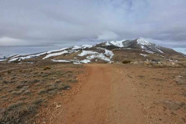
Hoge Road
This is an easy, high-speed trail for most of the distance but includes a few moderate hill climbs along the way. Hard-packed roads with some larger, avoidable rocks here and there. Expect heavy foot and mountain bike traffic, so ride with caution and be mindful of other trail users. The trail offer...
Learn more about Hoge Road
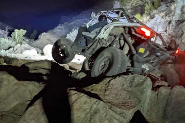
Billy Bob
From the start of Twister, or the top of Twister back down to Billy Bob, head up the canyon. At the fork, you will be presented with a choice; to the left is Billy Bob, to the right continues through Twister. For added fun, complete Twister and head back to Billy Bob. Both trails are advanced and re...
Learn more about Billy Bob
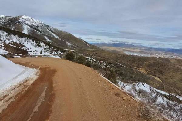
Golden Fleece Mine Road
Access Golden Fleece Mine Road from Headliner Trail at the top of Peavine, the main Peavine Access Road, Horizon Hills Staging Area, or Raleigh Heights Staging Area. No matter which route you take, this trail offers a rewarding ride. Travel through the Horizon Hills Mountain area, past the Kiowa Pon...
Learn more about Golden Fleece Mine Road
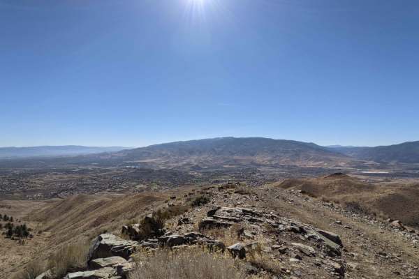
Peavine to Robb
The trail is made up of mostly dirt with some small rocks here and there. Most of the difficulty is the steepness of the mountain. Alternate paths can make the trail more challenging. Hitting the trail from the bottom up makes the trail much more challenging due to the loose nature of the ground. A ...
Learn more about Peavine to Robb
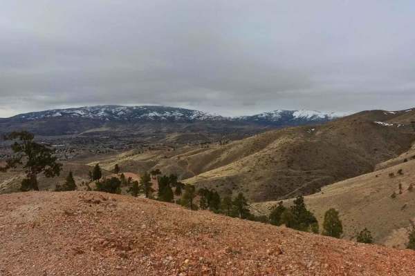
Headliner Trail
Starting from the Keystone Canyon OHV Area (which offers ample parking and space for trailers), the Headliner Trail takes you up to the main Peavine access road, down a canyon trail, past the Kiowa Ponds, and loops back to the Keystone staging area. This trail offers a bit of everything for those lo...
Learn more about Headliner Trail
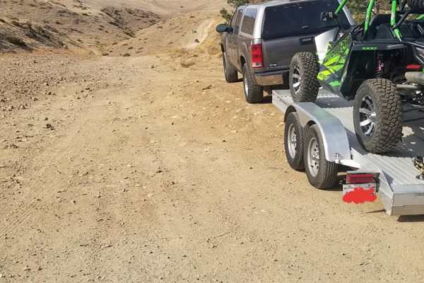
Peavine Prospector Run
Spectacular views of Reno abound from high above on this trail that traverses historic Peavine Mountain. In stark contrast to the urban hustle and bustle of Reno, Peavine showcases the desolate beauty of the harsh high desert that defines much of Nevada. Standing as the City of Reno's northwest boun...
Learn more about Peavine Prospector Run
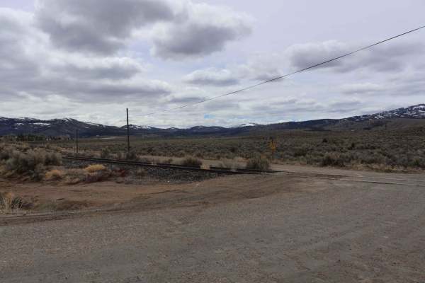
Long Valley Road
The route starts at the end of Virginia Street, crossing some railroad tracks and turning into a graded dirt road. There are some washboard sections, and during early spring, it is quite muddy. Of course, during winter, it has quite a bit of snow and can be inaccessible at times. Be cautious of larg...
Learn more about Long Valley Road
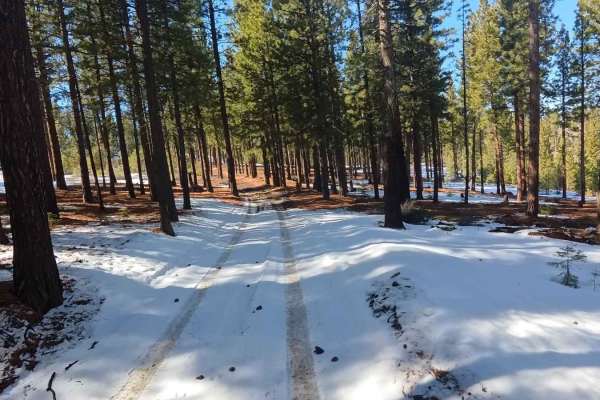
Mitchell Canyon Long Valley
Looking to explore the stunning landscapes of Dog Valley while taking a more adventurous and less-traveled route? This scenic drive is perfect for those who enjoy a bit more challenge and want to avoid the heavily traveled main road. Starting from Long Valley Road, you'll wind through dense forests,...
Learn more about Mitchell Canyon Long Valley
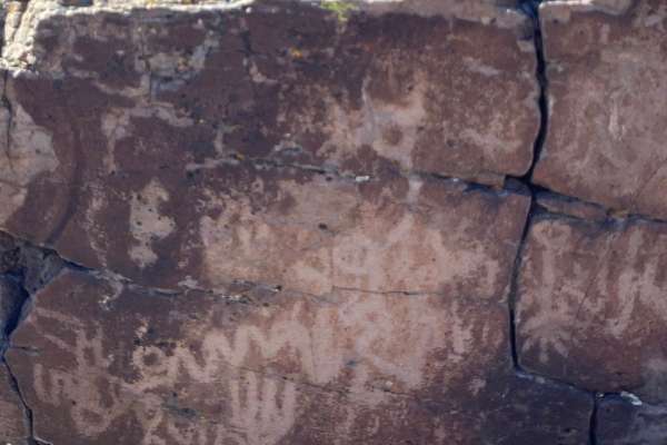
Spanish Springs Petroglyphs
Griffith Canyon is an approximately 2 mile out-and-back hike north of Reno that leads to several galleries of petroglyphs. While several trails in the area lead to petroglyphs, the Griffith Canyon trail is the easiest route to see the displays of native art. The trail is unmarked but is known and mo...
Learn more about Spanish Springs Petroglyphs
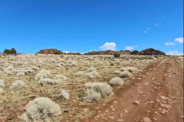
Rocky Glyph
Enjoy this South Reno access road into the foothills, then follow it all the way to the Glyphs via the Lockwood Trail. The route is rocky throughout, so plan on slow going. Keep an eye out—wild horses are commonly seen along this corridor (give them space). From the top, soak in the abundant, sweepi...
Learn more about Rocky Glyph
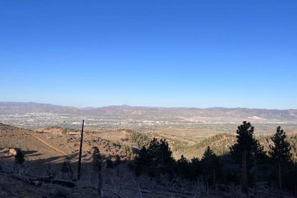
Blue Truck Fork
Tucked in the South-West corner of Reno, Blue Truck Fork is a great way to get out of the city and escape to some nearby nature. This trail offers some great sights of the surrounding mountains and a view of Reno higher up the trail. This is especially so once the sun sets and the city lights up. Mo...
Learn more about Blue Truck Fork
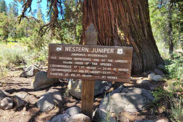
Verdi-Sardine-Loyalton
As you begin from Verdi, the paved road is great, then you begin the uphill, which is a very hard-packed 1.5 1.5-wide road with some small, sharp, pointed rocks. As you get closer to the top, it begins to smooth out a bit. At the top, there is a wide open space for parking or staging. Currently, th...
Learn more about Verdi-Sardine-Loyalton
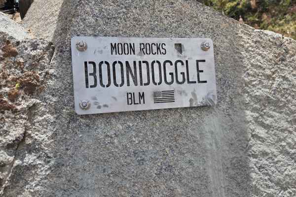
Boondoggle
Usually run from bottom to top, look for the plaque on your right as soon as you turn in. The trail gets busy immediately with big rocks, a V-crack, and a quick step-up. From there, you'll fight your way through a rock garden with multiple line choices and plenty of diff hangers, followed closely by...
Learn more about Boondoggle
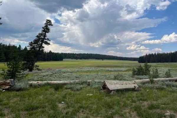
Hunter Lake
Hunter Lake Trail is a two-way trail. You can start at the end of Blue Truck Trail on Hunter Lake Rd or enter from Garson Road off of I-80. It will take you up to just over 8,500 passing through pine trees and past meadows. There are some quite narrow spots on the eastern end of the trail so be prep...
Learn more about Hunter Lake
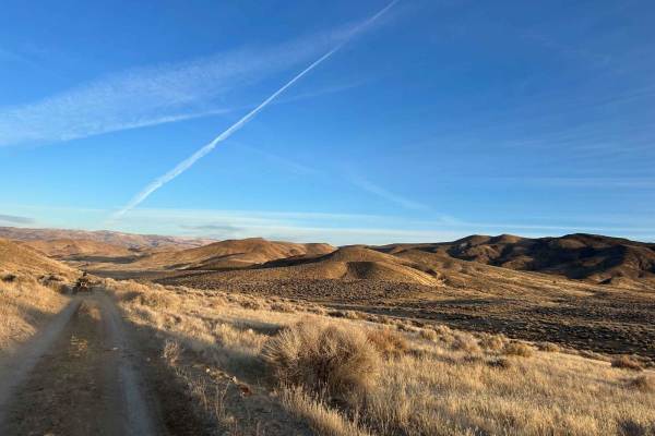
Wildhorse Track
Travel through Red Rock Canyon, running along the border of California and cutting back over to Antelope Valley using a popular off-road connector. Blaze across Antelope Valley and visit the Moon Rocks area, or continue up and over Warm Springs Mountain, down into Hungry Valley, and back to Winnemuc...
Learn more about Wildhorse Track
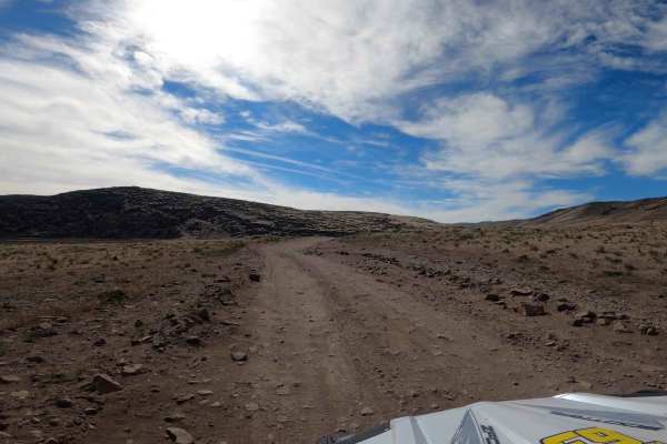
Spanish Springs Foothills
A multi-directional trail in the Spanish Springs Foothills that can be used as a connector to many other trails. The trail consists of various elevation changes and steep grades. Hard pack gravel is the norm with areas of large loose rocks. Cell Service is limited in the valley, make be sure to save...
Learn more about Spanish Springs Foothills
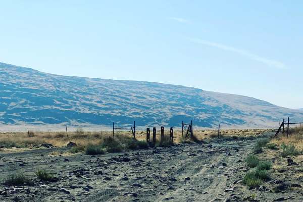
Dry Lakes Loop
The trail starts at a cattle guard after you leave the staging area. The first few miles are soft sand with little to no obstruction. The area to the north side of the trail is a public access shooting area. Once past the shooting area, the trail narrows and drops down a dry creek valley before comi...
Learn more about Dry Lakes Loop
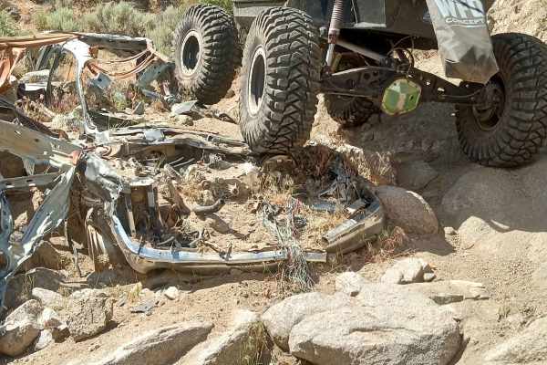
Suburban
Suburban gets its name from an old Suburban that is abandoned in the middle of the trail. There is not much left of the old Suburban, and the canyon has started to bury it as time has moved on. The trail starts as you drop into the drainage. When you hit the bottom of the drainage, you will head rig...
Learn more about Suburban
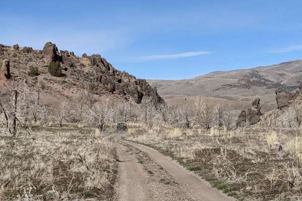
Flat Tire
The route starts at Moon Rocks recreation area. From there the path is fairly easy, with several whoops to ride over and rides along the side of the Dogskin Mountains. It Makes a detour at the top of one of the peaks where you can get a great view of the area. You can see Pyramid lake, Spark, Reno, ...
Learn more about Flat Tire
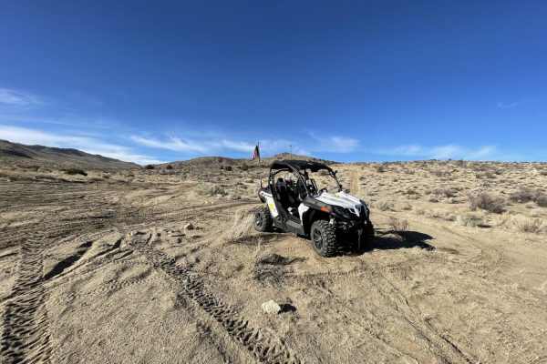
Warm Springs Mountain Loop
Warm Springs Mountain Loop is a 7-mile loop in Nevada, North of Reno/Sparks. The surface is rock and sand with minimal elevation changes. The loop connects to many other trails within the BLM OHV area, including Moon Rocks. There are areas of soft sand and deep washouts to cross over. There are no w...
Learn more about Warm Springs Mountain Loop
ATV trails near Lemmon Valley, Nevada
Explore ATV-friendly trails near you. These trails are accessible for vehicles up to 50 inches wide, perfect for ATVs and smaller off-road machines.
Hoge Road
This is an easy, high-speed trail for most of the distance but includes a few moderate hill climbs along the way. Hard-packed roads with some larger, avoidable rocks here and there. Expect heavy foot and mountain bike traffic, so ride with caution and be mindful of other trail users. The trail offer...
Learn more about Hoge Road
Golden Fleece Mine Road
Access Golden Fleece Mine Road from Headliner Trail at the top of Peavine, the main Peavine Access Road, Horizon Hills Staging Area, or Raleigh Heights Staging Area. No matter which route you take, this trail offers a rewarding ride. Travel through the Horizon Hills Mountain area, past the Kiowa Pon...
Learn more about Golden Fleece Mine Road
Peavine to Robb
The trail is made up of mostly dirt with some small rocks here and there. Most of the difficulty is the steepness of the mountain. Alternate paths can make the trail more challenging. Hitting the trail from the bottom up makes the trail much more challenging due to the loose nature of the ground. A ...
Learn more about Peavine to Robb
Headliner Trail
Starting from the Keystone Canyon OHV Area (which offers ample parking and space for trailers), the Headliner Trail takes you up to the main Peavine access road, down a canyon trail, past the Kiowa Ponds, and loops back to the Keystone staging area. This trail offers a bit of everything for those lo...
Learn more about Headliner Trail
UTV/side-by-side trails near Lemmon Valley, Nevada
Find UTV and side-by-side trails near you. These trails accommodate vehicles up to 60 inches wide, ideal for UTVs, side-by-sides, and wider off-road rigs.
Hoge Road
This is an easy, high-speed trail for most of the distance but includes a few moderate hill climbs along the way. Hard-packed roads with some larger, avoidable rocks here and there. Expect heavy foot and mountain bike traffic, so ride with caution and be mindful of other trail users. The trail offer...
Learn more about Hoge Road
Billy Bob
From the start of Twister, or the top of Twister back down to Billy Bob, head up the canyon. At the fork, you will be presented with a choice; to the left is Billy Bob, to the right continues through Twister. For added fun, complete Twister and head back to Billy Bob. Both trails are advanced and re...
Learn more about Billy Bob
Golden Fleece Mine Road
Access Golden Fleece Mine Road from Headliner Trail at the top of Peavine, the main Peavine Access Road, Horizon Hills Staging Area, or Raleigh Heights Staging Area. No matter which route you take, this trail offers a rewarding ride. Travel through the Horizon Hills Mountain area, past the Kiowa Pon...
Learn more about Golden Fleece Mine Road
Peavine to Robb
The trail is made up of mostly dirt with some small rocks here and there. Most of the difficulty is the steepness of the mountain. Alternate paths can make the trail more challenging. Hitting the trail from the bottom up makes the trail much more challenging due to the loose nature of the ground. A ...
Learn more about Peavine to Robb
The onX Offroad Difference
onX Offroad combines trail photos, descriptions, difficulty ratings, width restrictions, seasonality, and more in a user-friendly interface. Available on all devices, with offline access and full compatibility with CarPlay and Android Auto. Discover what you're missing today!
Open Trail Map