
Dirt Bike Trails
Near Lake Tansi, Tennessee
Explore All Dirt Bike Trails Near Lake Tansi, Tennessee
Dirt Bike Trails Near Lake Tansi, Tennessee
Discover the best dirt bike trails near you. Browse trail maps, check difficulty ratings, and find your next adventure — whether you're looking for a quick ride or an all-day expedition.
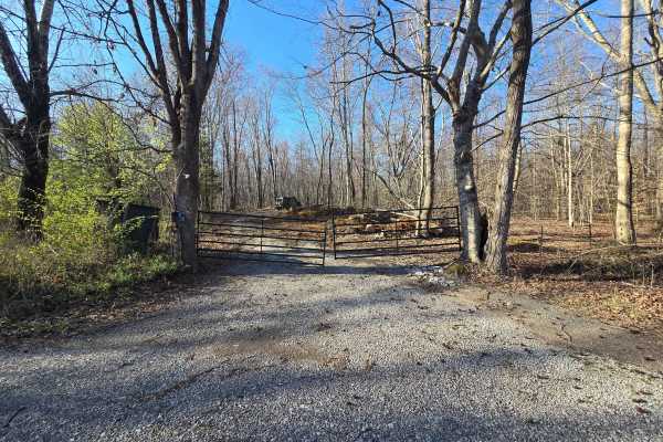
GMP Pavilion Road 1
The “Back Gate” entrance at Golden Mountain Offroad Park is a gravel access road that leads directly to the intersection of the main park road and Pavilion Road 2. This short, easy drive is primarily used by tow rigs and campers accessing the RV areas, making it well-maintained and suitable for all ...
Learn more about GMP Pavilion Road 1
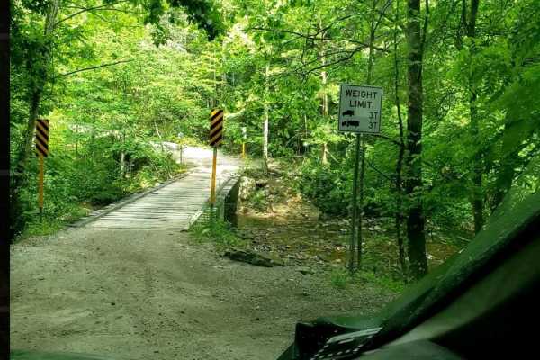
Catoosa WMA Noah Hambey
The Catoosa WMA Noah Hambey loop is a scenic, 17.7-mile gravel route winding through the southwestern reaches of the Catoosa Wildlife Management Area in Tennessee, ideal for beginners, families, or anyone seeking a relaxing, low-stress day in the woods. Rated as a mild 2 out of 10, this route is eas...
Learn more about Catoosa WMA Noah Hambey
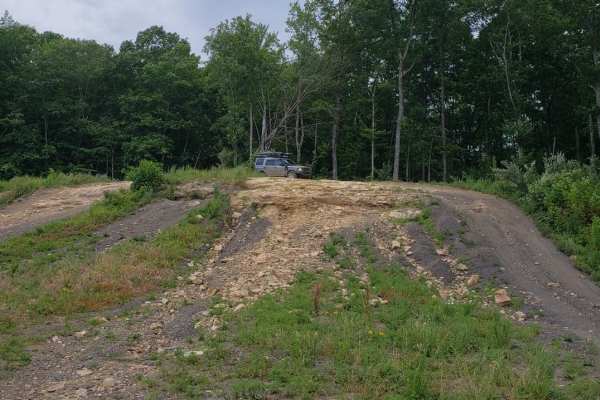
Catoosa Headrick Road
Catoosa Headrick Road offers an engaging 3.3-mile point-to-point journey across the scenic Cumberland Plateau, making it ideal for drivers of four-wheel-drive vehicles and SxSs looking for a mild yet diverse off-road experience. Rated as a 3 out of 10 in technical difficulty, this route climbs from ...
Learn more about Catoosa Headrick Road
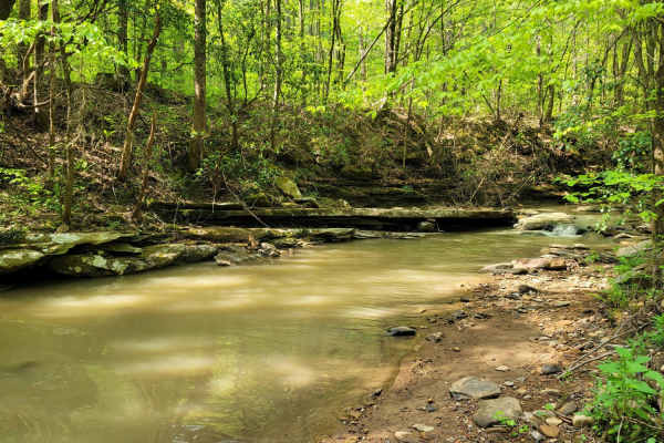
Trail 27 - Kener Gap
Trail 27- Kener Gap begins at the Rock Solid Pavilion at the end of Trail 26. This trail is much like its counterpart, but does not boast as many rock step formations. Expect more dirt roads with ruts and a minor rock bulge from the side of the trail. Water does quickly run off the mountain, and ha...
Learn more about Trail 27 - Kener Gap
S5
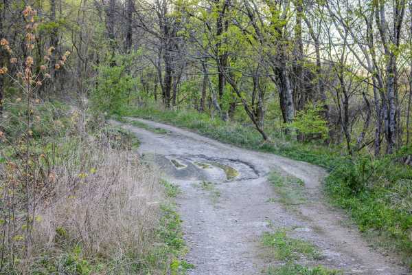
S5 is a two-way trail that connects S6 back to S4 and also provides access to 4 Lane. This trail works well as a primary connector route in the area, giving drivers several options for building a longer loop or moving between nearby trails. The surface is primarily gravel, which makes it more stable...
Learn more about S5
S7
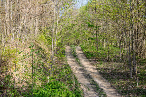
S7 is a short, two-way connector trail that links Pipeline Ridge Trail to S5 Trail. The trail connects near the middle section of S5, giving drivers the option to travel either direction once they reach the end of S7. While it is not a long trail, it is a useful connector for linking routes together...
Learn more about S7
Pipeline Ridge
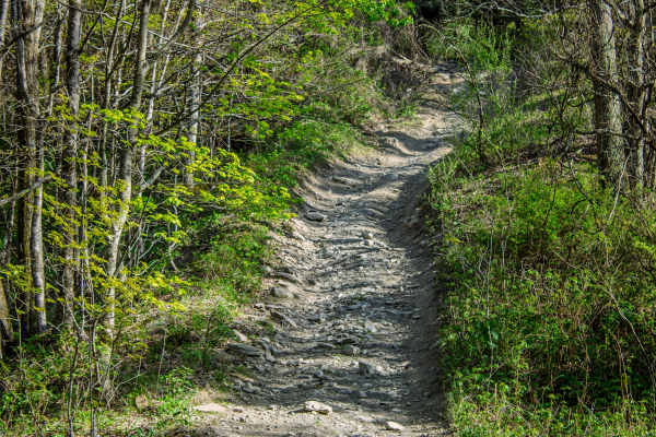
Pipeline Ridge Trail is a narrow, two-way dirt trail that connects the end of 4 Lane to S7 Trail. This route is a good connector, but it is noticeably tighter and more technical than 4 Lane. There are limited places to pull over and pass, so drivers should stay alert for oncoming traffic and be prep...
Learn more about Pipeline Ridge
S4
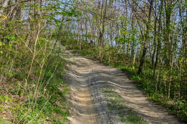
S4 is a two-way trail that connects S5 and S6. The trail is made up mostly of dirt, but it has several sections where mud, standing water, deep ruts, loose rock, and tight trees make it more challenging. There are a few places where vehicles can pull over and pass, but most of the trail is narrow. D...
Learn more about S4
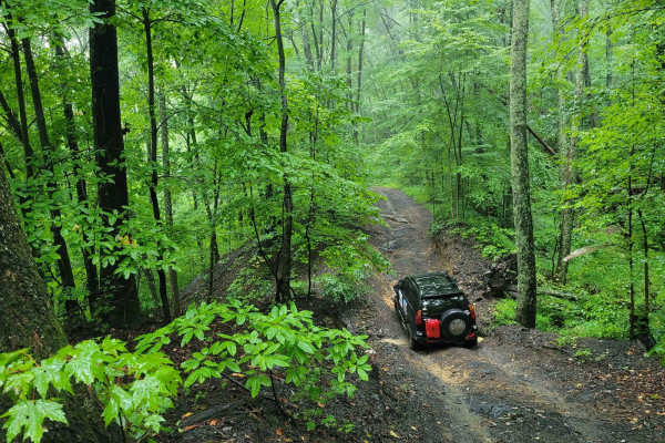
Trail 87 - Poplar Creek
Trail 87 is an easy rider's favorite. This blue trail according to the Windrock Parks Trail difficulty system would fall into the simpler blue trails the park has to offer. It offers light washouts and gradual elevation changes. Trail 87 is accessible from G6 on the south end and finishes on Trail ...
Learn more about Trail 87 - Poplar Creek
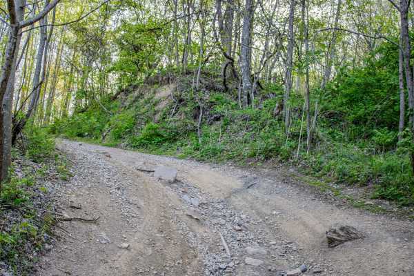
S6
S6 is a two-way dirt trail that connects S2, S4, and S5. This trail works well as a connector route, but it also has enough scenery and small obstacles to make it worth taking your time on. The trail is mostly dirt with several areas where water flows across the trail from nearby springs. These spri...
Learn more about S6
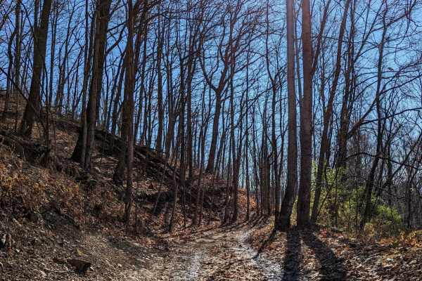
Trail 43
Trail 43 offers offroaders an engaging, scenic ridge-line run through the heart of the Cumberland Mountains, making it a perfect route for intermediate drivers seeking a mix of stunning vistas and moderate technical challenges. Spanning approximately 3.4 miles from Armes Gap near Highway 116, this t...
Learn more about Trail 43
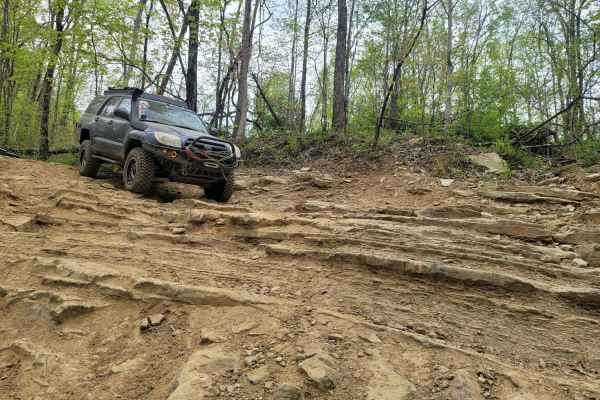
Trail 26 - Rock Solid
Jeepers, get your badges! This Jeep Badge of Honor trail is on the easier side with three short rock step formations and mud holes. This trail also runs simultaneously with Trail G26, should you need a quick exit. Trail 26 runs downhill for the first two rock steps from the East to West. It is full ...
Learn more about Trail 26 - Rock Solid
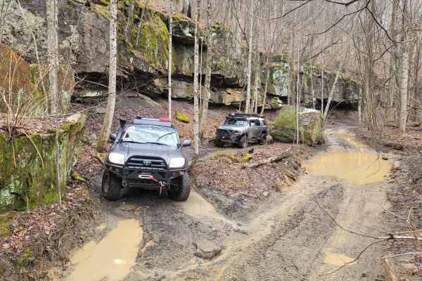
83 - American Knob Bypass
This fun trail gives insight into the area's natural wonders. These rock bluffs provide shelter to the caves beneath them, which you can go into if you are brave enough to explore them. The towering rock walls make mini-mountain ponds with lush moss patches and various fungi surrounding them. While ...
Learn more about 83 - American Knob Bypass
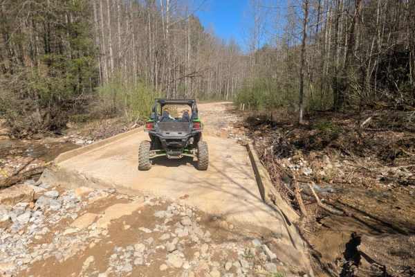
G6
G6 is a haul road that has a few small washouts and rock ledges. There are rocks along the trail up to 12 inches in size. This trail includes a long slow elevation change. There are many in and out trails along this route. The north end of this trail ends on New River Highway at a cemetery.
Learn more about G6
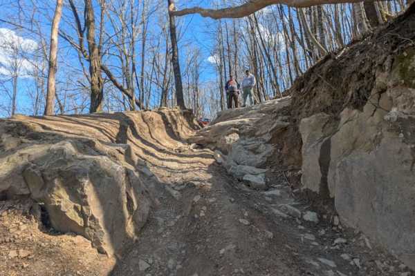
82
82 can be run in either direction, but most people run it from west to east. If run from east to west, it will be more difficult because there is a large rock formation to climb immediately as you enter the trail off of 83. This trail is scenic with rock faces on one side and a drop-off on the other...
Learn more about 82
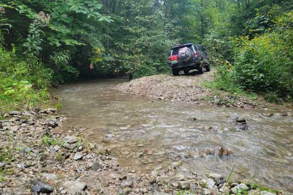
G21 - Skinned Ash Creek
G21 - Skinned Ash Creek gets its name from the waterway that runs parallel to it. This dead-end path cuts across a picturesque mountain side showing the power of nature. Water has cut large ruts into the trail side with depths as far as 2.5 feet deep. This tire-swallowing rut is easy to avoid in mos...
Learn more about G21 - Skinned Ash Creek
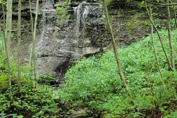
Trail 5 - Flat Gap
Trail 5 - Flat Gap begins at the major intersection of G37, G3, and G33. There isn't much elevation change on this trail, hence its name. This easy blue according to the Park's Map is smooth sailing and preferred by some to avoid the higher traveled G5 and G6 as they have gotten significantly worse ...
Learn more about Trail 5 - Flat Gap

G24 - Wildflowers
Get away from the hustle and bustle of the park with this less-than-traveled trail. You won't find even the most basic obstacle on Trail G24, but what you will find is serenity. In the springtime, you will find pops of color at this dead-end trail. It is smooth with the slightest mudhole. Bring a sa...
Learn more about G24 - Wildflowers
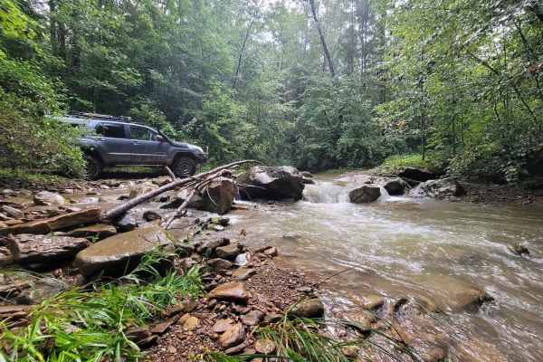
G19 - Bluefer Branch
G19 - Bluefer Branch screams, "Take me to the mountains!" This trail, when taken from beginning to end, will take you to a dead end, double back, and then take you to another section of the trail. This trail is for water lovers as it has multiple crossings and a plethora of spots to stop for picture...
Learn more about G19 - Bluefer Branch
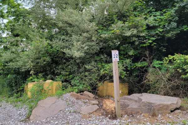
Trail 22
This trail combines hills, rocks, ruts, and off-camber riding. The trail was re-routed in June of 2021 to avoid underlying boulders. Elevation changes rapidly in some areas. This trail has several muddy rock ledges that exceed 10-12" stair steps for a distance of up to 20' at a time. ATV riders will...
Learn more about Trail 22
ATV trails near Lake Tansi, Tennessee
Explore ATV-friendly trails near you. These trails are accessible for vehicles up to 50 inches wide, perfect for ATVs and smaller off-road machines.
GMP Pavilion Road 1
The “Back Gate” entrance at Golden Mountain Offroad Park is a gravel access road that leads directly to the intersection of the main park road and Pavilion Road 2. This short, easy drive is primarily used by tow rigs and campers accessing the RV areas, making it well-maintained and suitable for all ...
Learn more about GMP Pavilion Road 1
Catoosa WMA Noah Hambey
The Catoosa WMA Noah Hambey loop is a scenic, 17.7-mile gravel route winding through the southwestern reaches of the Catoosa Wildlife Management Area in Tennessee, ideal for beginners, families, or anyone seeking a relaxing, low-stress day in the woods. Rated as a mild 2 out of 10, this route is eas...
Learn more about Catoosa WMA Noah Hambey
Catoosa Headrick Road
Catoosa Headrick Road offers an engaging 3.3-mile point-to-point journey across the scenic Cumberland Plateau, making it ideal for drivers of four-wheel-drive vehicles and SxSs looking for a mild yet diverse off-road experience. Rated as a 3 out of 10 in technical difficulty, this route climbs from ...
Learn more about Catoosa Headrick Road
Trail 27 - Kener Gap
Trail 27- Kener Gap begins at the Rock Solid Pavilion at the end of Trail 26. This trail is much like its counterpart, but does not boast as many rock step formations. Expect more dirt roads with ruts and a minor rock bulge from the side of the trail. Water does quickly run off the mountain, and ha...
Learn more about Trail 27 - Kener Gap
UTV/side-by-side trails near Lake Tansi, Tennessee
Find UTV and side-by-side trails near you. These trails accommodate vehicles up to 60 inches wide, ideal for UTVs, side-by-sides, and wider off-road rigs.
GMP Pavilion Road 1
The “Back Gate” entrance at Golden Mountain Offroad Park is a gravel access road that leads directly to the intersection of the main park road and Pavilion Road 2. This short, easy drive is primarily used by tow rigs and campers accessing the RV areas, making it well-maintained and suitable for all ...
Learn more about GMP Pavilion Road 1
Catoosa WMA Noah Hambey
The Catoosa WMA Noah Hambey loop is a scenic, 17.7-mile gravel route winding through the southwestern reaches of the Catoosa Wildlife Management Area in Tennessee, ideal for beginners, families, or anyone seeking a relaxing, low-stress day in the woods. Rated as a mild 2 out of 10, this route is eas...
Learn more about Catoosa WMA Noah Hambey
Catoosa Headrick Road
Catoosa Headrick Road offers an engaging 3.3-mile point-to-point journey across the scenic Cumberland Plateau, making it ideal for drivers of four-wheel-drive vehicles and SxSs looking for a mild yet diverse off-road experience. Rated as a 3 out of 10 in technical difficulty, this route climbs from ...
Learn more about Catoosa Headrick Road
Trail 27 - Kener Gap
Trail 27- Kener Gap begins at the Rock Solid Pavilion at the end of Trail 26. This trail is much like its counterpart, but does not boast as many rock step formations. Expect more dirt roads with ruts and a minor rock bulge from the side of the trail. Water does quickly run off the mountain, and ha...
Learn more about Trail 27 - Kener Gap
The onX Offroad Difference
onX Offroad combines trail photos, descriptions, difficulty ratings, width restrictions, seasonality, and more in a user-friendly interface. Available on all devices, with offline access and full compatibility with CarPlay and Android Auto. Discover what you're missing today!
Open Trail Map