
Dirt Bike Trails
Near Downieville, California
Explore All Dirt Bike Trails Near Downieville, California
Dirt Bike Trails Near Downieville, California
Discover the best dirt bike trails near you. Browse trail maps, check difficulty ratings, and find your next adventure — whether you're looking for a quick ride or an all-day expedition.
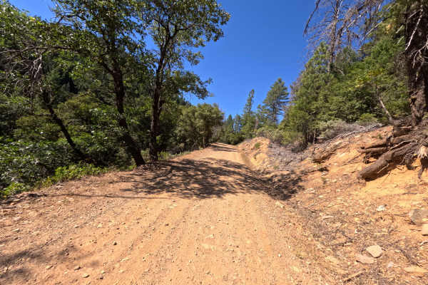
Lavezzola Road
Lavezzola Road is a scenic and relaxing journey through the thick, vibrant pine forest. The adventure begins on a brief paved section passing by some rustic green outbuildings before quickly transitioning into a wide, graded packed-dirt and gravel track. As you wind your way through the tall timber,...
Learn more about Lavezzola Road
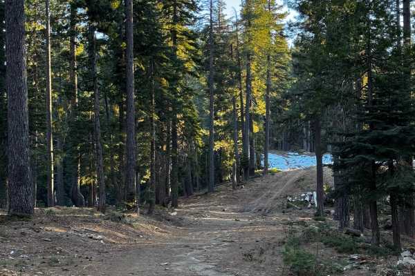
Red Ant
This trail is more like a fire road and features a few climbs and tight turns. It has a couple of areas designated for dispersed camping and offers some views of the canyon. The trail has been recently recut and cleared in certain sections. Additionally, there are some areas that are single-wide wit...
Learn more about Red Ant
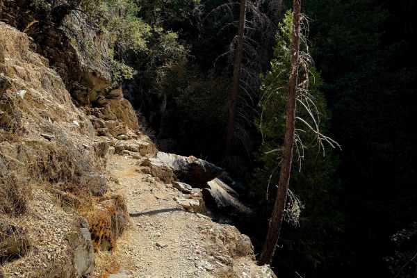
Second Divide
Second Divide is a fun, but extremely exposed, moto route near Downieville with several technical sections. This area is popular with mountain bikers, but this trail specifically may have fewer mountain bikers on the trail because it’s not part of the main “Downieville Downhill” route from Packer La...
Learn more about Second Divide
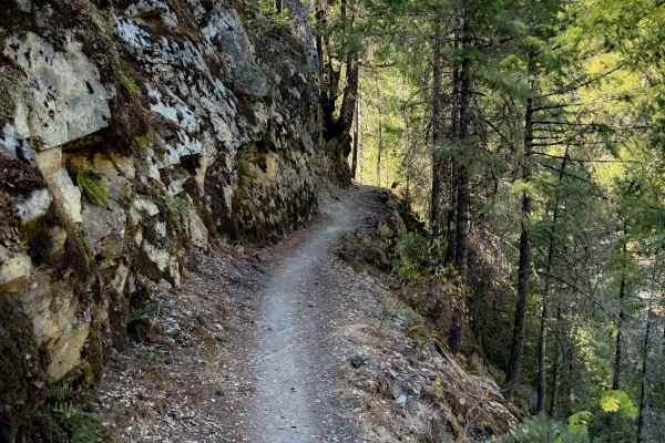
First Divide
First Divide is a fun moto route near Downieville that is also popular with downhill mountain bikers, and is part of the 15-mile-long “Downieville Downhill” that goes from Packer Lake Saddle to Downieville. It drops over 1,200 feet in 3.3 miles from north to south. This trail is very exposed and she...
Learn more about First Divide
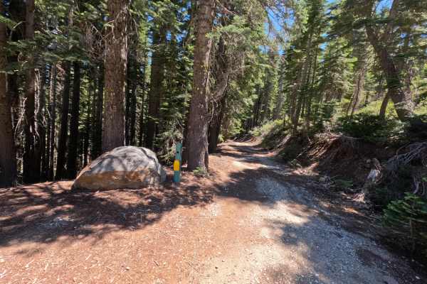
Fir Cap Trail - South Segment - FS 10E22
Fir Cap Trail - South Segment - FS 10E22 is accessed directly from the northern segment of the Fir Cap Trail. This southern section is significantly easier than the northern segment, featuring several flat, smooth areas alongside gentle descents. The trail climbs over a small, unnamed mountain that...
Learn more about Fir Cap Trail - South Segment - FS 10E22
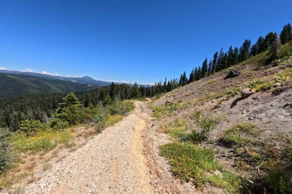
Fir Cap Trail - North Segment - 10E22
Fir Cap Trail - North Segment - FS 10E22 is the northern half of a connector route, accessed via Saddleback Road. The route begins with a slight descent into an area that resembles an old mining site, though no structural signs of a mine remain. From there, the trail climbs over Fir Top Mountain. Al...
Learn more about Fir Cap Trail - North Segment - 10E22
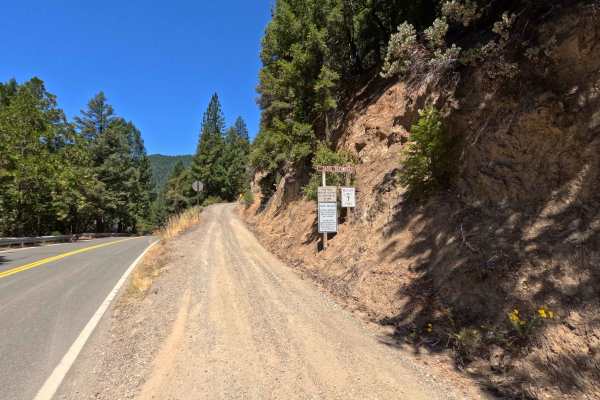
Saddleback Road - CR 509
Accessed directly off Highway 49 just outside the charming town of Downieville, Saddleback Road is a classic, highly enjoyable forest road. The journey begins with a smooth, well-packed dirt surface that offers plenty of fun, sweeping twists and turns under a beautiful canopy of tall, shading pine t...
Learn more about Saddleback Road - CR 509
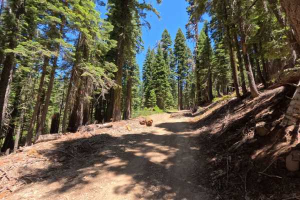
Saddleback - FS 25-023
This beautiful route picks up right where the regular county road maintenance ends, taking you deeper into the dense, shaded woods. As you journey along this path, you will find a very smooth, well-graded gravel surface that seamlessly transitions into sections of soft, packed dirt. The entire drive...
Learn more about Saddleback - FS 25-023
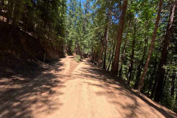
Lower Claycroft - FS 514-008
Lower Claycroft - FS 514-008, a remarkably peaceful and incredibly smooth journey winding through a dense, majestic evergreen forest. As you navigate this winding dirt path, you will experience a long, gradual descent that gently drops over two thousand feet in elevation over the course of the drive...
Learn more about Lower Claycroft - FS 514-008
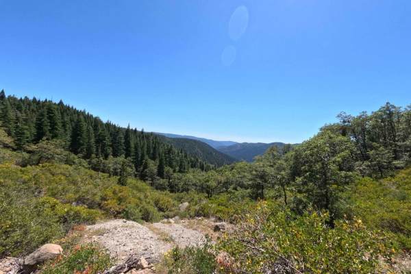
Claycroft Road - Upper - 514-008
This upper section of the Claycroft Road has a significantly different character than the lower section, offering a wilder and more rugged journey. The route is noticeably unmaintained, sending you pushing through very overgrown sections where thick, leafy brush and green foliage crowd the narrow di...
Learn more about Claycroft Road - Upper - 514-008
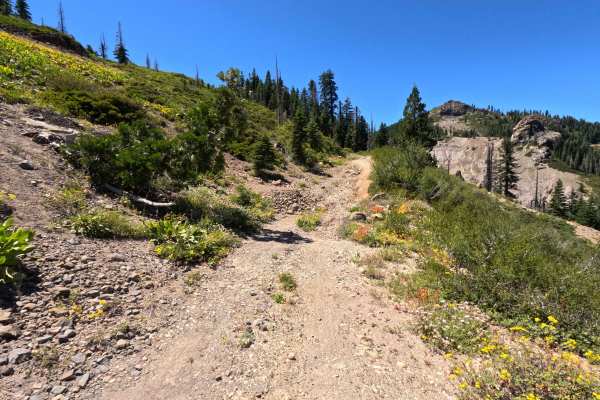
Fir Cap Road
Accessed directly from Saddleback Road, Fir Cap Road is a rugged and incredibly scenic off-road adventure. The trail begins with a slight descent into a basin that has the distinct feel of a former mining site, even though no physical signs or structures remain to confirm its history. As you navigat...
Learn more about Fir Cap Road
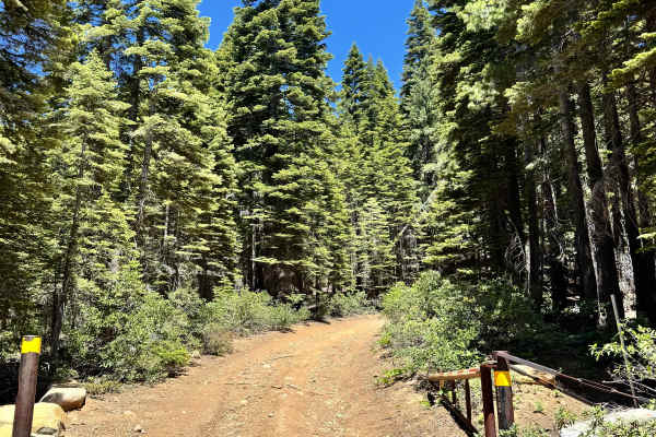
Saddleback Lookout - FS 25
This is a mostly dirt and rocky trail that takes you up to Saddleback Lookout. The trail is kind of steep, and some sections are a shelf road. The trail does start to have quite a bit of rock and is a little more like shale rock the closer you get to the lookout. You can go up to the lookout, it is ...
Learn more about Saddleback Lookout - FS 25
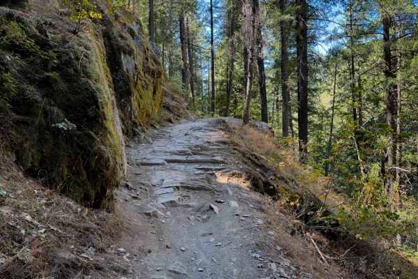
Third Divide
Third Divide is a fun 2 mile long moto route near Downieville that is also popular with downhill mountain bikers, and is part of the 15 mile long “Downieville Downhill” that goes from Packer Lake Saddle to the town of Downieville. The majority of Third Divide is pretty easy, as it is smooth and flow...
Learn more about Third Divide
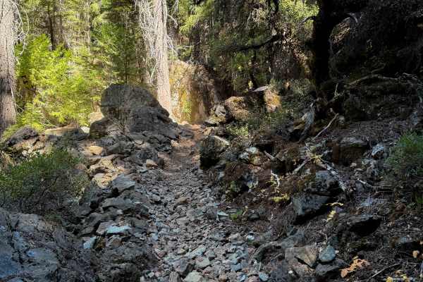
Big Boulder
Big Boulder is a fun and moderately easy singletrack near Downieville that is also popular for downhill mountain bikers. It drops over 1,500 feet in 3 miles from north to south. The trail has several wide and smooth switchbacks, including right away on the north end, and later on in the middle of th...
Learn more about Big Boulder
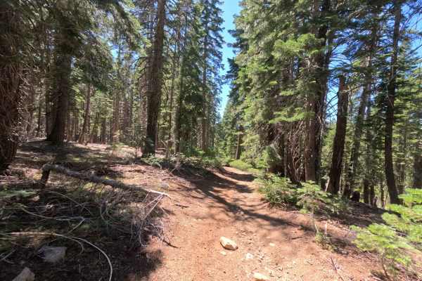
Claycroft Ridge Off-Highway Vehicle Trail - Lower - FS 11E18
Accessed directly from Claycroft Road, this exceptionally narrow off-highway vehicle track plunges you immediately into a beautifully lush, dense tree tunnel. The tight evergreen canopy provides constant, heavy shade, meaning you won't find sweeping scenic vistas or open clearings for dispersed camp...
Learn more about Claycroft Ridge Off-Highway Vehicle Trail - Lower - FS 11E18
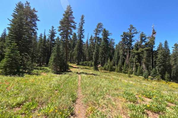
Claycroft Ridge Off Highway Vehicle Trail - Upper - FS 11E18
Accessed directly from the lower section of the ridge, the Upper Claycroft Ridge off-highway vehicle trail offers a rugged and heavily overgrown journey that quickly leaves traditional forest roads behind. As you venture deeper into the woods, the route devolves from a standard path into a tight, wi...
Learn more about Claycroft Ridge Off Highway Vehicle Trail - Upper - FS 11E18
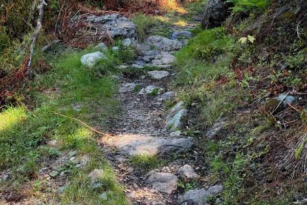
Pauley Creek
Pauley Creek starts at a three-way intersection with Butcher Ranch at a wide intersection that is a good place to take a break. It crosses a wide bridge over the creek, then enters a forested path full of embedded rock features. It has tight turns winding through the trees, with a few bigger hairpin...
Learn more about Pauley Creek
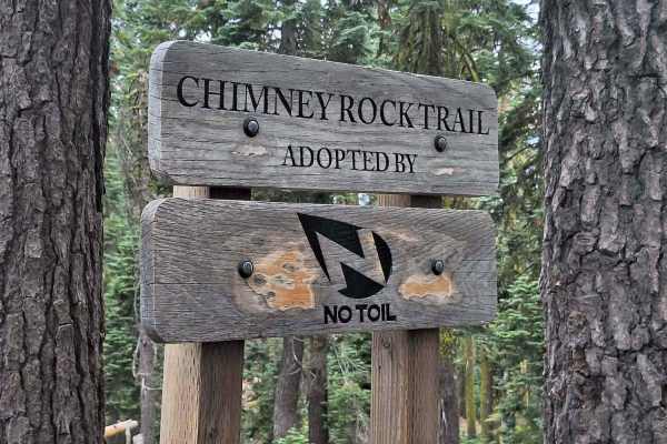
Chimney Rock
After riding Rattlesnake, you’ll arrive at Chimney Rock. The trail follows a ridgeline overlooking Tahoe National Forest and offers some of the most impressive views in the area.
Overall, Chimney Rock is one of the more approachable trails in the region, though riders should be prepared for signifi...
Learn more about Chimney Rock
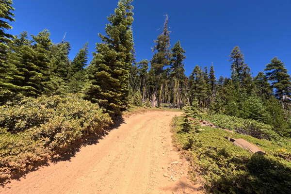
Monarch Spur - FS 93-002-03
Monarch Spur - FS 93-002-03 offers a short but wonderfully scenic drive. This half-mile spur branches off from Monarch Road and gently winds its way up through a beautiful, tall pine forest. The surface is mostly packed reddish-orange dirt mixed with a fair amount of loose gravel and small rocks, bu...
Learn more about Monarch Spur - FS 93-002-03
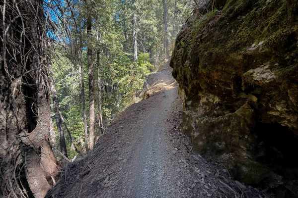
Butcher Ranch
Butcher Ranch is a long trail near Downieville – 6.6 miles long, and is part of the “Downieville Downhill” route from Packer Lake Saddle to Downieville – very popular with mountain bikers. There is a big bridge crossing early on over Pauley Creek. The west half of the trail is shelfy and narrow, wit...
Learn more about Butcher Ranch
ATV trails near Downieville, California
Explore ATV-friendly trails near you. These trails are accessible for vehicles up to 50 inches wide, perfect for ATVs and smaller off-road machines.
Lavezzola Road
Lavezzola Road is a scenic and relaxing journey through the thick, vibrant pine forest. The adventure begins on a brief paved section passing by some rustic green outbuildings before quickly transitioning into a wide, graded packed-dirt and gravel track. As you wind your way through the tall timber,...
Learn more about Lavezzola Road
Red Ant
This trail is more like a fire road and features a few climbs and tight turns. It has a couple of areas designated for dispersed camping and offers some views of the canyon. The trail has been recently recut and cleared in certain sections. Additionally, there are some areas that are single-wide wit...
Learn more about Red Ant
Fir Cap Trail - South Segment - FS 10E22
Fir Cap Trail - South Segment - FS 10E22 is accessed directly from the northern segment of the Fir Cap Trail. This southern section is significantly easier than the northern segment, featuring several flat, smooth areas alongside gentle descents. The trail climbs over a small, unnamed mountain that...
Learn more about Fir Cap Trail - South Segment - FS 10E22
Fir Cap Trail - North Segment - 10E22
Fir Cap Trail - North Segment - FS 10E22 is the northern half of a connector route, accessed via Saddleback Road. The route begins with a slight descent into an area that resembles an old mining site, though no structural signs of a mine remain. From there, the trail climbs over Fir Top Mountain. Al...
Learn more about Fir Cap Trail - North Segment - 10E22
UTV/side-by-side trails near Downieville, California
Find UTV and side-by-side trails near you. These trails accommodate vehicles up to 60 inches wide, ideal for UTVs, side-by-sides, and wider off-road rigs.
Lavezzola Road
Lavezzola Road is a scenic and relaxing journey through the thick, vibrant pine forest. The adventure begins on a brief paved section passing by some rustic green outbuildings before quickly transitioning into a wide, graded packed-dirt and gravel track. As you wind your way through the tall timber,...
Learn more about Lavezzola Road
Red Ant
This trail is more like a fire road and features a few climbs and tight turns. It has a couple of areas designated for dispersed camping and offers some views of the canyon. The trail has been recently recut and cleared in certain sections. Additionally, there are some areas that are single-wide wit...
Learn more about Red Ant
Fir Cap Trail - South Segment - FS 10E22
Fir Cap Trail - South Segment - FS 10E22 is accessed directly from the northern segment of the Fir Cap Trail. This southern section is significantly easier than the northern segment, featuring several flat, smooth areas alongside gentle descents. The trail climbs over a small, unnamed mountain that...
Learn more about Fir Cap Trail - South Segment - FS 10E22
Saddleback Road - CR 509
Accessed directly off Highway 49 just outside the charming town of Downieville, Saddleback Road is a classic, highly enjoyable forest road. The journey begins with a smooth, well-packed dirt surface that offers plenty of fun, sweeping twists and turns under a beautiful canopy of tall, shading pine t...
Learn more about Saddleback Road - CR 509
The onX Offroad Difference
onX Offroad combines trail photos, descriptions, difficulty ratings, width restrictions, seasonality, and more in a user-friendly interface. Available on all devices, with offline access and full compatibility with CarPlay and Android Auto. Discover what you're missing today!
Open Trail Map