
Dirt Bike Trails
Near Challenge-Brownsville, California
Explore All Dirt Bike Trails Near Challenge-Brownsville, California
Dirt Bike Trails Near Challenge-Brownsville, California
Discover the best dirt bike trails near you. Browse trail maps, check difficulty ratings, and find your next adventure — whether you're looking for a quick ride or an all-day expedition.
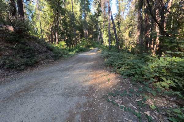
Dry Creek - FS 19N25
Dry Creek - FS 19N25 is a peaceful connector route linking Oregon Hill Road to Indiana-New York Road, offering convenient passage deeper into the surrounding backcountry. Set within the lush, mature conifer and hardwood canopy of Plumas National Forest, the corridor travels beneath towering ponderos...
Learn more about Dry Creek - FS 19N25
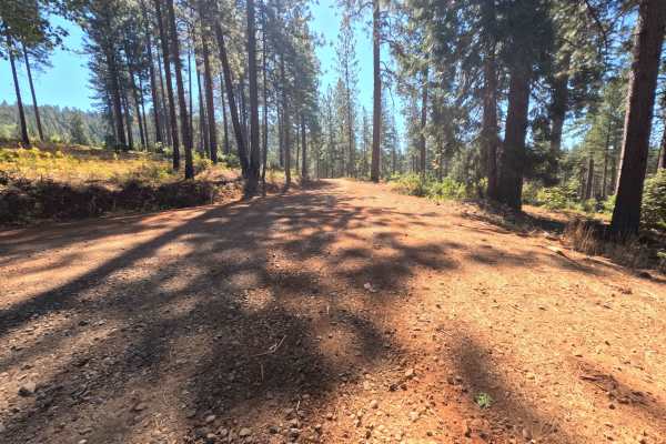
Plantation - FS 19N16
Plantation - FS 19N16 is a scenic connector loop that branches off Forest Service Road 21, circumnavigates a sprawling tract of backcountry timber, and rejoins Road 21 at an established paved junction. Situated within Plumas National Forest, the corridor traverses a lush woodland environment dominat...
Learn more about Plantation - FS 19N16
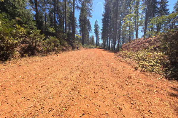
Pike CO Peak - FS 19N17
Pike CO Peak - FS 19N17 functions as a scenic mountain connector linking Forest Service Road 21 with Plantation - FS 19N16, offering elevated throughput across the forested crest of Pike County Peak. Situated in Plumas National Forest, the route travels through a lush, dense woodland of towering pon...
Learn more about Pike CO Peak - FS 19N17
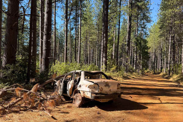
North Loop - FS 19N22
North Loop - FS 19N22 serves as a scenic woodland connector branching off Forest Road 21 and threading westward through the timbered foothills toward the small mountain community of Challenge. Set across the gently rolling terrain of Plumas National Forest, the corridor winds through a lush mixed-co...
Learn more about North Loop - FS 19N22
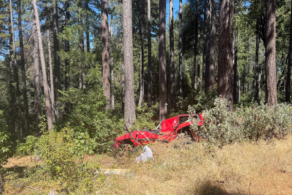
Milk Ranch - FS 19N04
Milk Ranch - FS 19N04 serves as an essential backcountry connector linking Plantation Road - FS 19N16 to Forest Service Road 21, providing dependable throughput across the undulating foothill ridges. Situated in Plumas National Forest, the track winds through a lush, vibrant canopy of towering ponde...
Learn more about Milk Ranch - FS 19N04
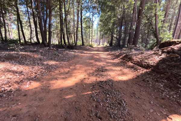
Milk - FS 19N00
Milk - FS 19N00 is a peaceful woodland connector branching off Plantation Road - FS 19N16 and descending through the hills toward lower Forest Service corridors near Bullards Bar Reservoir. Managed by Plumas National Forest, the track traverses a lush, dense mountain environment sheltered beneath to...
Learn more about Milk - FS 19N00
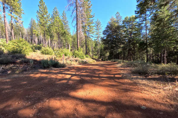
Dodge - FS 19N53
Dodge (Forest Service Road 19N53) is a tranquil out-and-back dirt spur accessed directly off Indian Road. Winding along a timbered ridgeline within the Feather River Ranger District of Plumas National Forest, the trail travels through mixed pine and oak woodland recovering from the 2015 Lumpkin Fire...
Learn more about Dodge - FS 19N53
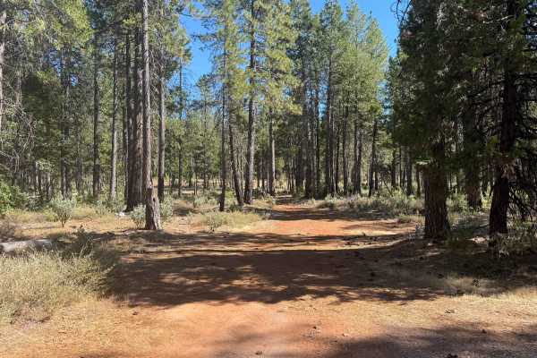
Indian - FS 19N03
Forest Service Road 19N03 (Indian) is an engaging backcountry connector branching off Forest Service Road 21 and tracing the scenic drainage of Indian Creek to an established junction with adjoining woodland routes. Nestled within the lush, canopy-rich evergreen forest of Plumas National Forest, the...
Learn more about Indian - FS 19N03
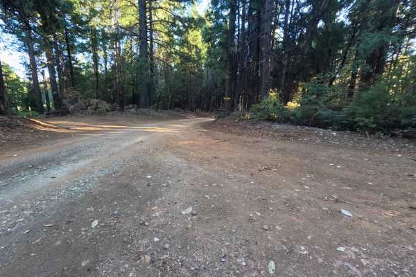
Weed Point - FS 20N14
Weed Point (Forest Service Road 20N14) serves as a scenic backcountry connector in the Plumas National Forest, creating a convenient dirt link between Forest Road 21 and the trail network along Peterson Ridge. The track traverses a lush, verdant woodland dominated by towering sugar pines, Douglas fi...
Learn more about Weed Point - FS 20N14
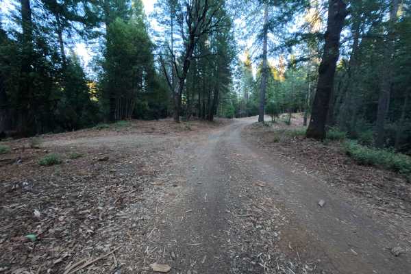
Cyprus - FS 20N81
Cyprus (Forest Service Road 20N81) is a peaceful, out-and-back woodland spur accessed directly off Peterson Ridge Road (FS 20N04). Winding through the Plumas National Forest, the track is enveloped by a healthy, dense canopy of mature pines, cedar, and fir trees carpeted with natural duff. This sing...
Learn more about Cyprus - FS 20N81
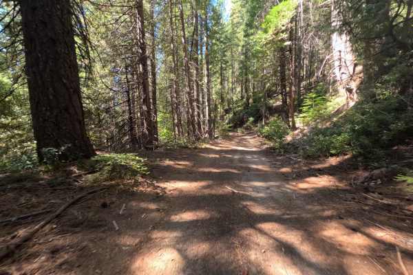
Sly Harry - FS 20N80
Branching off Harrison Ridge Road - FS 21N20, Sly Harry - FS 20N80 is an adventurous single-track dirt spur descending southward toward the scenic shoreline of Sly Creek Reservoir. The route traverses a lush, deeply shaded conifer woodland within the Plumas National Forest, surrounded by mature pine...
Learn more about Sly Harry - FS 20N80
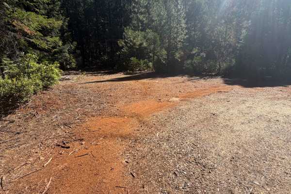
Harrison Ridge Spur A - FS 21N20A
Harrison Ridge Spur A - FS 21N20A is a tranquil, single-lane out-and-back spur branching northward off Harrison Ridge Road - FS 21N20. Winding beneath a dense canopy of towering pines and firs, the route traverses a lush, intact forest environment managed by the Plumas National Forest. The track con...
Learn more about Harrison Ridge Spur A - FS 21N20A
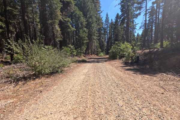
Upper French Creek - FS 21N56
Serving as a direct backcountry connector, Upper French Creek - FS 21N56 links Mooreville Ridge Road with the elevated ridgeline tracks overlooking the French Creek basin. This undulating single-lane dirt thoroughfare traverses terrain managed by the Plumas National Forest, traveling through an open...
Learn more about Upper French Creek - FS 21N56
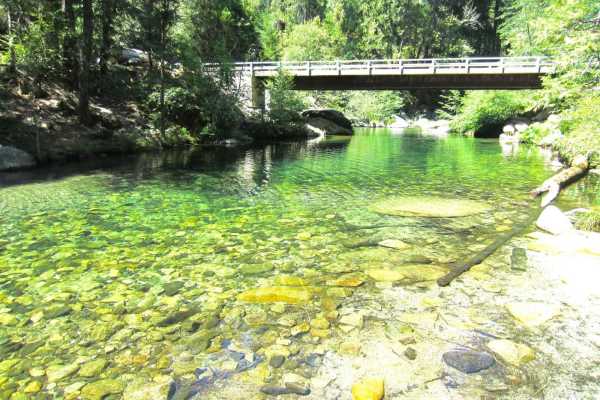
Sly Creek Trail
This trail is rated as a Level 1 difficulty. It offers a relatively easy experience, characterized by a flat, well-maintained road predominantly composed of gravel and dirt. However, it should be noted that during winter, the trail may become muddy, slippery, and snow-covered. Accessible from Laport...
Learn more about Sly Creek Trail
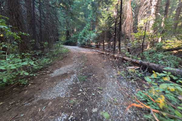
Bonanza - FS 21N01Y
Accessed directly off Forest Service Road 21N01, Bonanza - FS 21N01Y is a quiet, gently meandering out-and-back spur that ventures into the scenic upland country. The route winds through an unbroken, lush conifer woodland dominated by towering Douglas firs, sugar pines, and fragrant incense cedars m...
Learn more about Bonanza - FS 21N01Y
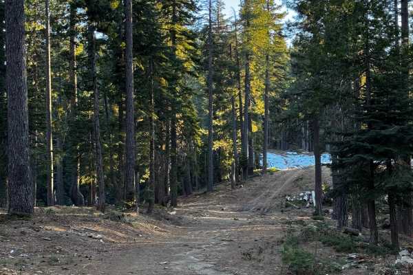
Red Ant
This trail is more like a fire road and features a few climbs and tight turns. It has a couple of areas designated for dispersed camping and offers some views of the canyon. The trail has been recently recut and cleared in certain sections. Additionally, there are some areas that are single-wide wit...
Learn more about Red Ant
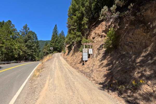
Saddleback Road - CR 509
Accessed directly off Highway 49 just outside the charming town of Downieville, Saddleback Road is a classic, highly enjoyable forest road. The journey begins with a smooth, well-packed dirt surface that offers plenty of fun, sweeping twists and turns under a beautiful canopy of tall, shading pine t...
Learn more about Saddleback Road - CR 509
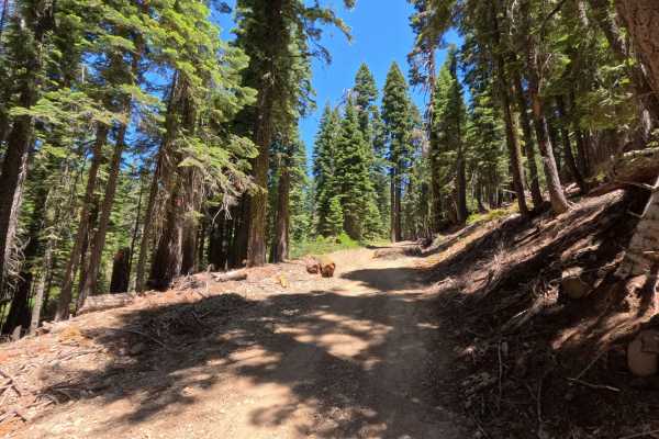
Saddleback - FS 25-023
This beautiful route picks up right where the regular county road maintenance ends, taking you deeper into the dense, shaded woods. As you journey along this path, you will find a very smooth, well-graded gravel surface that seamlessly transitions into sections of soft, packed dirt. The entire drive...
Learn more about Saddleback - FS 25-023
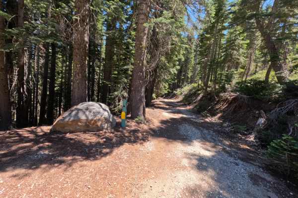
Fir Cap Trail - South Segment - FS 10E22
Fir Cap Trail - South Segment - FS 10E22 is accessed directly from the northern segment of the Fir Cap Trail. This southern section is significantly easier than the northern segment, featuring several flat, smooth areas alongside gentle descents. The trail climbs over a small, unnamed mountain that...
Learn more about Fir Cap Trail - South Segment - FS 10E22
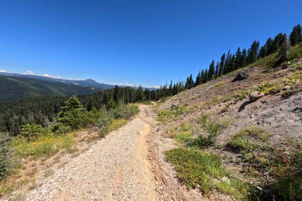
Fir Cap Trail - North Segment - 10E22
Fir Cap Trail - North Segment - FS 10E22 is the northern half of a connector route, accessed via Saddleback Road. The route begins with a slight descent into an area that resembles an old mining site, though no structural signs of a mine remain. From there, the trail climbs over Fir Top Mountain. Al...
Learn more about Fir Cap Trail - North Segment - 10E22
ATV trails near Challenge-Brownsville, California
Explore ATV-friendly trails near you. These trails are accessible for vehicles up to 50 inches wide, perfect for ATVs and smaller off-road machines.
Dry Creek - FS 19N25
Dry Creek - FS 19N25 is a peaceful connector route linking Oregon Hill Road to Indiana-New York Road, offering convenient passage deeper into the surrounding backcountry. Set within the lush, mature conifer and hardwood canopy of Plumas National Forest, the corridor travels beneath towering ponderos...
Learn more about Dry Creek - FS 19N25
Plantation - FS 19N16
Plantation - FS 19N16 is a scenic connector loop that branches off Forest Service Road 21, circumnavigates a sprawling tract of backcountry timber, and rejoins Road 21 at an established paved junction. Situated within Plumas National Forest, the corridor traverses a lush woodland environment dominat...
Learn more about Plantation - FS 19N16
Pike CO Peak - FS 19N17
Pike CO Peak - FS 19N17 functions as a scenic mountain connector linking Forest Service Road 21 with Plantation - FS 19N16, offering elevated throughput across the forested crest of Pike County Peak. Situated in Plumas National Forest, the route travels through a lush, dense woodland of towering pon...
Learn more about Pike CO Peak - FS 19N17
North Loop - FS 19N22
North Loop - FS 19N22 serves as a scenic woodland connector branching off Forest Road 21 and threading westward through the timbered foothills toward the small mountain community of Challenge. Set across the gently rolling terrain of Plumas National Forest, the corridor winds through a lush mixed-co...
Learn more about North Loop - FS 19N22
UTV/side-by-side trails near Challenge-Brownsville, California
Find UTV and side-by-side trails near you. These trails accommodate vehicles up to 60 inches wide, ideal for UTVs, side-by-sides, and wider off-road rigs.
Dry Creek - FS 19N25
Dry Creek - FS 19N25 is a peaceful connector route linking Oregon Hill Road to Indiana-New York Road, offering convenient passage deeper into the surrounding backcountry. Set within the lush, mature conifer and hardwood canopy of Plumas National Forest, the corridor travels beneath towering ponderos...
Learn more about Dry Creek - FS 19N25
Plantation - FS 19N16
Plantation - FS 19N16 is a scenic connector loop that branches off Forest Service Road 21, circumnavigates a sprawling tract of backcountry timber, and rejoins Road 21 at an established paved junction. Situated within Plumas National Forest, the corridor traverses a lush woodland environment dominat...
Learn more about Plantation - FS 19N16
Pike CO Peak - FS 19N17
Pike CO Peak - FS 19N17 functions as a scenic mountain connector linking Forest Service Road 21 with Plantation - FS 19N16, offering elevated throughput across the forested crest of Pike County Peak. Situated in Plumas National Forest, the route travels through a lush, dense woodland of towering pon...
Learn more about Pike CO Peak - FS 19N17
North Loop - FS 19N22
North Loop - FS 19N22 serves as a scenic woodland connector branching off Forest Road 21 and threading westward through the timbered foothills toward the small mountain community of Challenge. Set across the gently rolling terrain of Plumas National Forest, the corridor winds through a lush mixed-co...
Learn more about North Loop - FS 19N22
The onX Offroad Difference
onX Offroad combines trail photos, descriptions, difficulty ratings, width restrictions, seasonality, and more in a user-friendly interface. Available on all devices, with offline access and full compatibility with CarPlay and Android Auto. Discover what you're missing today!
Open Trail Map