
Dirt Bike Trails
Near Carney, Michigan
Explore All Dirt Bike Trails Near Carney, Michigan
Dirt Bike Trails Near Carney, Michigan
Discover the best dirt bike trails near you. Browse trail maps, check difficulty ratings, and find your next adventure — whether you're looking for a quick ride or an all-day expedition.
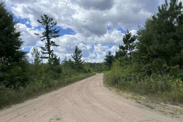
Fir - Forest Road 13042
Fir - Forest Road 13042 is a there-and-back trail open to all vehicle types, but it ends at an ungated ORV trail. This trail makes up the southern portion of the FIR route and runs from its intersection with Forest Road 13043 and Forest Road 34615 to its endpoint at FIT South. This trail is a modera...
Learn more about Fir - Forest Road 13042
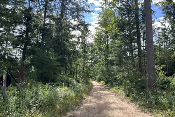
Route FIT West
Route FIT West is one of several 65 in. and under ORV routes located within the Escanaba Forest Management Unit. This trail begins at its intersection with Route FIR, Forest Road 31616, 14573, and navigates to its intersection with Route FIR 9995330. This trail is a converted 50 in. and under ORV ro...
Learn more about Route FIT West
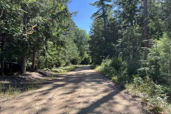
Fir - Forest Road 13040
Fir - Forest Road 13040 is a multi-use Forest Road which navigates from its intersection with Forest Road 14570 to where the trail dead-ends at an un-gated ORV trailhead. There are several short spur trails which navigate off this trail to provide additional areas to explore. This trail remains the ...
Learn more about Fir - Forest Road 13040
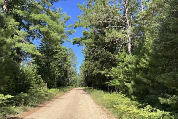
Fir - Forest Road 14570
Forest Road 14570 is a short spur trail that navigates from its intersection with Forest Road 14572, to Forest Road 13040. This trail serves as a quick way to access the east or west side of the Forest Island Trail system, rather than having to navigate further north or south where the eastern and w...
Learn more about Fir - Forest Road 14570
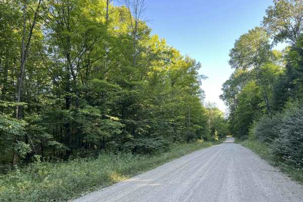
Trail FIT - FR 13044
Trail FIT - FR 13044 is the southernmost ATV and SxS trail located in the Forest Island Trail system. This trail navigates from its intersection with Forest Road 14571 to its northern intersection with Forest Road 13041 and Forest Road 34613. This trail, if traveled from the southern trailhead north...
Learn more about Trail FIT - FR 13044
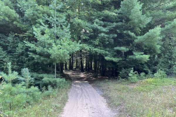
Fit East
Fit East is one of several 65 in. and under ORV routes located within the Escanaba Forest Management Unit. This trail begins at its intersection with Fir - 9995330 (Forest Island ORV Trailhead) and navigates to its endpoint at its intersection with Forest Road 13040 and Forest Road 14570. This was o...
Learn more about Fit East
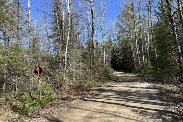
Norway Truck Trail Cassidy Creek Rd
This is the Dickinson County, Michigan, Norway Truck Trail, Cassidy Creek Road trail. Cassidy Creek is a full-width forest road serving the Norway Truck Trail system. This trail is wide and mainly has a gravel base. The scenery around the trail ranges from open meadows to thickly wooded forests. The...
Learn more about Norway Truck Trail Cassidy Creek Rd
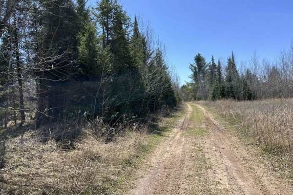
Norway Truck Trail 2 South Loop
This is Norway Truck Trail 2, part of the southern loop. This trail runs from its intersection with Black Creek Trail/ FR N3015 to Norway Truck Trail, Cassidy Creek Rd. This trail is open to ATV, SxS under 65in, and OHM traffic for its entire length;however, parts of the trail are open to truck and ...
Learn more about Norway Truck Trail 2 South Loop

Norway Truck Trail (NWT) Rd
This is Dickinson County, Norway Truck Trail. This trail runs from its start point at County Rd 573, to its end point at one of the borders of the Crystal Falls Forest Management Unit, where the trail changes to Felch Mtn Road. This trail has some excellent sights and something different to see in e...
Learn more about Norway Truck Trail (NWT) Rd
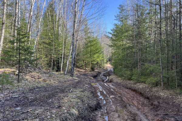
Norway Truck Trail 1
This is the Dickinson County, Michigan, Norway Truck Trail official trailhead. This trail starts at the trailhead located off Norway Truck Trail Road. There is a large parking lot for unloading and staging for a day of riding. This trail travels through old-growth forest and some areas that have bee...
Learn more about Norway Truck Trail 1
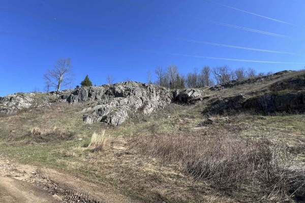
Norway Truck Trail 4 North Loop
This is Norway Truck Trail 4, located in Dickinson County, MI. It is one of the Northernmost trails in the NWT trail system and offers some pretty spectacular views. This trail starts as a full-width and ORV trail but becomes width-restricted to 65 inches for roughly one mile, about one mile from th...
Learn more about Norway Truck Trail 4 North Loop
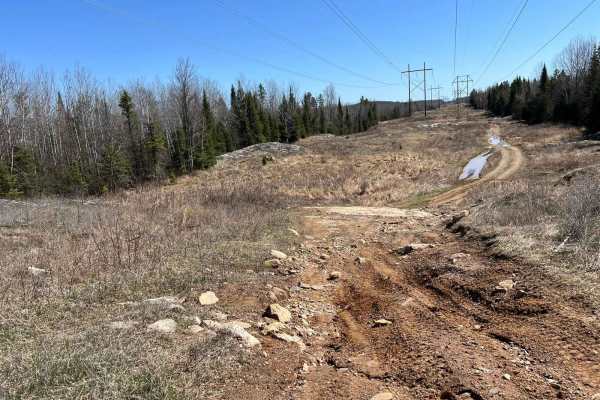
Norway Truck Trail 3 North Loop
This is Norway Truck Trail 3, located in Dickinson County, MI. This trail runs along the northern end of the NWT trail system before it begins to work its way down to the southeastern edge. While challenging, this trail is a lot of fun and should be considered by riders with some off-road experience...
Learn more about Norway Truck Trail 3 North Loop
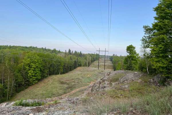
Norway Truck Trail (NWT) Trail 5 North
This short trail is the northernmost route that is a part of the NWT trail system. This trail is one of the trails that make up the northern loop. The trail begins at its intersection with Norway Truck Trail Road and navigates to its endpoint at its intersection with Norway Truck Trail 4 North Loop....
Learn more about Norway Truck Trail (NWT) Trail 5 North
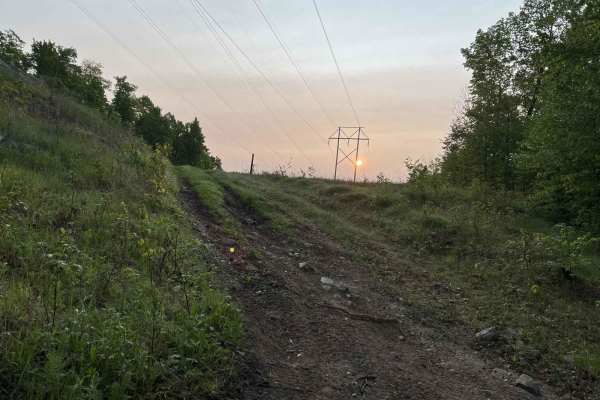
Norway Truck Trail (NWT) Trail 5 North ATV/ OHM Bypass
This is a very short section of challenging trail that is open only to ATV and OHM traffic. This trail navigates up and along the edge of a bluff that has been cleared out thanks to the power lines running above. At the highest point on the trail, there is a path that has been created that will lead...
Learn more about Norway Truck Trail (NWT) Trail 5 North ATV/ OHM Bypass
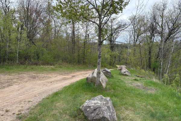
Dam Dead End
This easily flowing trail runs along the Peshtigo River, which flows down from the Johnson Fall Hydroelectric Dam. The trail features a mix of sandy whoops, hills, and scenic lookouts over the river. It eventually reaches a three-way dead end with gates at each split. A nice camping spot in one of t...
Learn more about Dam Dead End
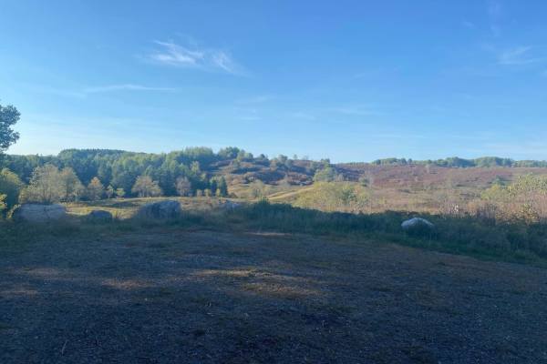
Barrens Loop
This is a twisting trail through the stunning Barrens Nature Area. This trail's surface is a lot like most other trails in this area and is made up of rocks and sand. There are several great picture opportunities along this loop and access to Sand Lake and Pine River Overlook.
Learn more about Barrens Loop
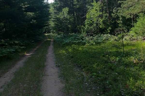
Bills Creek West - FSR 2814
Road Primary Name: FEDERAL FOREST ROAD 2814. Road Type: Non-DNR Road. ORV Status: Not a DNR Road - See local government laws. Surface Type: Dirt, native material. Condition: Fair. Owner: Federal. Closure Criteria: Open (Partial). Bills Creek Road West does not connect with Bills Creek Road Eas...
Learn more about Bills Creek West - FSR 2814
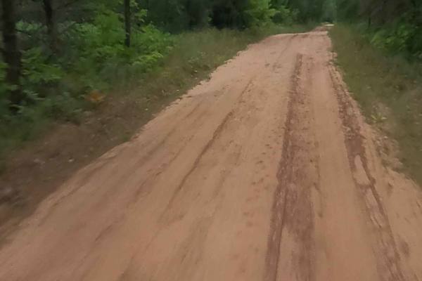
Kates Grade
Kates Grade Road is a non-DNR road owned by the county. The surface consists primarily of gravel, and the overall condition is considered fair. Since it is not a DNR road, ORV use is subject to local government laws. The road remains open under current closure criteria.
This route follows a former ...
Learn more about Kates Grade
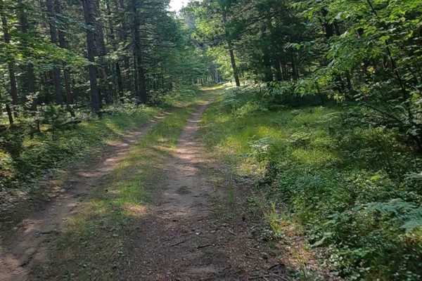
Mormon Creek Spur AB - FSR 2231AB
Mormon Creek Spur A and B is classified as a Non-DNR Road. It is not a DNR-managed road, so off-road vehicle use is subject to local government laws. The surface consists of both dirt and paved sections, and the overall condition is fair. Ownership is listed as unspecified to private. The road is cu...
Learn more about Mormon Creek Spur AB - FSR 2231AB
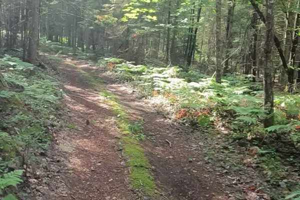
Ensign Spur C - FSR 2235G
Ensign Spur C is classified as a Primary Forest Road. The road is open to off-road vehicles and has a surface made up of dirt, grass, and native material. Its overall condition is rated as fair. Ownership is listed as state, and the road is currently open. This seasonally maintained county road incl...
Learn more about Ensign Spur C - FSR 2235G
ATV trails near Carney, Michigan
Explore ATV-friendly trails near you. These trails are accessible for vehicles up to 50 inches wide, perfect for ATVs and smaller off-road machines.
Fir - Forest Road 13042
Fir - Forest Road 13042 is a there-and-back trail open to all vehicle types, but it ends at an ungated ORV trail. This trail makes up the southern portion of the FIR route and runs from its intersection with Forest Road 13043 and Forest Road 34615 to its endpoint at FIT South. This trail is a modera...
Learn more about Fir - Forest Road 13042
Route FIT West
Route FIT West is one of several 65 in. and under ORV routes located within the Escanaba Forest Management Unit. This trail begins at its intersection with Route FIR, Forest Road 31616, 14573, and navigates to its intersection with Route FIR 9995330. This trail is a converted 50 in. and under ORV ro...
Learn more about Route FIT West
Fir - Forest Road 13040
Fir - Forest Road 13040 is a multi-use Forest Road which navigates from its intersection with Forest Road 14570 to where the trail dead-ends at an un-gated ORV trailhead. There are several short spur trails which navigate off this trail to provide additional areas to explore. This trail remains the ...
Learn more about Fir - Forest Road 13040
Fir - Forest Road 14570
Forest Road 14570 is a short spur trail that navigates from its intersection with Forest Road 14572, to Forest Road 13040. This trail serves as a quick way to access the east or west side of the Forest Island Trail system, rather than having to navigate further north or south where the eastern and w...
Learn more about Fir - Forest Road 14570
UTV/side-by-side trails near Carney, Michigan
Find UTV and side-by-side trails near you. These trails accommodate vehicles up to 60 inches wide, ideal for UTVs, side-by-sides, and wider off-road rigs.
Fir - Forest Road 13042
Fir - Forest Road 13042 is a there-and-back trail open to all vehicle types, but it ends at an ungated ORV trail. This trail makes up the southern portion of the FIR route and runs from its intersection with Forest Road 13043 and Forest Road 34615 to its endpoint at FIT South. This trail is a modera...
Learn more about Fir - Forest Road 13042
Route FIT West
Route FIT West is one of several 65 in. and under ORV routes located within the Escanaba Forest Management Unit. This trail begins at its intersection with Route FIR, Forest Road 31616, 14573, and navigates to its intersection with Route FIR 9995330. This trail is a converted 50 in. and under ORV ro...
Learn more about Route FIT West
Fir - Forest Road 13040
Fir - Forest Road 13040 is a multi-use Forest Road which navigates from its intersection with Forest Road 14570 to where the trail dead-ends at an un-gated ORV trailhead. There are several short spur trails which navigate off this trail to provide additional areas to explore. This trail remains the ...
Learn more about Fir - Forest Road 13040
Fir - Forest Road 14570
Forest Road 14570 is a short spur trail that navigates from its intersection with Forest Road 14572, to Forest Road 13040. This trail serves as a quick way to access the east or west side of the Forest Island Trail system, rather than having to navigate further north or south where the eastern and w...
Learn more about Fir - Forest Road 14570
The onX Offroad Difference
onX Offroad combines trail photos, descriptions, difficulty ratings, width restrictions, seasonality, and more in a user-friendly interface. Available on all devices, with offline access and full compatibility with CarPlay and Android Auto. Discover what you're missing today!
Open Trail Map