
Dirt Bike Trails
Near Bayfield, Wisconsin
Explore All Dirt Bike Trails Near Bayfield, Wisconsin
Dirt Bike Trails Near Bayfield, Wisconsin
Discover the best dirt bike trails near you. Browse trail maps, check difficulty ratings, and find your next adventure — whether you're looking for a quick ride or an all-day expedition.
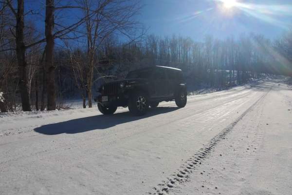
GG to Highbridge
GG to Highbridge is an easy and scenic 11.3-mile gravel forest route that is perfect for drivers of all skill levels seeking a relaxed dirt-road cruise through northern Wisconsin’s dense woodlands. Connecting State Highway GG just outside of Mellen to County Highway C in Highbridge, this trail provi...
Learn more about GG to Highbridge
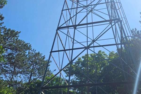
Berkshire Tower Ruins
This backwoods trail features the Mellen Lookout Tower at the top of Mount Whittlesey and a few old Berkshire Mine Ruins. The trail offered a few steep hill climbs, rutted-out and rock-filled sections, and a few rock gardens. The bugs were annoying, and cell service was minimal. A chainsaw or simila...
Learn more about Berkshire Tower Ruins
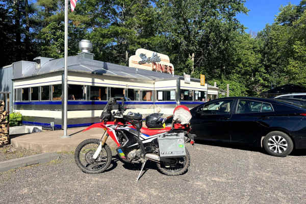
Trans Wisconsin Adventure Trail (Northern Portion)
Northern portion of the Trans Wisconsin Adventure Trail. Route pick up from the Clam Lake area, and travels along ATV trails, fire roads, forest service roads, and logging roads. Most of the route has poor cell service, so make sure you have offline maps and a backup plan for comms in case of emerge...
Learn more about Trans Wisconsin Adventure Trail (Northern Portion)
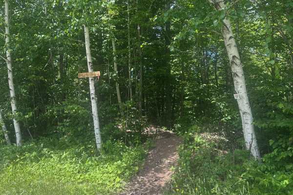
Parliament (M25 Access Trail)
Parliament is the main access trail for the M25 loop and the trail system as a whole. It takes you from the gravel pit staging area to where the M25 loop splits left and right on top of a large flat rock. Parliament is not technical, but it can be a little rugged in some spots. Expect some rocks, up...
Learn more about Parliament (M25 Access Trail)
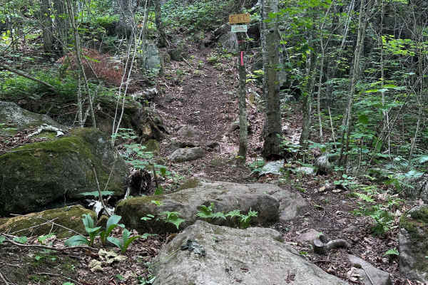
Elephant & Castle
Elephant & Castle is a very technical and rugged trail that traverses across multiple large boulder gardens, extremely steep grades, large rock ledges, and log crossings. It is defended at either end by extremely steep hills as gatekeeper obstacles. It is recommended that riders attempt this with at...
Learn more about Elephant & Castle
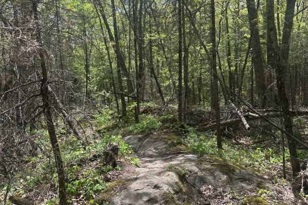
Lizzy (M25 Section 1)
Lizzy is the first section in the M25 outer loop of London OHM. It begins fairly tame with just a few simpler rock gardens/creek crossings, but gets a little more challenging as you go. Beware of the cliff exposure towards the start of the trail. One section contains a larger boulder garden, but it'...
Learn more about Lizzy (M25 Section 1)
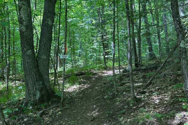
Trafalgar Square
Trafalgar Square is an intermediate-level trail with many advanced-level obstacles that have go-arounds. Expect lots of rock ledges, steep grades, off-camber sections, rock gardens, and tight single track. This is a good trail for riders to test their trials/hard enduro skills before hitting some of...
Learn more about Trafalgar Square
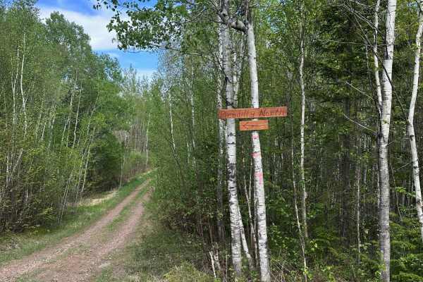
Piccadilly Circus North
Piccadilly North is mostly standard single track with several technical features mixed in. Riders can expect the same roots and rocks found throughout the rest of the trail system, along with a few technical rock step-ups that all have go-arounds. This is a good progression trail for riders graduati...
Learn more about Piccadilly Circus North
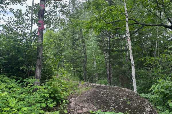
Piccadilly Circus South
Piccadilly Circus South is slightly more technical than Piccadilly Circus North thanks to several unavoidable rock ledges and steep hill climbs. A few of the larger obstacles offer challenging lines with optional go-arounds. Expect plenty of rocks, exposed roots, tight single track, and steep grades...
Learn more about Piccadilly Circus South
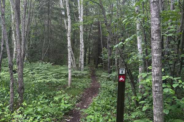
Alger Grade - Trail 8
Trail 8 is another one of those trails where riders can choose their own difficulty level. The main line keeps things approachable with the familiar mix of rocks, roots, and tight singletrack found throughout the system. In a few sections, harder optional lines split off and add some fun technical r...
Learn more about Alger Grade - Trail 8
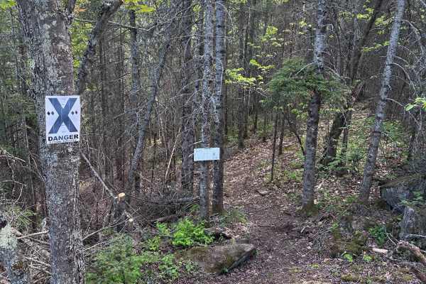
Valhalla Bound
Valhalla Bound is very likely the most difficult public dirt bike trail in Minnesota. If you’ve ever watched Red Bull Romaniacs and thought, “That looks fun!” then this trail might be for you. High-level hard enduro skills, some buddies, a desire for Type III fun, and good health insurance are highl...
Learn more about Valhalla Bound
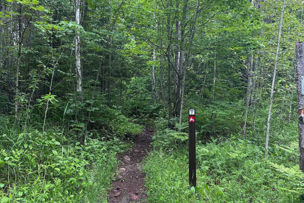
Alger Grade - Trail 7
At just under 3 miles, Trail 7 is the longest trail in the Alger Grade system. There are many boulder features throughout, with steep ledges and step-ups. Some of them can be avoided, but most are part of the main line. You can expect plenty of off-camber sections with roots and smaller loose rocks,...
Learn more about Alger Grade - Trail 7
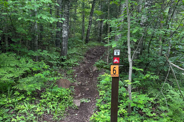
Alger Grade - Trail 6
Trail 6 is a short but technical trail featuring several challenging obstacles. The trail begins with a rocky section before climbing a steep chute filled with loose rock, embedded boulders, and a rock face near the top. Farther along, riders encounter another technical section that climbs onto a la...
Learn more about Alger Grade - Trail 6
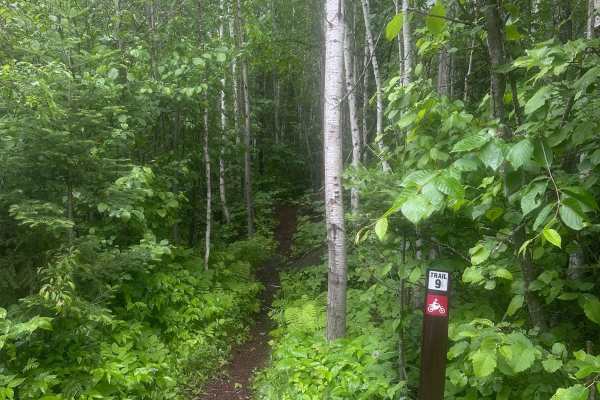
Alger Grade - Trail 9
Trail 9 winds through some of Alger Grade’s flatter ground, making it a solid intermediate trail without any major technical sections. Riders should expect the usual mix of tight trees, roots, and scattered rocks that define the system, but the trail stays fairly manageable overall. There is one sho...
Learn more about Alger Grade - Trail 9
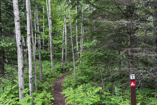
Alger Grade - Trail 5
Trail 5 is rugged and has all of the rocks and roots that are characteristic of the Alger Grade system. There are a number of splits in the trail that allow riders to choose the easier or harder features. Some of the optional hard features on this trail are genuinely dangerous, with one of them bein...
Learn more about Alger Grade - Trail 5
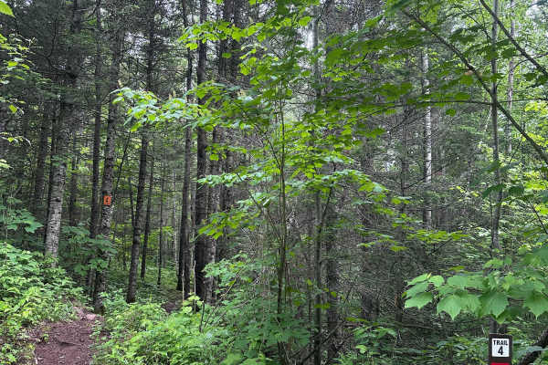
Alger Grade - Trail 4
Trail 4 can best be described as a "breather trail." It's relatively flat, smooth, loamy, and about as flowy as it gets at Alger Grade. There are a couple of sections that have tight trees, but there are no serious technical obstacles to cross. Use this trail to cool down after trail 3 and to prepar...
Learn more about Alger Grade - Trail 4
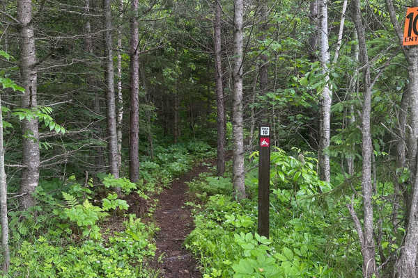
Alger Grade - Trail 10
Trail 10 is best considered easy to intermediate. The terrain is relatively flat and does not include any major technical features, steep climbs, or difficult rock sections. However, riders should still expect the usual Alger Grade mix of roots, rocks, and tight trees, which makes it more involved t...
Learn more about Alger Grade - Trail 10
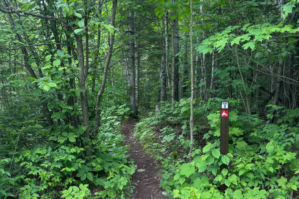
Alger Grade - Trail 3
Trail 3 is a "pick your own adventure" type trail with technical sections that have bypasses going around them. The mandatory lines have similar rocks, roots, and steep inclines as the rest of the system. The optional hard lines have rock ledges to go up and down with varying degrees of sketchiness,...
Learn more about Alger Grade - Trail 3
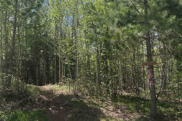
Big Ben (M25 Section 2)
Big Ben is the second section of the outer loop of London OHM. It's a mix of flowy and slightly technical sections through tight and open woodland. The technical sections are just spots with medium-sized roots and rocks, plus a few shallow water crossings with mud. There are a handful of hill climbs...
Learn more about Big Ben (M25 Section 2)
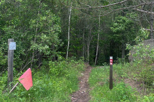
Alger Grade - Trail 1
Trail 1 begins smooth and loamy as it winds through the pine trees before the rocks and roots increase in number. There are no especially technical obstacles, but the rock/roots serve as a good primer for what to expect in the rest of the system. All of the trails at Alger Grade are tight and narrow...
Learn more about Alger Grade - Trail 1
ATV trails near Bayfield, Wisconsin
Explore ATV-friendly trails near you. These trails are accessible for vehicles up to 50 inches wide, perfect for ATVs and smaller off-road machines.
GG to Highbridge
GG to Highbridge is an easy and scenic 11.3-mile gravel forest route that is perfect for drivers of all skill levels seeking a relaxed dirt-road cruise through northern Wisconsin’s dense woodlands. Connecting State Highway GG just outside of Mellen to County Highway C in Highbridge, this trail provi...
Learn more about GG to Highbridge
Berkshire Tower Ruins
This backwoods trail features the Mellen Lookout Tower at the top of Mount Whittlesey and a few old Berkshire Mine Ruins. The trail offered a few steep hill climbs, rutted-out and rock-filled sections, and a few rock gardens. The bugs were annoying, and cell service was minimal. A chainsaw or simila...
Learn more about Berkshire Tower Ruins
Trans Wisconsin Adventure Trail (Northern Portion)
Northern portion of the Trans Wisconsin Adventure Trail. Route pick up from the Clam Lake area, and travels along ATV trails, fire roads, forest service roads, and logging roads. Most of the route has poor cell service, so make sure you have offline maps and a backup plan for comms in case of emerge...
Learn more about Trans Wisconsin Adventure Trail (Northern Portion)
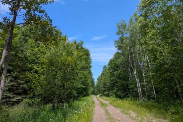
Kane Lake Spur J
This two-track trail is accessed from Kane Lake Road and remains relatively undamaged throughout its length. It winds through a mixed forest of pine and birch, offering a peaceful setting with a variety of wildflowers typically in bloom during July. The trail is mildly bumpy with gentle curves, asce...
Learn more about Kane Lake Spur J
UTV/side-by-side trails near Bayfield, Wisconsin
Find UTV and side-by-side trails near you. These trails accommodate vehicles up to 60 inches wide, ideal for UTVs, side-by-sides, and wider off-road rigs.
GG to Highbridge
GG to Highbridge is an easy and scenic 11.3-mile gravel forest route that is perfect for drivers of all skill levels seeking a relaxed dirt-road cruise through northern Wisconsin’s dense woodlands. Connecting State Highway GG just outside of Mellen to County Highway C in Highbridge, this trail provi...
Learn more about GG to Highbridge
Berkshire Tower Ruins
This backwoods trail features the Mellen Lookout Tower at the top of Mount Whittlesey and a few old Berkshire Mine Ruins. The trail offered a few steep hill climbs, rutted-out and rock-filled sections, and a few rock gardens. The bugs were annoying, and cell service was minimal. A chainsaw or simila...
Learn more about Berkshire Tower Ruins
Trans Wisconsin Adventure Trail (Northern Portion)
Northern portion of the Trans Wisconsin Adventure Trail. Route pick up from the Clam Lake area, and travels along ATV trails, fire roads, forest service roads, and logging roads. Most of the route has poor cell service, so make sure you have offline maps and a backup plan for comms in case of emerge...
Learn more about Trans Wisconsin Adventure Trail (Northern Portion)
Kane Lake Spur J
This two-track trail is accessed from Kane Lake Road and remains relatively undamaged throughout its length. It winds through a mixed forest of pine and birch, offering a peaceful setting with a variety of wildflowers typically in bloom during July. The trail is mildly bumpy with gentle curves, asce...
Learn more about Kane Lake Spur J
The onX Offroad Difference
onX Offroad combines trail photos, descriptions, difficulty ratings, width restrictions, seasonality, and more in a user-friendly interface. Available on all devices, with offline access and full compatibility with CarPlay and Android Auto. Discover what you're missing today!
Open Trail Map