
Dirt Bike Trails
Near Bath, Ontario
Explore All Dirt Bike Trails Near Bath, Ontario
Dirt Bike Trails Near Bath, Ontario
Discover the best dirt bike trails near you. Browse trail maps, check difficulty ratings, and find your next adventure — whether you're looking for a quick ride or an all-day expedition.
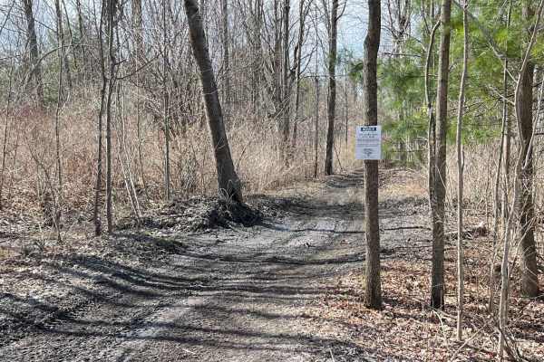
Indian River ATV Club
This is an old railroad bed. Originally, The Sissy Danforth Trail. Purchased and developed for ATVs some 20 years ago. Views of wildlife and nature abound. Lakes, farmland, and wetlands make up the landscape. Some very interesting historical locations along the trail, with some difficult wet, muddy ...
Learn more about Indian River ATV Club
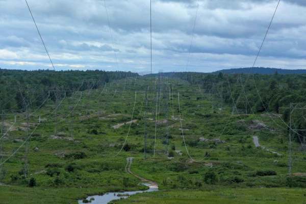
Lingham Hydro Line
One of the most scenic and accessible Hydro cuts around the area. Great option for an adventure that avoids pinstriping and drama. Easy going, with a few water crossings when run in the summer. However, it is one of the trails in the area that you are allowed to run in the winter, which requires bei...
Learn more about Lingham Hydro Line
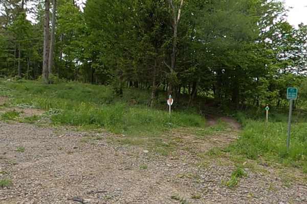
Lewis County Area A - Green Trail
This is a county parcel with several connecting trails, making for a good day of riding. You can expect narrow, muddy, hilly trails designed for ATVs and 60-inch SxSs. Bridges and tight turns make for some fun riding. Deer are a common sighting. There are open areas for picnics, etc. Lewis County T...
Learn more about Lewis County Area A - Green Trail
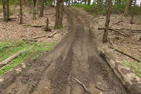
Lewis County Area A - Blue Trail
This is a county parcel with several connecting trails, making for a good day of riding. You can expect narrow, muddy, hilly trails designed for ATVs and 60-inch SxSs. Bridges and tight turns make for some fun riding. Deer are a common sighting. There are open areas for picnics, etc.
Learn more about Lewis County Area A - Blue Trail
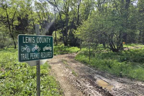
Worth Road Spur
Worth Road is a short, easy to moderate OHV connector in the Tug Hill Plateau designed for registered ATVs and compliant side-by-sides linking Worth Road and Culpepper Road within the Lewis County OHV Trail System. While not a destination trail on its own, it plays an important role in connecting la...
Learn more about Worth Road Spur
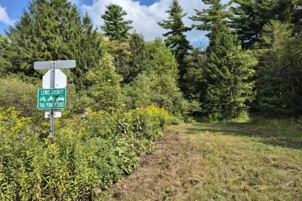
Culpepper Spur
Expect to see varying terrain as you creep through a mix of rocky trail and mud/dirt that traverses a mostly pine forest on the edge of O'Leary's pond. Lots of ruts and the potential for shallow water holes exist, especially after rain events. A Lewis County trail permit is required to use this trai...
Learn more about Culpepper Spur
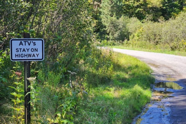
Worth Road Connector
Avoid the pavement! This route connects the Lewis County ATV/SXS trail system to the Jefferson County system and is all gravel/dirt. The trail offers many places to stop and take in the sights of the Tughill plateau. This trail is a public road and does not require a permit to ride.
Learn more about Worth Road Connector
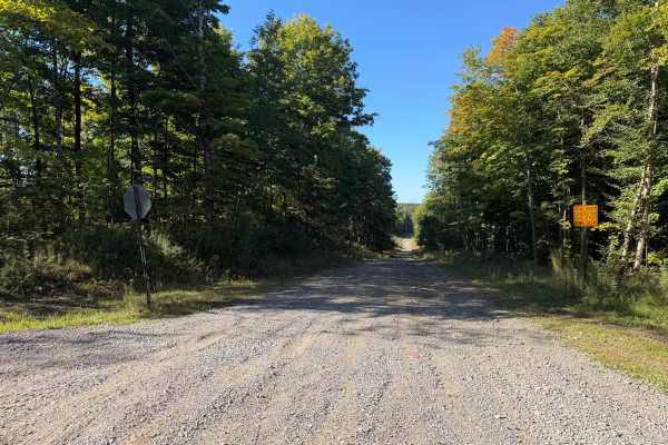
Olin Road
This seasonal road travels along a wide, wooded trail with a mix of maintained gravel, hard-packed dirt, loose stone, and several noticeably rocky sections. Travelers will encounter rolling hills and grades where exposed and embedded rocks create a rough, uneven surface and, at times, off-camber sec...
Learn more about Olin Road
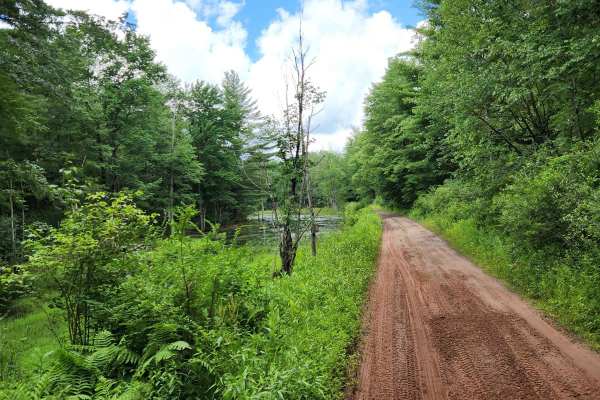
Happy Valley Road
Stony loamy trail connecting Route 26 and Stone Hill Road. The road goes through Happy Valley Wildlife Management Area. There is a pull-off access to Whitney Pond for fishing, hiking, or viewing wildlife. This road is part of the Oswego County ATV club so use caution for oncoming ATV traffic.
Learn more about Happy Valley Road
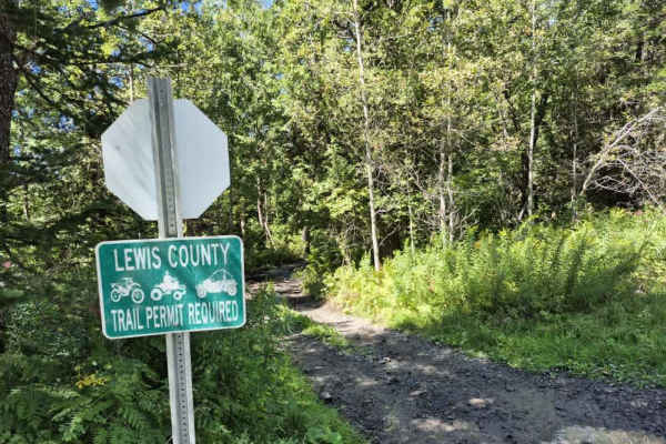
Flat Rock Swamp
Expect to find mudholes, deep ruts, large root systems and off camber waterholes on this trail. Probably the most technical trail on the Lewis County system thus far. A Lewis County permit is required to use this trail. Due to the this trails technical nature its easy to lose track of oncoming traff...
Learn more about Flat Rock Swamp
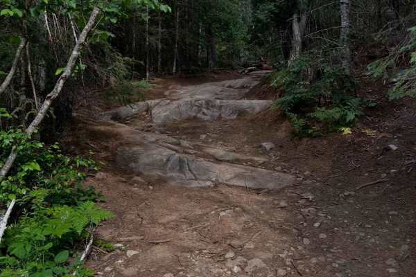
Petroglyph Hydroline
South to North allows the trail to unfold and get more difficult as you progress. This also has you descending the hardest obstacles later on the trail. Starting with the North end will put you through the gauntlet right away; this direction can increase the difficulty on certain obstacles. Near the...
Learn more about Petroglyph Hydroline
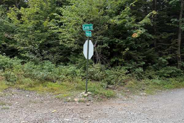
Carey Road
This route follows a maintained gravel road through mostly wooded terrain with a few open areas along the way. Travelers can expect a mix of packed gravel and loose stone terrain, gentle hills, and several curves. There is a narrow bridge located along the route, so use caution and watch for oncomin...
Learn more about Carey Road
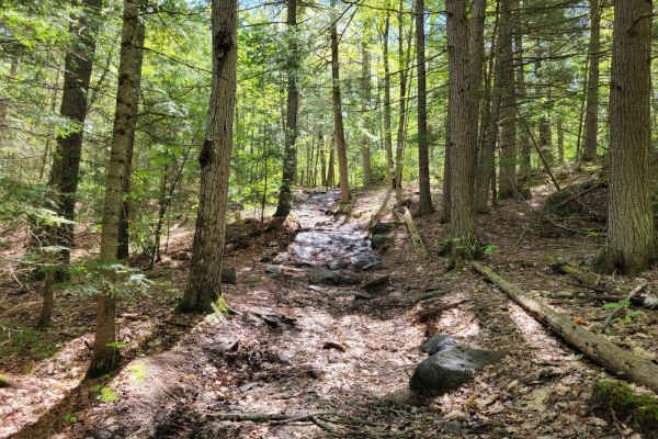
Quinn Loop Backdoor Trail
You start this journey on the Norcan Trail, a fairly simple trail that is mostly a dirt road with some crevasses. As you reach the Quinn Loop Backdoor Trail, things get more exciting with water crossings, boulders, off-camber obstacles, tight trails, and greasy conditions to be expected. A chainsaw ...
Learn more about Quinn Loop Backdoor Trail
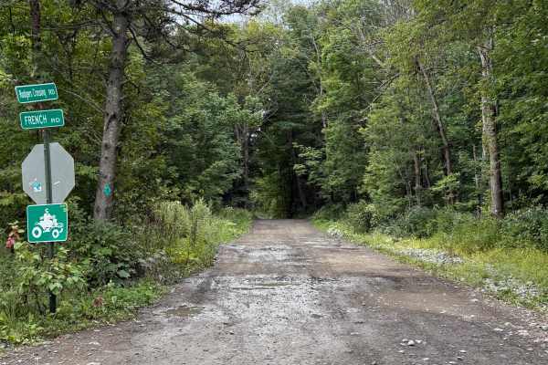
Rodgers Crossing Road
While traveling this seasonal road, you can expect a combination of dirt, gravel, embedded rock, shallow ruts, and numerous mud holes and areas of standing water. Conditions can become considerably wetter and muddier following rain. The route travels through mostly wooded terrain with some open wetl...
Learn more about Rodgers Crossing Road
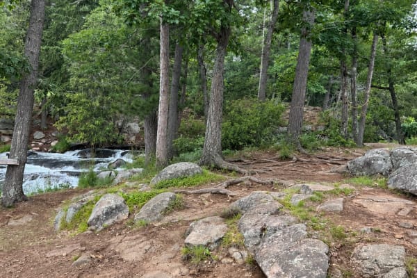
Havelock Belmont Trail
This trail is best suited for high-clearance 4x4 vehicles due to narrow sections, uneven terrain, wet areas, beaver dams, and possible flooding. Water levels can change quickly depending on the season and recent rainfall, making some sections more difficult or impassable. In low water, the route is ...
Learn more about Havelock Belmont Trail
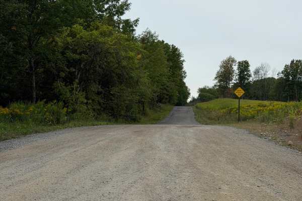
Fykes Road
This route is a well-maintained seasonal road in Lewis County with a mix of gravel and stone terrain. While traveling this route, be aware of posted road signs and use caution when approaching intersections, as both vehicle and ATV traffic may be present. A Lewis County Permit is not required for th...
Learn more about Fykes Road
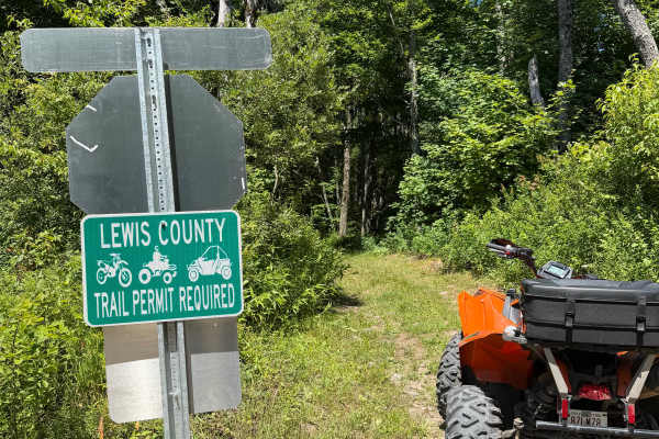
LC HMW-ORFF TRAIL
This route is a rugged two-track with a variety of terrain. Riders will encounter rocky sections, exposed roots, shallow climbs, and several long mud holes that can hold standing water during much of the riding season. While many puddles have bypasses, some water crossings span nearly the entire tra...
Learn more about LC HMW-ORFF TRAIL
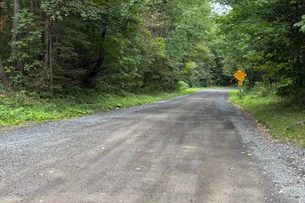
Alger Road
This route is a well-maintained seasonal road in Lewis County and is a mix of gravel and stone terrain. While traveling this route, you will encounter gentle grades and curves along the way, offering plenty of open fields with windmills. A Lewis County Permit is not required to travel this route.
Learn more about Alger Road
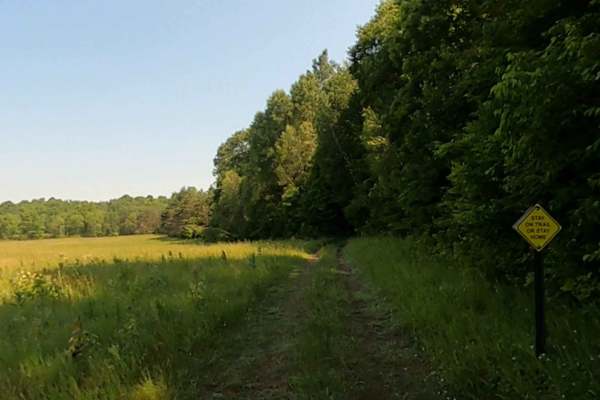
Adirondack ATV Riders Club
This is an ATV access trail to the clubhouse on Vrooman Road off NY State Highway 3 in Harrisville. Club memberships are required for the trails. Access is from the Garrison Road, a town road open to ATV use. There are many side trails on the property to explore.
Learn more about Adirondack ATV Riders Club
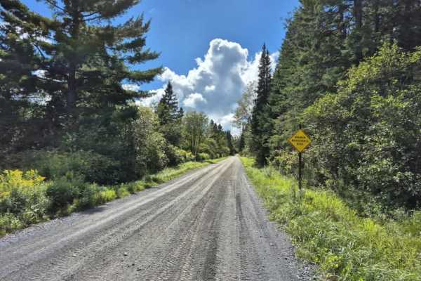
North Road
Expect a very well-maintained seasonal road that is an ATV/SXS highway connecting the southeastern end of the Tughill region's trail system. Expect very dusty conditions if it has not recently rained. A Lewis County permit is not required to ride this seasonal road. Always stay to the right and have...
Learn more about North Road
ATV trails near Bath, Ontario
Explore ATV-friendly trails near you. These trails are accessible for vehicles up to 50 inches wide, perfect for ATVs and smaller off-road machines.
Indian River ATV Club
This is an old railroad bed. Originally, The Sissy Danforth Trail. Purchased and developed for ATVs some 20 years ago. Views of wildlife and nature abound. Lakes, farmland, and wetlands make up the landscape. Some very interesting historical locations along the trail, with some difficult wet, muddy ...
Learn more about Indian River ATV Club
Lingham Hydro Line
One of the most scenic and accessible Hydro cuts around the area. Great option for an adventure that avoids pinstriping and drama. Easy going, with a few water crossings when run in the summer. However, it is one of the trails in the area that you are allowed to run in the winter, which requires bei...
Learn more about Lingham Hydro Line
Lewis County Area A - Green Trail
This is a county parcel with several connecting trails, making for a good day of riding. You can expect narrow, muddy, hilly trails designed for ATVs and 60-inch SxSs. Bridges and tight turns make for some fun riding. Deer are a common sighting. There are open areas for picnics, etc. Lewis County T...
Learn more about Lewis County Area A - Green Trail
Lewis County Area A - Blue Trail
This is a county parcel with several connecting trails, making for a good day of riding. You can expect narrow, muddy, hilly trails designed for ATVs and 60-inch SxSs. Bridges and tight turns make for some fun riding. Deer are a common sighting. There are open areas for picnics, etc.
Learn more about Lewis County Area A - Blue Trail
UTV/side-by-side trails near Bath, Ontario
Find UTV and side-by-side trails near you. These trails accommodate vehicles up to 60 inches wide, ideal for UTVs, side-by-sides, and wider off-road rigs.
Indian River ATV Club
This is an old railroad bed. Originally, The Sissy Danforth Trail. Purchased and developed for ATVs some 20 years ago. Views of wildlife and nature abound. Lakes, farmland, and wetlands make up the landscape. Some very interesting historical locations along the trail, with some difficult wet, muddy ...
Learn more about Indian River ATV Club
Lingham Hydro Line
One of the most scenic and accessible Hydro cuts around the area. Great option for an adventure that avoids pinstriping and drama. Easy going, with a few water crossings when run in the summer. However, it is one of the trails in the area that you are allowed to run in the winter, which requires bei...
Learn more about Lingham Hydro Line
Lewis County Area A - Green Trail
This is a county parcel with several connecting trails, making for a good day of riding. You can expect narrow, muddy, hilly trails designed for ATVs and 60-inch SxSs. Bridges and tight turns make for some fun riding. Deer are a common sighting. There are open areas for picnics, etc. Lewis County T...
Learn more about Lewis County Area A - Green Trail
Lewis County Area A - Blue Trail
This is a county parcel with several connecting trails, making for a good day of riding. You can expect narrow, muddy, hilly trails designed for ATVs and 60-inch SxSs. Bridges and tight turns make for some fun riding. Deer are a common sighting. There are open areas for picnics, etc.
Learn more about Lewis County Area A - Blue Trail
The onX Offroad Difference
onX Offroad combines trail photos, descriptions, difficulty ratings, width restrictions, seasonality, and more in a user-friendly interface. Available on all devices, with offline access and full compatibility with CarPlay and Android Auto. Discover what you're missing today!
Open Trail Map