
Dirt Bike Trails
Near Aldrich, Missouri
Explore All Dirt Bike Trails Near Aldrich, Missouri
Dirt Bike Trails Near Aldrich, Missouri
Discover the best dirt bike trails near you. Browse trail maps, check difficulty ratings, and find your next adventure — whether you're looking for a quick ride or an all-day expedition.
129
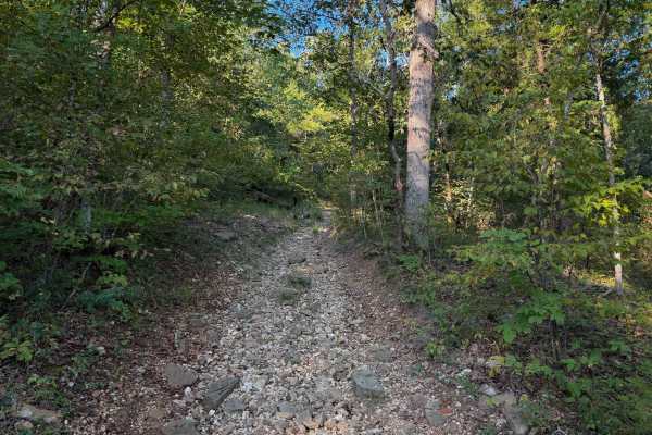
Chadwick Trail 129 is mostly a gradual climb from north to south, gaining about 260 feet in elevation over .8 miles. It’s a very narrow trail traversing up a hillside, with lots of chunky loose rock and slabs of rock. There are roots sticking out and tree gaps that would likely be quite narrow for a...
Learn more about 129
126
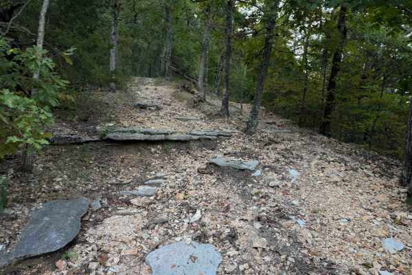
Chadwick Trail 126 is a 3-mile-long route through the Chadwick Motorized Trail System through a forest of hickory and oak. Going clockwise, it starts off Trail 101, just west of the KC Pavilion Trailhead. The route is mostly gradual, but it has several rock features that make it more of an intermedi...
Learn more about 126
140
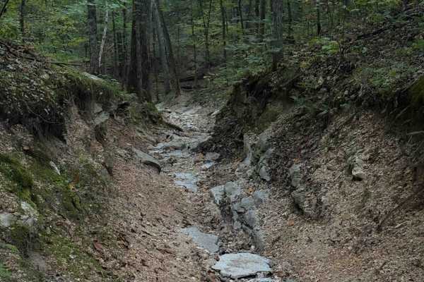
Chadwick Trail 140 starts at the KC Pavilion Trailhead. Riding clockwise, it starts as a narrow trail, more like a single track, going through a ravine covered in a layer of small, loose shale-like rocks all packed down into the ravine. It’s like riding in a V-bottom trough between mossy and rooty h...
Learn more about 140
132a
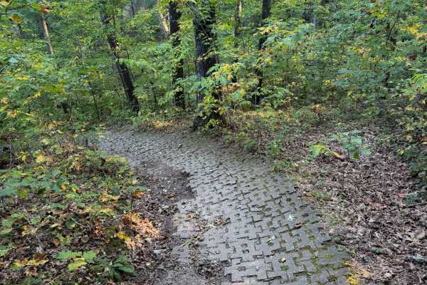
Chadwick Trail 132a is a 1.1-mile-long ATV trail that connects Trail 130 to the intersection with Trails 131 and 132. It mostly weaves through a tight forest on a narrow dirt path with minor loose rock and roots. There are cinder blocks reinforcing the path at times to prevent erosion, and the trail...
Learn more about 132a
130
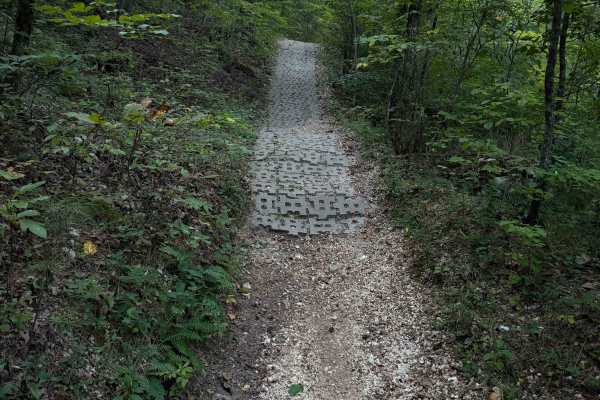
Chadwick Trail 130 makes a 1.2-mile loop off of Lookout Road in the Chadwick Motorized Trail System. Going clockwise, it starts off as a narrow ATV trail weaving through a tight forest above a ravine. It enters the ravine, riding on packed-down small loose rocks. This will likely be very tight for A...
Learn more about 130
Lookout Road
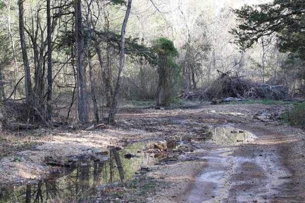
Lookout Road is a scenic, moderately challenging 3.5-mile unpaved route through the Mark Twain National Forest's Chadwick Motorcycle and ATV Recreation Area. Starting near Cobb Ridge Campground, the dirt and gravel road winds along forested ridges and hollows in southwest Missouri, with elevations r...
Learn more about Lookout Road
Schneider Hollow
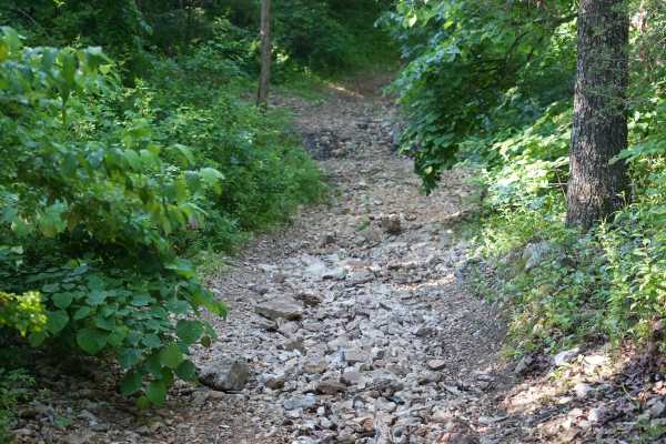
This is a very steep hill with loose rocks and no large ledges. Near the top, there is an off-camber turn, and the upper section of the trail remains off-camber. The trail can be very slippery after rain, with washed-out sections reaching 1 to 2 feet deep in places.
Learn more about Schneider Hollow
Will Power Hill
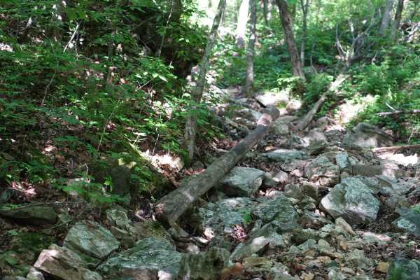
This trail starts with a sizable rock garden where 15 inches of clearance on 35-inch Rockzillas still resulted in frame contact. After the rock garden, the climb becomes steep quickly with loose rocks, sand, and gravel. A 74-inch-wide SXS can make it through, though some sections are tight. Any ledg...
Learn more about Will Power Hill
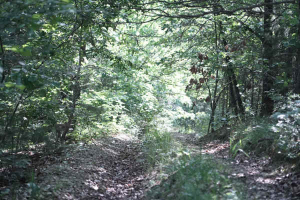
East Ridge Loop
This trail features a steep climb with loose rocks and small rock ledges, along with tight, off-camber turns and deep ruts. The trail is heavily overgrown in several areas, making the route difficult to follow at times. A 74-inch-wide machine can make it through, but some sections are very tight and...
Learn more about East Ridge Loop
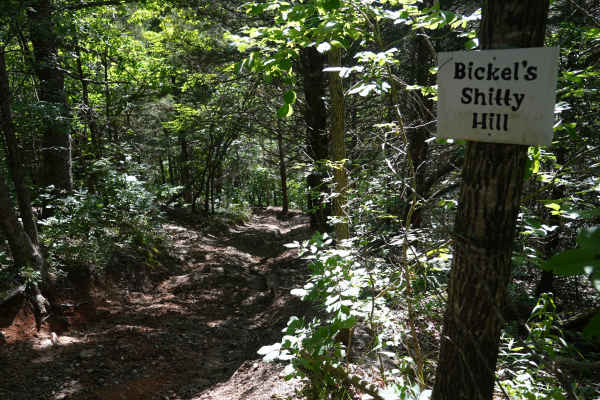
Bickel's Shitty Hill
This is a very steep dirt and mud hill with tight, off-camber turns, deep ruts, and a 15-inch rock ledge. Several lines are available, allowing drivers to choose which obstacles to tackle or avoid. A SXS on 35-inch Rockzillas with 15 inches of clearance required multiple attempts in some areas after...
Learn more about Bickel's Shitty Hill
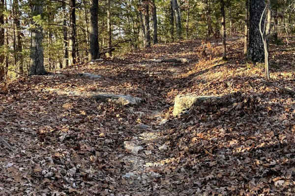
Blue Ridge Road
Blue Ridge Road is a spur offering additional access to Mark Twain National Forest. This route eventually dissolves into no discernible trail and should be considered an out-and-back. The route is characterized by heavy foliage and some chunky rocks scattered throughout, including a rock step sectio...
Learn more about Blue Ridge Road
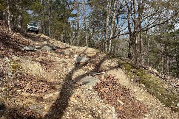
Devreaux Ridge Road Cave
This is a short trail that branches off the Devreaux Ridge Road trail. It starts pretty smooth, but soon approaches a few drops (approximately 10 inches). It will then lead to a small cave that sits on a hill. Make sure you stop to check it out. After that, you will go through some tight turns, and ...
Learn more about Devreaux Ridge Road Cave
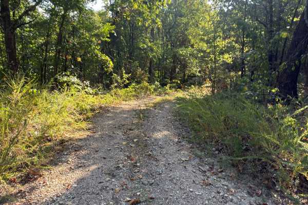
Bright Ridge - FS 548
This is an easy in-and-out trail that can become rutted after a hard rain; expect to encounter fallen limbs and heavy brush. Watch where you are going, as there are a lot of illegal trails that branch off of this trail. At the end of the trail, it appears to keep going, but this is a Forrest Servi...
Learn more about Bright Ridge - FS 548
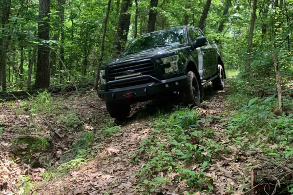
Williams Branch
Williams Branch Forest Road 1157 is a narrow-overgrown trail that varies in elevation between pine forests on the ridges to thick hardwoods in the lower areas. Passing by the marked campsite the trail becomes narrower and more overgrown. Expect pinstripes on a full-size rig. 4Low is highly recommend...
Learn more about Williams Branch
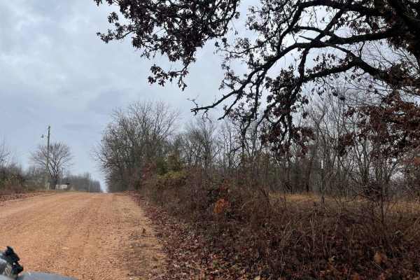
Ozark to Nettle
Enjoy some of Neosho's beautiful hidden scenery as you travel down this lovely dirt trail. This trail is another easy one for the area, there are no obstacles to overcome nor are there any branches or trees sticking out that will damage your rig. This can easily be completed with any of the other tr...
Learn more about Ozark to Nettle
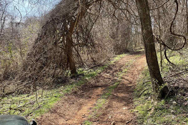
J&D Off-Road Park Chat Trail
This trail is located inside J&D off-road park. It is $25 to enter and that is good for the whole day. This trail begins with a rocky incline that is easily achieved in a 2WD drive. As you continue down the trail, you'll have the opportunity to go through some mud holes, after heavy rains they get ...
Learn more about J&D Off-Road Park Chat Trail

FR 1182
This trail will take you from 76 to Farm Road 2185. The first half starts easy with little to no obstacles. Various parts have brush and bendy branches coming onto the trail, so some scratches on your rig can be expected. This trail is heavily wooded with no camping spots along it. Towards the middl...
Learn more about FR 1182
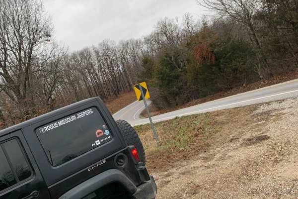
FR 1180 (Left Fork)
This is the perfect trail if you are looking to get out and enjoy the Mark Twain National Forest. This trail is very straightforward and can be easily completed solo. 4WD is not needed as this does not have any obstacles and the trail is very well maintained. There are some spots where it is a littl...
Learn more about FR 1180 (Left Fork)
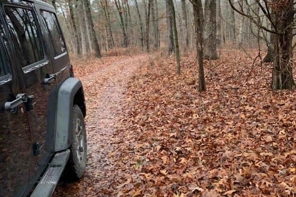
FR 1181 to Scroggins Ridge
If entering from 76, this trail will be on the right side of the fork and starts off easy, but if entering from Scroggins, the trail starts off difficult. This trail offers some gorgeous views of the Mark Twain National Forest. There are no spots to camp along this trail nor are there any clearings ...
Learn more about FR 1181 to Scroggins Ridge
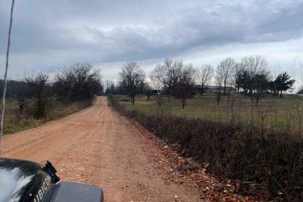
Palm Dirt Road
Ready to take a quick break after a long day? Look no further than Palm Road, the perfect dirt road that will curb your craving of going off road. This road is great at any time of year and is the perfect trail for any skill level. This road can be accessed by all vehicle types.
Learn more about Palm Dirt Road
ATV trails near Aldrich, Missouri
Explore ATV-friendly trails near you. These trails are accessible for vehicles up to 50 inches wide, perfect for ATVs and smaller off-road machines.
129
Chadwick Trail 129 is mostly a gradual climb from north to south, gaining about 260 feet in elevation over .8 miles. It’s a very narrow trail traversing up a hillside, with lots of chunky loose rock and slabs of rock. There are roots sticking out and tree gaps that would likely be quite narrow for a...
Learn more about 129
126
Chadwick Trail 126 is a 3-mile-long route through the Chadwick Motorized Trail System through a forest of hickory and oak. Going clockwise, it starts off Trail 101, just west of the KC Pavilion Trailhead. The route is mostly gradual, but it has several rock features that make it more of an intermedi...
Learn more about 126
140
Chadwick Trail 140 starts at the KC Pavilion Trailhead. Riding clockwise, it starts as a narrow trail, more like a single track, going through a ravine covered in a layer of small, loose shale-like rocks all packed down into the ravine. It’s like riding in a V-bottom trough between mossy and rooty h...
Learn more about 140
132a
Chadwick Trail 132a is a 1.1-mile-long ATV trail that connects Trail 130 to the intersection with Trails 131 and 132. It mostly weaves through a tight forest on a narrow dirt path with minor loose rock and roots. There are cinder blocks reinforcing the path at times to prevent erosion, and the trail...
Learn more about 132a
UTV/side-by-side trails near Aldrich, Missouri
Find UTV and side-by-side trails near you. These trails accommodate vehicles up to 60 inches wide, ideal for UTVs, side-by-sides, and wider off-road rigs.
Lookout Road
Lookout Road is a scenic, moderately challenging 3.5-mile unpaved route through the Mark Twain National Forest's Chadwick Motorcycle and ATV Recreation Area. Starting near Cobb Ridge Campground, the dirt and gravel road winds along forested ridges and hollows in southwest Missouri, with elevations r...
Learn more about Lookout Road
Schneider Hollow
This is a very steep hill with loose rocks and no large ledges. Near the top, there is an off-camber turn, and the upper section of the trail remains off-camber. The trail can be very slippery after rain, with washed-out sections reaching 1 to 2 feet deep in places.
Learn more about Schneider Hollow
Will Power Hill
This trail starts with a sizable rock garden where 15 inches of clearance on 35-inch Rockzillas still resulted in frame contact. After the rock garden, the climb becomes steep quickly with loose rocks, sand, and gravel. A 74-inch-wide SXS can make it through, though some sections are tight. Any ledg...
Learn more about Will Power Hill
East Ridge Loop
This trail features a steep climb with loose rocks and small rock ledges, along with tight, off-camber turns and deep ruts. The trail is heavily overgrown in several areas, making the route difficult to follow at times. A 74-inch-wide machine can make it through, but some sections are very tight and...
Learn more about East Ridge Loop
The onX Offroad Difference
onX Offroad combines trail photos, descriptions, difficulty ratings, width restrictions, seasonality, and more in a user-friendly interface. Available on all devices, with offline access and full compatibility with CarPlay and Android Auto. Discover what you're missing today!
Open Trail Map