
Beginner Off-Road Trails
Near Western Grove, Arkansas
Explore All Beginner Trails Near Western Grove, Arkansas
Beginner Off-Road Trails Near Western Grove, Arkansas
Discover the best beginner-friendly off-road trails near you. These easier, lower-rated trails are a great place to start — browse trail maps, check difficulty ratings, and find your next adventure.
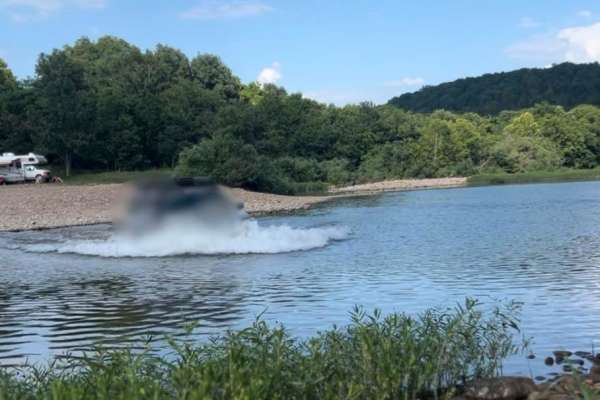
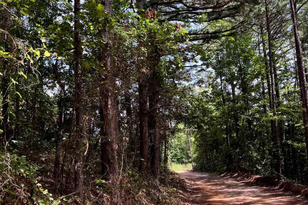
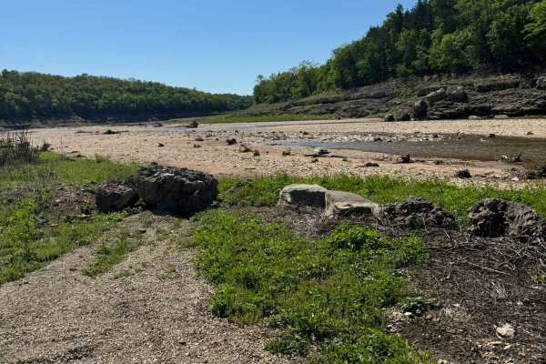
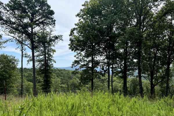
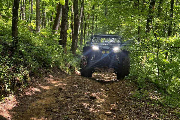
Flat Woolum
Starting off near Flat Arkansas, you make your way North towards Mt. Hersey and then follow the main gravel road down to Woolum. Please keep in mind of the water crossings and make sure to check water levels at all water crossings. Rain can change these crossings and water can be deep at certain tim...
Learn more about Flat Woolum
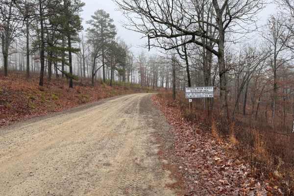
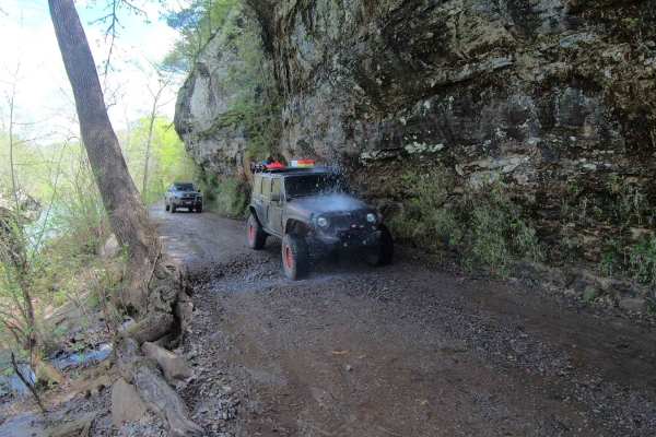
Old River Road
Old River Road is an enjoyable scenic drive through the Buffalo National River Wildlife Management Area. It features high mountain views, many creek crossings in the wet season, historic homesteads, campgrounds, and Buffalo River access points. The road varies in width and roughness with loose grave...
Learn more about Old River Road
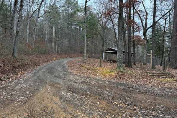
Erbie Campground Road
This is an easy gravel road that has many points of interest. There are scenic views of the mountains and a few water crossings to get to connecting roads. If coming from Highway 7, you will reach the Koen Interpretive Trail first. Then, you will come across an area on the right to pull over. Liles ...
Learn more about Erbie Campground Road
Tylers Bend View
This is a beautiful scenic drive from Snowball, Arkansas to Tylers Bend Campground at the Buffalo National River. The trail follows along the roads Searcy County 13, Gateway Road, and Peter Cave Road. The beautiful views of the Buffalo River and Ozarks surround you once you turn onto Peter Cave Road...
Learn more about Tylers Bend View
Valley of Peace
This is a beautiful Scenic backcountry driving through the Ozark National Forest. This is a great connection road for the area and it has stunning views. The trail starts off of Highway 123 by "Dick Knob" and makes its way through what is named the Valley of Peace. A sign on the road will show that ...
Learn more about Valley of Peace
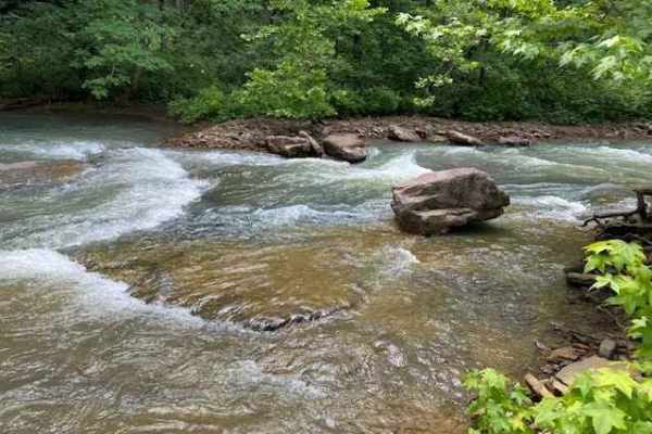
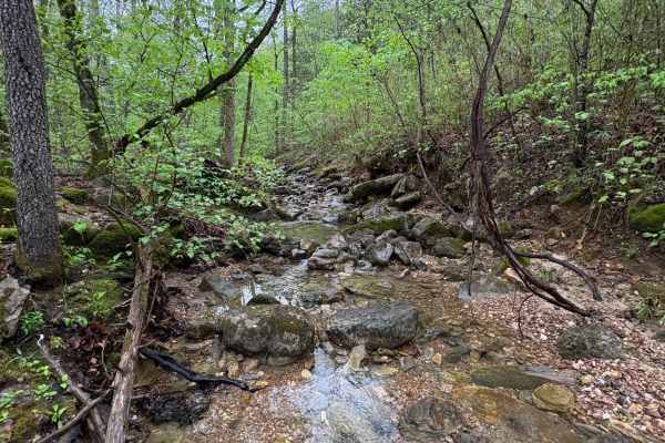
Falling Water Road
Falling Water Road is a relaxing dirt road that runs along the eastern border of the Richland Creek Wilderness Area, and also follows Falling Water Creek. The most photographed waterfall in Arkansas, Falling Water Falls, is located at the southernmost point of the route. You can expect to find over ...
Learn more about Falling Water Road
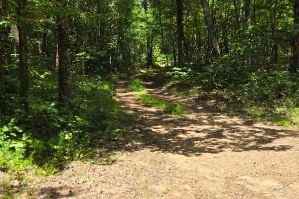
Sulphur Road
Sulphur Road is a fun trail that weaves through the Ozark National Forest. This trail features mild terrain that may require 4WD. Along this route, you will find a few small dispersed campsites with fire rings, as well as a shallow water crossing on the south end of the trail.
Learn more about Sulphur Road
Mincy Food Plot Row
This trail leads to the food plots and walking trails on the west side of Bee Creek in the Drury-Mincy Conservation Area. About three-quarters of the trail is an easy off-road drive, though there may be water crossings after recent rain. If you enter from the north, be aware that during high water, ...
Learn more about Mincy Food Plot Row
Mincy Bee Creek Trail
This is a maintained gravel road with several low-water crossings that may appear shallower than they actually are, so use caution. The road continues uphill and dead-ends in the woods; it is not advisable to drive all the way to the dead end. When the lake level is low, there is plenty of room to t...
Learn more about Mincy Bee Creek Trail
Spring Creek Falls
This trail is located on the eastern side of the Ozark National Forrest. This trail shares the side of the Ozark National Forrest and one side with the Leatherwood Wilderness Management area. Use caution, as well as always double-check MVUM to be sure you are on the correct trail, as Leatherwood Wil...
Learn more about Spring Creek Falls
Victor Road
Victor Road is a very well-maintained gravel road that sits between Highway 7 and Old Highway 27. The end closer to Old Highway 27 does have residential houses on either side of the road. There is a handful of dispersed camping sites once you pass Brock Cemetery and cross over the bridge that sits a...
Learn more about Victor Road
1000A - Brock Cemetery
Forest Service Road 1000A leads you from Victor Road down to Brock Cemetery. Once the first grave was there, the site became a community cemetery and has been ever since. The small stones you see in the background behind the Victory B. Keithley grave are graves of loved ones whose families could aff...
Learn more about 1000A - Brock Cemetery
Walnut Ridge Connector
Coming off of Highway 16 onto "Road 1264" you will be met with a very rocky road. This is a newer road however, it is extremely bumpy and rocky driving. The road can get very muddy after a good rain and can be slick in some spots going downhill.
Learn more about Walnut Ridge Connector
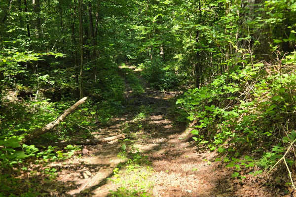
FS 93201B
This trail starts off County Road 1802. The trail has several shallow mud holes with no bypasses, but they cross easily. There is one deeper mud hole that does have a bypass. This trail gets really tight with trees and overgrown vegetation. There are a few downed logs that are crossable.
Learn more about FS 93201B
Carwash Falls
One of the most popular places to visit is the Ozark National Forest. This route runs north and south along the Big Piney Creek and offers abundant scenery and numerous places to camp along the way. You can expect to see wildlife such as bears and bald eagles along this route.
Learn more about Carwash Falls
FS 93201E
This trail connects FS 93201C to FS 93201G. This trail was very overgrown, and several fallen trees. Some of the trees are able to be driven over, and the others have bypasses. This trail has several small creek crossings. There is loose rock along a few portions of this trail.
Learn more about FS 93201E
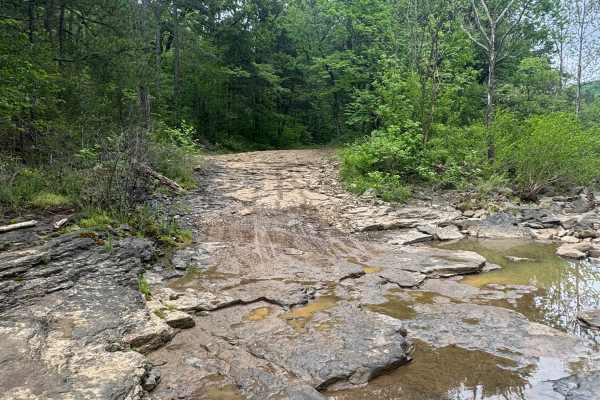
NFS 93216B
NFS 93216B, going west, begins at 93069A, which parallels the North Fork of the Illinois Bayou. The first 1/8-mile is flat, then quickly starts a climb with a few switchbacks and some off-camber sections. The trail is made up of large, loose rock and dirt and is narrow with no place to pass until yo...
Learn more about NFS 93216B
Barkshed Road
This trail offers a rewarding experience for those seeking both adventure and some of the best dispersed camping in this part of the Ozarks. It begins as a wide, smooth, and well-maintained road, but once past the trailhead, the terrain quickly becomes more challenging and engaging. Drivers will enc...
Learn more about Barkshed Road
Baxter 114
This route begins as a well maintained graded county gravel road winding through dense hardwood forest and rolling Ozark hills. The road is generally wide enough for two vehicles to pass comfortably, with long sightlines, gentle curves, and occasional elevation changes. Along the route, the scenery ...
Learn more about Baxter 114
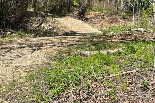
91033C
This is an easy out-and-back forest route that can also be used to access sections of the Ozark Highlands Hiking Trail. The trail winds through dense hardwood forest, narrow tree-lined corridors, and a few open grassy clearings that provide brief views before the route disappears back into the timbe...
Learn more about 91033C
Beginner ATV trails near Western Grove, Arkansas
Explore ATV-friendly trails near you. These trails are accessible for vehicles up to 50 inches wide, perfect for ATVs and smaller off-road machines.
Flat Woolum
Starting off near Flat Arkansas, you make your way North towards Mt. Hersey and then follow the main gravel road down to Woolum. Please keep in mind of the water crossings and make sure to check water levels at all water crossings. Rain can change these crossings and water can be deep at certain tim...
Learn more about Flat Woolum
Sulphur Road
Sulphur Road is a fun trail that weaves through the Ozark National Forest. This trail features mild terrain that may require 4WD. Along this route, you will find a few small dispersed campsites with fire rings, as well as a shallow water crossing on the south end of the trail.
Learn more about Sulphur Road
Mincy Food Plot Row
This trail leads to the food plots and walking trails on the west side of Bee Creek in the Drury-Mincy Conservation Area. About three-quarters of the trail is an easy off-road drive, though there may be water crossings after recent rain. If you enter from the north, be aware that during high water, ...
Learn more about Mincy Food Plot Row
Mincy Bee Creek Trail
This is a maintained gravel road with several low-water crossings that may appear shallower than they actually are, so use caution. The road continues uphill and dead-ends in the woods; it is not advisable to drive all the way to the dead end. When the lake level is low, there is plenty of room to t...
Learn more about Mincy Bee Creek Trail
Beginner UTV/side-by-side trails near Western Grove, Arkansas
Find UTV and side-by-side trails near you. These trails accommodate vehicles up to 60 inches wide, ideal for UTVs, side-by-sides, and wider off-road rigs.
Flat Woolum
Starting off near Flat Arkansas, you make your way North towards Mt. Hersey and then follow the main gravel road down to Woolum. Please keep in mind of the water crossings and make sure to check water levels at all water crossings. Rain can change these crossings and water can be deep at certain tim...
Learn more about Flat Woolum
Sulphur Road
Sulphur Road is a fun trail that weaves through the Ozark National Forest. This trail features mild terrain that may require 4WD. Along this route, you will find a few small dispersed campsites with fire rings, as well as a shallow water crossing on the south end of the trail.
Learn more about Sulphur Road
Mincy Food Plot Row
This trail leads to the food plots and walking trails on the west side of Bee Creek in the Drury-Mincy Conservation Area. About three-quarters of the trail is an easy off-road drive, though there may be water crossings after recent rain. If you enter from the north, be aware that during high water, ...
Learn more about Mincy Food Plot Row
Mincy Bee Creek Trail
This is a maintained gravel road with several low-water crossings that may appear shallower than they actually are, so use caution. The road continues uphill and dead-ends in the woods; it is not advisable to drive all the way to the dead end. When the lake level is low, there is plenty of room to t...
Learn more about Mincy Bee Creek Trail
The onX Offroad Difference
onX Offroad combines trail photos, descriptions, difficulty ratings, width restrictions, seasonality, and more in a user-friendly interface. Available on all devices, with offline access and full compatibility with CarPlay and Android Auto. Discover what you're missing today!
Open Trail Map