
Beginner Off-Road Trails
Near West Point, Utah
Explore All Beginner Trails Near West Point, Utah
Beginner Off-Road Trails Near West Point, Utah
Discover the best beginner-friendly off-road trails near you. These easier, lower-rated trails are a great place to start — browse trail maps, check difficulty ratings, and find your next adventure.

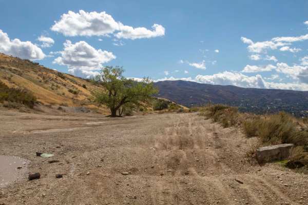
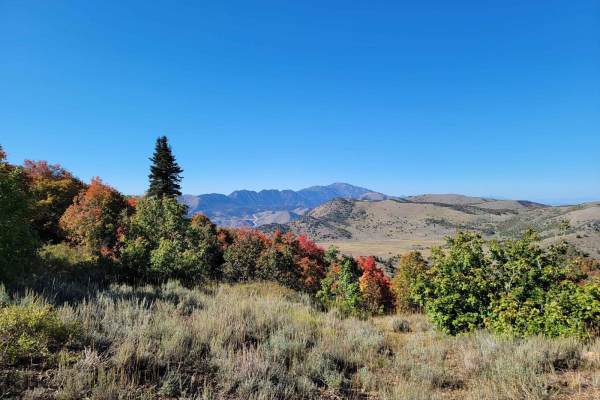
Farmington Firebreak Road
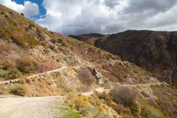
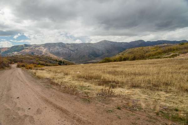
This is a short firebreak road that starts at the base of Farmington Canyon and dead ends shortly after a creek crossing. There are signs at the trailhead warning about a gate ahead, but this doesn't mean the road is closed; it just means you can't drive to the road that is after the gate. This trai...
Learn more about Farmington Firebreak Road
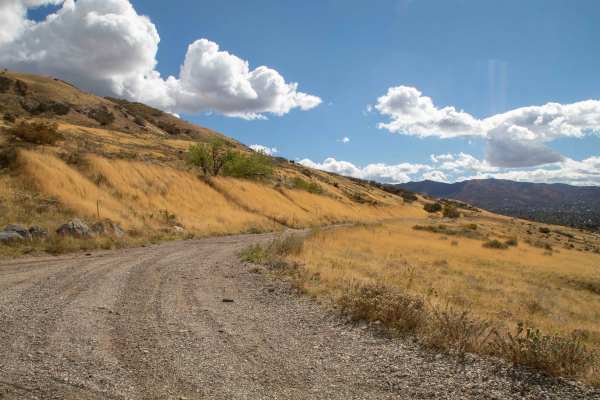
Farmington Canyon Trail
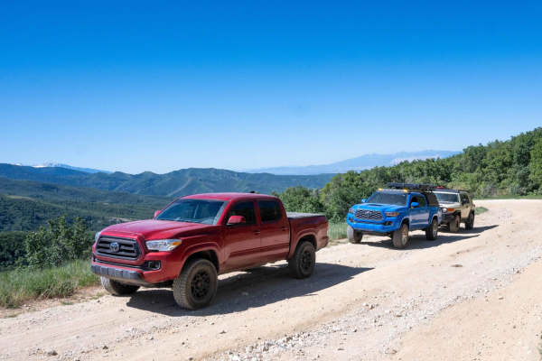
This trail is an easy well maintained road that starts in Farmington and heads up the canyon to where it ends at the start of Francis Peak Road and Skyline Drive. This trail stays about 2 vehicles wide but some spots may require larger vehicles to back up in order to find a good place to pass and ca...
Learn more about Farmington Canyon Trail
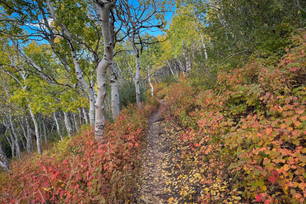
Coldwater Peak (6087)
Coldwater Peak is a short single-track trail that connects Skyline South and Lewis Peak trails. It runs west to east and side-hills across one of the peaks in this area. The track is very narrow without much room for picking a line. The plants along the trail are mostly short, but in some areas, tre...
Learn more about Coldwater Peak (6087)
Francis Peak Road (FS 009)
Francis Peak Road continues up from the intersection of Farmington Canyon Road and Skyline Drive. The route is very scenic, as you will have views from both sides of the mountain. Along the route, you will see multiple areas for camping. There are also two large areas for group parking that include ...
Learn more about Francis Peak Road (FS 009)
South Duel Creek Trail
This trail is a short spur off of Centerville Firebreak Road that leads you to the Offroad Bowl Trails as well as the trailhead for South Duel Creek hiking trail. This trail is easy with the surface consisting of gravel for the entire length. There is an optional obstacle at the final turn before yo...
Learn more about South Duel Creek Trail
Centerville Offroad Bowl Upper Trail
This trail follows the west rim of the Centerville Offroad Bowl. The upper trail is tight in some spots and has a couple of spots that are off-camber. This upper section is a good bypass for the sections of the lower bowl that are filled with mud too deep to traverse, but the surface is covered in w...
Learn more about Centerville Offroad Bowl Upper Trail
Centerville Offroad Bowl Return
This trail takes you from the South end of the Offroad Bowl and loops around the outside back to South Duel Creek Trail. This trail is relatively tame as it follows the hillside with only a couple of spots that may cause difficulty, those being the exit/entrance from the bowl being tight, and a spot...
Learn more about Centerville Offroad Bowl Return
Centerville Firebreak Road
Centerville Firebreak Road runs from Bountiful to Farmington, following the benches above the neighborhoods. It is an easy, scenic drive that makes for a great short trip between Ward and Farmington Canyons. The road runs along the benches, staying high enough to overlook the valley and Antelope Isl...
Learn more about Centerville Firebreak Road
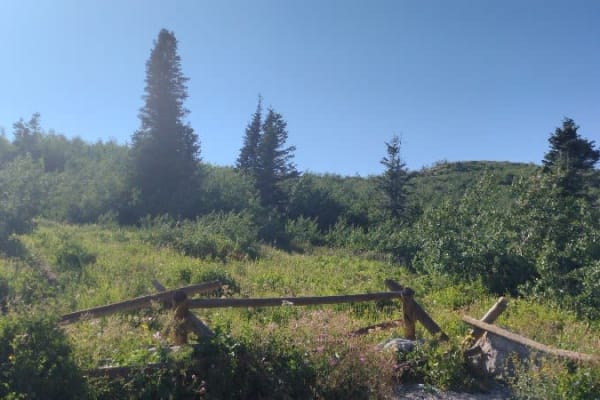
Parish Creek
This short trail branches off of Skyline Drive and runs basically parallel to it, heading down to Parish Creek. This trail is an easy scenic drive through the trees, with the only real worry being the overgrown bushes along the sides of the trail and a few low-hanging branches. This trail is open fr...
Learn more about Parish Creek
Liberty Avon Road
The Liberty-Avon Road is a great little off-road drive. This makes a scenic alternative between Ogden and Logan if you have extra time. It offers nice scenery and few different recreation options. This is also easily driven with a visit to Powder Mountain, which is also extremely scenic. The road is...
Learn more about Liberty Avon Road
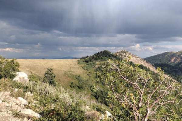
Upper Ward Canyon Road
This is a continuation of the lower Ward Canyon Road. It continues winding up the mountainside with amazing views off of the side of the road. The trail has a few ruts and small rock gardens but there shouldn't be any issues getting any car up here. At the top, you get a view out to the west and the...
Learn more about Upper Ward Canyon Road
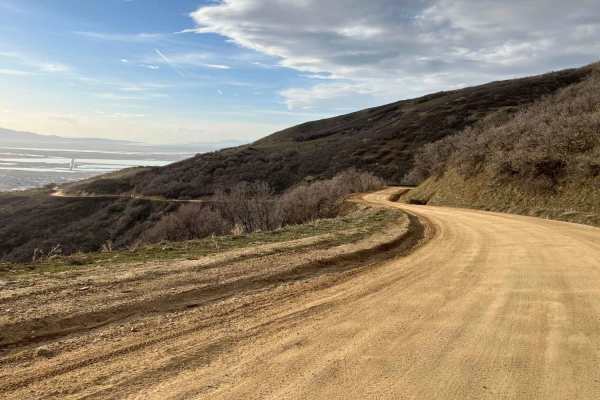
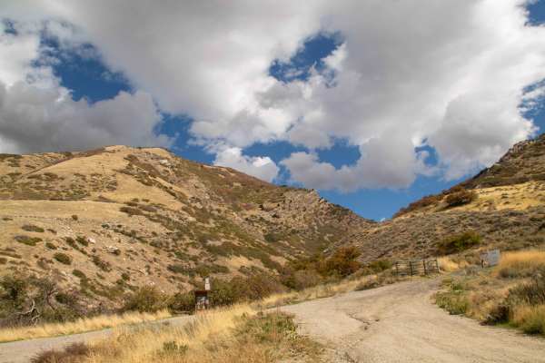
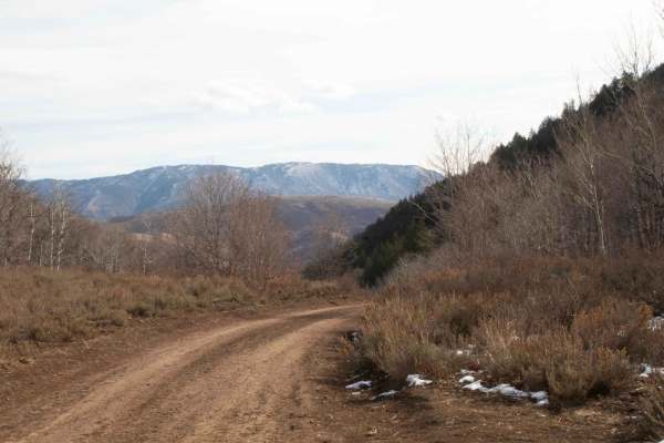
Ward Canyon Road
This is a well-maintained packed dirt and gravel road which takes you to the Old Ward Canyon camping and target practice site. The route starts at the Skyline Drive trailhead below the bountiful "B" on the hillside. There are several pull-offs along the way which give great views of Salt Lake and An...
Learn more about Ward Canyon Road
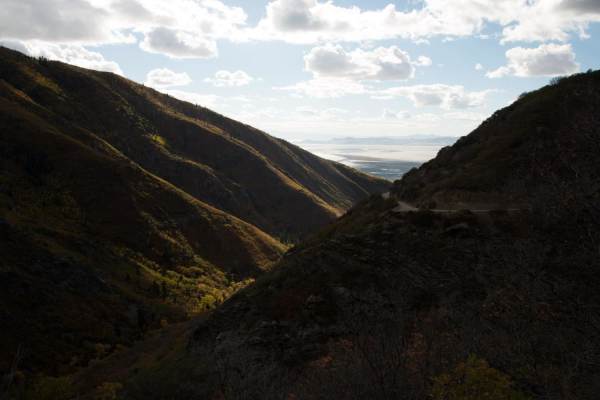
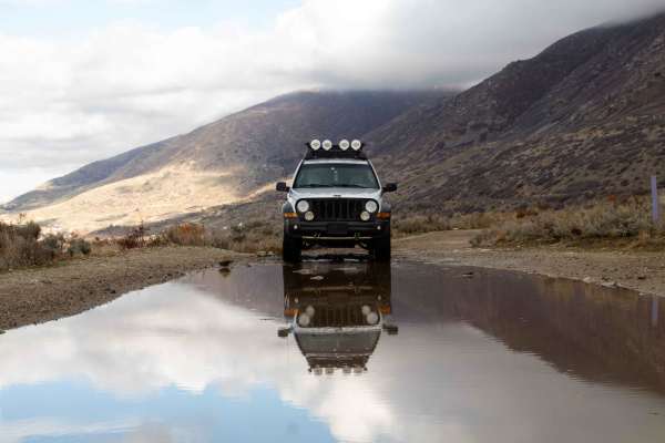
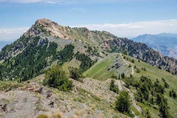
Skyline Drive
This is an easy dirt road with some steep drop offs on the west side of the trail. The gates to this trail close November through March, as high elevation snow makes it impassable. Springtime you may encounter snow or muddy spots. Best time is mid summer and fall. Once dry, the trail is very easy. T...
Learn more about Skyline Drive
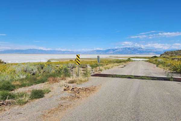
Southeast Promontory Road
This is a scenic drive that follows along shore of the Great Salt Lake and the Promontory Mountains in the high desert of Box Elder County down to the railroad causeway that splits the lake in half. All street-legal vehicles are capable of completing this road. There is nowhere to camp along this tr...
Learn more about Southeast Promontory Road
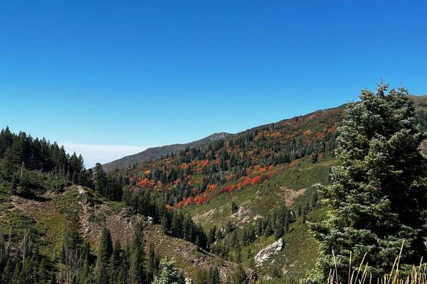
Sessions Mountain Road
This is a beautiful drive through the pine and aspen trees, with a few areas that have some dry camping spots. The road is mostly gravel with areas of rough rock. There are a few areas that have some rutted erosion running down, it but is easy to stay on top of it and not get in the ruts. This road ...
Learn more about Sessions Mountain Road
North Holbrook FS 1629
This is an out-and-back easy trail. It goes over to a small turnaround viewpoint. For larger vehicles, you will need to park here and walk the next 100 feet to the second viewpoint. ATVs and motorcycles can continue on the trail to the small turnaround and viewpoint. There is a small trail that take...
Learn more about North Holbrook FS 1629
North Park
North Park near Bountiful, Utah, is a great beginner-friendly trail for dirt bikers. Starting from the parking lot, you follow a 4x4 road up to the North Park single-track trailhead. The trail is relatively easy to handle, with gradual climbs and smooth sections, making it perfect for new or experie...
Learn more about North Park
Three Mile Canyon Trail
This is a small hunting trail that cuts through the mountains to Avon Pass. It's very narrow in several spots, which makes passing other vehicles near impossible. It's mainly used by 4-wheelers and hunters. The trail is only open from July 15th to November 15th. It goes through private land, so if y...
Learn more about Three Mile Canyon Trail
Three Mile Canyon
This is an easy trail that starts from Liberty Avon Road and goes to Three Mile Canyon Trail. This road is closed for the winter on November 15th and opens on June 15th but may have a delayed opening depending on when they open Liberty Avon Road. This trail is one vehicle wide with pullouts to pass....
Learn more about Three Mile Canyon
Inspiration Point
This is an awesome drive. You will need a high clearance vehicle due to rocks, but 4x4 is not necessary. This road gets very tight and very high and if you aren't experienced in off-road driving, or if serious heights worry you, this probably is not the road for you. If you are ok with that then thi...
Learn more about Inspiration Point
Beginner ATV trails near West Point, Utah
Explore ATV-friendly trails near you. These trails are accessible for vehicles up to 50 inches wide, perfect for ATVs and smaller off-road machines.
Farmington Firebreak Road
This is a short firebreak road that starts at the base of Farmington Canyon and dead ends shortly after a creek crossing. There are signs at the trailhead warning about a gate ahead, but this doesn't mean the road is closed; it just means you can't drive to the road that is after the gate. This trai...
Learn more about Farmington Firebreak Road
Farmington Canyon Trail
This trail is an easy well maintained road that starts in Farmington and heads up the canyon to where it ends at the start of Francis Peak Road and Skyline Drive. This trail stays about 2 vehicles wide but some spots may require larger vehicles to back up in order to find a good place to pass and ca...
Learn more about Farmington Canyon Trail
Francis Peak Road (FS 009)
Francis Peak Road continues up from the intersection of Farmington Canyon Road and Skyline Drive. The route is very scenic, as you will have views from both sides of the mountain. Along the route, you will see multiple areas for camping. There are also two large areas for group parking that include ...
Learn more about Francis Peak Road (FS 009)
South Duel Creek Trail
This trail is a short spur off of Centerville Firebreak Road that leads you to the Offroad Bowl Trails as well as the trailhead for South Duel Creek hiking trail. This trail is easy with the surface consisting of gravel for the entire length. There is an optional obstacle at the final turn before yo...
Learn more about South Duel Creek Trail
Beginner UTV/side-by-side trails near West Point, Utah
Find UTV and side-by-side trails near you. These trails accommodate vehicles up to 60 inches wide, ideal for UTVs, side-by-sides, and wider off-road rigs.
Farmington Firebreak Road
This is a short firebreak road that starts at the base of Farmington Canyon and dead ends shortly after a creek crossing. There are signs at the trailhead warning about a gate ahead, but this doesn't mean the road is closed; it just means you can't drive to the road that is after the gate. This trai...
Learn more about Farmington Firebreak Road
Farmington Canyon Trail
This trail is an easy well maintained road that starts in Farmington and heads up the canyon to where it ends at the start of Francis Peak Road and Skyline Drive. This trail stays about 2 vehicles wide but some spots may require larger vehicles to back up in order to find a good place to pass and ca...
Learn more about Farmington Canyon Trail
Francis Peak Road (FS 009)
Francis Peak Road continues up from the intersection of Farmington Canyon Road and Skyline Drive. The route is very scenic, as you will have views from both sides of the mountain. Along the route, you will see multiple areas for camping. There are also two large areas for group parking that include ...
Learn more about Francis Peak Road (FS 009)
South Duel Creek Trail
This trail is a short spur off of Centerville Firebreak Road that leads you to the Offroad Bowl Trails as well as the trailhead for South Duel Creek hiking trail. This trail is easy with the surface consisting of gravel for the entire length. There is an optional obstacle at the final turn before yo...
Learn more about South Duel Creek Trail
The onX Offroad Difference
onX Offroad combines trail photos, descriptions, difficulty ratings, width restrictions, seasonality, and more in a user-friendly interface. Available on all devices, with offline access and full compatibility with CarPlay and Android Auto. Discover what you're missing today!
Open Trail Map