
Beginner Off-Road Trails
Near Walker Lake, Nevada
Explore All Beginner Trails Near Walker Lake, Nevada
Beginner Off-Road Trails Near Walker Lake, Nevada
Discover the best beginner-friendly off-road trails near you. These easier, lower-rated trails are a great place to start — browse trail maps, check difficulty ratings, and find your next adventure.
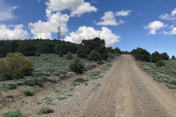
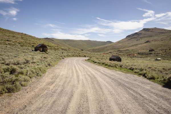
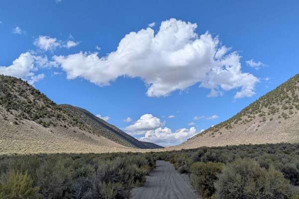
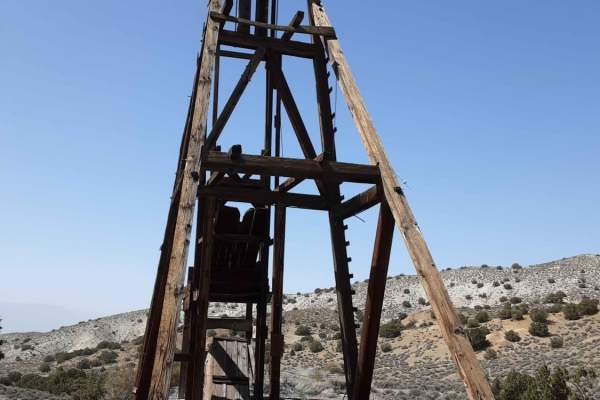
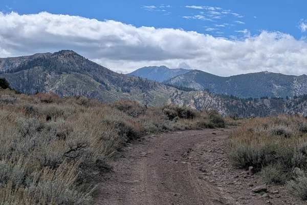
Microwave Road FS 42192
Incredible vistas and solitude are the rewards for choosing Microwave Road. It is passenger car friendly and rated an Easy1. Microwave Road is a wide well-maintained gravel road that allows two cars to pass. Located at the end of Microwave Road is a microwave communication station and tower. Microwa...
Learn more about Microwave Road FS 42192
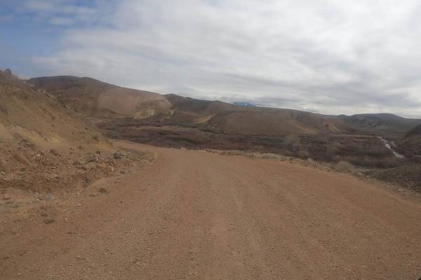
Hawthorne-Fletcher Rd/42028
This main trail, located alongside the East Walker River, is a well-maintained/graded road that traverses through some stunning Nevada landscape. Something this trail has to offer is the Walker River State Recreation Area, which has a seasonal campground and what the fisherman calls "The Elbow"--loo...
Learn more about Hawthorne-Fletcher Rd/42028

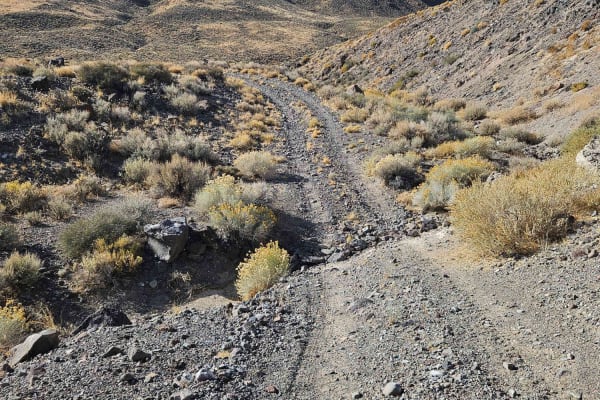
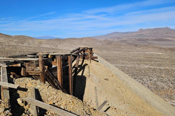
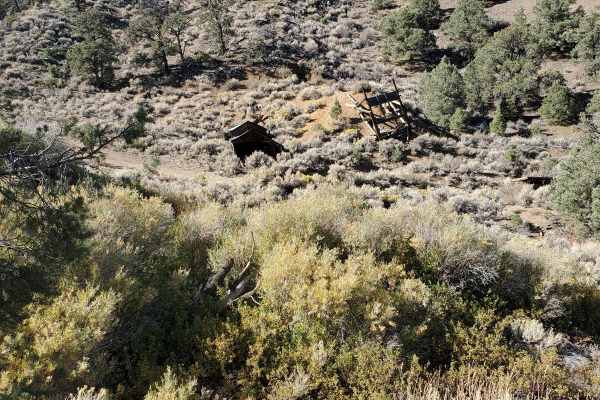
Masonic Mine
Ground clearance isn't much of a concern, but there are a lot of sharp rocks, so passenger car tires will not do. This is a good side trip to other trails in the area. Vehicles with better ground clearance can continue past the mine and explore trails to complete a loop back to Hawthorne-Fletcher ro...
Learn more about Masonic Mine
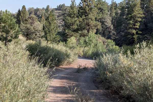
Desert Creek Loop
Short loop following Desert Creek between Smith Valley, NV and Bridgeport, CA. Several campgrounds are located along the creek, and there's good fishing and hiking nearby. The road is mostly one vehicle wide along the creek and ranges from hard packed dirt to loose rocks and gravel. There are 6 wate...
Learn more about Desert Creek Loop
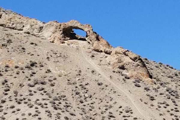
Backway to Wilson Spring Arch
Wilson Spring Arch is a good-sized natural arch. This route leads you into the Pine Nut Range. Besides the arch, you can reach sites like Pine Grove and Rockland. The trail starts following a creek bed, which is dry most of the time. After the creek bed, you climb over the hills into the next valley...
Learn more about Backway to Wilson Spring Arch
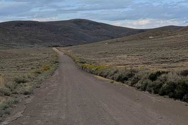
Bodie High Desert Highway
The Bodie High Desert Highway is a scenic and relatively easy off-pavement route that traverses the rolling high desert terrain just outside the historic Bodie Ghost Town area. This trail is often used to explore lesser-known mining remnants and access surrounding high desert plateaus with sweeping ...
Learn more about Bodie High Desert Highway
Cottonwood Canyon Road
This route begins at the dirt section after 3.3 miles of paved road from Highway 167. The trail starts off high above Mono Lake with great views of the lake and the Eastern Sierras behind it. Within a mile, a canyon appears with tall walls filled with trees, bushes, and rocks. The trail runs along a...
Learn more about Cottonwood Canyon Road
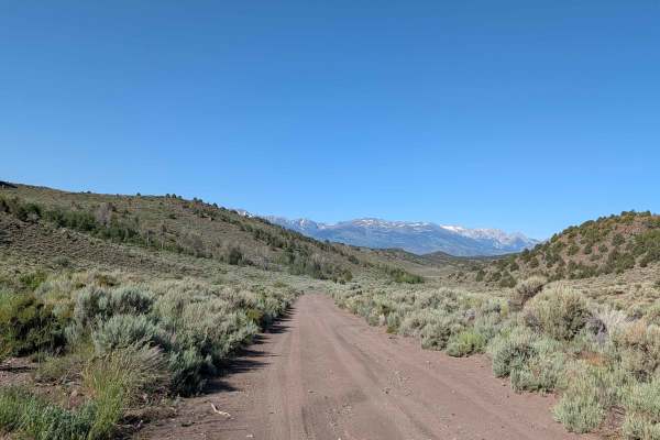
Wellington Hills Road - 42778
This out and back, double-track, dirt trail mostly accommodates one-way traffic. It begins at Eastside Lane and gradually rises in elevation into the Wellington Hills, located in Toiyabe National Forest. There are vistas of Antelope Valley and the snow-capped Sierra Nevada mountain range to the east...
Learn more about Wellington Hills Road - 42778
Bodie Ghost Town
The route to Bodie Ghost Town, a remarkably preserved historic mining site tucked into the Eastern Sierra backcountry, is more than just a drive--it's a journey into the past. The trail to Bodie is mostly wide and accessible, but don't let the easy start fool you. The last two miles leading into the...
Learn more about Bodie Ghost Town
Larkin Lake
This sand and pumice trail is one vehicle wide and lined with brush, offering 360-degree views of hills and mountains, including the Eastern Sierras and the Bodie Mountain area. The trail climbs 200 feet and drops 200 feet into a valley and meadow over just over 5.6 miles. The route leads to Larkin ...
Learn more about Larkin Lake
Rattlesnake Canyon
This route takes you from the Mina area to Little Huntoon Valley. It is easy and can be completed in dry conditions with a 2WD full-size vehicle. You cross Garfield Flat where Aerojet General uses the dry lakebed for a test facility. After the dry lakebed, you can follow Rattlesnake Flats Road for a...
Learn more about Rattlesnake Canyon
Aurora Canyon Road
This trail is located near the historic Bodie Ghost Town and starts near Bridgeport, California, climbing up almost 2000 feet into the mountains along Aurora Canyon. The route travels primarily through BLM land with some sections of private property along the way, so staying on the established trail...
Learn more about Aurora Canyon Road
Burcham Flat Road North
This trail can be accessed from the north off Camp Antelope Rd in Walker, California, or from the south off Highway 395 using Holy Climber Trail and Burcham Flat Road South. The northern approach features a dramatic descent of over 3,000 feet in just over 10 miles, creating an exciting elevation cha...
Learn more about Burcham Flat Road North
The Road to the Simon Lead Mine
The road to the Simon Lead mine is traveled via a well-maintained dirt road until the last 4 miles. The road then contains washed-out areas and narrow passages. According to https://www.nvexpeditions.com, small amounts of silver-lead ore were discovered and shipped from this district as early as 187...
Learn more about The Road to the Simon Lead Mine
Gaging Station - FS 22396
Gaging Station is a dirt trail that climbs over 600 feet in just over one mile, creating a steep and sustained ascent that challenges both vehicle and driver. The trail initially follows power lines, providing a clear navigation reference while ascending the mountainside. The route is lined with bus...
Learn more about Gaging Station - FS 22396
Rebel Canyon Loop
This is a fairly short route that takes you to Douglas Camp, an area of several mines. It loops out through Rebel Canyon. There are active mining claims if you continue up towards Thunder Mountain, please respect the claim owners and don't go beyond posted signs. The Maryann Mine is on the way down ...
Learn more about Rebel Canyon Loop
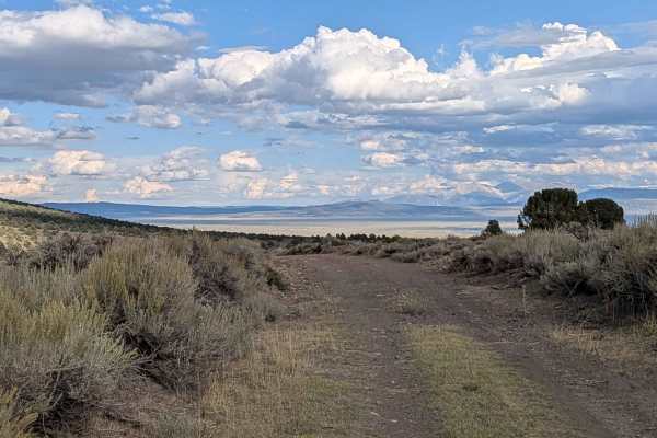
Coyote Springs Road
Starting from the Bodie Rd, this route drops almost 900 feet and climbs over 300 feet in just over 6.5 miles. The trail immediately starts cutting through the canyon with low brush and rolling hills, and the area is used for grazing so watch out for cattle. At mile 1.8, you reach the summit where yo...
Learn more about Coyote Springs Road
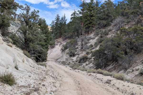
Cottonwood Meadows Road - FS 32106
This 3-mile out-and-back trail starts at Burcham Flat North Road and quickly establishes its character as a narrow, technical route through varied terrain. The trail maintains a single vehicle width throughout, lined with grasses and brush that create an enclosed corridor feeling. The dirt surface f...
Learn more about Cottonwood Meadows Road - FS 32106
By Day Creek - FS 32076
By Day Creek is a sandy single-width vehicle trail that climbs almost 700 feet over just 1.4 miles, creating a steep and challenging ascent. This 3-mile in-and-out trail begins on the Buckeye Robinson Creek North Trail and follows the scenic By Day Creek canyon. The trail runs along a shelf road pos...
Learn more about By Day Creek - FS 32076
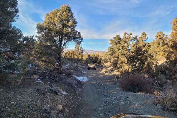
Holy Climber
This is a busy trail, with beautiful fall colors and great vistas. There are sections of loose, rocky terrain and sections with softer dirt that may be whooped out. Most are shallow and smooth, so you can roll through at a good clip. There are a couple of long, steep climbs with decent traction. One...
Learn more about Holy Climber
Beginner ATV trails near Walker Lake, Nevada
Explore ATV-friendly trails near you. These trails are accessible for vehicles up to 50 inches wide, perfect for ATVs and smaller off-road machines.
Hawthorne-Fletcher Rd/42028
This main trail, located alongside the East Walker River, is a well-maintained/graded road that traverses through some stunning Nevada landscape. Something this trail has to offer is the Walker River State Recreation Area, which has a seasonal campground and what the fisherman calls "The Elbow"--loo...
Learn more about Hawthorne-Fletcher Rd/42028
Masonic Mine
Ground clearance isn't much of a concern, but there are a lot of sharp rocks, so passenger car tires will not do. This is a good side trip to other trails in the area. Vehicles with better ground clearance can continue past the mine and explore trails to complete a loop back to Hawthorne-Fletcher ro...
Learn more about Masonic Mine
Desert Creek Loop
Short loop following Desert Creek between Smith Valley, NV and Bridgeport, CA. Several campgrounds are located along the creek, and there's good fishing and hiking nearby. The road is mostly one vehicle wide along the creek and ranges from hard packed dirt to loose rocks and gravel. There are 6 wate...
Learn more about Desert Creek Loop
Backway to Wilson Spring Arch
Wilson Spring Arch is a good-sized natural arch. This route leads you into the Pine Nut Range. Besides the arch, you can reach sites like Pine Grove and Rockland. The trail starts following a creek bed, which is dry most of the time. After the creek bed, you climb over the hills into the next valley...
Learn more about Backway to Wilson Spring Arch
Beginner UTV/side-by-side trails near Walker Lake, Nevada
Find UTV and side-by-side trails near you. These trails accommodate vehicles up to 60 inches wide, ideal for UTVs, side-by-sides, and wider off-road rigs.
Hawthorne-Fletcher Rd/42028
This main trail, located alongside the East Walker River, is a well-maintained/graded road that traverses through some stunning Nevada landscape. Something this trail has to offer is the Walker River State Recreation Area, which has a seasonal campground and what the fisherman calls "The Elbow"--loo...
Learn more about Hawthorne-Fletcher Rd/42028
Desert Creek Loop
Short loop following Desert Creek between Smith Valley, NV and Bridgeport, CA. Several campgrounds are located along the creek, and there's good fishing and hiking nearby. The road is mostly one vehicle wide along the creek and ranges from hard packed dirt to loose rocks and gravel. There are 6 wate...
Learn more about Desert Creek Loop
Backway to Wilson Spring Arch
Wilson Spring Arch is a good-sized natural arch. This route leads you into the Pine Nut Range. Besides the arch, you can reach sites like Pine Grove and Rockland. The trail starts following a creek bed, which is dry most of the time. After the creek bed, you climb over the hills into the next valley...
Learn more about Backway to Wilson Spring Arch
Bodie High Desert Highway
The Bodie High Desert Highway is a scenic and relatively easy off-pavement route that traverses the rolling high desert terrain just outside the historic Bodie Ghost Town area. This trail is often used to explore lesser-known mining remnants and access surrounding high desert plateaus with sweeping ...
Learn more about Bodie High Desert Highway
The onX Offroad Difference
onX Offroad combines trail photos, descriptions, difficulty ratings, width restrictions, seasonality, and more in a user-friendly interface. Available on all devices, with offline access and full compatibility with CarPlay and Android Auto. Discover what you're missing today!
Open Trail Map