
Beginner Off-Road Trails
Near Valdez, Colorado
Explore All Beginner Trails Near Valdez, Colorado
Beginner Off-Road Trails Near Valdez, Colorado
Discover the best beginner-friendly off-road trails near you. These easier, lower-rated trails are a great place to start — browse trail maps, check difficulty ratings, and find your next adventure.
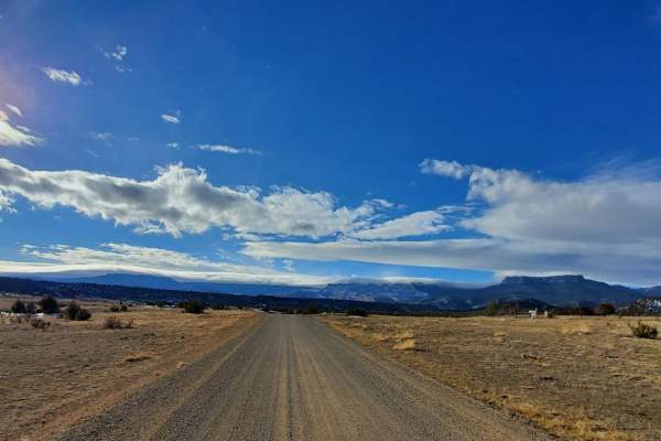
Trinchera Pass
Trinchera Pass is a scenic, point-to-point offroad route ideal for beginners and scenic tourers looking for an off-the-beaten-path journey between Folsom, New Mexico, and Trinidad, Colorado. Stretching approximately 44.3 miles, this easy dirt and gravel road winds through the historic Raton Mesas, o...
Learn more about Trinchera Pass
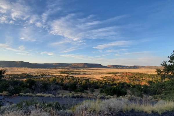
NE Passage via Cimarron Canyon
This is a very long dirt road route connecting Clayton Lake State Park NM and Trinidad, Colorado. There is a shortcut that will eliminate approximately 20 miles (if you look at the route closely, it's evident where I'm talking about) In dry conditions, any vehicle with at least 5-6 inches of ground ...
Learn more about NE Passage via Cimarron Canyon
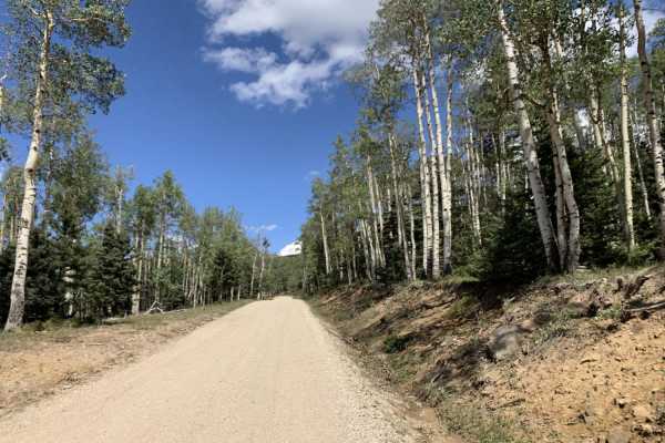
Cucharas Pass
This is a fun, scenic drive through San Isabel National Forest. The road west of the pass is well maintained, with plenty of room for two-way traffic. East of the pass is rougher in spots, and varies in width from two to one vehicle wide. The pass can be travelled in either direction, and does not ...
Learn more about Cucharas Pass
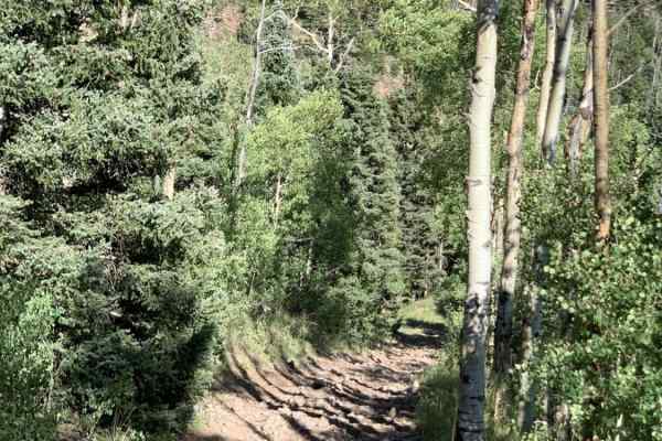
Fan Dike
Fan Dike (Forest Road 437) is a scenic, steep out-and-back trail in the Rio Grande National Forest, ideal for high-clearance four-wheel-drive vehicles seeking a continuous climb with panoramic views of the Sangre de Cristo Mountains. Spanning approximately 3 miles, this mountain route begins at an e...
Learn more about Fan Dike
Steep Mountain
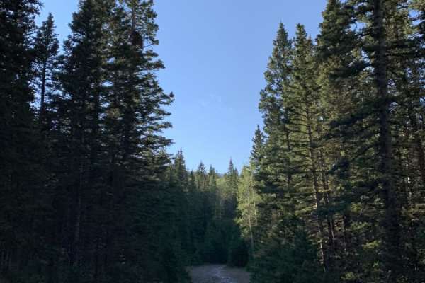
Steep Mountain is an easy, beginner-friendly route perfect for campers and those looking for a quick getaway in the scenic Cuchara area of the San Isabel National Forest. Branching off the popular Blue Lakes Road, this short spur provides access to several quiet, dispersed camping sites nestled amon...
Learn more about Steep Mountain

Cimarron Run
This is an easy route that takes you to Cimarron Campground in the Carson National Forest. A portion of this route travels through Vermejo Park Ranch via FS 1950. This is not public land; be aware of where you are. Vermejo Park Ranch is Private land; do not trespass. This is an excellent route for v...
Learn more about Cimarron Run
Valle Vidal - FR 1950
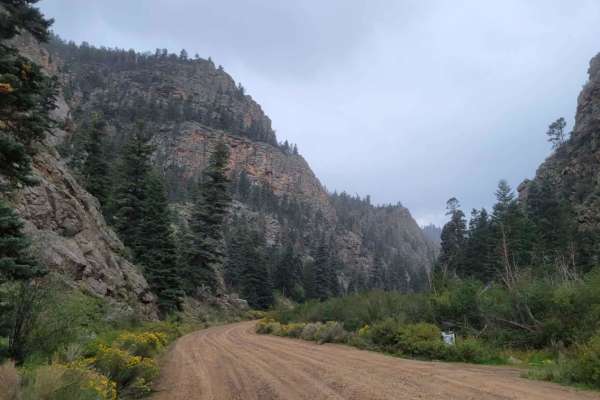
This route is a beautiful forest road that takes you into the Carson National Forest/Sangre De Christo Mountains. The beginning of the trail immediately kicks off with stunning, towering rock cliffs on either side as you follow the Costilla Creek up the canyon. For the first few miles, you'll pass t...
Learn more about Valle Vidal - FR 1950
Old Highway
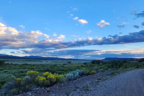
This is the old unmaintained highway, the surface is broken pavement and gravel mix. This route can be easily traversed with any roadworthy car, precipitation may make the route impassable for passenger cars. It is a great quick detour from the main highway, perfect for a picnic or just to get off t...
Learn more about Old Highway
Medano's Back Door
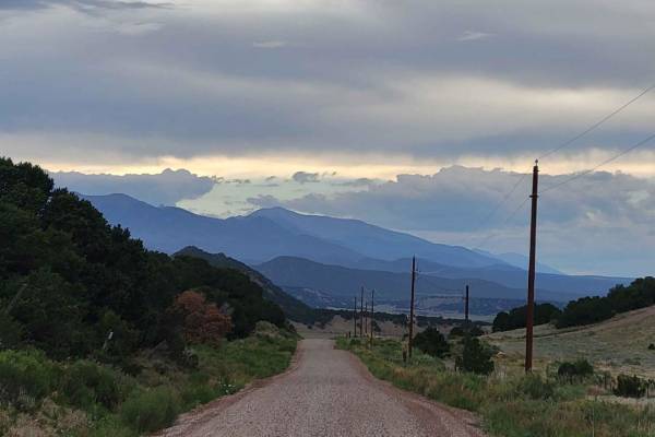
This is a well-maintained graded dirt road. It will be passable for any road-worthy vehicle in good weather conditions. If poor weather does occur, it could be trouble for road cars. A 4x4 with clearance will be able to travel this road year-round, so long as it's been plowed in the winter.
Learn more about Medano's Back Door
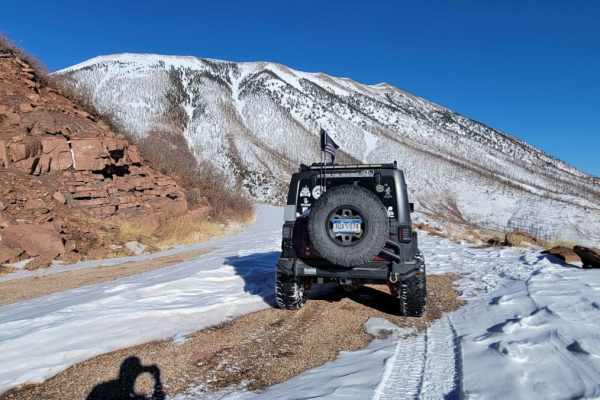
Old La Veta Pass
This trail is an old train route that connected the east and west sides of the Sangre de Cristo mountains until the 1960s when the highway was put in. It is now an unmaintained road with no obstacles. There are several spots where you will traverse over the old paved road that has become little more...
Learn more about Old La Veta Pass
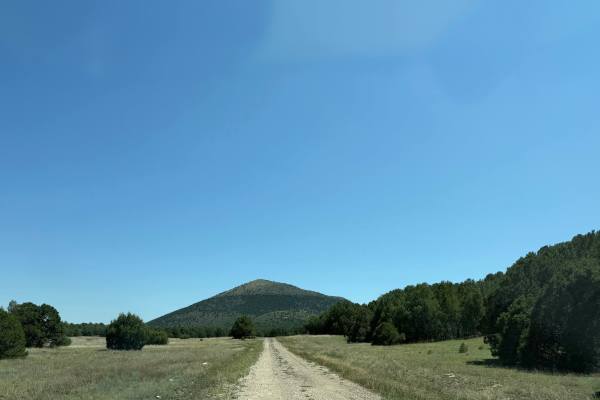
Capulin Circumnavigation
From Capulin on the Raton Highway, head north. After the NPS entrance to the volcano, a dirt path will be on the right. At the beginning of the trail, there is a fork. Take the left, as the right is NPS. Farther ahead, there’s another fork, but difficult to identify due to the trail being overgrown;...
Learn more about Capulin Circumnavigation
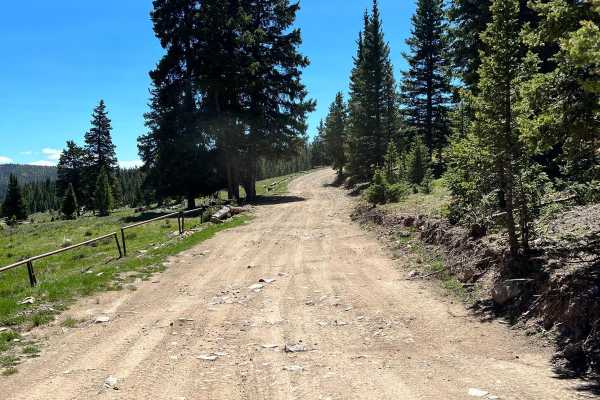
Greenie Peak via Cabresto Canyon - FS 54
Forest Service Road 54 and 54D is a gradual ascent from Cabresto Canyon to Greenie Peak in Carson National Forest. The windy road up the peak is rocky, steep in some areas, and very narrow. The trail is a popular route for adventure SxS riders in the area. 4WD vehicles with short wheelbases are high...
Learn more about Greenie Peak via Cabresto Canyon - FS 54
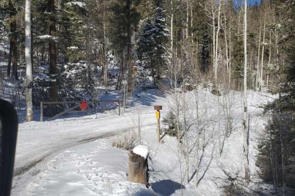
Greenie East
Greenie East is a moderately challenging 4.4-mile off-road trail near Red River, New Mexico, ideal for intermediate drivers looking for an alternative route to the high-elevation ridges of the Carson National Forest. Beginning in Mallette Canyon, this unpaved dirt route diverges from the Sawmill Tra...
Learn more about Greenie East
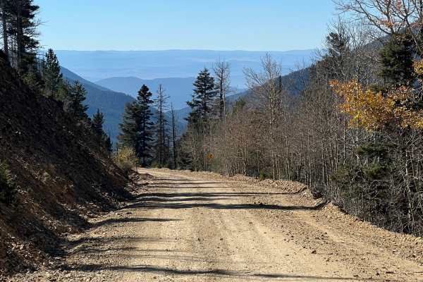
Sawmill
This is a rough and rocky mountain road that climbs high into the mountains of Carson National Forest. The route is generally easy with no technical obstacles and can be traveled in either direction. It offers excellent scenery and connects with several other notable off-road trails in the Red River...
Learn more about Sawmill
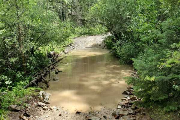
Pioneer Creek
Pioneer Creek Trail leaves from Red River behind the ski resort and then follows the canyon up. There are some large loose rocks towards the end and four water crossings where the trail crosses the creek. Although the map shows the trail goes further, it has been closed where the track ends, and a l...
Learn more about Pioneer Creek
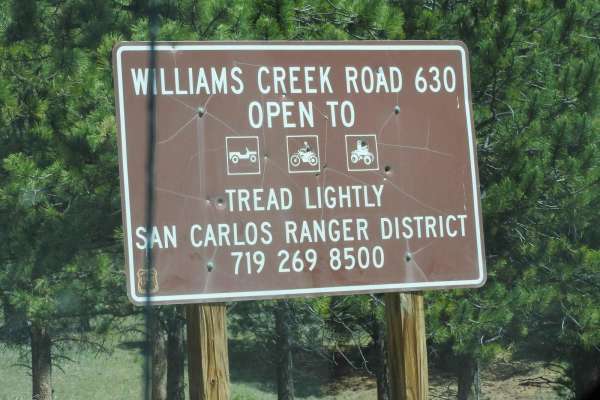
Forest Road 630/Williams Creek
This road is fairly easy as it is a county/Forest Service road that gives you access to several jeep trails, hiking, dispersed camping, and mountain biking trails. The road travels through open pasture lands with great views of the Sangre de Cristo Mountain range to the west. Be advised, during summ...
Learn more about Forest Road 630/Williams Creek
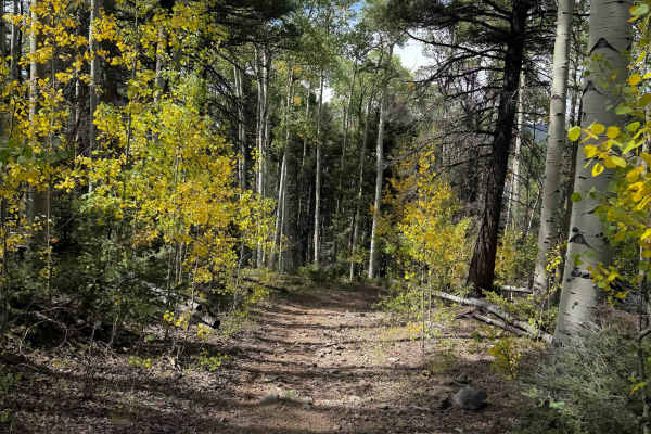
FS 195 Alternate
This is a 1.4-mile-long dirt bike trail that parallels the main Elephant Rock Trail - FS 195. On the west end, it starts at an intersection with FS 195 where the signs indicate that FS 195 goes to a photo opportunity, while this trail goes left instead. This route is very defined and easy to follow,...
Learn more about FS 195 Alternate

FS 195W
FS 195W is a short access trail into the Elephant Rock trail system, but this is not the main entrance into the system, and riders will need to be street legal to connect to it on Highway 38. It starts as a wide road-width trail on pea-gravel that climbs up into the forest from the highway. It is un...
Learn more about FS 195W
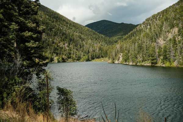
Cabresto Lake - FS 134A
Forest Service Road 134A is a steep, rocky road that leads to Cabresto Lake; it's a beautiful mountain lake surrounded by the high peaks of Carson National Forest. The trail is narrow and consists of sharp rocks no larger than 12 inches in height. High-clearance 4x4 is recommended but high-clearance...
Learn more about Cabresto Lake - FS 134A
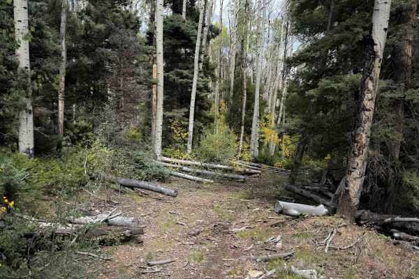
FS 195 Connector
The FS 195 Connector Trail is a quarter-mile-long dirt bike trail that connects FS 195S and the main Elephant Rock Trail 195. It goes through a narrow forested tree corridor of aspens that are really pretty in fall when the leaves start to change color. The north entrance is unmarked off of FS 195, ...
Learn more about FS 195 Connector
Beginner ATV trails near Valdez, Colorado
Explore ATV-friendly trails near you. These trails are accessible for vehicles up to 50 inches wide, perfect for ATVs and smaller off-road machines.
Valle Vidal - FR 1950
This route is a beautiful forest road that takes you into the Carson National Forest/Sangre De Christo Mountains. The beginning of the trail immediately kicks off with stunning, towering rock cliffs on either side as you follow the Costilla Creek up the canyon. For the first few miles, you'll pass t...
Learn more about Valle Vidal - FR 1950
Old La Veta Pass
This trail is an old train route that connected the east and west sides of the Sangre de Cristo mountains until the 1960s when the highway was put in. It is now an unmaintained road with no obstacles. There are several spots where you will traverse over the old paved road that has become little more...
Learn more about Old La Veta Pass
Greenie East
Greenie East is a moderately challenging 4.4-mile off-road trail near Red River, New Mexico, ideal for intermediate drivers looking for an alternative route to the high-elevation ridges of the Carson National Forest. Beginning in Mallette Canyon, this unpaved dirt route diverges from the Sawmill Tra...
Learn more about Greenie East
Sawmill
This is a rough and rocky mountain road that climbs high into the mountains of Carson National Forest. The route is generally easy with no technical obstacles and can be traveled in either direction. It offers excellent scenery and connects with several other notable off-road trails in the Red River...
Learn more about Sawmill
Beginner UTV/side-by-side trails near Valdez, Colorado
Find UTV and side-by-side trails near you. These trails accommodate vehicles up to 60 inches wide, ideal for UTVs, side-by-sides, and wider off-road rigs.
Valle Vidal - FR 1950
This route is a beautiful forest road that takes you into the Carson National Forest/Sangre De Christo Mountains. The beginning of the trail immediately kicks off with stunning, towering rock cliffs on either side as you follow the Costilla Creek up the canyon. For the first few miles, you'll pass t...
Learn more about Valle Vidal - FR 1950
Old La Veta Pass
This trail is an old train route that connected the east and west sides of the Sangre de Cristo mountains until the 1960s when the highway was put in. It is now an unmaintained road with no obstacles. There are several spots where you will traverse over the old paved road that has become little more...
Learn more about Old La Veta Pass
Greenie Peak via Cabresto Canyon - FS 54
Forest Service Road 54 and 54D is a gradual ascent from Cabresto Canyon to Greenie Peak in Carson National Forest. The windy road up the peak is rocky, steep in some areas, and very narrow. The trail is a popular route for adventure SxS riders in the area. 4WD vehicles with short wheelbases are high...
Learn more about Greenie Peak via Cabresto Canyon - FS 54
Sawmill
This is a rough and rocky mountain road that climbs high into the mountains of Carson National Forest. The route is generally easy with no technical obstacles and can be traveled in either direction. It offers excellent scenery and connects with several other notable off-road trails in the Red River...
Learn more about Sawmill
The onX Offroad Difference
onX Offroad combines trail photos, descriptions, difficulty ratings, width restrictions, seasonality, and more in a user-friendly interface. Available on all devices, with offline access and full compatibility with CarPlay and Android Auto. Discover what you're missing today!
Open Trail Map