
Beginner Off-Road Trails
Near Summerlin South, Nevada
Explore All Beginner Trails Near Summerlin South, Nevada
Beginner Off-Road Trails Near Summerlin South, Nevada
Discover the best beginner-friendly off-road trails near you. These easier, lower-rated trails are a great place to start — browse trail maps, check difficulty ratings, and find your next adventure.
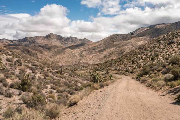
Bird Spring Pass
This is an easy, scenic trail through the Nevada desert. Although the trail lacks any large trees, you do get to experience the natural offerings of the desert as well as great views of the Spring Mountains to the west. The elevation gain provides views of Mount Potosi, Mount Charleston, and the Las...
Learn more about Bird Spring Pass
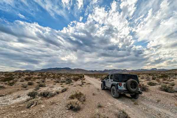
Wilson Tank Trail
The trail starts just outside of Las Vegas by one of the last housing communities before BLM land. At first glance, it doesn't look great, but about a mile into the trail, the populated world drops away and the scenery is gorgeous. The first few miles are a fun wash (note, this wash will flood in a ...
Learn more about Wilson Tank Trail
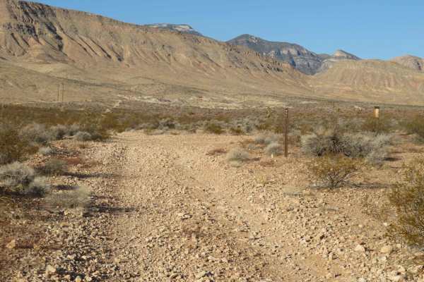
Blue Diamond Cut-off
This is just a cut-off route from Blue Diamond BLM Access to Restless Road that takes you back to State Highway 160 or over to Cottonwood Pass Trail. It's only a bit over half a mile with pleasant desert views. A high-clearance vehicle is needed for this cut-off.
Learn more about Blue Diamond Cut-off
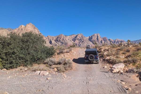
Black Velvet Road
This is an easy trail from the highway onto the Black Velvet Road. Head in a short distance to an area to air down. After airing down, the trail has a few small obstacles with easy bypasses. Most of the trail is easy gravel with a few sections of rock gardens, a few wash crossings, and some washboar...
Learn more about Black Velvet Road
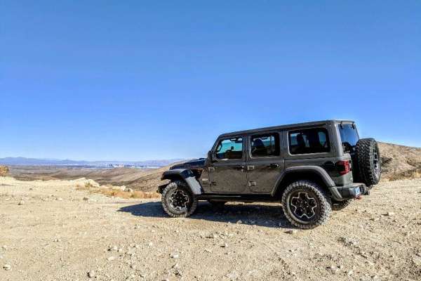
Cottonwood Pass
Cottonwood Pass runs north and south through the Spring Mountain and Red Rock conservation areas just west of Las Vegas, NV. From Blue Diamond Road, you can take Cottonwood Pass all the way to Goodsprings, NV. Once you get down there, stop at the Pioneer Saloon for a good burger or visit some old hi...
Learn more about Cottonwood Pass
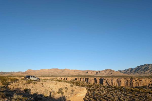
Lovell Wash Road
This short trail runs from Lovell Canyon Road to Highway 160. You can go in either direction, though I went from Highway 160 to Lovell Canyon. You turn off the highway right onto this trail, and there are no gates or barriers to entry at the time of this writing. If you are headed towards Vegas from...
Learn more about Lovell Wash Road
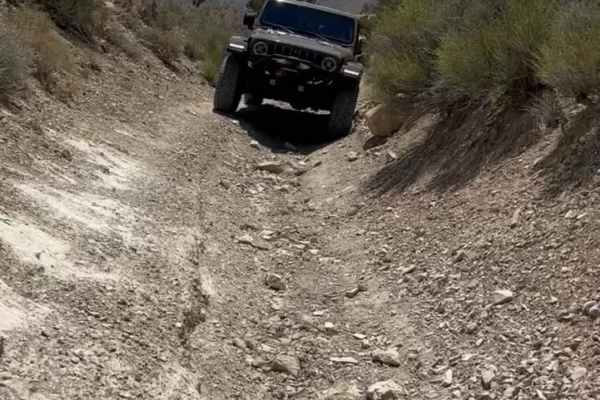
Lucky Strike Road
The trail starts off of Kyle Canyon Rd (Highway 157) and takes you into Grapevine Canyon in Mount Charleston. 4WD is recommended. The first part of the trail is pretty easy with some sandy areas that lead to Grapevine Springs. This is a beautiful canyon with a lot of greenery, as you continue past t...
Learn more about Lucky Strike Road
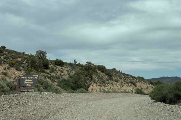
Harris Springs Cutoff Road
This trail starts in the Spring Mountains Recreational Area and ends in the Red Rock National Conservation Area managed by the BLM. The area within the BLM boundaries is known as the Harris Springs Recreation Area. The main purpose of this trail is to provide access to the Prospect Springs Road as w...
Learn more about Harris Springs Cutoff Road
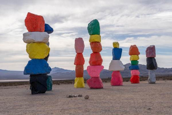
Seven Magic Mountains
Seven Magic Mountains is one of the most recognizable roadside stops outside Las Vegas, but this route adds an off-road twist to the experience. Instead of taking the standard paved-road approach to the colorful desert art installation, this trail follows a more adventurous route through open Mojave...
Learn more about Seven Magic Mountains
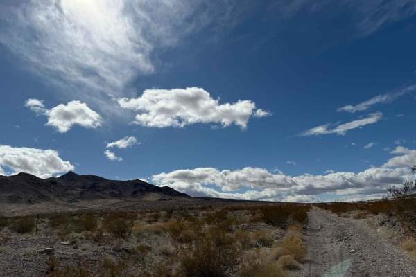
Shock Test Alley
This well-known roadside "send-it" spot is a go-to destination for shock testing and tuning. It features a mix of tight, loose whoops that challenge suspension setups, along with brutally choppy washboard sections that will put any vehicle to the test. Whether you're dialing in your rig or just out ...
Learn more about Shock Test Alley
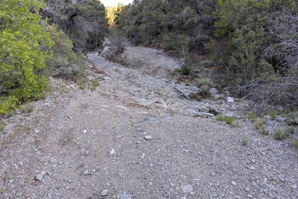
Telephone Canyon Road (530)
Telephone Canyon Road connects highway 157 (Kyle Canyon) to 158 (Deer Creek Road). It is a 2-track trail that runs up a canyon wash in the forest and can shift with heavy rains. The trail surface is mostly loose gravel and rock. In the winter, it can have deep snow. There are some wash crossings wit...
Learn more about Telephone Canyon Road (530)
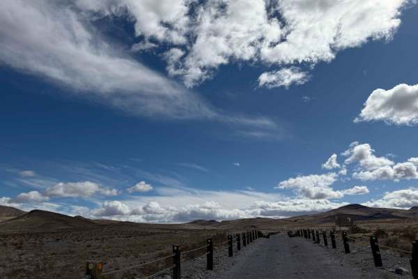
Color Rock Road
This is a fast, dead-straight stretch of road that's an absolute dream with the right setup. The trail runs in front of the iconic Colored Rock Pillars installation, offering a unique backdrop for the ride. However, use caution in this area, as there is foot traffic from visitors accessing the site-...
Learn more about Color Rock Road
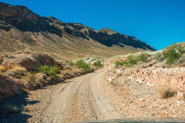
Kodachrome Road
Kodachrome Road offers an easy, family-friendly scenic drive through the Rainbow Gardens Area of Critical Environmental Concern, making it ideal for beginners and those looking to admire striking desert geology just east of Las Vegas. Spanning approximately 9.2 miles with modest elevation changes, t...
Learn more about Kodachrome Road
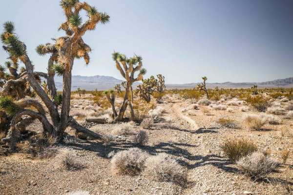
Pants Connector
The Pants Connector Trail is an 8.6-mile single-track connection between the Pants Loop Trail and the Ridge Trail. Riding NE to SW, it departs from the east end of the Pants Loop at an intersection marked with a cairn and heads southwest. The beginning of the trail is hardpacked dirt with small loos...
Learn more about Pants Connector
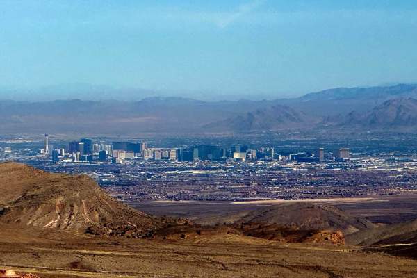
Potosi Tower Road
The Potosi Tower Road is a 14.6 out and back trail that goes to a great overlook of the Las Vegas Strip and Potosi Mountain. Built as a service road for the multiple communication towers on the ridge line, this trail is suitable for any 4WD vehicles. Many switchbacks and sweeping views of the high d...
Learn more about Potosi Tower Road
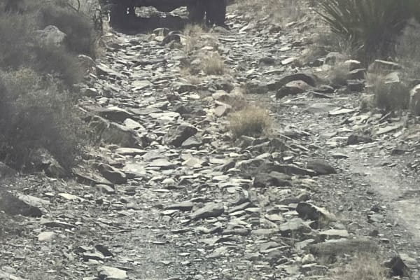
Rogers Wildlife Guzzler
Rogers Wildlife Water Guzzler is a fun but moderately challenging 4x4 trail with a surface made up of gravel and medium-sized loose rock, creating a consistently bouncy ride. The loose rock sections increase the difficulty, earning the trail a solid 3–4 rating. Some ground clearance and 4WD are reco...
Learn more about Rogers Wildlife Guzzler
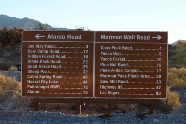
Mormon Well Road
Mormon Well is a stock-friendly trail that traverses the Desert National Wildlife Refuge. You will cross a well-maintained dirt road that rises in elevation from the desert floor to more than 6,000 feet in elevation. Along the way, you will see Joshua forests give way to groves of pine trees. Picnic...
Learn more about Mormon Well Road
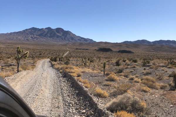
Gass Peak Rd
This out and back trail has great views of the city and surrounding mountains. Most of the trail is wide enough for two vehicles to pass. Very little in terms of obstacles, but still a great day trip to explore the mines and caves along the trails. At the end you are greeted with an incredible view ...
Learn more about Gass Peak Rd
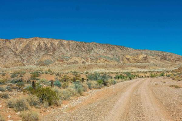
Lava Butte Loop
Rainbow Gardens and Lava Butte form this loop trail. It is an easy trail suitable for any 4x4 truck or SUV, as well as off road vehicles and mountain bikes. Red, tan and white hills make up the colorful Rainbow Gardens loop while a dark volcanic ridge forms the Lava Butte side. Views of the Las V...
Learn more about Lava Butte Loop

Snore 250 Start Course
This trail marks the starting course for the SNORE 250, delivering a true off-road racing experience. Expect classic racecourse conditions, including loose rocks, deep whoops, and fast, flowing sections that invite full-send moments. The terrain constantly challenges both driver and machine, making ...
Learn more about Snore 250 Start Course
Beginner ATV trails near Summerlin South, Nevada
Explore ATV-friendly trails near you. These trails are accessible for vehicles up to 50 inches wide, perfect for ATVs and smaller off-road machines.
Wilson Tank Trail
The trail starts just outside of Las Vegas by one of the last housing communities before BLM land. At first glance, it doesn't look great, but about a mile into the trail, the populated world drops away and the scenery is gorgeous. The first few miles are a fun wash (note, this wash will flood in a ...
Learn more about Wilson Tank Trail
Blue Diamond Cut-off
This is just a cut-off route from Blue Diamond BLM Access to Restless Road that takes you back to State Highway 160 or over to Cottonwood Pass Trail. It's only a bit over half a mile with pleasant desert views. A high-clearance vehicle is needed for this cut-off.
Learn more about Blue Diamond Cut-off
Cottonwood Pass
Cottonwood Pass runs north and south through the Spring Mountain and Red Rock conservation areas just west of Las Vegas, NV. From Blue Diamond Road, you can take Cottonwood Pass all the way to Goodsprings, NV. Once you get down there, stop at the Pioneer Saloon for a good burger or visit some old hi...
Learn more about Cottonwood Pass
Lovell Wash Road
This short trail runs from Lovell Canyon Road to Highway 160. You can go in either direction, though I went from Highway 160 to Lovell Canyon. You turn off the highway right onto this trail, and there are no gates or barriers to entry at the time of this writing. If you are headed towards Vegas from...
Learn more about Lovell Wash Road
Beginner UTV/side-by-side trails near Summerlin South, Nevada
Find UTV and side-by-side trails near you. These trails accommodate vehicles up to 60 inches wide, ideal for UTVs, side-by-sides, and wider off-road rigs.
Wilson Tank Trail
The trail starts just outside of Las Vegas by one of the last housing communities before BLM land. At first glance, it doesn't look great, but about a mile into the trail, the populated world drops away and the scenery is gorgeous. The first few miles are a fun wash (note, this wash will flood in a ...
Learn more about Wilson Tank Trail
Blue Diamond Cut-off
This is just a cut-off route from Blue Diamond BLM Access to Restless Road that takes you back to State Highway 160 or over to Cottonwood Pass Trail. It's only a bit over half a mile with pleasant desert views. A high-clearance vehicle is needed for this cut-off.
Learn more about Blue Diamond Cut-off
Lovell Wash Road
This short trail runs from Lovell Canyon Road to Highway 160. You can go in either direction, though I went from Highway 160 to Lovell Canyon. You turn off the highway right onto this trail, and there are no gates or barriers to entry at the time of this writing. If you are headed towards Vegas from...
Learn more about Lovell Wash Road
Lucky Strike Road
The trail starts off of Kyle Canyon Rd (Highway 157) and takes you into Grapevine Canyon in Mount Charleston. 4WD is recommended. The first part of the trail is pretty easy with some sandy areas that lead to Grapevine Springs. This is a beautiful canyon with a lot of greenery, as you continue past t...
Learn more about Lucky Strike Road
The onX Offroad Difference
onX Offroad combines trail photos, descriptions, difficulty ratings, width restrictions, seasonality, and more in a user-friendly interface. Available on all devices, with offline access and full compatibility with CarPlay and Android Auto. Discover what you're missing today!
Open Trail Map