
Beginner Off-Road Trails
Near Spanish Valley, Utah
Explore All Beginner Trails Near Spanish Valley, Utah
Beginner Off-Road Trails Near Spanish Valley, Utah
Discover the best beginner-friendly off-road trails near you. These easier, lower-rated trails are a great place to start — browse trail maps, check difficulty ratings, and find your next adventure.

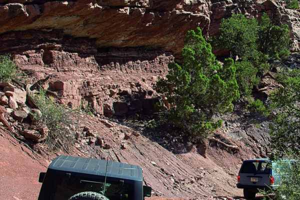
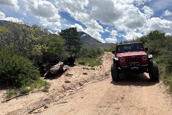
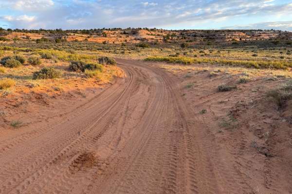
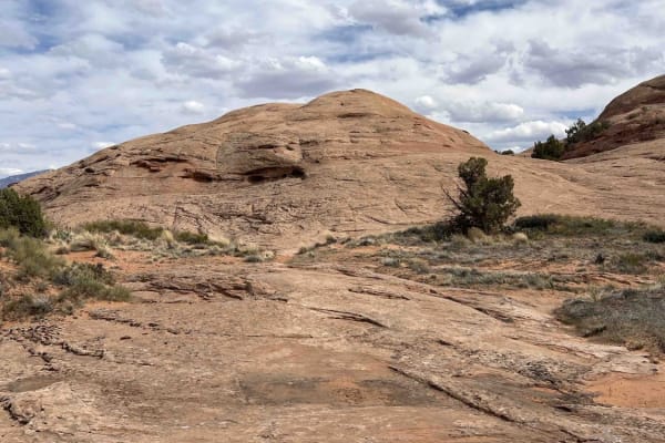
Kane Creek Overlook
Moab may be full of amazing views, but this one certainly won't disappoint! You leave from the small sand dune area off of Behind the Rocks RD, and meander through mainly sandy/dirt 2 track that is relatively smooth, with some areas of sandstone as well. When you are nearing the end, there is more ...
Learn more about Kane Creek Overlook
La Sal Pass
Beautiful autumn colors provide an awesome backdrop to enjoyable and moderately challenging drive. ATVs and UTVs will especially love venturing up the west side.
Learn more about La Sal Pass
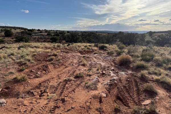
Moon Rock
This is a less-traveled trail dead end trail toward Moon Rock terrain with beautiful rim view. The ride is mainly loose rocks with some deep sand sections, which could be challenging for dirt bikes and squirrelly fun for ATVs and UTVs. Definitely worth riding to the end of the trail.
Learn more about Moon Rock
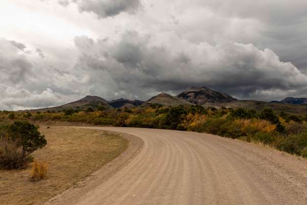
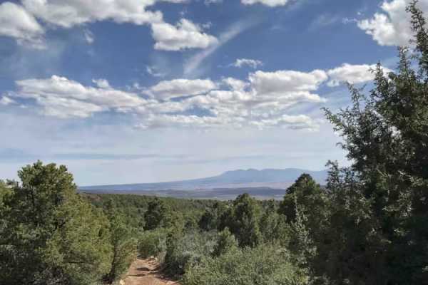
Geyser Pass
Geyser Pass is a wide mountain road that climbs into the La Sal Mountains southeast of Moab. The route is generally straightforward with no obstacles, though it includes a series of switchbacks as it gains elevation. Expect some washboarded stretches and intermittent cellular service. The road provi...
Learn more about Geyser Pass
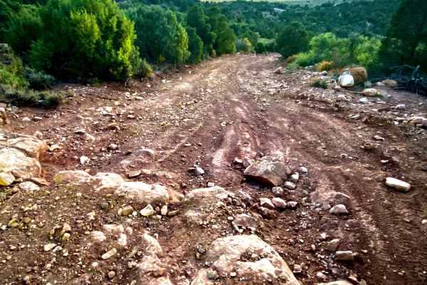
Tracking Station Road
Tracking Station Road is a nice short road off Mountain Loop Road going back to Sand Flats Recreation Area. Towards the Mountain Loop Road's end, there are several primitive campsite spots. The road gets a bit rougher near Sand Flats Road where 4WD may be necessary. The drive towards Sand Flats in t...
Learn more about Tracking Station Road
Kokopelli Trail (Castle Valley Overlook to Sand Flats Road)
This 3.8-mile point-to-point trail is part of the larger Kokopelli Trail System. This portion takes you from the Castle Valley Overlook on La-Sal Mountain Loop Road to Sand Flats Road. Sand Flats Road goes into the Sand Flats Recreation Area which is a Grand County Fee area. The first half of this t...
Learn more about Kokopelli Trail (Castle Valley Overlook to Sand Flats Road)

Loop Road Trail FR Rd 636
This loop road goes from the Kokopelli Trail to the Tracking Station Road. It winds around, up and down with several crossings of the Jimmy Keen hike and bike trail. There is a single spot to camp in the lower section of the road next to one of the crossings. The road mainly serves the purpose of co...
Learn more about Loop Road Trail FR Rd 636
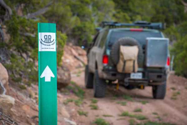
Rim Rocker
The Rim Rocker is a 160-mile route winding it's way through aspen groves, over red rock, along the edges of sheer cliffs, and across rivers. Spanning from Moab, Utah to Montrose, CO., the track varies from rocky two-track to perfectly graded gravel. Each mile offers something exciting and different,...
Learn more about Rim Rocker
Fins & Things Cutoff
This 0.6-mile point-to-point trail provides an early cutoff for the popular Fins and Things Trail. This trail allows off-roaders to depart the trail early if time does not permit completion of the entire trail. This trail can also be used to enter the Fins and Things trail to finish the last third o...
Learn more about Fins & Things Cutoff
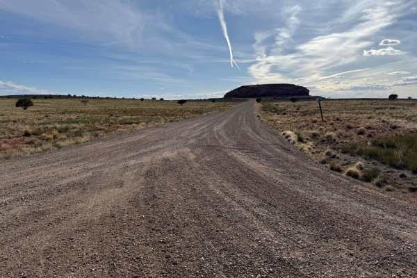
Sand Flats Road
Sand Flats Road is a wide, generally easy route that connects Moab to the Manti-La Sal National Forest. The drive has no major obstacles, though some narrow sections and washboarded stretches keep you attentive. Being close to town, it’s a well-trafficked corridor with trailheads and recreation acce...
Learn more about Sand Flats Road
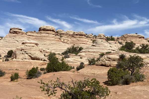
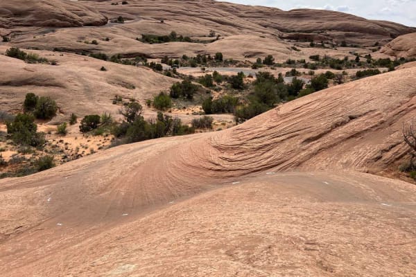
Slickrock 1
Slickrock 1 trail is the only trail branching off from the Slickrock Practice Loop that will take you to the main Slickrock Trail System. Heading west, this 0.7-mile-long track takes you up a decent climb before descending near the midpoint. From here, there are several smaller elevation changes and...
Learn more about Slickrock 1
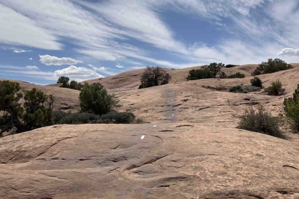
Slickrock 2
Slickrock 2 begins at Hell's Revenge Staircase Bypass & Overlook and continues northeast to the Slickrock Main Loop. This trail covers 0.7 miles across smooth slickrock and is well-marked with white painted lines on the ground. The trail has a few small bumps along the way but generally travels uphi...
Learn more about Slickrock 2
Slickrock 3
Slickrock 3 branches off of Slickrock 1 after about 0.4 miles and heads north/west to the Slickrock Main Loop. This trail is 2.2 miles long across smooth slickrock. The white paint markings on this route are worn and hard to see--especially in the beginning. Be aware: the markings do not match the O...
Learn more about Slickrock 3
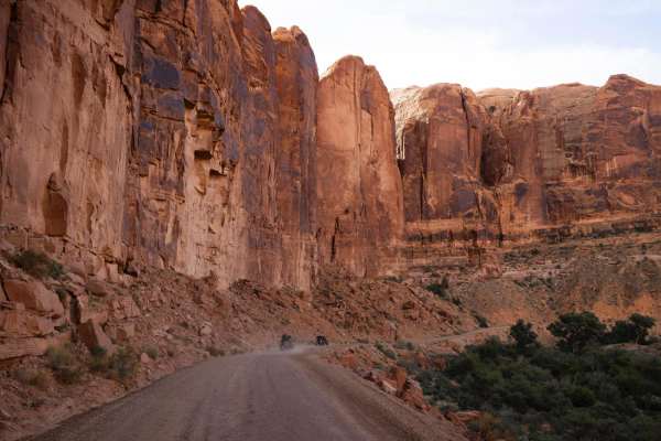
Hurrah Pass
Hurrah Pass is a classic Moab route that blends scenic red rock landscapes with approachable off-road terrain, making it one of the more accessible and popular trails in the region. The trail stretches west from the Kane Creek area, winding its way through a dramatic canyon corridor before climbing ...
Learn more about Hurrah Pass
D1778
Branching off from trail D1172, D1178 offers a short in-and-out route that parallels D0661. This trail presents a slightly more adventurous driving experience compared to the relatively straightforward County Road 132. Notably, aside from its connection to D1172, there are no other direct connecting...
Learn more about D1778
D1172
Branching off from trail D0661, D1172 offers an alternative route that parallels County Road 132 as you head towards Anticline Overlook. This trail presents a slightly more adventurous driving experience compared to the relatively straightforward County Road 132. Notably, aside from its connection t...
Learn more about D1172
FS 4759
This is an offshoot of the Rim Rocker. Be warned, dense vegetation along the edges of the trail will scratch your vehicle. I would only recommend using this trail if you are looking for a more secluded camping spot. The views are about the same as the actual Rim Rocker
Learn more about FS 4759
Minor Overlook
Despite its name, Minor Overlook delivers impressive views of the La Sal Mountains, buttes, and the Colorado River. It's a great stop both morning and afternoon: mornings highlight the canyon and river, while afternoons showcase the La Sals (though the canyon view remains worthwhile). The overlook i...
Learn more about Minor Overlook
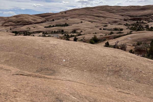
Slickrock 7
Slickrock 7 begins at the intersection of Slickrock 6 and 8 and travels north until hitting the Slickrock Main Loop. This route is about 0.5 miles long over smooth slickrock with minimal markings. The white trail paint has mostly worn away (as of 2024). This trail is mostly flat until about midway, ...
Learn more about Slickrock 7

Slickrock Moab Overlook
Slickrock Moab Overlook is a short trail that breaks off from the Slickrock Main Loop near the southwest corner of the loop. The trail travels west along a rock ridgeline which is smooth and without obstacles. When you get to the end on your bike, there isn't much of a view. You'll have to dismount ...
Learn more about Slickrock Moab Overlook
Beginner ATV trails near Spanish Valley, Utah
Explore ATV-friendly trails near you. These trails are accessible for vehicles up to 50 inches wide, perfect for ATVs and smaller off-road machines.
Kane Creek Overlook
Moab may be full of amazing views, but this one certainly won't disappoint! You leave from the small sand dune area off of Behind the Rocks RD, and meander through mainly sandy/dirt 2 track that is relatively smooth, with some areas of sandstone as well. When you are nearing the end, there is more ...
Learn more about Kane Creek Overlook
La Sal Pass
Beautiful autumn colors provide an awesome backdrop to enjoyable and moderately challenging drive. ATVs and UTVs will especially love venturing up the west side.
Learn more about La Sal Pass
Moon Rock
This is a less-traveled trail dead end trail toward Moon Rock terrain with beautiful rim view. The ride is mainly loose rocks with some deep sand sections, which could be challenging for dirt bikes and squirrelly fun for ATVs and UTVs. Definitely worth riding to the end of the trail.
Learn more about Moon Rock
Geyser Pass
Geyser Pass is a wide mountain road that climbs into the La Sal Mountains southeast of Moab. The route is generally straightforward with no obstacles, though it includes a series of switchbacks as it gains elevation. Expect some washboarded stretches and intermittent cellular service. The road provi...
Learn more about Geyser Pass
Beginner UTV/side-by-side trails near Spanish Valley, Utah
Find UTV and side-by-side trails near you. These trails accommodate vehicles up to 60 inches wide, ideal for UTVs, side-by-sides, and wider off-road rigs.
Kane Creek Overlook
Moab may be full of amazing views, but this one certainly won't disappoint! You leave from the small sand dune area off of Behind the Rocks RD, and meander through mainly sandy/dirt 2 track that is relatively smooth, with some areas of sandstone as well. When you are nearing the end, there is more ...
Learn more about Kane Creek Overlook
La Sal Pass
Beautiful autumn colors provide an awesome backdrop to enjoyable and moderately challenging drive. ATVs and UTVs will especially love venturing up the west side.
Learn more about La Sal Pass
Moon Rock
This is a less-traveled trail dead end trail toward Moon Rock terrain with beautiful rim view. The ride is mainly loose rocks with some deep sand sections, which could be challenging for dirt bikes and squirrelly fun for ATVs and UTVs. Definitely worth riding to the end of the trail.
Learn more about Moon Rock
Geyser Pass
Geyser Pass is a wide mountain road that climbs into the La Sal Mountains southeast of Moab. The route is generally straightforward with no obstacles, though it includes a series of switchbacks as it gains elevation. Expect some washboarded stretches and intermittent cellular service. The road provi...
Learn more about Geyser Pass
The onX Offroad Difference
onX Offroad combines trail photos, descriptions, difficulty ratings, width restrictions, seasonality, and more in a user-friendly interface. Available on all devices, with offline access and full compatibility with CarPlay and Android Auto. Discover what you're missing today!
Open Trail Map