
Beginner Off-Road Trails
Near Moab, Utah
Explore All Beginner Trails Near Moab, Utah
Beginner Off-Road Trails Near Moab, Utah
Discover the best beginner-friendly off-road trails near you. These easier, lower-rated trails are a great place to start — browse trail maps, check difficulty ratings, and find your next adventure.
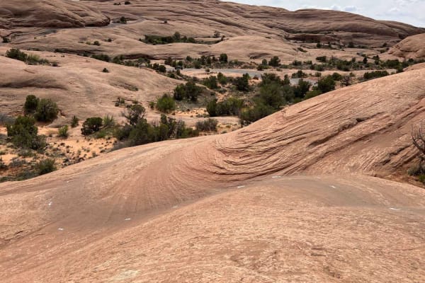
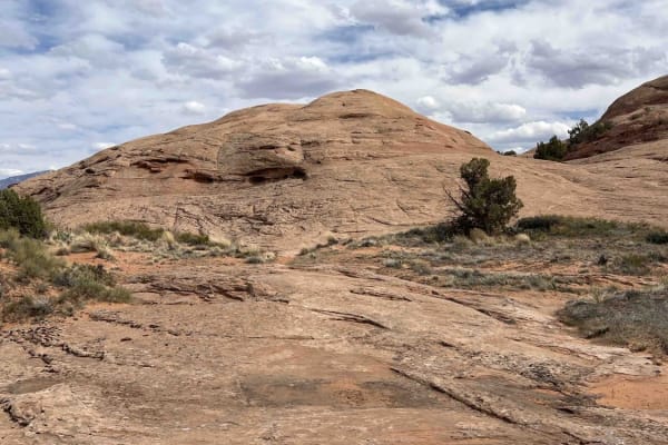
Slickrock 2
Slickrock 2 begins at Hell's Revenge Staircase Bypass & Overlook and continues northeast to the Slickrock Main Loop. This trail covers 0.7 miles across smooth slickrock and is well-marked with white painted lines on the ground. The trail has a few small bumps along the way but generally travels uphi...
Learn more about Slickrock 2
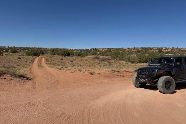
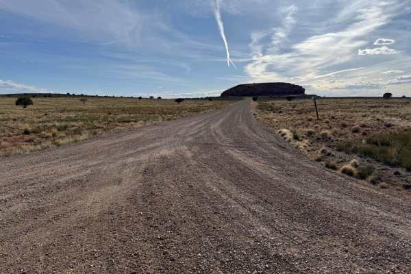
Sand Flats Road
Sand Flats Road is a wide, generally easy route that connects Moab to the Manti-La Sal National Forest. The drive has no major obstacles, though some narrow sections and washboarded stretches keep you attentive. Being close to town, it’s a well-trafficked corridor with trailheads and recreation acce...
Learn more about Sand Flats Road
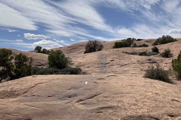
Slickrock 3
Slickrock 3 branches off of Slickrock 1 after about 0.4 miles and heads north/west to the Slickrock Main Loop. This trail is 2.2 miles long across smooth slickrock. The white paint markings on this route are worn and hard to see--especially in the beginning. Be aware: the markings do not match the O...
Learn more about Slickrock 3

Slickrock Moab Overlook
Slickrock Moab Overlook is a short trail that breaks off from the Slickrock Main Loop near the southwest corner of the loop. The trail travels west along a rock ridgeline which is smooth and without obstacles. When you get to the end on your bike, there isn't much of a view. You'll have to dismount ...
Learn more about Slickrock Moab Overlook
Slickrock 1
Slickrock 1 trail is the only trail branching off from the Slickrock Practice Loop that will take you to the main Slickrock Trail System. Heading west, this 0.7-mile-long track takes you up a decent climb before descending near the midpoint. From here, there are several smaller elevation changes and...
Learn more about Slickrock 1
Slickrock 7
Slickrock 7 begins at the intersection of Slickrock 6 and 8 and travels north until hitting the Slickrock Main Loop. This route is about 0.5 miles long over smooth slickrock with minimal markings. The white trail paint has mostly worn away (as of 2024). This trail is mostly flat until about midway, ...
Learn more about Slickrock 7
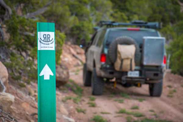
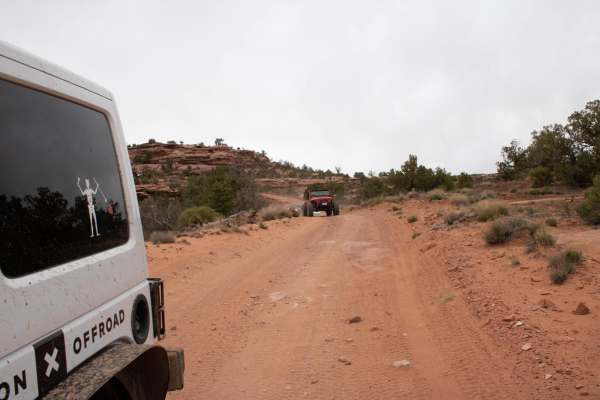
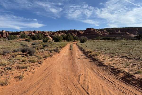
Rim Rocker
The Rim Rocker is a 160-mile route winding it's way through aspen groves, over red rock, along the edges of sheer cliffs, and across rivers. Spanning from Moab, Utah to Montrose, CO., the track varies from rocky two-track to perfectly graded gravel. Each mile offers something exciting and different,...
Learn more about Rim Rocker
Slickrock 5
Slickrock 5 is a shortcut trail that bridges across the Slickrock Main Loop at the northernmost part. By riding this trail, you'll skip the section of the Main Loop that runs closest to the Colorado River. Riding west, this trail runs downhill through a small valley. The painted trail makers are ext...
Learn more about Slickrock 5
Fins & Things Cutoff
This 0.6-mile point-to-point trail provides an early cutoff for the popular Fins and Things Trail. This trail allows off-roaders to depart the trail early if time does not permit completion of the entire trail. This trail can also be used to enter the Fins and Things trail to finish the last third o...
Learn more about Fins & Things Cutoff
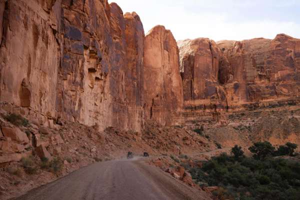
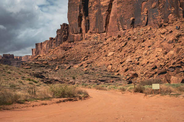
Hurrah Pass
Hurrah Pass is a classic Moab route that blends scenic red rock landscapes with approachable off-road terrain, making it one of the more accessible and popular trails in the region. The trail stretches west from the Kane Creek area, winding its way through a dramatic canyon corridor before climbing ...
Learn more about Hurrah Pass
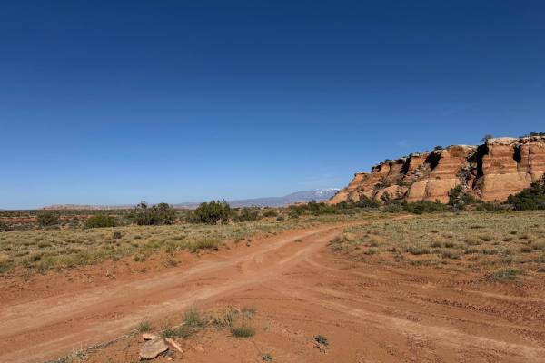
Long Canyon
Long Canyon is a beautiful and easy trail, beginning just off of 313 heading towards Dead Horse Park. Primarily rock, this trail has no major obstacles on it. Early on, there is a wash crossing that could prove problematic if a major rain event has happened. Later along the route, there is a giant r...
Learn more about Long Canyon
D1605
D1605 is known by some as Surprise Overlook. This very short trail delivers big on scenery, showcasing the immediate desert landscape and framing distant vistas of the La Sal Mountains. The reward at the trail's end is a breathtaking plunge into the depths of Day Canyon. True to its name, the overlo...
Learn more about D1605
Bridge Canyon Road
Bridge Canyon Road is an off shoot trail of Gemini Bridges, just before reaching The Gooney Bird Rock. This is an out and back trail with a loop at the end so turning around is less painful. The loop is smaller so if you have a camper or a trailer it may be more challenging. There are 4 designated d...
Learn more about Bridge Canyon Road
D1789
Beginning as a straightforward gravel road off of Gemini Bridges, this path eventually evolves into a more rustic two-track trail. As you progress onto the two-track portion, the terrain becomes a bit more challenging for some. Notably, this particular route is characterized by a lack of significant...
Learn more about D1789
D1900
D1900 is a trail that connects Metal Masher to another spot of the Gemini Bridges. There are some great views of the surrounding red rocks from this offshoot trail. This trail could be used as an entrance or exit point if there are a lot of vehicles sitting at the official Metal Masher trail sign.
Learn more about D1900
Eye of the Whale Arch
ATVs are currently not allowed in national parks so you will need to have a truck, Jeep, or other high clearance vehicle equipped with 4WD for this trail. The off-road portion is easy. If you just go slow over all the small and medium sized rocks you will be fine. But since this is mostly a sand ...
Learn more about Eye of the Whale Arch
Metal Masher Bypass
Not to be confused with the Widow Maker Bypass (which bypasses the Widow Maker obstacle), this trail (officially designated D1799) allows either half of Metal Masher to be bypassed. The bypass is a dirt road, with a quarter-mile stretch at the north end covered with small rocks (3-6 inches in diamet...
Learn more about Metal Masher Bypass
D1782
This trail primarily consists of sandy terrain, with sections exhibiting washout areas that require mindful navigation. Despite these features, the trail remains relatively straightforward, gradually descending towards the base of a significant and impressive rock formation that serves as its natura...
Learn more about D1782
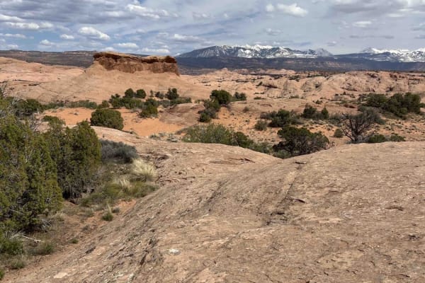
Minor Overlook
Despite its name, Minor Overlook delivers impressive views of the La Sal Mountains, buttes, and the Colorado River. It's a great stop both morning and afternoon: mornings highlight the canyon and river, while afternoons showcase the La Sals (though the canyon view remains worthwhile). The overlook i...
Learn more about Minor Overlook
D1781
This is an offshoot trail from Saucer Canyon. This trail offers a diverse driving surface, alternating between sandy stretches and sections of solid, hard rock. The truly stunning panoramic vistas that unfold along this trail offer a significant reward for your journey.There are also some spots towa...
Learn more about D1781
Beginner ATV trails near Moab, Utah
Explore ATV-friendly trails near you. These trails are accessible for vehicles up to 50 inches wide, perfect for ATVs and smaller off-road machines.
Sand Flats Road
Sand Flats Road is a wide, generally easy route that connects Moab to the Manti-La Sal National Forest. The drive has no major obstacles, though some narrow sections and washboarded stretches keep you attentive. Being close to town, it’s a well-trafficked corridor with trailheads and recreation acce...
Learn more about Sand Flats Road
Rim Rocker
The Rim Rocker is a 160-mile route winding it's way through aspen groves, over red rock, along the edges of sheer cliffs, and across rivers. Spanning from Moab, Utah to Montrose, CO., the track varies from rocky two-track to perfectly graded gravel. Each mile offers something exciting and different,...
Learn more about Rim Rocker
Fins & Things Cutoff
This 0.6-mile point-to-point trail provides an early cutoff for the popular Fins and Things Trail. This trail allows off-roaders to depart the trail early if time does not permit completion of the entire trail. This trail can also be used to enter the Fins and Things trail to finish the last third o...
Learn more about Fins & Things Cutoff
Hurrah Pass
Hurrah Pass is a classic Moab route that blends scenic red rock landscapes with approachable off-road terrain, making it one of the more accessible and popular trails in the region. The trail stretches west from the Kane Creek area, winding its way through a dramatic canyon corridor before climbing ...
Learn more about Hurrah Pass
Beginner UTV/side-by-side trails near Moab, Utah
Find UTV and side-by-side trails near you. These trails accommodate vehicles up to 60 inches wide, ideal for UTVs, side-by-sides, and wider off-road rigs.
Sand Flats Road
Sand Flats Road is a wide, generally easy route that connects Moab to the Manti-La Sal National Forest. The drive has no major obstacles, though some narrow sections and washboarded stretches keep you attentive. Being close to town, it’s a well-trafficked corridor with trailheads and recreation acce...
Learn more about Sand Flats Road
Rim Rocker
The Rim Rocker is a 160-mile route winding it's way through aspen groves, over red rock, along the edges of sheer cliffs, and across rivers. Spanning from Moab, Utah to Montrose, CO., the track varies from rocky two-track to perfectly graded gravel. Each mile offers something exciting and different,...
Learn more about Rim Rocker
Fins & Things Cutoff
This 0.6-mile point-to-point trail provides an early cutoff for the popular Fins and Things Trail. This trail allows off-roaders to depart the trail early if time does not permit completion of the entire trail. This trail can also be used to enter the Fins and Things trail to finish the last third o...
Learn more about Fins & Things Cutoff
Hurrah Pass
Hurrah Pass is a classic Moab route that blends scenic red rock landscapes with approachable off-road terrain, making it one of the more accessible and popular trails in the region. The trail stretches west from the Kane Creek area, winding its way through a dramatic canyon corridor before climbing ...
Learn more about Hurrah Pass
The onX Offroad Difference
onX Offroad combines trail photos, descriptions, difficulty ratings, width restrictions, seasonality, and more in a user-friendly interface. Available on all devices, with offline access and full compatibility with CarPlay and Android Auto. Discover what you're missing today!
Open Trail Map