
Beginner Off-Road Trails
Near Castle Valley, Utah
Explore All Beginner Trails Near Castle Valley, Utah
Beginner Off-Road Trails Near Castle Valley, Utah
Discover the best beginner-friendly off-road trails near you. These easier, lower-rated trails are a great place to start — browse trail maps, check difficulty ratings, and find your next adventure.
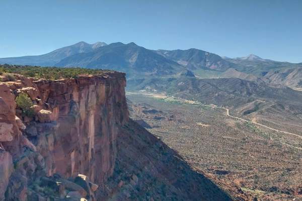
Adobe Mesa
This trail accesses the Adobe Mesa. It is a 12-mile round-trip out-and-back trail. The mesa peninsula overlook is about another 1.4-mile round-trip walk from the end of the motorized trail. The overlook offers spectacular views of the Castle Valley and surrounding areas. The trail heads west from Ta...
Learn more about Adobe Mesa
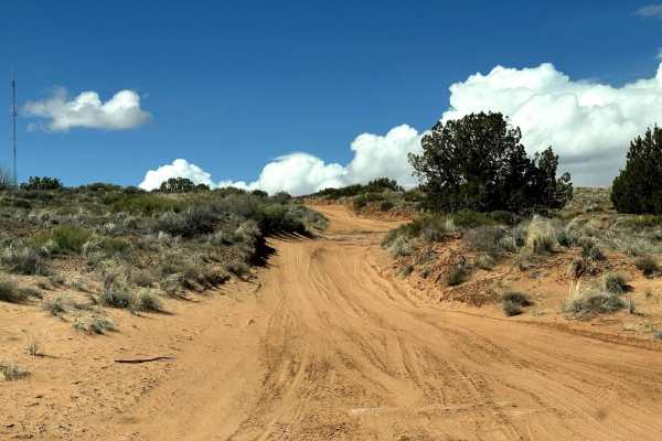
Fins & Things Cutoff
This 0.6-mile point-to-point trail provides an early cutoff for the popular Fins and Things Trail. This trail allows off-roaders to depart the trail early if time does not permit completion of the entire trail. This trail can also be used to enter the Fins and Things trail to finish the last third o...
Learn more about Fins & Things Cutoff
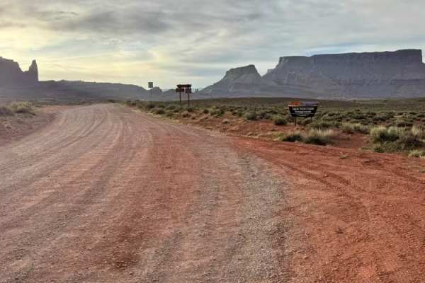
Onion Creek
Onion Creek is one of those rare Moab routes that feels different around every bend. The trail begins in wide-open desert with sweeping views of towering mesas, Fisher Towers, and distant mountain backdrops before narrowing into a colorful canyon lined with layered red rock walls. As you continue, t...
Learn more about Onion Creek

Loop Road Trail FR Rd 636
This loop road goes from the Kokopelli Trail to the Tracking Station Road. It winds around, up and down with several crossings of the Jimmy Keen hike and bike trail. There is a single spot to camp in the lower section of the road next to one of the crossings. The road mainly serves the purpose of co...
Learn more about Loop Road Trail FR Rd 636
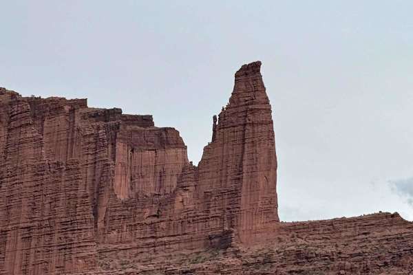
Fisher Tower Viewpoint
This trail can be joined from the Onion Creek/Fisher Towers trail. It is only a 1.5-mile round trip but is technical for lower-clearance vehicles due to the slick rock and small ledges. At the end, drivers arrive at a larger parking area and are rewarded with a beautiful viewpoint of Fisher Towers.
Learn more about Fisher Tower Viewpoint
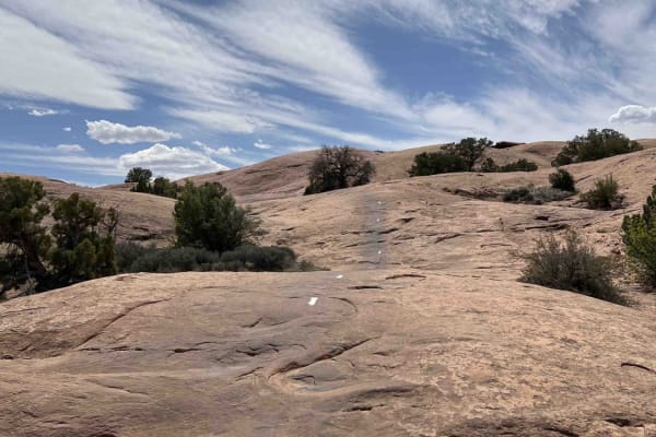
Slickrock 1
Slickrock 1 trail is the only trail branching off from the Slickrock Practice Loop that will take you to the main Slickrock Trail System. Heading west, this 0.7-mile-long track takes you up a decent climb before descending near the midpoint. From here, there are several smaller elevation changes and...
Learn more about Slickrock 1
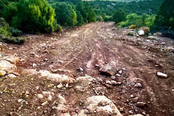
Tracking Station Road
Tracking Station Road is a nice short road off Mountain Loop Road going back to Sand Flats Recreation Area. Towards the Mountain Loop Road's end, there are several primitive campsite spots. The road gets a bit rougher near Sand Flats Road where 4WD may be necessary. The drive towards Sand Flats in t...
Learn more about Tracking Station Road
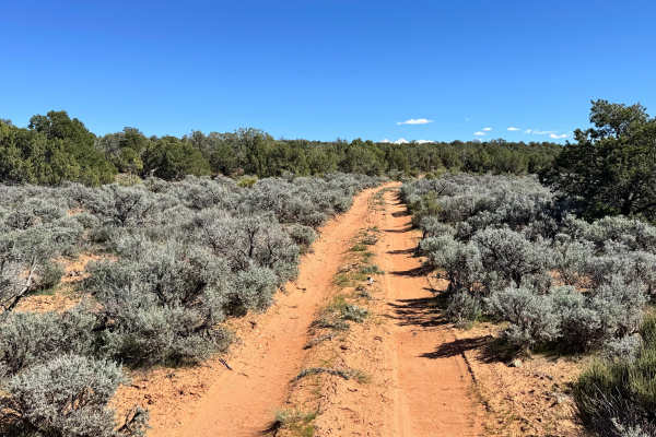
Professor Valley Rim
Non-Resident OHV permits apply to ATVs, UTVs, and dirt bikes. Plated street-legal vehicles typically do not need one on legal motorized routes. This short 1.6-mile dead-end spur follows the southwest end of Dome Plateau to a dramatic rim nearly 2,000 feet above Professor Valley. For more than half a...
Learn more about Professor Valley Rim
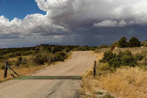
Sand Flats Road
Sand Flats Road is an accessible, beginner-friendly dirt route that serves as the primary connection between Moab and the scenic Manti-La Sal National Forest, making it perfect for offroaders seeking stunning canyon views without technical difficulty. Spanning approximately 18.7 miles, this unpaved ...
Learn more about Sand Flats Road
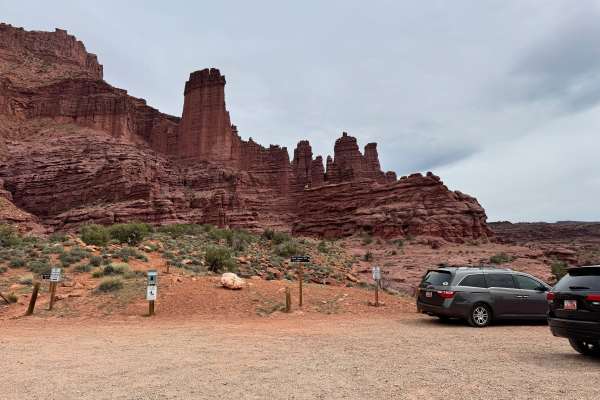
Fisher Tower Road
This route follows a wide, well-traveled gravel road through one of the most scenic desert landscapes near Moab. Suitable for most stock high-clearance vehicles in dry conditions, the road is generally easy to navigate but features frequent washboards that can make the ride rough at higher speeds. A...
Learn more about Fisher Tower Road
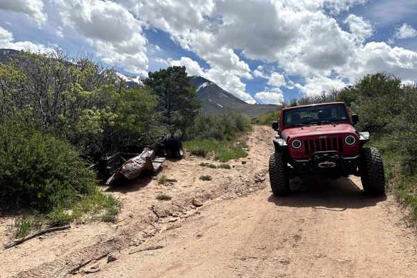
Kokopelli Trail (Castle Valley Overlook to Sand Flats Road)
This 3.8-mile point-to-point trail is part of the larger Kokopelli Trail System. This portion takes you from the Castle Valley Overlook on La-Sal Mountain Loop Road to Sand Flats Road. Sand Flats Road goes into the Sand Flats Recreation Area which is a Grand County Fee area. The first half of this t...
Learn more about Kokopelli Trail (Castle Valley Overlook to Sand Flats Road)
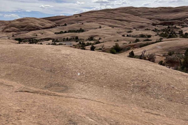
Slickrock 3
Slickrock 3 branches off of Slickrock 1 after about 0.4 miles and heads north/west to the Slickrock Main Loop. This trail is 2.2 miles long across smooth slickrock. The white paint markings on this route are worn and hard to see--especially in the beginning. Be aware: the markings do not match the O...
Learn more about Slickrock 3
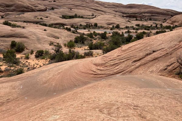
Slickrock 2
Slickrock 2 begins at Hell's Revenge Staircase Bypass & Overlook and continues northeast to the Slickrock Main Loop. This trail covers 0.7 miles across smooth slickrock and is well-marked with white painted lines on the ground. The trail has a few small bumps along the way but generally travels uphi...
Learn more about Slickrock 2
Slickrock 5
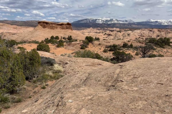
Slickrock 5 is a shortcut trail that bridges across the Slickrock Main Loop at the northernmost part. By riding this trail, you'll skip the section of the Main Loop that runs closest to the Colorado River. Riding west, this trail runs downhill through a small valley. The painted trail makers are ext...
Learn more about Slickrock 5
Slickrock 7
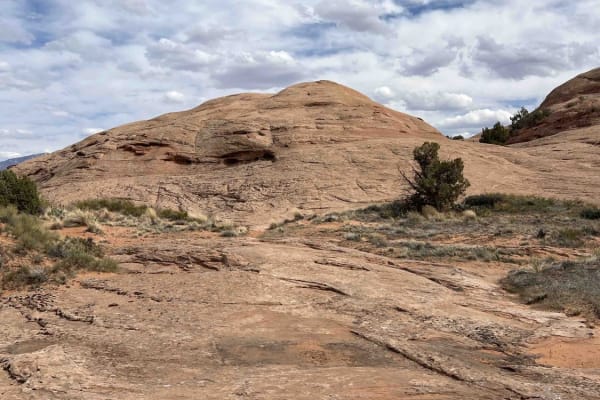
Slickrock 7 begins at the intersection of Slickrock 6 and 8 and travels north until hitting the Slickrock Main Loop. This route is about 0.5 miles long over smooth slickrock with minimal markings. The white trail paint has mostly worn away (as of 2024). This trail is mostly flat until about midway, ...
Learn more about Slickrock 7
Dome Plateau - BLM 345
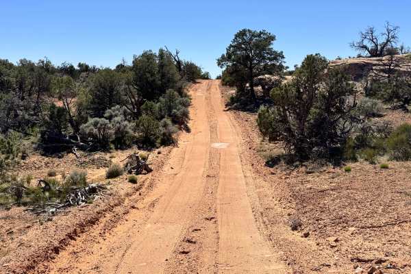
Non-Resident OHV permits apply to ATVs, UTVs, and dirt bikes. Plated street-legal vehicles typically do not need one on legal motorized routes. This route begins as a smooth, maintained dirt road that is easy to travel and suitable for most high-clearance 4x4s. As you continue farther in, the road t...
Learn more about Dome Plateau - BLM 345
Rim Rocker
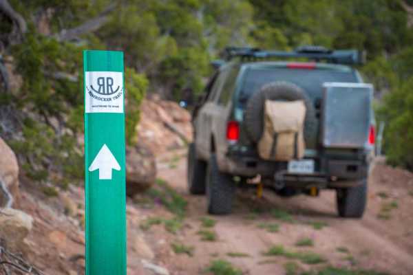
The Rim Rocker is a 160-mile route winding it's way through aspen groves, over red rock, along the edges of sheer cliffs, and across rivers. Spanning from Moab, Utah to Montrose, CO., the track varies from rocky two-track to perfectly graded gravel. Each mile offers something exciting and different,...
Learn more about Rim Rocker
Slickrock Moab Overlook
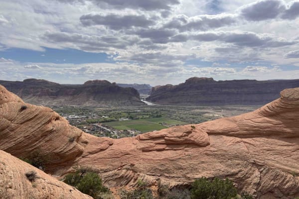
Slickrock Moab Overlook is a short trail that breaks off from the Slickrock Main Loop near the southwest corner of the loop. The trail travels west along a rock ridgeline which is smooth and without obstacles. When you get to the end on your bike, there isn't much of a view. You'll have to dismount ...
Learn more about Slickrock Moab Overlook
Richardson Overlook
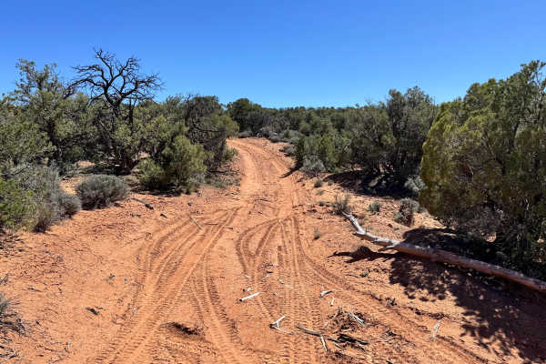
Non-Resident OHV permits apply to ATVs, UTVs, and dirt bikes. Plated street-legal vehicles typically do not need one on legal motorized routes. Tucked away in a lesser-used section of Dome Plateau, Richardson Overlook is a short out-and-back spur that delivers a rewarding destination with impressive...
Learn more about Richardson Overlook
Dome Plateau - BLM 2118
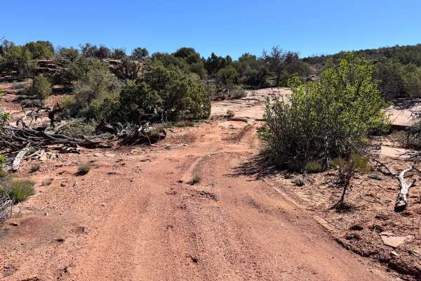
Non-Resident OHV permits apply to ATVs, UTVs, and dirt bikes. Plated street-legal vehicles typically do not need one on legal motorized routes. This spur is a 1.75-mile dead-end out-and-back route that leads to an east-facing rim with elevated views over the Colorado River and the tip of Dome Platea...
Learn more about Dome Plateau - BLM 2118
Beginner ATV trails near Castle Valley, Utah
Explore ATV-friendly trails near you. These trails are accessible for vehicles up to 50 inches wide, perfect for ATVs and smaller off-road machines.
Adobe Mesa
This trail accesses the Adobe Mesa. It is a 12-mile round-trip out-and-back trail. The mesa peninsula overlook is about another 1.4-mile round-trip walk from the end of the motorized trail. The overlook offers spectacular views of the Castle Valley and surrounding areas. The trail heads west from Ta...
Learn more about Adobe Mesa
Fins & Things Cutoff
This 0.6-mile point-to-point trail provides an early cutoff for the popular Fins and Things Trail. This trail allows off-roaders to depart the trail early if time does not permit completion of the entire trail. This trail can also be used to enter the Fins and Things trail to finish the last third o...
Learn more about Fins & Things Cutoff
Onion Creek
Onion Creek is one of those rare Moab routes that feels different around every bend. The trail begins in wide-open desert with sweeping views of towering mesas, Fisher Towers, and distant mountain backdrops before narrowing into a colorful canyon lined with layered red rock walls. As you continue, t...
Learn more about Onion Creek
Loop Road Trail FR Rd 636
This loop road goes from the Kokopelli Trail to the Tracking Station Road. It winds around, up and down with several crossings of the Jimmy Keen hike and bike trail. There is a single spot to camp in the lower section of the road next to one of the crossings. The road mainly serves the purpose of co...
Learn more about Loop Road Trail FR Rd 636
Beginner UTV/side-by-side trails near Castle Valley, Utah
Find UTV and side-by-side trails near you. These trails accommodate vehicles up to 60 inches wide, ideal for UTVs, side-by-sides, and wider off-road rigs.
Adobe Mesa
This trail accesses the Adobe Mesa. It is a 12-mile round-trip out-and-back trail. The mesa peninsula overlook is about another 1.4-mile round-trip walk from the end of the motorized trail. The overlook offers spectacular views of the Castle Valley and surrounding areas. The trail heads west from Ta...
Learn more about Adobe Mesa
Fins & Things Cutoff
This 0.6-mile point-to-point trail provides an early cutoff for the popular Fins and Things Trail. This trail allows off-roaders to depart the trail early if time does not permit completion of the entire trail. This trail can also be used to enter the Fins and Things trail to finish the last third o...
Learn more about Fins & Things Cutoff
Onion Creek
Onion Creek is one of those rare Moab routes that feels different around every bend. The trail begins in wide-open desert with sweeping views of towering mesas, Fisher Towers, and distant mountain backdrops before narrowing into a colorful canyon lined with layered red rock walls. As you continue, t...
Learn more about Onion Creek
Loop Road Trail FR Rd 636
This loop road goes from the Kokopelli Trail to the Tracking Station Road. It winds around, up and down with several crossings of the Jimmy Keen hike and bike trail. There is a single spot to camp in the lower section of the road next to one of the crossings. The road mainly serves the purpose of co...
Learn more about Loop Road Trail FR Rd 636
The onX Offroad Difference
onX Offroad combines trail photos, descriptions, difficulty ratings, width restrictions, seasonality, and more in a user-friendly interface. Available on all devices, with offline access and full compatibility with CarPlay and Android Auto. Discover what you're missing today!
Open Trail Map