
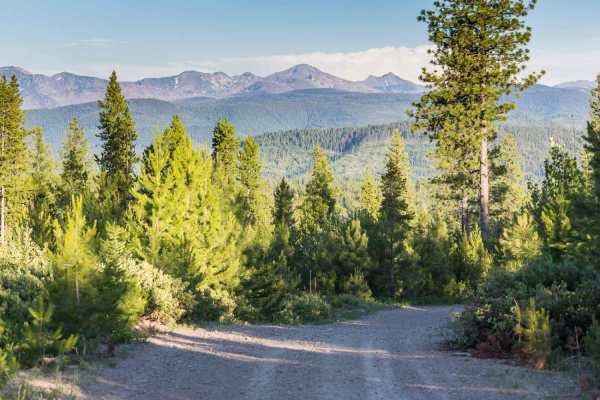
Beginner Off-Road Trails
Near Orchard Homes, Montana
Explore All Beginner Trails Near Orchard Homes, Montana
Beginner Off-Road Trails Near Orchard Homes, Montana
Discover the best beginner-friendly off-road trails near you. These easier, lower-rated trails are a great place to start — browse trail maps, check difficulty ratings, and find your next adventure.
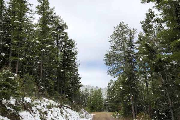
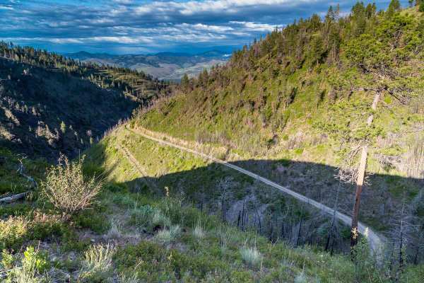
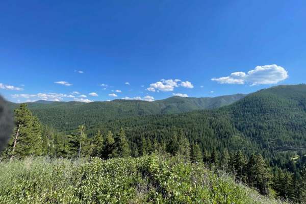
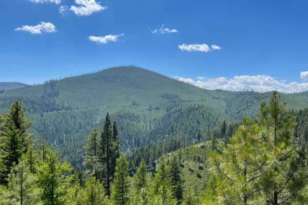
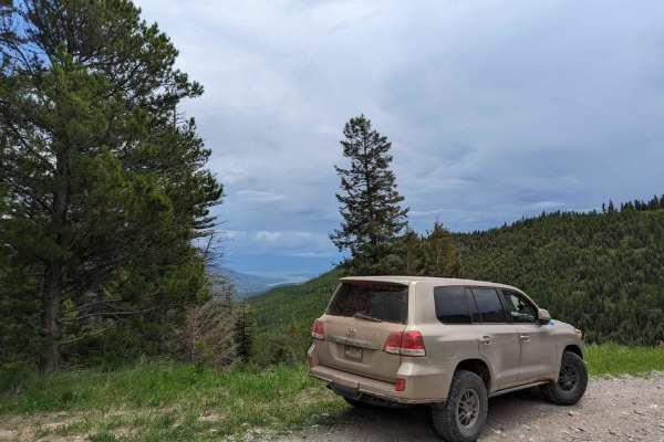
Blue Mountain
Be sure to start your day with a round of frisbee golf at the Blue Mountain Disc Golf Course before continuing up Blue Mountain to find incredible vistas of the Missoula valley. The road is well maintained gravel with some deeper potholes and jagged rocks but be prepared to run into snow during the ...
Learn more about Blue Mountain
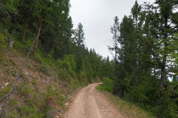
Larch Camp Road
Larch Camp Road is Located in a part of The Lolo National Forest in the South Hills of Missoula, Montana. It is a scenic backcountry road just a few miles from town. Great hiking in the area along with amazing scenery all around. Road is easy gravel for any type of vehicle.
Learn more about Larch Camp Road
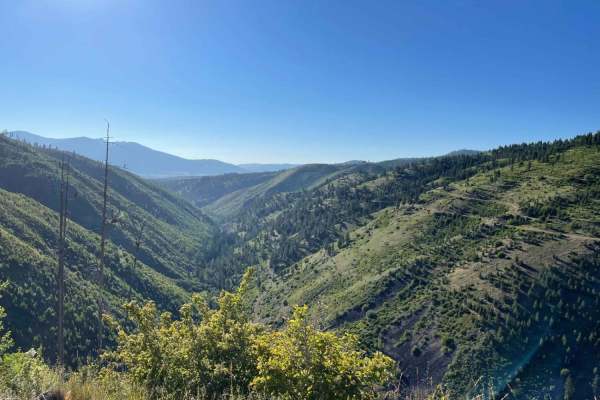
Forest Service (FS) #2127-1
Forest Service (FS) #2127-1 is open from 5/16 to 11/30. The 7.3-mile drive along the rugged forest service road is an adventurous and scenic journey. Steep mountainsides offer thrilling moments and breathtaking views of the skyline that make it worthwhile. Despite the rough terrain, cell phone servi...
Learn more about Forest Service (FS) #2127-1
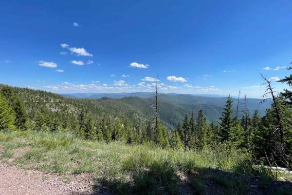
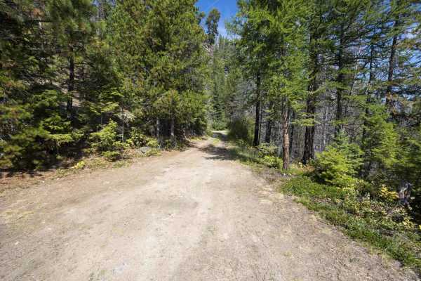
Mormon Peak
The Mormon Peak Trail is an out and back at Lolo National Forest, Montana. The ride is very smooth until a bumpy section at the top. There are pull-outs along the trail to camp, but the campsite at Mormon Peak has breathtaking views. Some cell service can be found on top of the mountain, but be sure...
Learn more about Mormon Peak
McClain Creek Road (FS 1311)
McClain Creek Road is also known as Forest Service Road 1311 and goes from the Bitterroot Valley to Carlton Lake but is gated at the 5-mile mark. The road passes through the former McClay Ranch land that was part of the attempt to build Bitterroot Resort in the early 2000's. The road will cut across...
Learn more about McClain Creek Road (FS 1311)
Elk Meadows - Packers Meadows
This is an enjoyable route that can be completed in 1-2 hours. The route consists of Forest Service roads that will take you through parts of Lolo and Clearwater National forests and is usually free of snow by mid-June. There are many spur trails and dispersed camping areas along this route.
Learn more about Elk Meadows - Packers Meadows
Bear Creek FS 504 and 4239
This is an out-and-back route in the Lolo National Forest. The first right-hand turn takes you to a gate just before a bridge that crosses Bear Creek. The left turn takes you up the west side of the drainage above Bear Creek and provides stunning views of the Bitterroot Mountains. There were several...
Learn more about Bear Creek FS 504 and 4239
West Greenough
This easy out-and-back passes by a great shooting range spot carved into the hillside about a third of the way along the trail. There are tight turns and muddy puddles from all the little springs that bubble up along the trail. Watch for boulders that roll down the cliffside, as they could be hiding...
Learn more about West Greenough
Middle Fork Schwartz
This ridge road blasts across the top of the ridge over the Yukon Saddle. It has long straight always with epic views, a dense forest section, an old burned-out section that's regrowing well, and a western-facing section that's hot as heck. There are some severe pot craters. Not potholes, craters! K...
Learn more about Middle Fork Schwartz
Miller Peak
This peak tower access road starts with some loose rocky, rutted, steep, and longer duration climbs. There are also a few rainwater diverting hills. Once those are out of the way, the trail is relatively easy, with tight turns and some rocky sections. A few spots collect water and end up with larger...
Learn more about Miller Peak
Albert Lothrop Rd 5563
Climb your way up into the hills above Alberton and enjoy the views of the Clark Fork river as well as the hills of the Lolo National Forest. This well maintained dirt road is open year-round but is inaccessible to the majority of wheeled vehicles during winter due to snow. Snow often melts by mid s...
Learn more about Albert Lothrop Rd 5563
Edith Peak Trail 42
Feeling like going for a hike without all the sweat and effort? Hop on your ATV or Dirt Bike and head up Edith Peak Trail 42. Weave your way between the ponderosas and larches, shimmy your way along narrow drops to the valley below, and splash through the puddles or snow along the way. Enjoy the vie...
Learn more about Edith Peak Trail 42
Corral Creek Rd 2146
Corral Creek road draws its name from the corral at the north end of the road and offers access to beautiful views of the Missoula and Frenchtown areas as well as access to the Lolo National Forest. Whether you're looking for camping, hunting, or just looking for some fields of wildflowers, this is ...
Learn more about Corral Creek Rd 2146
West Holloman Schwartz
This rim road cruises along the top of the hills and has epic views around almost every corner as it twists and turns its way to the Holoman Saddle. There are a few different decent-sized pullouts that make a great spot to camp for the night with established rock fire rings. Keep an eye out for wild...
Learn more about West Holloman Schwartz
8 Mile
This narrow, easy climb heads from the Bitterroot valley into the sapphire mountains. It begins in a residential area and then hits loose, steep switchbacks to begin the ascent. The trail gets relatively narrow in parts and has many low branches. Be aware of some rockslide areas and frequent slides ...
Learn more about 8 Mile
Small Creek FS 4292
This offshoot of Elk Meadows FS 451 offers fantastic views of the South Fork of Lolo Creek drainage. There are several nice dispersed campsites that have excellent views. The out-and-back extension is worth checking out if you are already on a trip from Elk Meadows to Packer Meadows and have extra t...
Learn more about Small Creek FS 4292
East Twin Creek Road 2117 (To Sheep Mountain hiking Trailhead)
This trail is an easy track that climbs up Sheep Mountain while gaining a lot of elevation. The trail is wide until you reach the upper portion where passing becomes more difficult. There is a parking area at the hiking trailhead. The trail starts at about 3,500 Ft in elevation and climbs to almost ...
Learn more about East Twin Creek Road 2117 (To Sheep Mountain hiking Trailhead)
Wagon Mountain Road
Wagon Mountain Road travels between Graves Creek Road and Fish Creek Road, mostly along a ridge in the Lolo National Forest. When starting at Graves Creek Road, you have the option to exit via Howard Creek or Fish Creek Road heading north or south. You can also take FS 4237 to the location of the pr...
Learn more about Wagon Mountain Road
Schwartz Creek
This dirt road into the Saphire Mountains is THE smoothest and most effortless way up the mountain range. The grade isn't steep. The potholes are few. The only drawback is that there are few pullouts for oncoming traffic, but you'll make it work. There are a couple of directions you can choose to ad...
Learn more about Schwartz Creek
Sluice Creek
This is a rocky twisty ridge road. It's open seasonally with a gate near the first bottom switchback. The trail has fantastic views of the Bitterroot Valley and Sapphire Range. The trail is loose and rocky; in some spots, rockslides and loose hills could leave large impassable boulders in the way. T...
Learn more about Sluice Creek
Beginner ATV trails near Orchard Homes, Montana
Explore ATV-friendly trails near you. These trails are accessible for vehicles up to 50 inches wide, perfect for ATVs and smaller off-road machines.
Blue Mountain
Be sure to start your day with a round of frisbee golf at the Blue Mountain Disc Golf Course before continuing up Blue Mountain to find incredible vistas of the Missoula valley. The road is well maintained gravel with some deeper potholes and jagged rocks but be prepared to run into snow during the ...
Learn more about Blue Mountain
Larch Camp Road
Larch Camp Road is Located in a part of The Lolo National Forest in the South Hills of Missoula, Montana. It is a scenic backcountry road just a few miles from town. Great hiking in the area along with amazing scenery all around. Road is easy gravel for any type of vehicle.
Learn more about Larch Camp Road
Forest Service (FS) #2127-1
Forest Service (FS) #2127-1 is open from 5/16 to 11/30. The 7.3-mile drive along the rugged forest service road is an adventurous and scenic journey. Steep mountainsides offer thrilling moments and breathtaking views of the skyline that make it worthwhile. Despite the rough terrain, cell phone servi...
Learn more about Forest Service (FS) #2127-1
Mormon Peak
The Mormon Peak Trail is an out and back at Lolo National Forest, Montana. The ride is very smooth until a bumpy section at the top. There are pull-outs along the trail to camp, but the campsite at Mormon Peak has breathtaking views. Some cell service can be found on top of the mountain, but be sure...
Learn more about Mormon Peak
Beginner UTV/side-by-side trails near Orchard Homes, Montana
Find UTV and side-by-side trails near you. These trails accommodate vehicles up to 60 inches wide, ideal for UTVs, side-by-sides, and wider off-road rigs.
Blue Mountain
Be sure to start your day with a round of frisbee golf at the Blue Mountain Disc Golf Course before continuing up Blue Mountain to find incredible vistas of the Missoula valley. The road is well maintained gravel with some deeper potholes and jagged rocks but be prepared to run into snow during the ...
Learn more about Blue Mountain
Larch Camp Road
Larch Camp Road is Located in a part of The Lolo National Forest in the South Hills of Missoula, Montana. It is a scenic backcountry road just a few miles from town. Great hiking in the area along with amazing scenery all around. Road is easy gravel for any type of vehicle.
Learn more about Larch Camp Road
Forest Service (FS) #2127-1
Forest Service (FS) #2127-1 is open from 5/16 to 11/30. The 7.3-mile drive along the rugged forest service road is an adventurous and scenic journey. Steep mountainsides offer thrilling moments and breathtaking views of the skyline that make it worthwhile. Despite the rough terrain, cell phone servi...
Learn more about Forest Service (FS) #2127-1
Mormon Peak
The Mormon Peak Trail is an out and back at Lolo National Forest, Montana. The ride is very smooth until a bumpy section at the top. There are pull-outs along the trail to camp, but the campsite at Mormon Peak has breathtaking views. Some cell service can be found on top of the mountain, but be sure...
Learn more about Mormon Peak
The onX Offroad Difference
onX Offroad combines trail photos, descriptions, difficulty ratings, width restrictions, seasonality, and more in a user-friendly interface. Available on all devices, with offline access and full compatibility with CarPlay and Android Auto. Discover what you're missing today!
Open Trail Map