
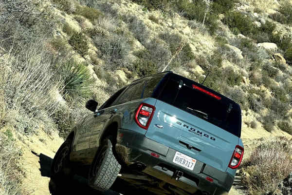
Beginner Off-Road Trails
Near Mount Laguna, California
Explore All Beginner Trails Near Mount Laguna, California
Beginner Off-Road Trails Near Mount Laguna, California
Discover the best beginner-friendly off-road trails near you. These easier, lower-rated trails are a great place to start — browse trail maps, check difficulty ratings, and find your next adventure.
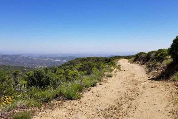
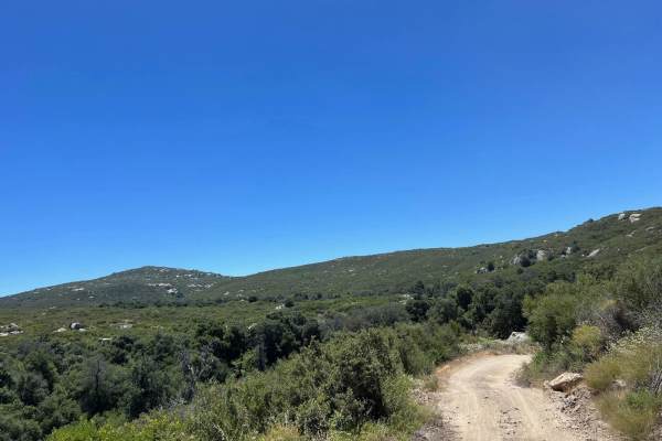
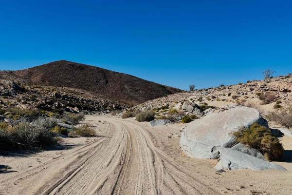
16S08 Fred Canyon Road
16S08 Fred Canyon Road is a 6.1-mile point-to-point trail rated 3 of 10 located within the Cleveland National Forest, Descanso Ranger District. This trail is usually run in conjunction with Fred Canyon to create a 14.2-mile point-to-point trail. It's generally considered a moderately challenging rou...
Learn more about 16S08 Fred Canyon Road
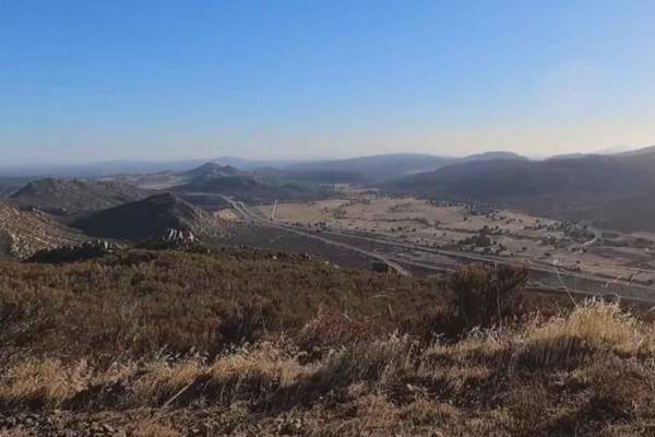
15S18 Sheephead Mountain Road
15S18 Sheephead Mountain Road is a 4.6-mile out-and-back trail rated 3 of 10 located within the Cleveland National Forest, Descanso Ranger District. The trail to the top is a full 6.8 miles, but due to a slide, the trail is closed at the 2.3-mile point. This trail is a continual climb from the trail...
Learn more about 15S18 Sheephead Mountain Road
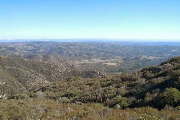
15S05 La Posta Truck Trail
15S05 La Posta Truck Trail is a 7.6-mile point-to-point trail rated 3 of 10 located within the Cleveland National Forest, Descanso Ranger District. This trail is usually run in conjunction with Fred Canyon to create a 14.2-mile point-to-point trail and can be run in either direction. It's generally ...
Learn more about 15S05 La Posta Truck Trail
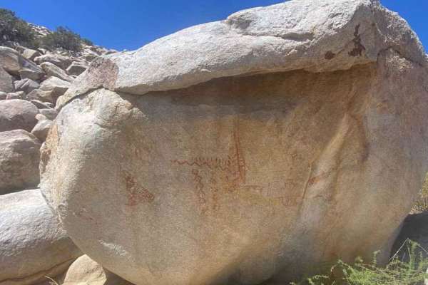
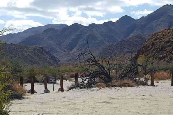
Blair Valley Pictographs
Blair Valley Pictographs is a 2.8-mile out-and-back trail rated 3 out of 10 within the California Anza-Borrego Desert State Park. This short dirt track ends at a small parking area and trailhead. A BLM informational sign is located here providing information about the location of the pictograph rock...
Learn more about Blair Valley Pictographs
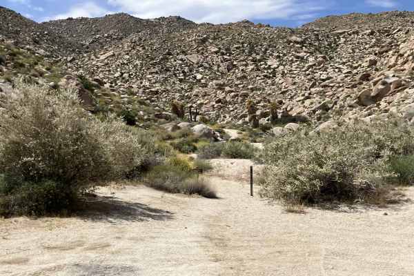
Indian Valley South Fork
This is an out-and-back spur trail (6-miles round trip) off Indian Gorge Road that leads to a dead-end box canyon. The trail is only single-vehicle wide, relatively flat, and comprised of packed dirt with sections of shallow sand. At the dead-end, there is a protected area large enough for up to fiv...
Learn more about Indian Valley South Fork
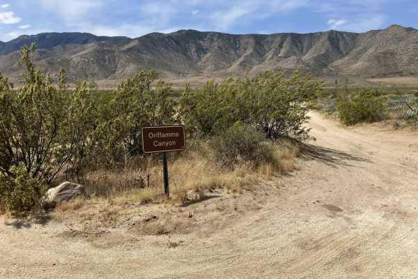
Oriflamme Canyon Backdoor
This short single vehicle-width trail connects the Oriflamme Canyon Loop trail with Highway S2, allowing vehicles to enter/exit the Oriflamme Canyon area from the eastern side. It is primarily a dirt road that winds through and around a sandy wash. There are also occasional large rocks that are easi...
Learn more about Oriflamme Canyon Backdoor
Blair Valley Loop
Blair Valley Loop is a 7.9-mile point-to-point trail rated 3 of 10 within the California Anza-Borrego Desert State Park. Blair Valley area is a collection of two small valleys with several attractions to see. The trip around the loop road through these valleys passes three major attractions. The mos...
Learn more about Blair Valley Loop
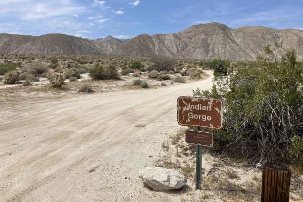
Indian Gorge Road
This one-vehicle-width trail runs into the Indian Valley area of the Anza Borrego Desert State Park and is restricted to street-legal vehicles only. It is an out-and-back route (10 miles round-trip) that is relatively flat and comprised of hard-packed dirt and shallow sand with occasional rocks prot...
Learn more about Indian Gorge Road
Corral Canyon Road
This is the main east-west connector inside the Corral Canyon OHV area and can be run in either direction. There are some gentle obstacles as this is a poorly maintained forest service road, and can be used to bypass the long way around Los Pinos Mountain Loop, especially the newly created waterfall...
Learn more about Corral Canyon Road
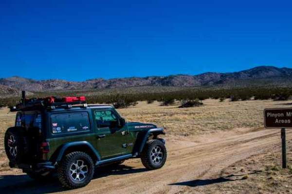
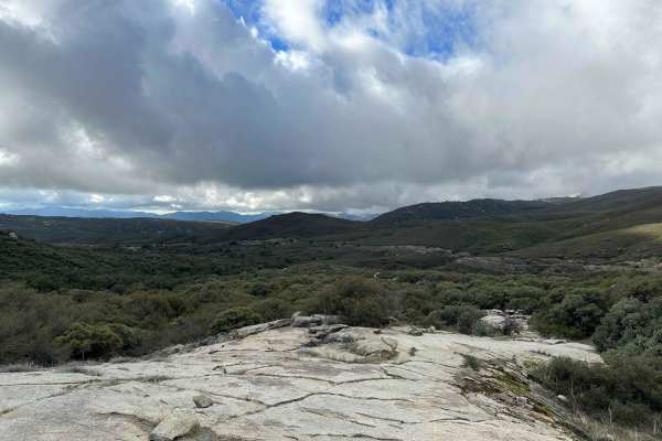
North Pinyon Mountain Road
This trail traverses a scenic desert landscape. It is an out-and-back trail with designated areas for dispersed camping. A spur trail offers a scenic and level campsite equipped with a fire ring. Ground fires are strictly prohibited in Anza-Borrego Desert State Park to safeguard the desert soil. Cam...
Learn more about North Pinyon Mountain Road

Hueso Wash
Arroyo Hueso, also known as Hueso Wash, is a scenic trail located within Anza Borrego State Park. The trail’s name is derived from the Spanish word “hueso,” meaning bone. The trail offers a moderate difficulty level, spanning 5.9 miles in an out-and-back loop. The terrain is predominantly soft sand ...
Learn more about Hueso Wash
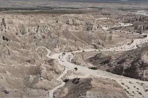
Arroyo Seco del Diablo
Arroyo Seco del Diablo is a 13.2-mile point-to-point trail rated 3 of 10 located within the California Anza-Borrego Desert State Park (ABDSP). Arroyo Seco del Diablo is Spanish for Devil's Dry Wash and lies amid the Carrizo Badlands, part of the alluvial fan from the ancestral Colorado River. The wa...
Learn more about Arroyo Seco del Diablo
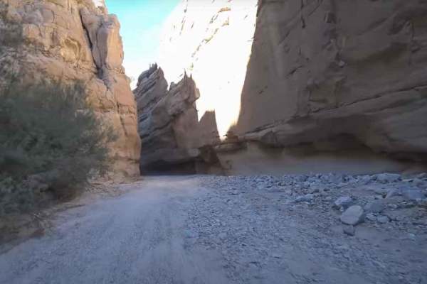
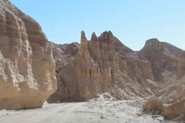
Sandstone Canyon Trail
Sandstone Canyon Trail is a 3.4-mile out-and-back trail rated 3 out of 10 located within the Anza-Borrego Desert State Park. The trail provides the unique opportunity to drive in one of the only slot canyons in the park. The trailhead is located in Fish Creek Wash. The wash consists of sandy wash an...
Learn more about Sandstone Canyon Trail
Olla Wash
This is an out-and-back trail that splits from Fish Creek wash in the Sandstone Canyon area of Anza Borrego State Park. Just before the end of the trail, there is a small fork; to the right, there is a small dispersed campsite with a fire ring, to the left, the wash ends at the wilderness boundary a...
Learn more about Olla Wash
Arroyo Tapiado Trail
Arroyo Tapiado Trail is a 9.1-mile point-to-point trail rated 3 of 10 located in located within the California Anza-Borrego Desert State Park (ABDSP). Trails within the ABDSP are restricted to street-legal vehicles. Arroyo Tapiado is one of the most visited washes within the ABDSP. The wash itself p...
Learn more about Arroyo Tapiado Trail
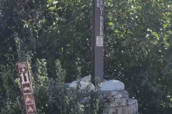
Gunslinger Trail #11
Gunslinger Trail #11 is a 1.8-mile point-to-point trail rated 3 of 10 located in the Corral Canyon OHV recreation area. Corral Canyon OHV is located roughly 30 miles east of San Diego and it offers trails for all types of offroad vehicles, including dirtbike single track, narrow ATV track, and full-...
Learn more about Gunslinger Trail #11
Diablo Dropoff
Diablo Dropoff is a 2.3-mile point-to-point trail rated 3 out of 10 located within the Anza-Borrego Desert State Park. In the middle of the Deep of the Carrizo Badlands portion of the ABDSP lies the Diablo Dropoff trail. The trail is well known to local offroad riders and has been well-documented in...
Learn more about Diablo Dropoff
Carrizo Canyon
Carrizo Canyon is a 13.2-mile out-and-back trail rated 3 of 10 within the California Anza-Borrego Desert State Park. Street-legal vehicles are only allowed off-road within the ABDSP. Carrizo Canyon starts at State Road 2 (S2) and runs south along Carrizo Creek and through Rockhouse Canyon. The trail...
Learn more about Carrizo Canyon
Wrangler Trail (901)
Wrangler Trail is part of the Corral Canyon OHV Area in the Laguna Mountains of San Diego County. Corral Canyon is one of the only remaining OHV areas in San Diego, which attracts offroaders of many different types. From technical 4x4 trails to singletrack, there is something for everyone at Corral ...
Learn more about Wrangler Trail (901)
Canyon Sin Nombre
Street-legal vehicles only on this winding route through Canyon Sin Nombre; a great spot for its unique geologic features. Follow the sandy washes on to the Butterfield Stage Route. Near the end of the route you will pass a shaded watering hole that is also a popular camping destination.
Learn more about Canyon Sin Nombre
Beginner ATV trails near Mount Laguna, California
Explore ATV-friendly trails near you. These trails are accessible for vehicles up to 50 inches wide, perfect for ATVs and smaller off-road machines.
Corral Canyon Road
This is the main east-west connector inside the Corral Canyon OHV area and can be run in either direction. There are some gentle obstacles as this is a poorly maintained forest service road, and can be used to bypass the long way around Los Pinos Mountain Loop, especially the newly created waterfall...
Learn more about Corral Canyon Road
Gunslinger Trail #11
Gunslinger Trail #11 is a 1.8-mile point-to-point trail rated 3 of 10 located in the Corral Canyon OHV recreation area. Corral Canyon OHV is located roughly 30 miles east of San Diego and it offers trails for all types of offroad vehicles, including dirtbike single track, narrow ATV track, and full-...
Learn more about Gunslinger Trail #11
Wrangler Trail (901)
Wrangler Trail is part of the Corral Canyon OHV Area in the Laguna Mountains of San Diego County. Corral Canyon is one of the only remaining OHV areas in San Diego, which attracts offroaders of many different types. From technical 4x4 trails to singletrack, there is something for everyone at Corral ...
Learn more about Wrangler Trail (901)
Oriflamme Canyon Loop
This trail starts and ends in Banner and loops around Chariot Mountain and goes into the Oriflamme Canyon. The trail is open to all types of 4x4s and dirt bikes, although the entrance through Banner is only open to highway-legal vehicles as that entrance is only accessible by the highway. You will e...
Learn more about Oriflamme Canyon Loop
Beginner UTV/side-by-side trails near Mount Laguna, California
Find UTV and side-by-side trails near you. These trails accommodate vehicles up to 60 inches wide, ideal for UTVs, side-by-sides, and wider off-road rigs.
Corral Canyon Road
This is the main east-west connector inside the Corral Canyon OHV area and can be run in either direction. There are some gentle obstacles as this is a poorly maintained forest service road, and can be used to bypass the long way around Los Pinos Mountain Loop, especially the newly created waterfall...
Learn more about Corral Canyon Road
Oriflamme Canyon Loop
This trail starts and ends in Banner and loops around Chariot Mountain and goes into the Oriflamme Canyon. The trail is open to all types of 4x4s and dirt bikes, although the entrance through Banner is only open to highway-legal vehicles as that entrance is only accessible by the highway. You will e...
Learn more about Oriflamme Canyon Loop
Mortero Wash
This trail leads from the main paved highway of Sweeney pass road into the network of trails in the area. It begins as rough washboard and crushed rock and quickly becomes really packed sand as it weaves its way up the wash. There are a few tight pinch points with massive boulders in the wash. There...
Learn more about Mortero Wash

EC 39 Table Mountain
EC 39 Table Mountain is a 1.3-mile point-to-point trail rated 3 of 10 located in San Diego County. EC 39 is the westernmost trail within the Table Mountain area and provides the north/south connection between EC 19 and EC 33. This is a BLM-designated "open" trail and can be used by all vehicles. EC ...
Learn more about EC 39 Table Mountain
The onX Offroad Difference
onX Offroad combines trail photos, descriptions, difficulty ratings, width restrictions, seasonality, and more in a user-friendly interface. Available on all devices, with offline access and full compatibility with CarPlay and Android Auto. Discover what you're missing today!
Open Trail Map