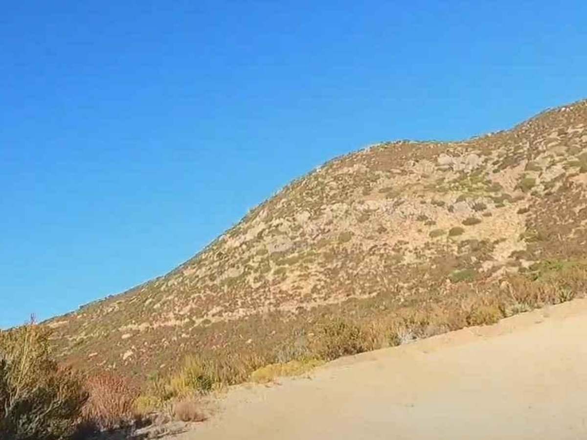
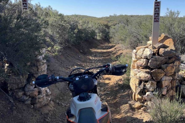
15S18 Sheephead Mountain Road

Total Miles 6.8
Technical Rating
3 Easy
Best Time Spring, Summer, Fall, Winter
Trail Type Full-Width Road
Accessible By
Open Trail Map

Trail Overview

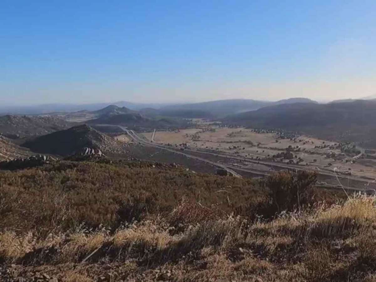
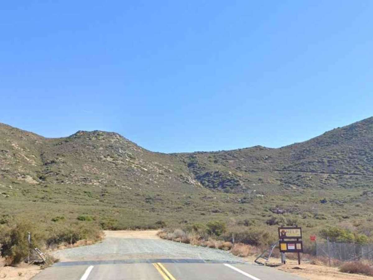
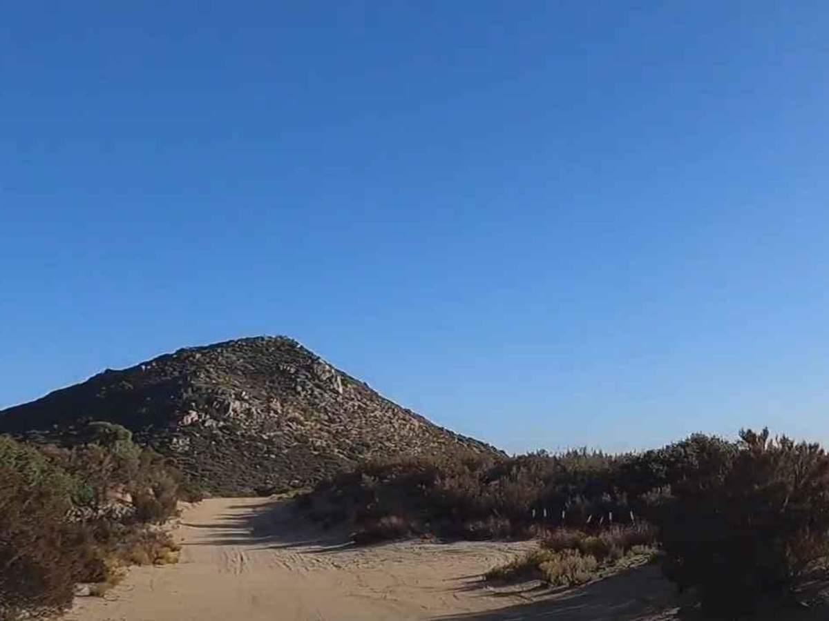
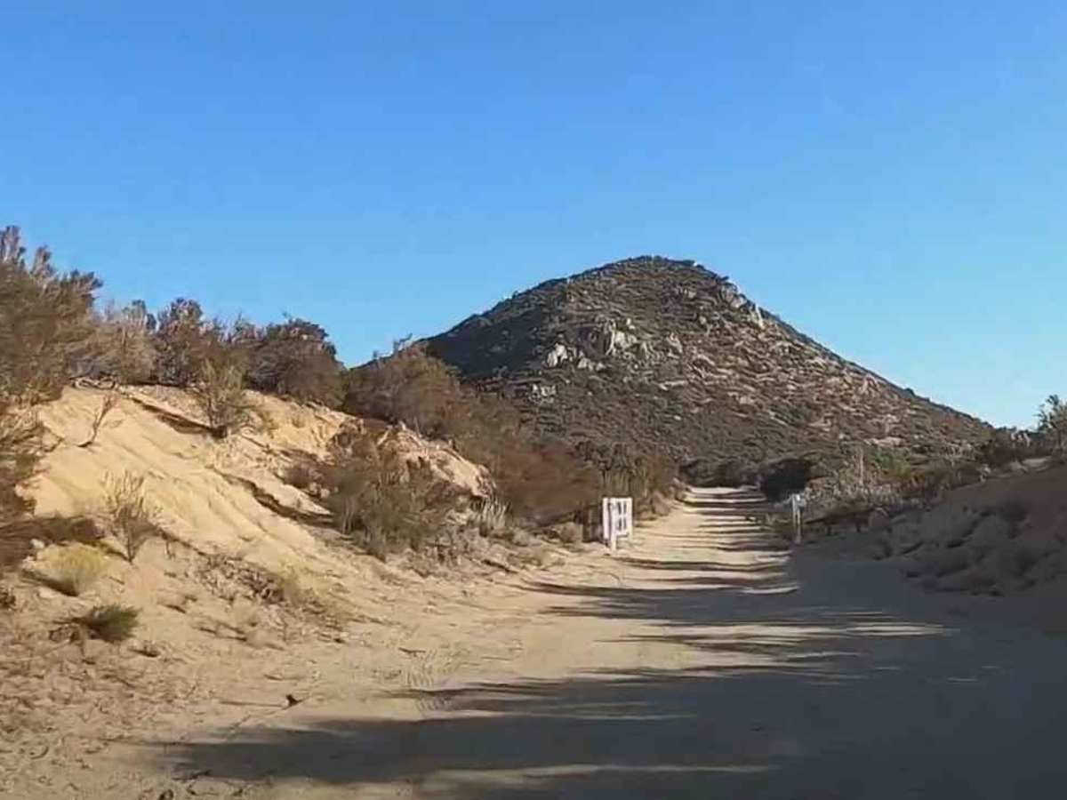
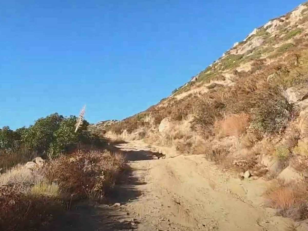
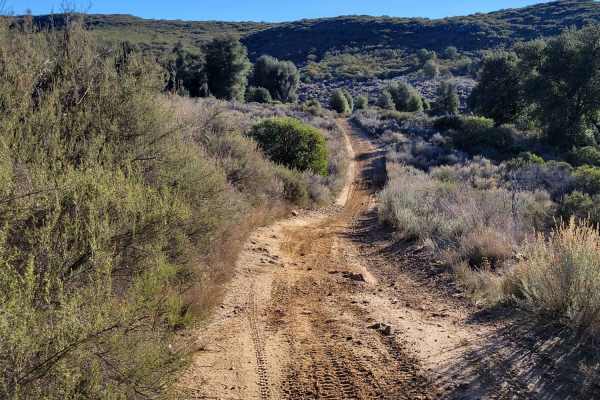
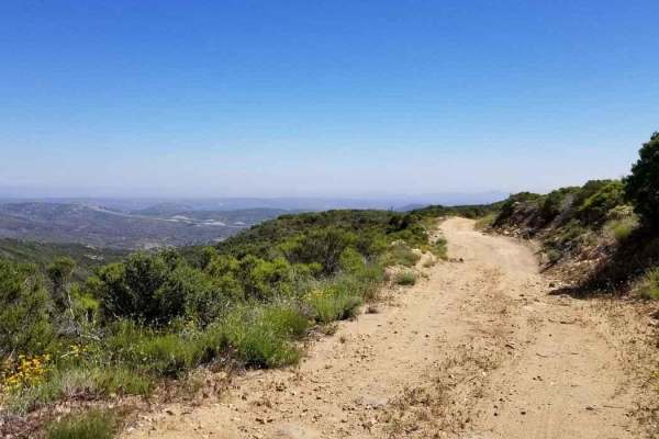
15S18 Sheephead Mountain Road is a 4.6-mile out-and-back trail rated 3 of 10 located within the Cleveland National Forest, Descanso Ranger District. The trail to the top is a full 6.8 miles, but due to a slide, the trail is closed at the 2.3-mile point. This trail is a continual climb from the trailhead to this point of nearly 1,000 feet. The remaining 4.5 miles will gain an additional 1,000 feet for those that hike to the top. The trail starts relatively smooth but quickly becomes more of a shelf road with multiple washouts during the climb. There is plenty of room to turn around at the end of the trail and a permanent fence marks the beginning of the hiking trail. Cell phone service is intermittent. The nearest services are located along Interstate 8.

Photos of 15S18 Sheephead Mountain Road

Difficulty

The trail consists of loose rocks, dirt, and sand with some slick rock surfaces. Mud holes are possible, but there are no steps higher than 12 inches. 4WD may be required, and aggressive tires are a plus.

History

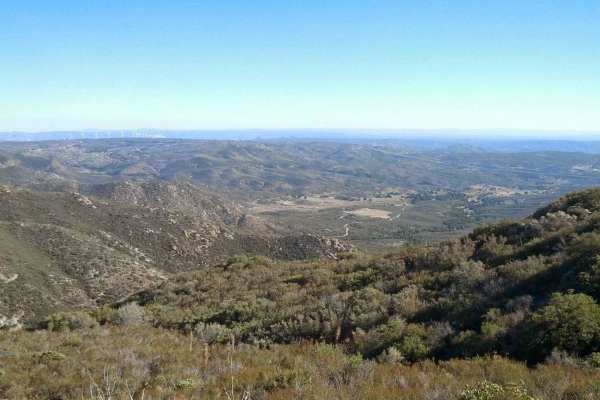
Sheephead Mountain is a rather prominent peak in the southern end of the Laguna Mountains of eastern San Diego County. Although its flanks are dominated by chaparral, manzanita, and similar brush, the surrounding lands have matured stands of pine trees and nice grassy meadows. Sheephead Mountain gets its name from the unusual boulder formation on its summit which resembles an entire sheep's body, not just its head. Though it falls short of the San Diego 6,000-footer list, it does make the Sierra Club Hundred Peaks Section List, and its summit views are fantastic. With views far into Mexico and the eastern desert, on clearer days, Sheephead Mountain allows you to see Toro Peak and San Jacinto Peak to the north and the Pacific Ocean to the west.

Technical Rating

3

Status Reports

Add Status Report
Dalton Hutchison
May 14, 2026
Open
Dry conditions, road is easily manageable for any stock 4x4.
Joel Addikted RC
Mar 15, 2026
Open
Keep an eye out for sharp rocks 🪨
NicAr Das
Feb 15, 2026
Open
Very fun trail, did it in 4H. There are a lot of ruts and dont be fooled with the trail on the app, it cuts off mid trail. There are good spots for pictures and the designated peak is fun to unwind and eat lunch!
Roetta Tyer
Aug 16, 2025
Open
Trail closed about halfway up. We did not go around closure. Trail is in good shape.
JHON DOE
Jun 28, 2025
Open
Does anybody else like riding trails at night? I mean, what’s the point of buying cool lights if we’re not gonna use them. Anyways made it all the way up till the first tight turn in 2 Wheel drive . after that I kept it in 4 Wheel drive I did go around the Closure and I think I made the trail a little bit wider on my full size truck lol. However, I did not get that far as it started to get sketchy at 2 AM. Trail wise, not paranormal. So I just went back to a suitable spot. Overall, it’s a great trail. Not too shabby.
Ed B
May 28, 2025
Open
David H
May 21, 2025
Open
Trail is rocky with some tight turns and some ruts. It's a short trail and my Xterra scraped the large mud flaps here and there, but it seems to always do that. I wouldn't say it's necessarily an easy trail, but it's not difficult either. I kept it in 4wd as not to chew up my rear tires with all the loose rocks and my Xterra climbed to the top no problem. I didn't even try to go past the metal barricade that other users mentioned was overgrown.
Ed B
May 13, 2025
Open
Ray D
May 07, 2025
Open
Pretty easy trail to get up. We did go around the blocked portion of the trail just after the glider take off area. We ended up turning around not long after. It was overgrown and you will get some pinstripes.
Dylan Dobey
May 03, 2025
Open
Road is rocky, with some minor off camber sections on the way up. Once we reached the viewpoint where the hang gliders take off, we could not continue further. There was a pipe fence blocking the registered route. Looks like there may be a way around, but heard it's overgrown. Fun trail to a cool spot to hangout.
Navi A
Apr 24, 2025
Open
First half of trail was fun. Clear on where to go and clean. Second half was hard to find. Had to go around the barrier and was unclear what route to take. After barrier track was unkept and over grown. Minor scratches to jeep by overgrowth. Fun trail overall.
Red Testudski
Apr 10, 2025
Open
Lots of mid size rocks and boulders on edges. Def rocky but 4H handled it just fine. The last .5 miles is a little unclear, have to go around a barrier and the road seems a lot less maintained in that last bit.
Thomas Hughes
Jan 03, 2025
Open
Kyle SR
Nov 16, 2024
Open
Single wide most the way. Several pull outs on the way up. Trail is rocky but nothing too serious. We were able to make it a little past the turnaround about 1/3 of the way up. Pin striping is real beyond the gate, seems like no other vehicle has been back there in some time. We turned around about another mile past the gate bc the trail was blocked by some big rocks
Tom S
Nov 09, 2024
Open
Easy trail. Nice starter trail. Had a first time driver with me and she was able to navigate it with no issue. Majority of trail is one vehicle wide, but multiple opportunities to pass. Unfortunately the trail is blocked by a gate about 1/3 of the way up and looks like it’s been closed off for quite some time. Recommend for any beginners!

15S18 Sheephead Mountain Road Trail can be accessed by the following ride types:

  • High Clearance
  • Full Width

15S18 Sheephead Mountain Road Map

The onX Offroad Difference

onX Offroad combines trail photos, descriptions, difficulty ratings, width restrictions, seasonality, and more in a user-friendly interface. Available on all devices, with offline access and full compatibility with CarPlay and Android Auto. Discover what you're missing today!

Open Trail Map