
Beginner Off-Road Trails
Near East Pecos, New Mexico
Explore All Beginner Trails Near East Pecos, New Mexico
Beginner Off-Road Trails Near East Pecos, New Mexico
Discover the best beginner-friendly off-road trails near you. These easier, lower-rated trails are a great place to start — browse trail maps, check difficulty ratings, and find your next adventure.
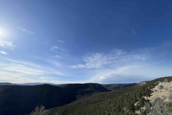
Pecos Barillas 83
When I tell people I'm in New Mexico, they automatically think about the desert, but the Santa Fe National forest encompasses 1.6 million acres of mountains, valley's and mesa's. This trail ranges from an elevation of 6,852 feet to an elevation of 8,529 feet. The road winds and twists through the fo...
Learn more about Pecos Barillas 83
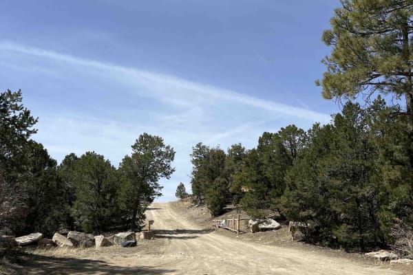
Bull Creek 86
Bull Creek is one of the most beautiful drives I've ever been on. Driving past the Santa Fe National Forest off Interstate 40, I knew that taking the time to explore this area was going to be worth it. As you start up Bull Creek 86, you start a pretty steep climb that's on a single-lane dirt road th...
Learn more about Bull Creek 86
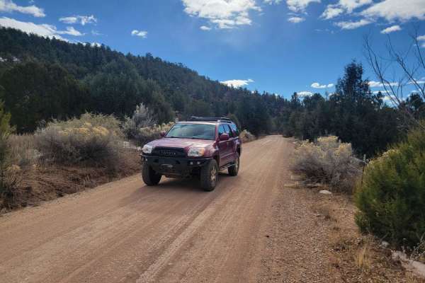
Molino Meadows
Molino Meadows is an easy, scenic two-mile trail ideal for beginners, family outings, and high-clearance vehicles looking to explore the beautiful rolling foothills of the Sangre de Cristo Mountains. This wide, graded dirt road offers a gentle climb with a starting elevation of 7,154 feet, rising ju...
Learn more about Molino Meadows
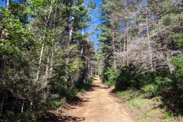
Glorieta Baldy
Glorieta Baldy is a trail on the South end of the Pecos Mountain area featuring numerous camp sites and an expansive view of the Pecos/Glorieta area. The trail starts at the back of a neighborhood on La Cueva road, and ascends Glorieta Baldy from there. The first half of the trail is open, with wide...
Learn more about Glorieta Baldy
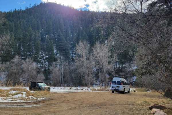
Dalton Canyon
This trail is one of the more accessible routes into the Pecos Mountains. Navigable by most cross-overs, this trail is a local favorite for camping and riding. The trail is mostly well-maintained gravel, with some sections of dirt that can be prone to rutting in the rainy season. Most of the road ha...
Learn more about Dalton Canyon
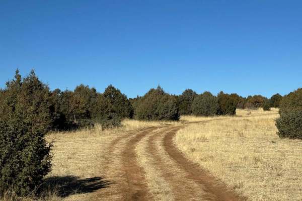
Rowe Peak Pass
The beginning of the trail starts off with driving on flat grass and mild rocky terrain. It quickly becomes a narrow path that cuts through heavy foliage that can be difficult to navigate with a larger full-width vehicle. There are multiple locations of rutted and off-camber obstacles that can range...
Learn more about Rowe Peak Pass
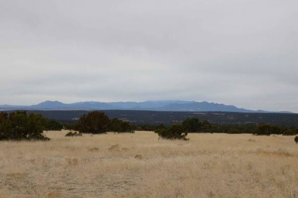
North Glorieta Pass
North Glorieta Pass can be run from its east entrance at the top of Rowe Hill off of CR34 or from its west entrance located off of CR51. The primarily dirt two track is just over one and a half vehicles in width for the majority of its length and doesn't feature any obstacles larger than 10" in size...
Learn more about North Glorieta Pass
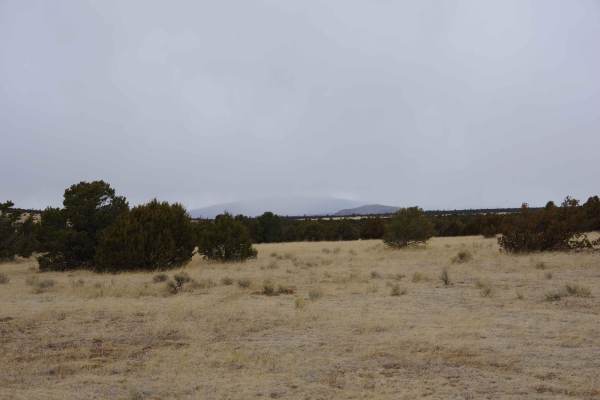
West Mesa Loop
This primarily dirt two-track partially loops through the northwest section of the Glorieta Mesa area. It features some deeper ruts and off-camber sections and has the potential to become very slick mud after rain or snow. Most of the trail is wide enough for two vehicles and provides enough room to...
Learn more about West Mesa Loop
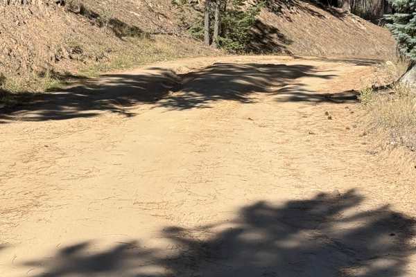
Upper Cow Creek - FS 92
Tucked into the southern reaches of the Pecos Wilderness, Forest Road 92 follows the scenic Cow Creek drainage through a cool forest of ponderosa pine, Douglas-fir, and aspen. This quiet backcountry road offers a peaceful escape from the busier sections of the Pecos River corridor, making it an exce...
Learn more about Upper Cow Creek - FS 92
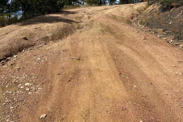
Arroyo Hondo Forest Service 79
Forest Service road that climbs a wide loose and rutted road. There are many shallow ruts and a few deep ruts that must be navigated around if clearance is an issue. There is a very steep descent about 2.5 miles past the Santa Fe National Forest signs or about 0.25 miles past the rough parking lot. ...
Learn more about Arroyo Hondo Forest Service 79
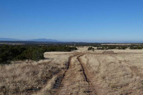
Cerro Encinoso Loop
Cerro Encinoso Loop begins immediately off CR-34 and is an easy dirt two-track for the first mile before making its steeper 19.4% grade climb up to the Cerro Encinoso plateau and continuing on to Hogback Hill. The climb up is over a rocky and lightly rutted uneven surface that most 4WD vehicles will...
Learn more about Cerro Encinoso Loop
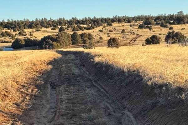
Cattle Run Pass
The trail is mostly dirt that runs through cattle pastures. The trail has ruts that can be 6-12 inches deep and can be off-camber. After rainfall, there are chances for multiple muddy sections and standing water. There are some rocky sections with rocks not exceeding over 6 inches. This trail provid...
Learn more about Cattle Run Pass
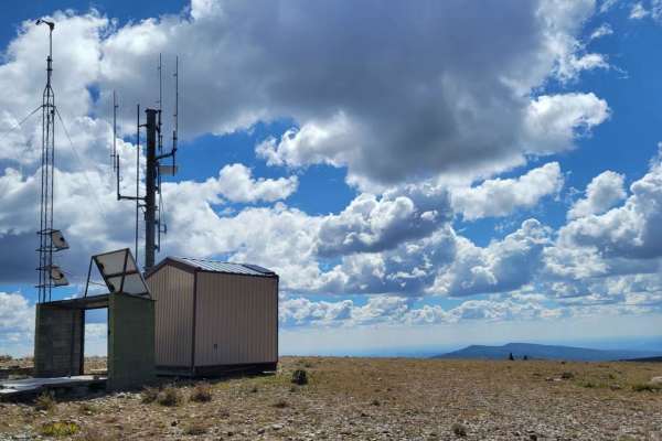
Elk Mountain
The Elk Mountain Trail is an out-and-back at Santa Fe National Forest in New Mexico. It is an easy and very scenic ride to the peak at 11.6k feet, where the views are incredible. Towards the top is a cattle gate which can be opened/closed. After the gate, the trail gets rutted and rocky with the pot...
Learn more about Elk Mountain
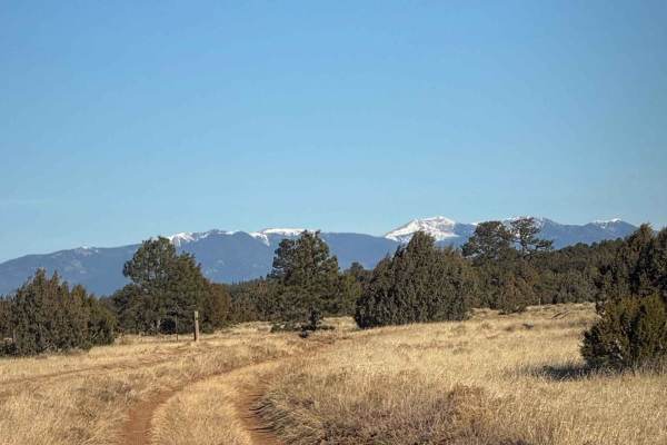
Valle Grande
Mostly flat plains with sections of deep erosion causing washouts exceeding 10-12 inches deep. He trail has off-camber areas. Ock faces that are approximately 12 inches tall. Sections of deeply rutted muddy areas with standing water/mud can be 6-10 inches deep--scenic views of the surrounding mounta...
Learn more about Valle Grande
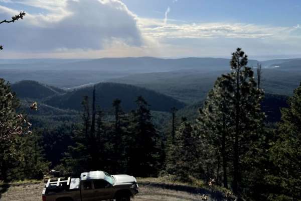
County Road A19A to Hermits Peak
County Road A19A to Hermits Peak is a scenic, beginner-friendly dirt road that offers stunning canyon views, mountain vistas, and direct access to the Santa Fe National Forest near Las Vegas, New Mexico. It begins at an elevation of 6,729 feet and winds steadily upward alongside a picturesque creek,...
Learn more about County Road A19A to Hermits Peak
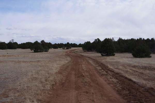
Arroyo de los Diegos
Arroyo de los Diegos is a primary dirt two-track that makes a partial loop from its connecting points off Valle Grande. The dirt surface shows some significant signs of rutting and erosion, with some areas of rutting being more than 20" or more in-depth, but still easily passable for most high clear...
Learn more about Arroyo de los Diegos
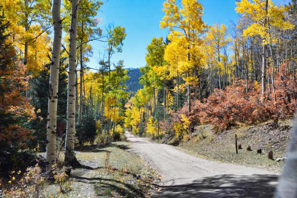
Pacheco Canyon
Pacheco Canyon is a great easy trail near the Santa Fe Ski area, just outside Santa Fe, NM. The trail can be run in either direction, but the views heading downhill into Tesuque Village are amazing. There are several great places to camp along the side roads for this trail, so take extra time to exp...
Learn more about Pacheco Canyon
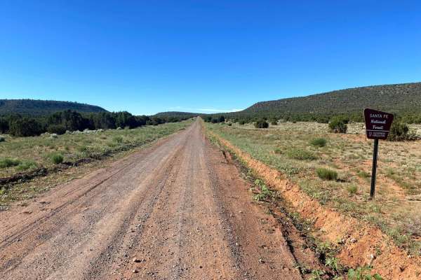
El Cerrito Area of Santa Fe National Forest
Open mesa plains with a web-like network of dirt roads with the occasional rocky obstacle and/or ledge. The general area is wide-open with scenic views of surrounding mesas. If you navigate deep enough into this area a couple nice rocky canyons can be found. Watch out for cattle as this is a commonl...
Learn more about El Cerrito Area of Santa Fe National Forest
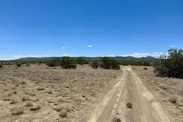
Dispersed Camping Loop
This is a simple and smooth dirt trail leading to dispersed camping. There is one small steep hill drop, where you will need to take it slow. Most of this is smooth and leads to a few other trails, such as Powerline and Dead Dog Trail Offshoot.
Learn more about Dispersed Camping Loop
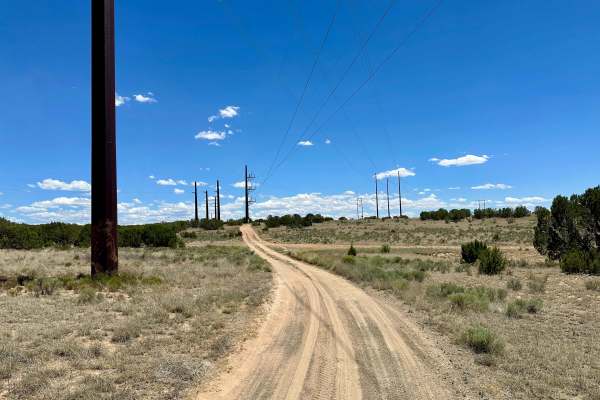
Dead Dog Trail Offshoot
This is a mostly smooth dirt trail with some off-camber areas and ruts at the beginning. There is one deeply rutted area with no bypass. There is a gate you will need to open and close, but it will be unlocked. This trail also leads to the Powerline Trail. This trail also leads to dispersed camping.
Learn more about Dead Dog Trail Offshoot
Beginner ATV trails near East Pecos, New Mexico
Explore ATV-friendly trails near you. These trails are accessible for vehicles up to 50 inches wide, perfect for ATVs and smaller off-road machines.
Pecos Barillas 83
When I tell people I'm in New Mexico, they automatically think about the desert, but the Santa Fe National forest encompasses 1.6 million acres of mountains, valley's and mesa's. This trail ranges from an elevation of 6,852 feet to an elevation of 8,529 feet. The road winds and twists through the fo...
Learn more about Pecos Barillas 83
Bull Creek 86
Bull Creek is one of the most beautiful drives I've ever been on. Driving past the Santa Fe National Forest off Interstate 40, I knew that taking the time to explore this area was going to be worth it. As you start up Bull Creek 86, you start a pretty steep climb that's on a single-lane dirt road th...
Learn more about Bull Creek 86
Molino Meadows
Molino Meadows is an easy, scenic two-mile trail ideal for beginners, family outings, and high-clearance vehicles looking to explore the beautiful rolling foothills of the Sangre de Cristo Mountains. This wide, graded dirt road offers a gentle climb with a starting elevation of 7,154 feet, rising ju...
Learn more about Molino Meadows
Glorieta Baldy
Glorieta Baldy is a trail on the South end of the Pecos Mountain area featuring numerous camp sites and an expansive view of the Pecos/Glorieta area. The trail starts at the back of a neighborhood on La Cueva road, and ascends Glorieta Baldy from there. The first half of the trail is open, with wide...
Learn more about Glorieta Baldy
Beginner UTV/side-by-side trails near East Pecos, New Mexico
Find UTV and side-by-side trails near you. These trails accommodate vehicles up to 60 inches wide, ideal for UTVs, side-by-sides, and wider off-road rigs.
Pecos Barillas 83
When I tell people I'm in New Mexico, they automatically think about the desert, but the Santa Fe National forest encompasses 1.6 million acres of mountains, valley's and mesa's. This trail ranges from an elevation of 6,852 feet to an elevation of 8,529 feet. The road winds and twists through the fo...
Learn more about Pecos Barillas 83
Bull Creek 86
Bull Creek is one of the most beautiful drives I've ever been on. Driving past the Santa Fe National Forest off Interstate 40, I knew that taking the time to explore this area was going to be worth it. As you start up Bull Creek 86, you start a pretty steep climb that's on a single-lane dirt road th...
Learn more about Bull Creek 86
Molino Meadows
Molino Meadows is an easy, scenic two-mile trail ideal for beginners, family outings, and high-clearance vehicles looking to explore the beautiful rolling foothills of the Sangre de Cristo Mountains. This wide, graded dirt road offers a gentle climb with a starting elevation of 7,154 feet, rising ju...
Learn more about Molino Meadows
Glorieta Baldy
Glorieta Baldy is a trail on the South end of the Pecos Mountain area featuring numerous camp sites and an expansive view of the Pecos/Glorieta area. The trail starts at the back of a neighborhood on La Cueva road, and ascends Glorieta Baldy from there. The first half of the trail is open, with wide...
Learn more about Glorieta Baldy
The onX Offroad Difference
onX Offroad combines trail photos, descriptions, difficulty ratings, width restrictions, seasonality, and more in a user-friendly interface. Available on all devices, with offline access and full compatibility with CarPlay and Android Auto. Discover what you're missing today!
Open Trail Map