
Beginner Off-Road Trails
Near Centerfield, Utah
Explore All Beginner Trails Near Centerfield, Utah
Beginner Off-Road Trails Near Centerfield, Utah
Discover the best beginner-friendly off-road trails near you. These easier, lower-rated trails are a great place to start — browse trail maps, check difficulty ratings, and find your next adventure.
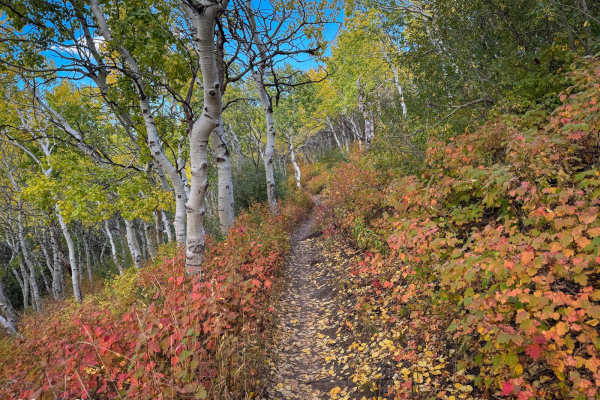
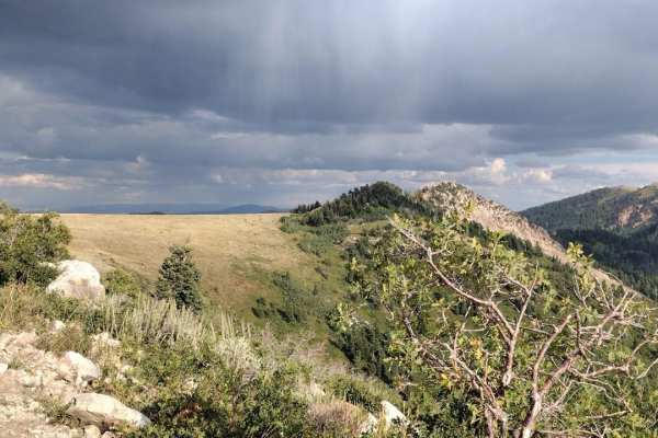
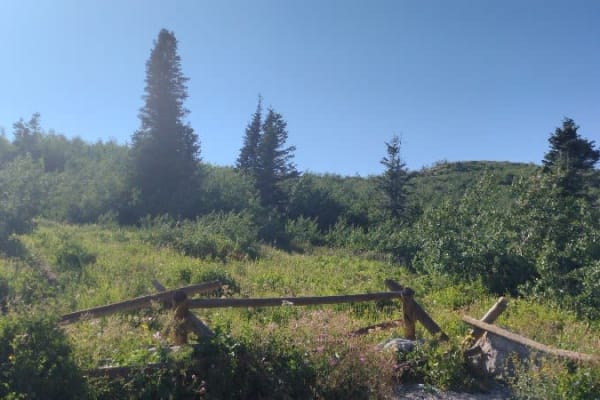
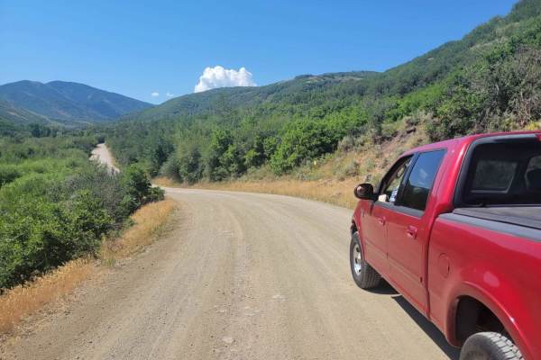
North Park
North Park near Bountiful, Utah, is a great beginner-friendly trail for dirt bikers. Starting from the parking lot, you follow a 4x4 road up to the North Park single-track trailhead. The trail is relatively easy to handle, with gradual climbs and smooth sections, making it perfect for new or experie...
Learn more about North Park
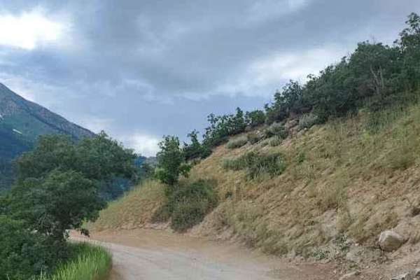
Ward Canyon Road
This is a well-maintained packed dirt and gravel road which takes you to the Old Ward Canyon camping and target practice site. The route starts at the Skyline Drive trailhead below the bountiful "B" on the hillside. There are several pull-offs along the way which give great views of Salt Lake and An...
Learn more about Ward Canyon Road
Centerville Firebreak Road
Centerville Firebreak Road runs from Bountiful to Farmington, following the benches above the neighborhoods. It is an easy, scenic drive that makes for a great short trip between Ward and Farmington Canyons. The road runs along the benches, staying high enough to overlook the valley and Antelope Isl...
Learn more about Centerville Firebreak Road
Centerville Offroad Bowl Return
This trail takes you from the South end of the Offroad Bowl and loops around the outside back to South Duel Creek Trail. This trail is relatively tame as it follows the hillside with only a couple of spots that may cause difficulty, those being the exit/entrance from the bowl being tight, and a spot...
Learn more about Centerville Offroad Bowl Return
North Holbrook FS 1629
This is an out-and-back easy trail. It goes over to a small turnaround viewpoint. For larger vehicles, you will need to park here and walk the next 100 feet to the second viewpoint. ATVs and motorcycles can continue on the trail to the small turnaround and viewpoint. There is a small trail that take...
Learn more about North Holbrook FS 1629
South Duel Creek Trail
This trail is a short spur off of Centerville Firebreak Road that leads you to the Offroad Bowl Trails as well as the trailhead for South Duel Creek hiking trail. This trail is easy with the surface consisting of gravel for the entire length. There is an optional obstacle at the final turn before yo...
Learn more about South Duel Creek Trail
Centerville Offroad Bowl Upper Trail
This trail follows the west rim of the Centerville Offroad Bowl. The upper trail is tight in some spots and has a couple of spots that are off-camber. This upper section is a good bypass for the sections of the lower bowl that are filled with mud too deep to traverse, but the surface is covered in w...
Learn more about Centerville Offroad Bowl Upper Trail
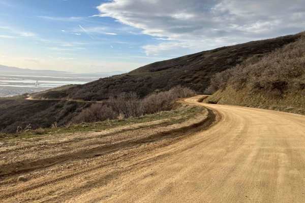
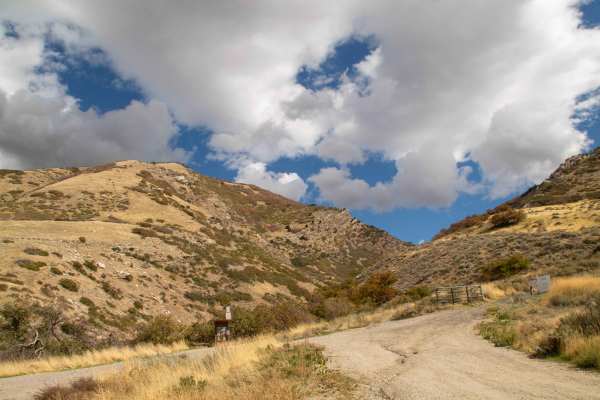
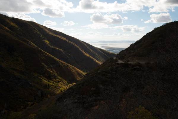
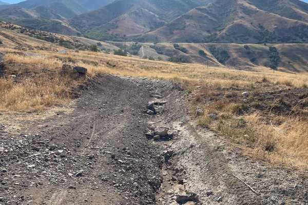
Upper Ward Canyon Road
This is a continuation of the lower Ward Canyon Road. It continues winding up the mountainside with amazing views off of the side of the road. The trail has a few ruts and small rock gardens but there shouldn't be any issues getting any car up here. At the top, you get a view out to the west and the...
Learn more about Upper Ward Canyon Road
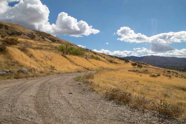
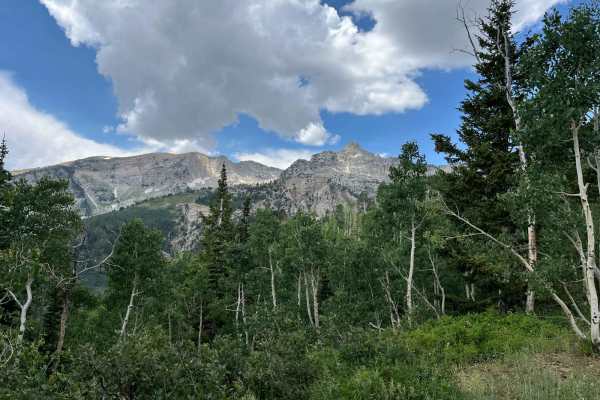
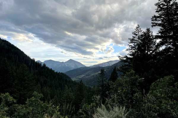
Sessions Mountain Road
This is a beautiful drive through the pine and aspen trees, with a few areas that have some dry camping spots. The road is mostly gravel with areas of rough rock. There are a few areas that have some rutted erosion running down, it but is easy to stay on top of it and not get in the ruts. This road ...
Learn more about Sessions Mountain Road
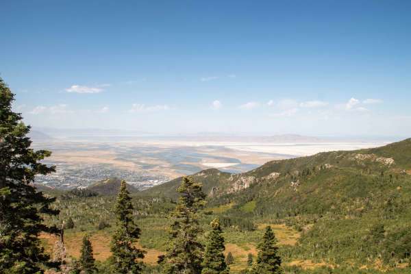
Skyline Drive
This is an easy dirt road with some steep drop offs on the west side of the trail. The gates to this trail close November through March, as high elevation snow makes it impassable. Springtime you may encounter snow or muddy spots. Best time is mid summer and fall. Once dry, the trail is very easy. T...
Learn more about Skyline Drive
Major Evans
This is a narrow track through pleasant trees. The track switches up the mountainside and provides good views of the surrounding peaks. Since it ends at a locked gate, it needs an hour up, and an hour down. Passing can be difficult due to the track width. There are some pleasant meadows at the turno...
Learn more about Major Evans
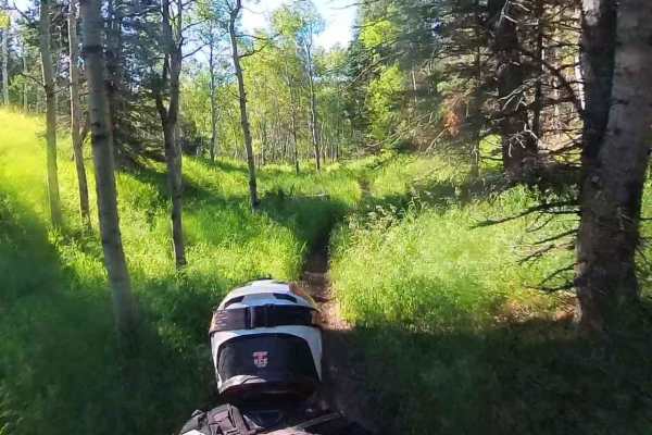
Parish Creek
This short trail branches off of Skyline Drive and runs basically parallel to it, heading down to Parish Creek. This trail is an easy scenic drive through the trees, with the only real worry being the overgrown bushes along the sides of the trail and a few low-hanging branches. This trail is open fr...
Learn more about Parish Creek
Silver Lake Road
This 9-mile out-and-back dirt road from Tibble Fork Reservoir to Silver Lake is beautiful and boasts mountain views. Make sure to bring your paddleboards and/or kayaks to use at either lake. The road is well maintained and driven by cars and vans but is narrow in a few places-not quite wide enough f...
Learn more about Silver Lake Road
Springs Road Fence Line Trail
This trail starts off the dirt road called Foothill Drive. It starts heading east up the hill on the section line road and then connects to TC03617 back to the southeast all the way to the fence line. There is a gate that has been broken down in the past. There is NO Motorized access past this gate,...
Learn more about Springs Road Fence Line Trail
American Fork Snake Creek
This trail is a low risk, high pay out trail with lots of jaw dropping views. The trail could honestly be done in a 2WD sedan if you don't explore any of the side trails. There are lots of picnicking and dispersed camping sites along the way. The trail runs from Tibble Fork reservoir in American ...
Learn more about American Fork Snake Creek
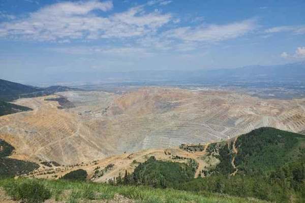
Kennecott Copper Mine Overlook
This trail is a quick 5-mile total out-and-back. It is well-maintained dirt leading to a large parking area that overlooks the main pit of the mine. One can also see the Salt Lake Valley to the east and Tooele Valley to the west and the views of the mountains, valleys, and mine are incredible. The r...
Learn more about Kennecott Copper Mine Overlook
Jeremy Ranch Road
Best for those looking for a scenic route near Park City, this road provides a "back way" into the Jeremy Ranch area as well as backcountry access to Mormon Flats State Park and the Mormon Flats Campground. Most of the road is a broad, graded dirt track, with a very brief section with some very smal...
Learn more about Jeremy Ranch Road
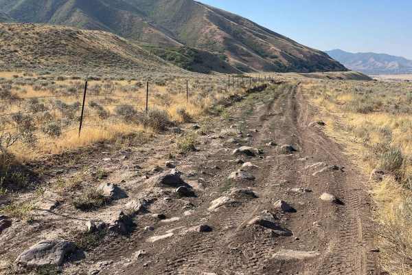
Bates Canyon Trail
This is a well-traveled two-track with all types of 4x4 and off-road machines. This trail is a great way to overlook the Tooele Valley above Stansbury Park and Erda. You will encounter some large rocks and rutted roads along the way to the top. There is a gate at the end where motorized travel is pr...
Learn more about Bates Canyon Trail
Pole Canyon Trail
This is one of the easiest ways to the top of the plateau. There are some large boulders and sand that could present a challenge depending on your vehicle type. There are mostly rocks on the lower half of the trail and then once climbing on the upper section, you will find a good hard pack and some ...
Learn more about Pole Canyon Trail
Tibble Fork (2041)
From Mill Canyon, this trail runs west and then southeast, climbing about 1,400 feet where it intersects with Ridge Trail. The lower portion running west takes you on a ledge trail through the woods above Tibble Fork Reservoir. From here, it continues climbing, intersects Mud Springs, and finally re...
Learn more about Tibble Fork (2041)
Beginner ATV trails near Centerfield, Utah
Explore ATV-friendly trails near you. These trails are accessible for vehicles up to 50 inches wide, perfect for ATVs and smaller off-road machines.
Ward Canyon Road
This is a well-maintained packed dirt and gravel road which takes you to the Old Ward Canyon camping and target practice site. The route starts at the Skyline Drive trailhead below the bountiful "B" on the hillside. There are several pull-offs along the way which give great views of Salt Lake and An...
Learn more about Ward Canyon Road
Centerville Firebreak Road
Centerville Firebreak Road runs from Bountiful to Farmington, following the benches above the neighborhoods. It is an easy, scenic drive that makes for a great short trip between Ward and Farmington Canyons. The road runs along the benches, staying high enough to overlook the valley and Antelope Isl...
Learn more about Centerville Firebreak Road
Centerville Offroad Bowl Return
This trail takes you from the South end of the Offroad Bowl and loops around the outside back to South Duel Creek Trail. This trail is relatively tame as it follows the hillside with only a couple of spots that may cause difficulty, those being the exit/entrance from the bowl being tight, and a spot...
Learn more about Centerville Offroad Bowl Return
North Holbrook FS 1629
This is an out-and-back easy trail. It goes over to a small turnaround viewpoint. For larger vehicles, you will need to park here and walk the next 100 feet to the second viewpoint. ATVs and motorcycles can continue on the trail to the small turnaround and viewpoint. There is a small trail that take...
Learn more about North Holbrook FS 1629
Beginner UTV/side-by-side trails near Centerfield, Utah
Find UTV and side-by-side trails near you. These trails accommodate vehicles up to 60 inches wide, ideal for UTVs, side-by-sides, and wider off-road rigs.
Ward Canyon Road
This is a well-maintained packed dirt and gravel road which takes you to the Old Ward Canyon camping and target practice site. The route starts at the Skyline Drive trailhead below the bountiful "B" on the hillside. There are several pull-offs along the way which give great views of Salt Lake and An...
Learn more about Ward Canyon Road
Centerville Firebreak Road
Centerville Firebreak Road runs from Bountiful to Farmington, following the benches above the neighborhoods. It is an easy, scenic drive that makes for a great short trip between Ward and Farmington Canyons. The road runs along the benches, staying high enough to overlook the valley and Antelope Isl...
Learn more about Centerville Firebreak Road
Centerville Offroad Bowl Return
This trail takes you from the South end of the Offroad Bowl and loops around the outside back to South Duel Creek Trail. This trail is relatively tame as it follows the hillside with only a couple of spots that may cause difficulty, those being the exit/entrance from the bowl being tight, and a spot...
Learn more about Centerville Offroad Bowl Return
North Holbrook FS 1629
This is an out-and-back easy trail. It goes over to a small turnaround viewpoint. For larger vehicles, you will need to park here and walk the next 100 feet to the second viewpoint. ATVs and motorcycles can continue on the trail to the small turnaround and viewpoint. There is a small trail that take...
Learn more about North Holbrook FS 1629
The onX Offroad Difference
onX Offroad combines trail photos, descriptions, difficulty ratings, width restrictions, seasonality, and more in a user-friendly interface. Available on all devices, with offline access and full compatibility with CarPlay and Android Auto. Discover what you're missing today!
Open Trail Map