
Beginner Off-Road Trails
Near Broadlands, Virginia
Explore All Beginner Trails Near Broadlands, Virginia
Beginner Off-Road Trails Near Broadlands, Virginia
Discover the best beginner-friendly off-road trails near you. These easier, lower-rated trails are a great place to start — browse trail maps, check difficulty ratings, and find your next adventure.
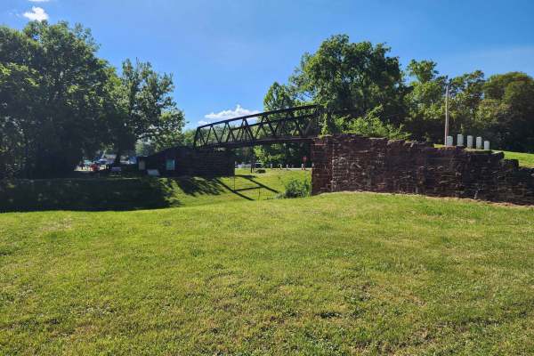
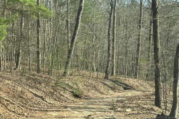
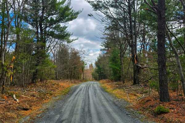
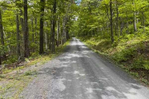
Whites Ferry
This is an easy drive with many tranquil farm views near the Potomac River. The drive from West to East starts at Whites Ferry, which is a car ferry that is currently closed. When it re-opens, you will be able to start or end your adventure by crossing the Potomac in your car on a ferry. The Western...
Learn more about Whites Ferry
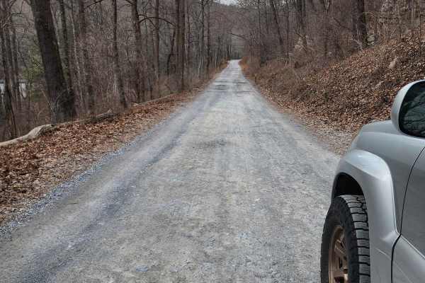
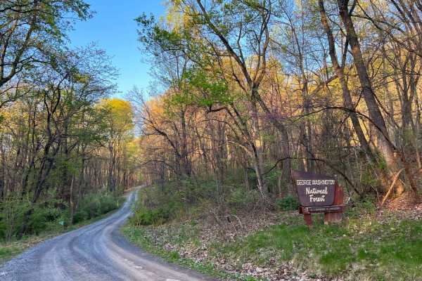
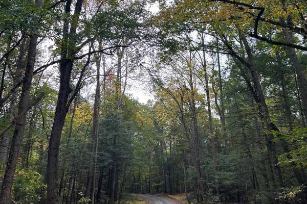
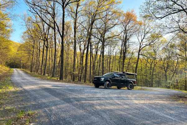
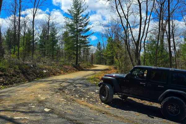
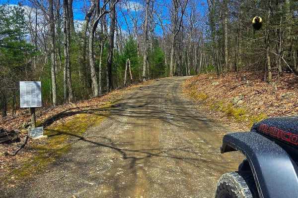
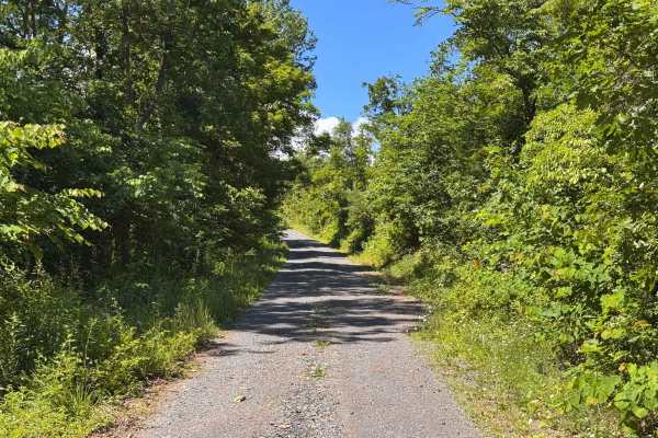
Frederick Watershed
This is an easy cruise through the Frederick Watershed which is an unmaintained mostly gravel road. It can be done in just about any vehicle however I recommend an off-road oriented vehicle due to persistent bumps and ruts. There are a variety of activities in the watershed including hiking, mountai...
Learn more about Frederick Watershed
Peters Mill Run
Peters Mill Run is an easy point-to-point trail near Fort Valley, Virginia. The trail is stock-friendly and is a great spot for those new to off-roading. The trail can be entered from either the north or south end, with the southernmost two miles being the most challenging. Woodstock Tower near the ...
Learn more about Peters Mill Run
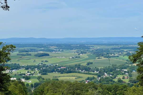
Woodstock Tower Road
This is a steep, windy road leading up to the Woodstock Observation Tower. This tower offers amazing views of the surrounding valleys and mountains. This road is mainly loose gravel with switchbacks and steep inclines. This can be driven in 2WD, but use caution if snow or ice is present. Peters Mill...
Learn more about Woodstock Tower Road
Hawk
Hawk Run is a meandering forest road that crosses through some private property as it climbs Spring Mountain along the border of Virginia and West Virginia. The road is mostly gravel with some dirt and clay in good condition with a few potholes and washouts. It crests at an elevation of over 2,000ft...
Learn more about Hawk
Dry Gap Ridge
Dry Gap is a short step, out and back trail climbing along a ridge leading to a cell tower. The beginning climb is the most challenging part due to its steep nature; 4WD is recommended. The sweeping views from the ridge are incredible when no leaves are on the trees following the border of Virginia ...
Learn more about Dry Gap Ridge
Vances Cove
Vances Cove trail is a meandering gravel road starting at Cold Spring Gap. Descending into the valley along cold spring creek. The road can become washed out in some areas after heavy rain, as the trail so closely follows it. Tight and narrow, the trail winds down to an intersection at Vances Cove, ...
Learn more about Vances Cove
Rattlesnake Run
This is one of the first trails you'll hit if you enter Michaux from the south end. It is an unmaintained gravel road with multiple inclines and declines. There are many hiking trail options surrounding this trail, with Appalachian Trail access points. During the winter months, 4-wheel drive is sugg...
Learn more about Rattlesnake Run
Biesecker Gap
This is a short but fun side trail located off of Wirt Road. The entire trail is made up of small rocks, ruts, inclines/declines, and loose gravel. The trail is wide enough to avoid pinstripes but not wide enough to pass another vehicle. Expect downed trees any time of year on this trail. 4WD and hi...
Learn more about Biesecker Gap
Hornet
Hornet descends out the back forest of George Washington National Forest to Hawk Campground. Many dispersed campsites can also be found past the Hawk Recreation and Picnic area. The road down is mostly gravel with many washouts of clay and mud exposing ruts and rocks. This is a scenic and secluded a...
Learn more about Hornet
Oak Road
This forest road in the southwest corner of Michaux State Forest is notable for the Valley View Vista that offers a good view towards the town of Mont Alto to the west. It runs north/south between Quincy Mountain to the south and the area on the western slope of Oak Knob to the north. It's generally...
Learn more about Oak Road
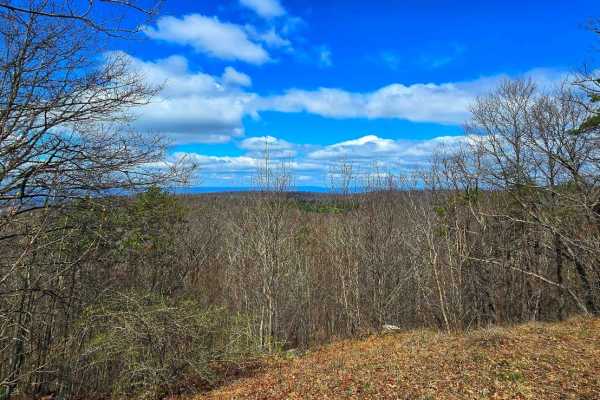
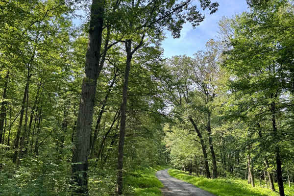
Snowy Mountain Road
A short but scenic gravel byway, Snowy Mountain Road connects Swamp Road to Swift Run Road, winding through dense hardwoods to a network of multi-use trails. It offers easy access to the Snowy Mountain Vista, where sweeping views of South Mountain and the Cumberland Valley open up. Along its 1.5-mil...
Learn more about Snowy Mountain Road
Swift Run Road
Traveling between Old Forge Road and Snowy Mountain Road, Swift Run Road offers a scenic backwoods route through Michaux's rugged heart. This gravel forest road passes key trailheads, including the Climbing Rock Trail, and provides access to the well-known climbing destination Shaffer Rocks--a popul...
Learn more about Swift Run Road
Wirt Road
Wirt Road is a scenic gravel route running from Staley Road to Old Forge Road, cutting through the quiet woodlands of Michaux State Forest. Along the way, it crosses Biesecker Run and Vineyard Run, which offer peaceful streamside views. The road also passes several trailheads popular with hikers, mo...
Learn more about Wirt Road
High Rock Road
A good way into the southern part of Michaux State Forest if coming from the east. This is a largely gravel/shale state forest road that meanders along the west side of the ridge of the South Mountain. It's notable for having three rustic, dispersed camp sites in a forest that does not have that man...
Learn more about High Rock Road
Staley Road
This is an unmaintained forest road running through Michaux State Forest, and can be accessed from Route 233 as well as Old Forge Road. There is a plethora of hiking and mountain bike trail access points, making it a popular spot for all outdoor enthusiasts. There are a few inclines and declines tha...
Learn more about Staley Road
Three Springs Road
Three Springs Road is a short but scenic gravel route winding through the eastern edge of Michaux State Forest along the South Mountain ridge. While not long on its own, it’s best considered an extension of High Rock Road, together covering the entire eastern side of South Mountain within the forest...
Learn more about Three Springs Road
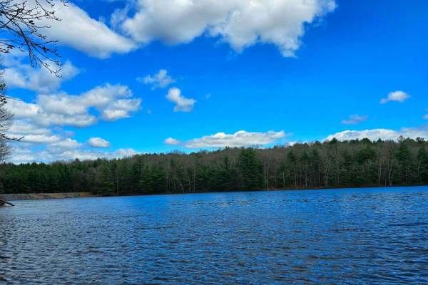
Carbaugh Road
Carbaugh Road is a short but significant connector between District Road and Newman Road, winding through a mix of public forest and private land--please be respectful of residents and any posted boundaries. Along this gravel byway, you'll find direct access to the Carbaugh Reservoir, a serene spot ...
Learn more about Carbaugh Road
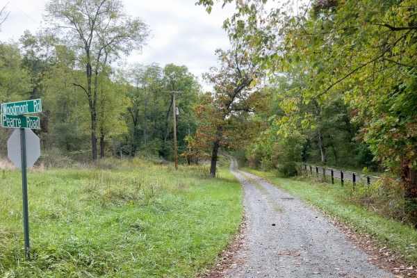
Pearre Road
This is a scenic gravel/dirt drive along the Potomac River! This is one road you'd truly never know existed if you didn't find it on a map. The route begins paralleling the C&O Canal trail, but briefly diverts as it winds up and over some of the gnarly topography of this region. At one point, the ro...
Learn more about Pearre Road
District Road
Meandering between Route 233 and Newman Road, District Road is a serene gravel forest byway through Michaux State Forest. Along the way, it provides prime access to the Carbaugh Reservoir, a tranquil fishing and wildlife-watching destination near the Carbaugh Run Natural Area, home to protected amph...
Learn more about District Road
Beginner ATV trails near Broadlands, Virginia
Explore ATV-friendly trails near you. These trails are accessible for vehicles up to 50 inches wide, perfect for ATVs and smaller off-road machines.
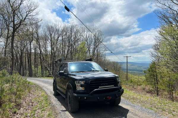
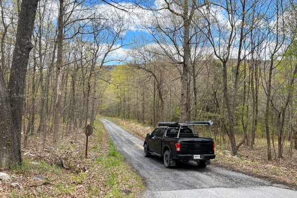
Devils Hole Road
Devils Hole Road, or RT 691 Gravel Road, is an adventure weaving through the heart of the George Washington National Forest. Rocky in sections, with winding forest roads, leads to breathtaking mountain overlooks. Surrounded by towering hardwoods and remote wilderness, the trail delivers a perfect mi...
Learn more about Devils Hole Road
Moss Road - T-318
Moss road or T-318 cuts through the southern Game lands. Reaching elevations of 1166 Ft traversing the forest and meadows. There is no public camping allowed on this route. Several parking locations are along the trail. If coming from the south look for a sharp turn heading up a gravel road.
Learn more about Moss Road - T-318
Beginner UTV/side-by-side trails near Broadlands, Virginia
Find UTV and side-by-side trails near you. These trails accommodate vehicles up to 60 inches wide, ideal for UTVs, side-by-sides, and wider off-road rigs.
Devils Hole Road
Devils Hole Road, or RT 691 Gravel Road, is an adventure weaving through the heart of the George Washington National Forest. Rocky in sections, with winding forest roads, leads to breathtaking mountain overlooks. Surrounded by towering hardwoods and remote wilderness, the trail delivers a perfect mi...
Learn more about Devils Hole Road
Moss Road - T-318
Moss road or T-318 cuts through the southern Game lands. Reaching elevations of 1166 Ft traversing the forest and meadows. There is no public camping allowed on this route. Several parking locations are along the trail. If coming from the south look for a sharp turn heading up a gravel road.
Learn more about Moss Road - T-318
The onX Offroad Difference
onX Offroad combines trail photos, descriptions, difficulty ratings, width restrictions, seasonality, and more in a user-friendly interface. Available on all devices, with offline access and full compatibility with CarPlay and Android Auto. Discover what you're missing today!
Open Trail Map