
Beginner Off-Road Trails
Near Brethren, Michigan
Explore All Beginner Trails Near Brethren, Michigan
Beginner Off-Road Trails Near Brethren, Michigan
Discover the best beginner-friendly off-road trails near you. These easier, lower-rated trails are a great place to start — browse trail maps, check difficulty ratings, and find your next adventure.
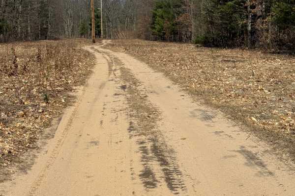
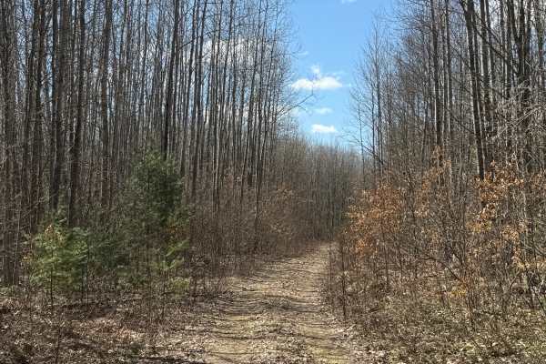
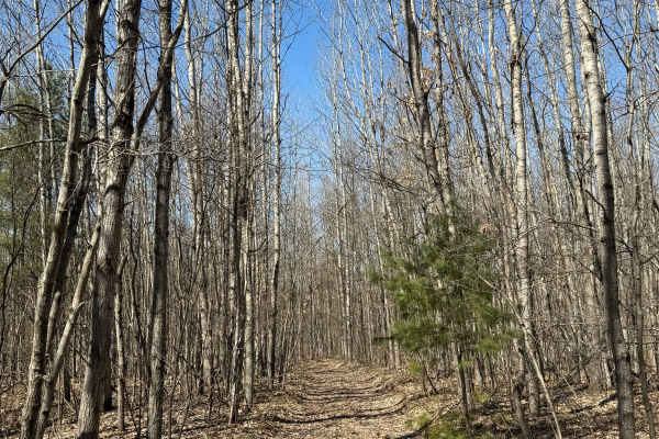
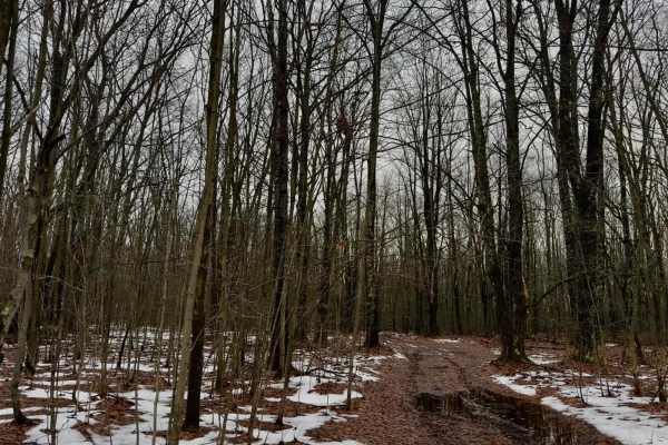
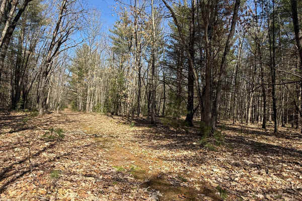
FS 8783
FS 8783 is a classic Michigan two-track trail within the Manistee National Forest. Located right off River Road from the north or FS 8580 from the south, this trail is easily accessible. This trail surface consists of a dirt and sand combination. This trail is a pretty open trail that follows the po...
Learn more about FS 8783
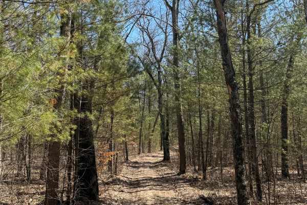
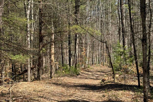
FS 8580
FS 8580 is a laid-back and scenic bidirectional trail within the Manistee National Forest. Located right off River Road from the west side, this trail is easily accessible. If you choose to come from the east side, you will first need to go down FS 8783. This trail surface consists of a dirt, gravel...
Learn more about FS 8580
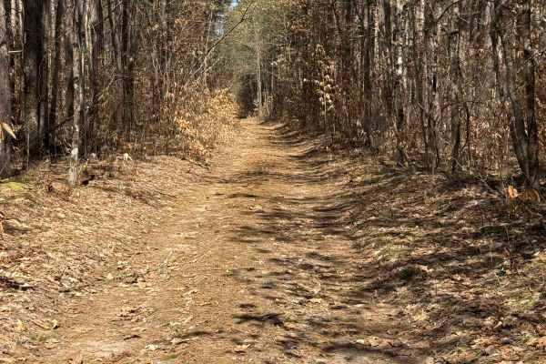
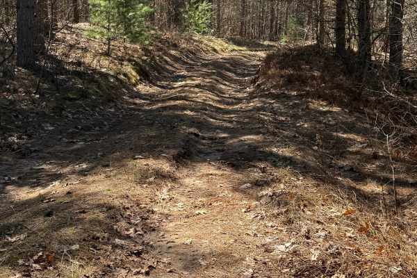
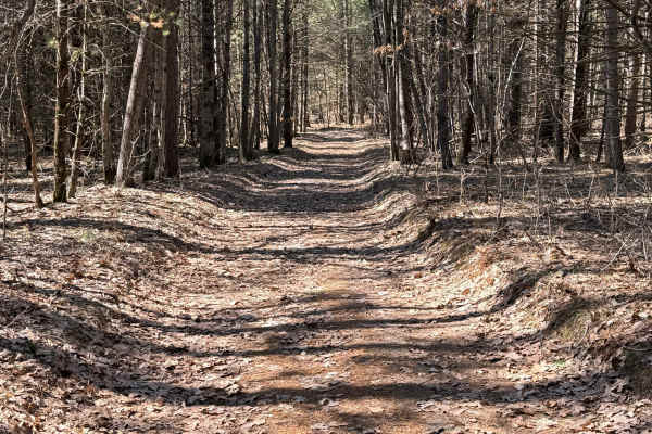
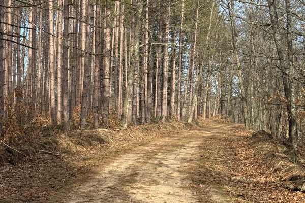
FS 8810
FS 8810 is a classic Michigan two-track trail within the Manistee National Forest. Located right off River Road, this trail is easily accessible. This trail surface consists of a dirt, sand, and gravel combination. This route weaves through a gorgeous section of pine trees within the forest. There a...
Learn more about FS 8810
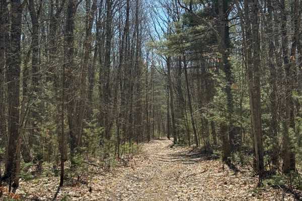
FS 8789
FS 8789 is a laid-back and scenic "out and back" trail within the Manistee National Forest. Located right off River Road, this trail is easily accessible. This trail surface consists of a dirt, sand, grass, and leafy combination. This route twists through a beautiful portion of the forest, high abov...
Learn more about FS 8789
FS 8755
FS 8755 is a laid-back and scenic "out and back" trail within the Manistee National Forest. Located right off River Road, this trail is easily accessible. This trail surface consists of a dirt, gravel, sand, grass, and leafy combination. This route twists through a beautiful portion of the forest, h...
Learn more about FS 8755
FS 5555
FS 5555 is an exciting out and back almost 1 mile trail within the Manistee National Forest. Located just off Chicago Avenue, this trail is easily accessible. This trail gives way to the Blacksmith Bayou River Access. A Michigan Recreation Passport is required for entry onto this trail, so keep that...
Learn more about FS 5555
FS 5096
FS 5096 is a quick and unique out-and-back trail within the Manistee National Forest. Located off North High Bridge Road, this trail is easily accessible and can make for a fun adventure. You'll start on a dirt road with tons of leaves covering up the trail. The trail then enters a thicker portion o...
Learn more about FS 5096
FS 5095
FS 5095 is an easy out-and-back two-track in Michigan's Manistee National Forest that follows the edge of Cedar Swamp through a quiet and scenic section of forest. Accessed from North High Bridge Road, the trail features a mostly sandy dirt surface and quickly enters a narrow corridor lined with mat...
Learn more about FS 5095
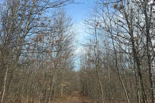
FS 8729
FS 8729 is an easy out-and-back trail in Michigan's Manistee National Forest that winds through a quiet, heavily wooded section of public land. Accessed from FS 8746, the route begins beneath a dense canopy before transitioning into an even tighter corridor lined with lush vegetation and mature tree...
Learn more about FS 8729
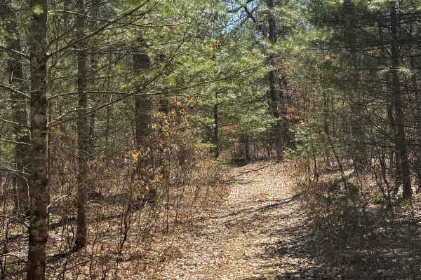
FS 8758
FS 8758 is an easy out-and-back trail in Michigan's Manistee National Forest that offers a peaceful drive through a diverse mix of open landscapes and dense woodland. Beginning directly off Huff Road, the route starts with expansive views before narrowing into a heavily forested corridor lined with ...
Learn more about FS 8758
FS 5077
FS 5077 is an exciting and fun, almost 1-mile bidirectional trail within the Manistee National Forest. Located off Cedar Creek Road or North High Bridge Road, this trail is easily accessible from either end. Starting from the north end off Cedar Creek Road, you'll start in a dense section of the for...
Learn more about FS 5077
FS 8746
FS 8746 is a unique, almost 1-mile Michigan bidirectional trail within the Manistee National Forest. Located between Cedar Creek Road from the west and North High Bridge Road from the east, this trail is easily accessible. Starting from the eastern end, you will start on mostly dirt road in a tighte...
Learn more about FS 8746
FS 8075
FS 8075 travels north and south through some beautiful country of Manistee National Forest Land. Throughout this trail, you will be surrounded by beautiful scenery of thick, dense trees as well as open clearings where you can see wildlife. The trail is relatively easy. Passable by anything with 4WD/...
Learn more about FS 8075
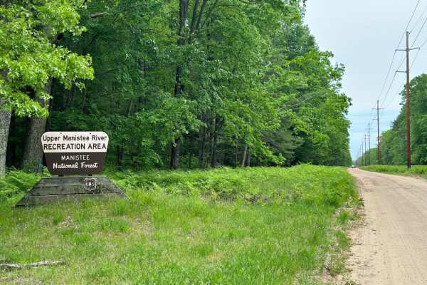
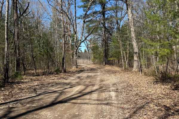
River Road
River Road is an amazing drive that gives access to some of the best attractions in the area. On the south end of the trail just off of Dilling Road is the Tippy Dam Recreation Area. During the drive, you will see amazing views of the surrounding forest as well as the Manistee River. The road is two...
Learn more about River Road
FS 8218
FS 8218 is a laid-back and scenic bidirectional trail within the Manistee National Forest. Located off North Horseshoe Bend Road, this trail is easily accessible. You can either start directly off North Horseshoe Bend Road or go down FS 8219 and start this trail after that one. This trail surface co...
Learn more about FS 8218
FS 8326
FS 8326 is an easy out-and-back trail in Michigan's Manistee National Forest that offers a relaxing drive through a scenic stretch of public land. Accessed from Guenthardt Road, the route follows a mostly sand and dirt surface with a wide, well-defined corridor that is generally suitable for two-way...
Learn more about FS 8326
FS 8219
FS 8219 is an easy, bidirectional trail in Michigan's Manistee National Forest that provides a relaxing drive through a scenic section of public land. Accessible from North Horseshoe Bend Road or by continuing from FS 8218, the route follows a varied surface of dirt, gravel, sand, grass, and leaf-co...
Learn more about FS 8219
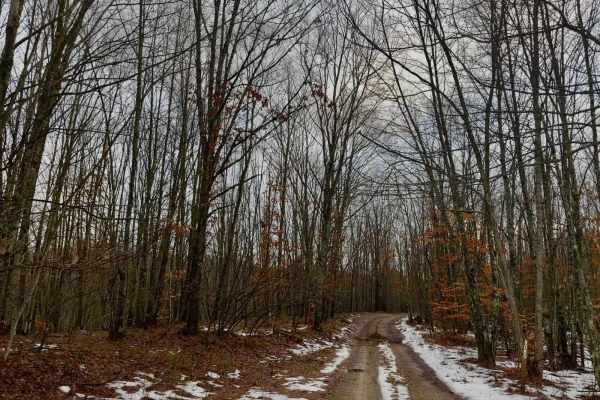
FS 8250
FS 8250 is an easy, bidirectional two-track loop at the end of North Kettle Hole Road in Michigan's Manistee National Forest, making it a great option for anyone looking for a short but scenic off-road drive. The trail follows a dirt and sand surface as it winds through the forest above the Manistee...
Learn more about FS 8250
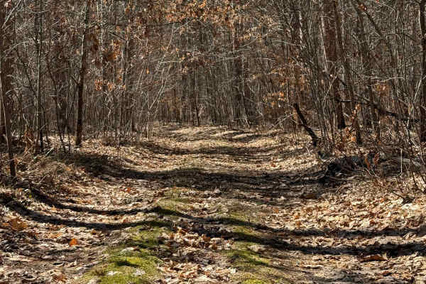
FS 8336
FS 8336 is an easy, bidirectional two-track in Michigan's Manistee National Forest that offers a quiet drive through a densely wooded section of the forest. Accessed from North Kettle Hole Road, the trail follows a dirt surface often covered with fallen leaves, creating a classic northern Michigan f...
Learn more about FS 8336
FS 8080
FS 8080 is an out-and-back trail that winds through Manistee National Forest. It starts off Marilla Road. The beginning of the trail is open with beautiful landscapes, and as you continue on, it becomes more and more dense with trees. At the end of the trail, you will encounter a turnaround that wil...
Learn more about FS 8080
Beginner ATV trails near Brethren, Michigan
Explore ATV-friendly trails near you. These trails are accessible for vehicles up to 50 inches wide, perfect for ATVs and smaller off-road machines.
FS 8783
FS 8783 is a classic Michigan two-track trail within the Manistee National Forest. Located right off River Road from the north or FS 8580 from the south, this trail is easily accessible. This trail surface consists of a dirt and sand combination. This trail is a pretty open trail that follows the po...
Learn more about FS 8783
FS 8580
FS 8580 is a laid-back and scenic bidirectional trail within the Manistee National Forest. Located right off River Road from the west side, this trail is easily accessible. If you choose to come from the east side, you will first need to go down FS 8783. This trail surface consists of a dirt, gravel...
Learn more about FS 8580
FS 8810
FS 8810 is a classic Michigan two-track trail within the Manistee National Forest. Located right off River Road, this trail is easily accessible. This trail surface consists of a dirt, sand, and gravel combination. This route weaves through a gorgeous section of pine trees within the forest. There a...
Learn more about FS 8810
FS 8789
FS 8789 is a laid-back and scenic "out and back" trail within the Manistee National Forest. Located right off River Road, this trail is easily accessible. This trail surface consists of a dirt, sand, grass, and leafy combination. This route twists through a beautiful portion of the forest, high abov...
Learn more about FS 8789
Beginner UTV/side-by-side trails near Brethren, Michigan
Find UTV and side-by-side trails near you. These trails accommodate vehicles up to 60 inches wide, ideal for UTVs, side-by-sides, and wider off-road rigs.
FS 8783
FS 8783 is a classic Michigan two-track trail within the Manistee National Forest. Located right off River Road from the north or FS 8580 from the south, this trail is easily accessible. This trail surface consists of a dirt and sand combination. This trail is a pretty open trail that follows the po...
Learn more about FS 8783
FS 8580
FS 8580 is a laid-back and scenic bidirectional trail within the Manistee National Forest. Located right off River Road from the west side, this trail is easily accessible. If you choose to come from the east side, you will first need to go down FS 8783. This trail surface consists of a dirt, gravel...
Learn more about FS 8580
FS 8810
FS 8810 is a classic Michigan two-track trail within the Manistee National Forest. Located right off River Road, this trail is easily accessible. This trail surface consists of a dirt, sand, and gravel combination. This route weaves through a gorgeous section of pine trees within the forest. There a...
Learn more about FS 8810
FS 8789
FS 8789 is a laid-back and scenic "out and back" trail within the Manistee National Forest. Located right off River Road, this trail is easily accessible. This trail surface consists of a dirt, sand, grass, and leafy combination. This route twists through a beautiful portion of the forest, high abov...
Learn more about FS 8789
The onX Offroad Difference
onX Offroad combines trail photos, descriptions, difficulty ratings, width restrictions, seasonality, and more in a user-friendly interface. Available on all devices, with offline access and full compatibility with CarPlay and Android Auto. Discover what you're missing today!
Open Trail Map