Best Multi-Day Overlanding Routes in the US: Maps, Terrain, and Planning Tips
Multi-day overlanding trips require solid planning, reliable maps, and an honest look at your vehicle’s capabilities. This guide covers some of the best routes across the country, from the 5,000-mile TransAmerica Trail to remote desert, alpine, Appalachian, and Arctic routes. You’ll find practical information on terrain types, seasonal timing, fuel planning, and vehicle preparation. You’ll also find onX Offroad Rugged Adventures—fully planned, multi-day off-road routes built with onX Trail Guides and Ambassadors, complete with downloadable Routes, camping Waypoints, fuel stops, trail obstacles, and points of interest.
The onX Offroad App helps you navigate offline, identify land boundaries, see trail closures or obstructions with Trail Reports, and find free, legal camping spots along the way with a proprietary Dispersed Camping Maps. Whether you’re planning your first overnight route or a month-long crossing, the right preparation makes the difference between a memorable trip and a miserable one.
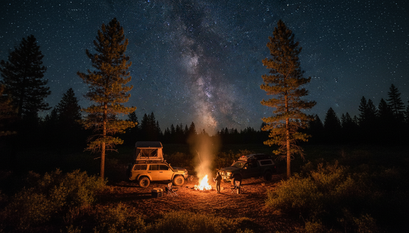
There’s a moment on every multi-day overlanding trip when the pavement ends, cell service disappears, and you realize you’re genuinely on your own. The landscape opens up. The pace slows down. And suddenly, you’re not just driving somewhere. You’re actually out there.
Multi-day overlanding trips demand more than a full tank and a sense of adventure. They require planning, the right maps, an honest assessment of your vehicle’s capabilities, and enough preparation to handle whatever the terrain throws at you. The payoff? Some of the most remote, beautiful, and rewarding experiences you can have on four wheels in this country.
This guide covers some of the best multi-day overlanding routes across the United States, breaks down the terrain you’ll encounter, and walks through the practical planning steps you need.
What Makes a Great Multi-Day Overlanding Route
Not every long trail qualifies as a true overlanding route. The best multi-day trips share a few common characteristics that set them apart from simple day trips strung together.
A quality overlanding route offers variety. You want changing landscapes, different terrain challenges, and scenery that rewards the slow pace of travel. The route should have logical camping options spaced at reasonable intervals, whether that’s established campgrounds, dispersed camping on public land, or designated overnight areas.
Access to water and resupply points matters too. You can carry a lot of gear in a well-equipped rig, but a five-day route with no fuel stops requires serious auxiliary tank capacity. The best routes balance remoteness with occasional touchpoints for fuel, water, and food.
Great overlanding routes also tell a story. They follow historic paths, traverse distinct ecosystems, or connect meaningful points of interest. You’re not just covering miles. You’re experiencing a region.
That’s also what makes onX Offroad Rugged Adventures useful for trip planning. Each Rugged Adventure is built as a multi-day route you can save and follow in the onX Offroad App, with Waypoints for camping, trail obstacles, fuel stations, and points of interest already mapped out.
Top Multi-Day Overlanding Routes Across the US
TransAmerica Trail
The TransAmerica Trail stretches roughly 5,000 miles from the Atlantic coast in North Carolina to the Pacific in Oregon. It’s the longest continuous off-road route in the country, and completing the entire thing is a bucket-list accomplishment for serious overlanders.
The TAT follows a patchwork of dirt roads, forest service routes, and two-track paths across the country. You’ll cross the Appalachian Mountains, traverse the Great Plains, climb through the Rockies, and descend into the high desert of the Pacific Northwest. Terrain ranges from muddy clay in the East to rocky mountain passes in Colorado to sandy washes in the desert Southwest.
Most overlanders break the TAT into sections, tackling a week or two at a time over multiple years. The eastern sections through Tennessee, Mississippi, and Arkansas tend to be muddier and more technical after rain. The western half, particularly through Colorado, Utah, and Nevada, offers more dramatic scenery but demands attention to elevation changes and exposure.
Plan for at least three weeks if you want to complete the full route without rushing. Many people take a month or more, building in rest days and side explorations.
Mojave Road
Location: Eastern California, from Needles to Barstow
The Mojave Road runs approximately 140 miles across California’s Mojave Desert, following a historic trade and mail route that predates paved highways. It’s one of the more accessible multi-day routes for overlanders based in the Southwest, and it packs a surprising amount of variety into its relatively short length.
Starting near Needles on the Arizona border and ending near Barstow, the route crosses open desert, climbs through volcanic rock formations, passes by abandoned mines, and skirts the edges of several wilderness areas. The terrain is mostly sandy and rocky, with a few technical sections that require careful line selection.
Three to four days is a comfortable pace for the Mojave Road. This gives you time to explore side routes, visit historic sites like Fort Piute, and camp at scenic spots without feeling rushed. Water is extremely scarce along the route, so you’ll need to carry everything you need or know exactly where the few reliable springs are located.
The best time to run the Mojave Road is late fall through early spring. Summer temperatures regularly exceed 110°F, which is dangerous for both vehicles and people.
White Rim Trail
Location: Canyonlands National Park, Utah (Permit required)
The White Rim Trail is a 100-mile loop that drops below the Island in the Sky mesa and winds through some of the most dramatic red rock scenery in the American Southwest. It’s a permitted route, which means you’ll need to plan ahead and secure camping reservations, but the extra effort is worth it.
The trail itself isn’t extremely technical by overlanding standards, but it’s exposed, remote, and unforgiving of mechanical failures. You’ll traverse ledges with significant drop-offs, navigate rocky sections that test suspension travel, and climb steep grades that demand low-range gearing.
Most overlanders complete the White Rim in two to three days. The permit system limits the number of vehicles on the trail, which means you’ll enjoy a relatively uncrowded experience even during peak season. Camping is restricted to designated sites along the route, and each site is assigned when you get your permit.
Spring and fall offer the best conditions. Summer brings extreme heat, and winter can see snow and ice on the higher sections of the trail.
Backcountry Discovery Routes
Location: Multiple states across the western U.S.
The Backcountry Discovery Routes are a series of point-to-point routes designed specifically for adventure motorcycles and 4×4 vehicles. Each BDR traverses an entire state using a combination of dirt roads, forest service routes, and connecting pavement.
Currently, BDRs exist for Arizona, California, Colorado, Idaho, Nevada, New Mexico, Oregon, Utah, Washington, and several other states. Each route takes between five days and two weeks to complete, depending on the state and your pace.
The terrain varies dramatically by route. The Arizona BDR includes desert washes and high-elevation pine forests. The Colorado BDR climbs multiple mountain passes above 12,000 feet. The Washington BDR winds through dense Pacific Northwest forests and crosses the Cascade Range.
What makes the BDRs particularly useful for planning is the quality of documentation available. Each route has detailed maps, GPS tracks, and information about fuel stops, camping, and terrain difficulty. They’re designed to be achievable for stock or lightly modified vehicles, though some sections on certain routes push into more challenging territory.
onX Offroad Rugged Adventures
onX Offroad Rugged Adventures are multi-day off-road trips created with onX Trail Guides and Ambassadors. Each route can be saved in the onX Offroad App as a custom Folder, giving you a ready-to-follow Route plus Waypoints for camping, fuel stations, trail obstacles, and points of interest. That makes them especially useful if you want a mapped multi-day overlanding route without starting from a blank map.
The following Rugged Adventures are strong options for overlanders looking for planned, multi-day routes across different regions and terrain types.
Mount Baker Route
Location: Washington
Best for: Pacific Northwest forest roads, ridge-line camping, and mountain views
The Mount Baker Route is a three-day overlanding route through Mount Baker National Forest in Washington. This Rugged Adventure highlights classic Pacific Northwest terrain, including evergreen forest roads, river corridors, remote camps, logging history, and high-elevation viewpoints.
The route is a strong choice for overlanders who want a forested multi-day trip with a mix of scenic driving and destination-based stops. Ridgeline camping and a fire lookout objective give the trip a true backcountry feel, while the established route structure makes planning more manageable.
Because this route is built as an onX Offroad Rugged Adventure, you can save the full Route and supporting Waypoints in the App before you go. That gives you offline access to the route, campsites, and key planning details once cell service drops.
Desert to Alpine Backcountry Route
Location: Southern California
Best for: Desert travel, mountain roads, and major elevation changes
The Desert to Alpine Backcountry Route connects the desert terrain around Joshua Tree and Johnson Valley with the cooler alpine forests near Big Bear. Few routes show off Southern California’s terrain variety this clearly, making it a memorable option for a multi-day overlanding trip.
Over the course of the route, you’ll move from open desert and sandy tracks into forested mountain roads and higher-elevation terrain. That transition requires smart planning, since weather, temperatures, traction, and vehicle demands can change significantly from one section to the next.
As a Rugged Adventure, this route includes mapped Waypoints for key stops, obstacles, camping, and points of interest. It’s a useful option for overlanders who want the contrast of desert and alpine travel without having to build the full route from scratch.
Colorado to Utah: Desert vs. Mountains Route
Location: Colorado and Utah
Best for: Desert scenery, mountain terrain, creek crossings, and Colorado River camping
The Colorado to Utah: Desert vs. Mountains Route is a 225-mile multi-day route from Delta, Colorado, to Professor Valley, Utah. It connects high-desert terrain, rocky roads, creek crossings, aspen country, and Colorado River camping into one point-to-point overlanding trip.
This route is a good fit for overlanders who want both mountain and desert terrain in a single trip. One day may bring shaded forest roads and creek crossings, while another opens into red rock, desert tracks, and wide views across the Utah backcountry.
Because it’s part of onX Offroad Rugged Adventures, the route comes with downloadable navigation and Waypoints for camps, fuel, obstacles, and points of interest. That structure makes it easier to plan your mileage, overnight stops, and resupply points before heading into remote sections.
Ozarks: Headwaters + Highlands Route
Location: Arkansas and Missouri Ozarks
Best for: Waterfalls, forest roads, scenic camps, and approachable Midwest overlanding
The Ozarks: Headwaters + Highlands Route is a customizable three-day overlanding route through the Ozarks. It combines scenic trail miles, waterfalls, hiking opportunities, historic stops, primitive dispersed campsites, and more developed campground options.
This is a strong choice for overlanders who want a balanced multi-day route that feels remote without requiring an extreme expedition setup. The route can work well for solo travelers, families, or groups looking for a flexible Midwest overlanding trip with plenty of natural features along the way.
As a Rugged Adventure, the route is already organized inside onX Offroad with a Route and supporting Waypoints. That makes it easier to choose campsites, identify points of interest, and adjust the route based on time, weather, or vehicle capability.
Maine’s Mighty Moose Traverse
Location: Maine
Best for: Remote East Coast backcountry, lakes, rivers, and North Woods scenery
Maine’s Mighty Moose Traverse covers more than 170 miles of remote backcountry, beginning near Greenville and following a stretch of the Golden Road before winding through western Maine’s mountains, lakes, rivers, and wildlife habitat.
For East Coast overlanders, this route offers a rare combination of distance, remoteness, and classic North Woods terrain. Expect forest roads, water features, wildlife viewing opportunities, and long stretches where planning ahead for fuel, camping, and navigation matters.
The Rugged Adventure format makes the route easier to prepare for by packaging the Route and relevant Waypoints inside onX Offroad. Before heading out, you can review the full track, save offline maps, and identify key stops along the way.
Monongahela 200
Location: West Virginia
Best for: Rocky forest roads, water crossings, mud, and Appalachian scenery
The Monongahela 200 is a 200-mile route through West Virginia’s Monongahela National Forest. Starting on the Canaan Loop outside Davis, the route mixes rocky technical sections, muddy ruts, water crossings, faster gravel roads, scenic hikes, and East Coast campsites.
This route is a strong option for overlanders who want a more technical Appalachian route without committing to a cross-country expedition. Terrain conditions can change quickly, especially after rain, so good tires, recovery gear, and smart line choice matter.
As an onX Offroad Rugged Adventure, the Monongahela 200 includes mapped route details and Waypoints for camps, obstacles, fuel, and points of interest. That makes it easier to plan each day’s mileage while still getting the feel of a rugged, self-supported overlanding trip.
Remote Appalachia
Location: Tennessee
Best for: Remote ridgelines, rocky switchbacks, caves, elk country, and dark-sky camping
Remote Appalachia is a 150-mile overlanding route through Tennessee’s Cumberland Plateau and surrounding Appalachian terrain. The route includes rocky switchbacks, misty ridgelines, caves, elk habitat, and remote camping opportunities.
This is a good choice for overlanders looking for an Appalachian route with a more isolated feel. The terrain is varied enough to keep the drive interesting, while the landscape offers a mix of forest roads, overlooks, and backcountry stops.
Because Remote Appalachia is part of Rugged Adventures, you can save the mapped Route and Waypoints in onX Offroad before the trip. That helps with offline navigation, camp planning, and identifying important stops once you’re away from cell coverage.
Arctic Overland Adventure
Location: Alaska and Northwestern Canada
Best for: Long-distance expedition travel, tundra, gravel highways, ferries, and Arctic Ocean access
The Arctic Overland Adventure is a long-distance northern route that follows the Alaska Highway from Dawson Creek toward Tuktoyaktuk on the Arctic Ocean. This route links hot springs, mountain passes, gravel stretches, ferries, tundra, and long daylight hours under the midnight sun.
This is one of the more serious Rugged Adventures because of its scale, remoteness, and logistics. Overlanders should plan carefully for fuel range, tire damage, weather changes, ferry schedules, and long distances between services.
As a Rugged Adventure, the route gives you a mapped framework to build from, including key Waypoints and planning details inside onX Offroad. For overlanders who want a true northern expedition, it offers a structured way to approach one of the most remote road-based adventures in North America.
Alpine Loop
Location: San Juan Mountains, Colorado
The Alpine Loop connects the historic mining towns of Lake City, Silverton, and Ouray via a network of high-altitude passes. The core loop is about 65 miles, but the surrounding area offers enough side routes and extensions to fill a week of exploration.
This route climbs over Engineer Pass and Cinnamon Pass, both exceeding 12,000 feet in elevation. The terrain is rocky, steep, and narrow in places, with exposure that demands respect. You’ll pass abandoned mines, ghost towns, and alpine meadows filled with wildflowers in summer.
Two to four days works well for the Alpine Loop, depending on how many side trips you want to include. The towns at each corner of the loop offer fuel, food, and lodging if you want to mix camping with the occasional hot shower.
The Alpine Loop is only accessible from late June through September, depending on snowpack. In summer, afternoon thunderstorms are common at elevation, and the rocky terrain becomes slick when wet.
Rubicon Trail
Location: Sierra Nevada, California (Permit required)
The Rubicon Trail is only 22 miles long, but it’s earned a reputation as one of the most challenging 4×4 routes in the country. Running through the Sierra Nevada, the Rubicon features massive granite slabs, deep water crossings, and technical obstacles that test even heavily modified vehicles.
This isn’t a route for stock vehicles or inexperienced drivers. The Rubicon demands serious articulation, rock sliders, skid plates, and the knowledge to use them. Breakdowns are common, and recovery can be complicated by the remote terrain.
Most groups take two to three days to complete the Rubicon, camping at established sites like Rubicon Springs along the way. The social aspect is part of the experience. You’ll likely encounter other groups, and helping each other through difficult sections is expected.
The Rubicon opens after snowmelt, typically in July, and remains accessible through October. Permits are required, and vehicle limits help manage impact on the fragile alpine environment.
Dalton Highway
Location: Alaska, Fairbanks to Deadhorse
The Dalton Highway runs 414 miles from Fairbanks to Deadhorse on the Arctic Ocean, following the Trans-Alaska Pipeline through some of the most remote terrain accessible by road in North America. It’s not a technical trail, most of the route is gravel. But the isolation, weather, and distance from services make it a serious overlanding undertaking.
You’ll cross the Arctic Circle, traverse the Brooks Range through Atigun Pass, and drive across the North Slope tundra to the edge of the continent. Wildlife is abundant, including caribou, grizzly bears, and musk oxen. The landscape shifts from boreal forest to treeless tundra as you head north.
Plan for four to seven days round trip, depending on how much time you spend exploring side areas and waiting out weather. Fuel is available at only three points along the entire route, so auxiliary fuel capacity is essential. Tire damage is common on the rough gravel, and you should carry at least two full-size spares.
The Dalton is accessible from late May through September. Summer brings 24 hours of daylight north of the Arctic Circle, which is disorienting but allows for flexible travel schedules.
How to Choose the Best Multi-Day Overlanding Route
The best multi-day overlanding route depends on your vehicle, experience level, available time, and appetite for remoteness. A first-time overlander in a lightly modified 4×4 may be better served by a planned weekend route like the Ozarks: Headwaters + Highlands. A more experienced driver with recovery gear and remote travel experience might look toward routes like the Monongahela 200, Colorado to Utah, the Dalton Highway, or a longer Backcountry Discovery Route.
Use these questions to narrow your options:
- How many days do you actually have, including travel to and from the route?
- Does your vehicle have the clearance, tires, armor, and recovery points needed for the terrain?
- How far apart are fuel, water, and resupply points?
- Are there legal camping options spaced throughout the route?
- Are permits, seasonal closures, or land-use restrictions part of the planning process?
- Do you want a raw route-building challenge or a mapped route you can download and follow?
For many overlanders, a planned route is the best place to start. Rugged Adventures give you a route framework, known Waypoints, and a better sense of what to expect before you ever leave home.
Planning Your Multi-Day Route
Mapping and Navigation
Reliable navigation is non-negotiable for multi-day trips in remote areas. Paper maps provide a backup and help with big-picture route planning, but digital tools have become essential for real-time navigation and tracking.
Download Offline Maps for your entire route before you leave cell coverage. The onX Offroad App lets you download detailed topographic maps, trail data with difficulty ratings, and satellite imagery for use without a signal. Being able to see trail conditions, seasonal closures, and user-submitted photos helps you anticipate what’s ahead.
If you’re starting with a Rugged Adventure, save the custom Folder before your trip. These Folders include the Route plus Waypoints for camping, obstacles, fuel stations, and points of interest, giving you a stronger planning foundation before you get to the trailhead.
Mark additional Waypoints for backup fuel stops, water sources, camping options, and potential bail-out points. Having these saved in advance means you’re not scrambling to find information when you need it most.
Understanding Land Boundaries
Multi-day routes frequently cross between different land management jurisdictions. National forests, Bureau of Land Management land, state trust land, and private property all have different rules about access, camping, and vehicle use.
Knowing where public land ends and private property begins prevents uncomfortable encounters and potential legal issues. The onX Offroad App displays land ownership boundaries clearly, which becomes especially useful when you’re looking for dispersed camping spots or trying to determine if a side road is legal to explore.
Fuel and Resupply Planning
Calculate your vehicle’s range conservatively, then plan fuel stops with margin to spare. Multi-day routes often have longer gaps between services than you might expect, and factors like soft sand, steep grades, and heavy loads all reduce fuel economy.
Map out each segment of your route with distances between fuel stops. If any segment exceeds your comfortable range, plan to carry extra fuel or adjust your route accordingly.
Camping and Water
Identify camping options along your route before you leave. Some routes have designated campgrounds with amenities. Others rely entirely on dispersed camping on public land. Know the regulations for each area. Some require permits, others have fire restrictions, and a few prohibit camping entirely.
Water is heavy, but dehydration in remote areas is dangerous. Carry more than you think you’ll need, and know where reliable water sources exist along your route. A filtration system provides backup if you need to resupply from natural sources.
Vehicle Preparation
A multi-day trip puts sustained stress on your vehicle in ways that day trips don’t. Address maintenance items before you leave, not on the trail.
Check these systems thoroughly before departure:
- Tires, including sidewall condition and tread depth.
- Brakes, especially if you’ll encounter steep descents.
- Fluids including oil, coolant, transmission, and differential.
- Belts and hoses for wear or cracking.
- Battery terminals and charge.
- Suspension components for play or damage.
Carry spares and tools appropriate for your vehicle and the route’s remoteness. At minimum, bring a full-size spare tire, basic hand tools, a tire repair kit, an air compressor, and recovery gear including traction boards and proper recovery points. For very remote routes, consider carrying two full-size spares and additional fuel.
Communication and Safety
Let someone know your route and expected timeline. Check in when you have cell service, and establish a protocol for what happens if you miss a check-in.
A satellite communicator provides a safety net in areas without cell coverage. These devices allow you to send messages and, in emergencies, summon help from anywhere. The peace of mind is worth the investment for serious multi-day trips.
Carry a comprehensive first aid kit and know how to use it. Remote areas mean delayed medical response, so basic wilderness first aid knowledge becomes genuinely important.
Getting Out There
Multi-day overlanding trips offer something you can’t get from day trips or paved-road travel. The rhythm of life slows down when you’re measuring progress in terrain crossed rather than miles per hour. You notice things. The way light changes through the day. The sounds of a landscape without traffic. The satisfaction of making camp in a place you reached under your own power.
The routes covered here represent some of the best opportunities for multi-day exploration in the U.S., but they’re just starting points. Every region has its own network of backroads, forest routes, and connecting trails waiting to be discovered.
If you want to start with a route that’s already been scouted, mapped, and organized for multi-day travel, explore onX Offroad Rugged Adventures. Save a Route, download Offline Maps, review the Waypoints, prepare your vehicle, and set realistic expectations for your first trip.
The trails are out there. The only question is which one you’ll explore first.
Frequently Asked Questions
The best multi-day overlanding route depends on your location, vehicle, experience level, and how remote you want to be. Classic routes like the TransAmerica Trail, White Rim Trail, Mojave Road, Backcountry Discovery Routes, Alpine Loop, and Dalton Highway are all strong options. If you want a route that’s already mapped with camping, fuel, obstacles, and points of interest, onX Offroad Rugged Adventures are a good place to start because they’re built as downloadable multi-day trips inside the onX Offroad App.
A stock 4×4 SUV or truck with good ground clearance can handle many multi-day routes. More technical trails like the Rubicon require significant modifications. Match your vehicle to your chosen route rather than trying to force a mismatch. Start with easier routes and work up as you gain experience and upgrade your rig.
Public land managed by the Forest Service and BLM generally allows dispersed camping unless posted otherwise. Look for established pullouts and fire rings that indicate previous use. The onX Offroad App has a Dispersed Camping Layer that helps identify campsite options at a glance with local rules like distance from the road and stay limits.
Some routes require permits, while others don’t. National park routes like the White Rim Trail always require permits. BLM and national forest routes generally don’t, though some popular areas have implemented permit systems to manage use. Research permit requirements for your specific route well in advance. Popular permits can book up months ahead.
Start with a route that matches your experience level and vehicle capability. The Mojave Road offers a good introduction to desert overlanding without extreme technical challenges. State Backcountry Discovery Routes are designed to be accessible for stock vehicles. Rugged Adventures like the Ozarks: Headwaters + Highlands Route, and Mount Baker Route can also be strong first multi-day options because they’re planned routes with key Waypoints already mapped in onX Offroad.
Preparation is your best defense. Maintain your vehicle properly, carry appropriate spares and tools, and know basic repair skills. Travel with another vehicle when possible, especially on remote routes. Carry a satellite communicator for emergencies. Know your bail-out options along the route, meaning points where you can reach pavement and services if needed.