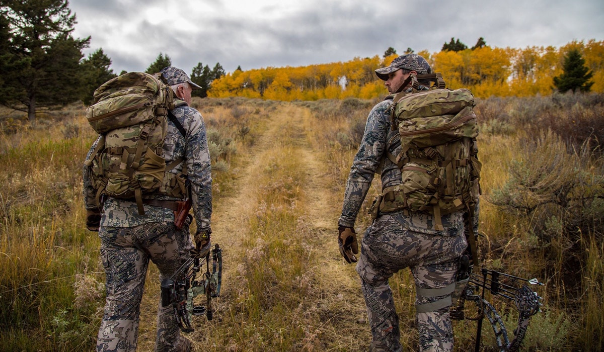
Federal Land Management Agencies Are Digitizing Access Routes for Better Adventures
On the fourth anniversary of the MAPLand Act, the U.S. Forest Service and five other federal land management agencies released key data to support better recreation access for all. Read more to learn how that can impact your adventures this year while using onX Hunt and onX Offroad.
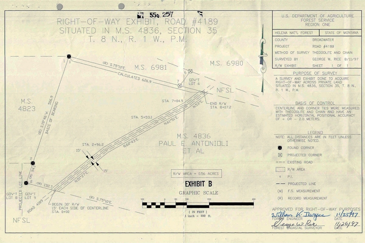
Public land access is best preserved and stewarded when everyone has clear, accurate information. But for decades, some access-related documentation existed only on paper records, lined up neatly on a library’s worth of shelves, dispersed across government office buildings around the country. These paper files, some going back to the late 1800’s, contain a wealth of information about where and how the public can access certain public lands. And though they have been tended carefully by their record-keepers, they have never been completely safe from floods, fires, or mold, and they certainly weren’t easy for the public to view.
The Modernizing Access to Our Public Land (MAPLand) Act is helping change that.
As of spring 2026, the agencies have digitally published more than 30,000 easements, marking one of the biggest public-access transparency milestones in recent memory.

What Is the MAPLand Act?
The MAPLand Act, signed into law in 2022, requires each of the federal land management agencies to digitize records and regulations in a map-compatible format. The agencies involved are the U.S. Forest Service, Bureau of Land Management, National Park Service, U.S. Fish and Wildlife Service, Bureau of Reclamation, and U.S. Army Corps of Engineers. Since the passage of the act, these agencies have worked together to create a single, standardized geographic data system so that each agency records and adds to the data in the same way nationwide.
The Theodore Roosevelt Conservation Partnership (TRCP) has been the unwavering champion of the MAPLand Act, from the earliest days of conceptualizing the bill to advocating for implementation today. This work is in the service of all outdoor adventurers, ensuring access to the public lands we all own. “This MAPLand Act milestone is a significant step forward in ensuring that hunters and anglers have more complete information about their access opportunities,” said Joel Webster, Chief Conservation Officer with TRCP. “We are excited to see this additional access easement information included in the onX platform for everyone to use and enjoy. TRCP will continue to work with the federal agencies to see the successful implementation of the MAPLand Act law.”
The bipartisan support of this bill reflected the strong collaboration among public, private, and non-profit sectors. At every stage, the MAPLand Act demonstrated that public access to public land is something that all Americans cherish. As a company that makes navigation tools and advocates for sustainable access to the outdoors, onX has been proud to support this effort from the beginning. In the case of MAPLand, access to data is access to land.

As MAPLand work progresses, we can expect to see more access data, including:
- More public easements and rights-of-way (more on that below).
- Information about which roads and trails on federal lands are open or closed.
- The dates that roads and trails on federal land are seasonally closed each year.
- The classes of vehicles and types of recreational uses that are allowed on each segment of roads and trails on the federal land, including the permissibility of off-highway vehicles, motorcycles, nonmotorized and electric bicycles, passenger vehicles, and over-snow vehicles.
- The boundaries of areas where hunting or recreational shooting (including archery, firearm discharge, and target shooting) is regulated or closed on federal lands.

What Are Public Access Easements and Rights-of-Way?
Public easements and rights-of-way held by federal land management agencies that allow members of the public to travel through non‑federal property to reach public land. In simple terms, an easement is a legal right that allows someone to use another person’s property for a specific purpose—in this case, public access to land we all own. Subject to the terms, restrictions, and conditions applicable to the easement, access is available through varied modes of transportation. In some cases, these easements may be the only way of accessing thousands of acres of federal land, and oftentimes adventurers don’t know they exist. This is why the MAPLand Act is so important; it’s bringing hard-to-find information about legally perfected easements to light, giving everyone more opportunities to access federal land. MAPLand isn’t about creating more rights-of-way, so there is no cost to the agencies or taxpayers to acquire the easements already represented on paper.

Why This Matters to onX and Our Customers
At onX, we believe that better recreation data builds a more engaged community of stewards: when people can experience a place, they can form a connection with it. We also believe that when land managers, search-and-rescue personnel, neighboring landowners, and adventurers are all equipped with the same information, everyone can enjoy a safer, more equitable outdoor experience. Better data means better planning, which means people travel in the backcountry more responsibly and confidently.
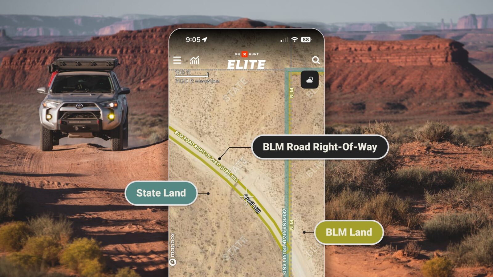
How to View Public Access Easements in onX Hunt and Offroad
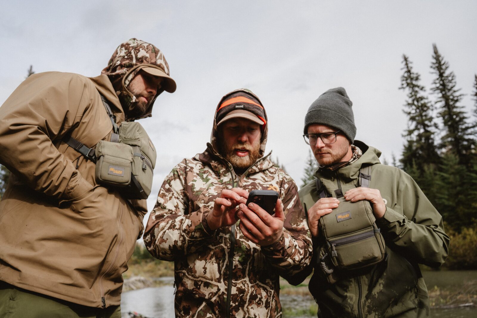
Find new access routes to parcels of federal public land by using onX Hunt and onX Offroad. With this information in your back pocket, even when you’re using Offline Maps, you’ll have what you need to reduce confusion, avoid accidental trespass, and make safer choices in the field.
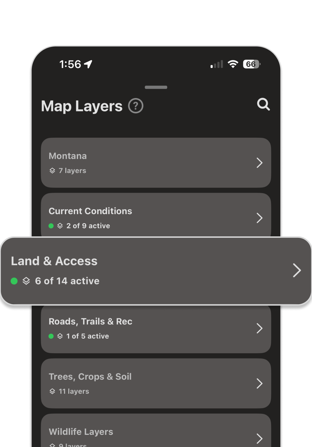
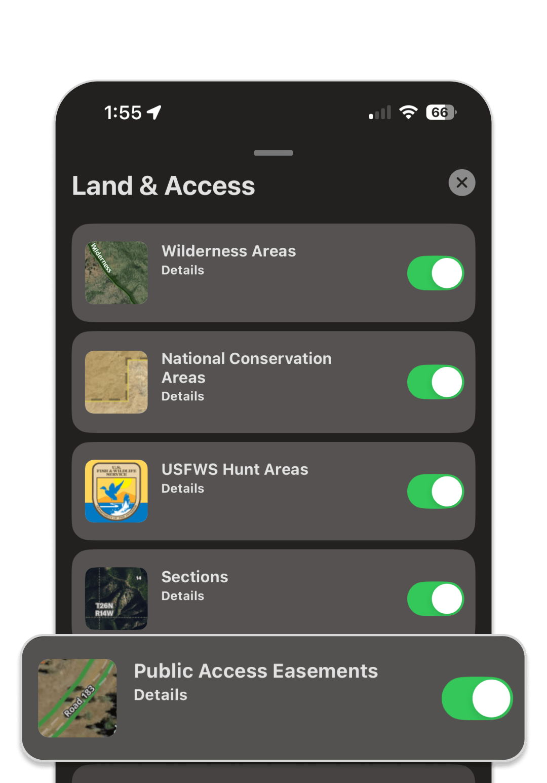
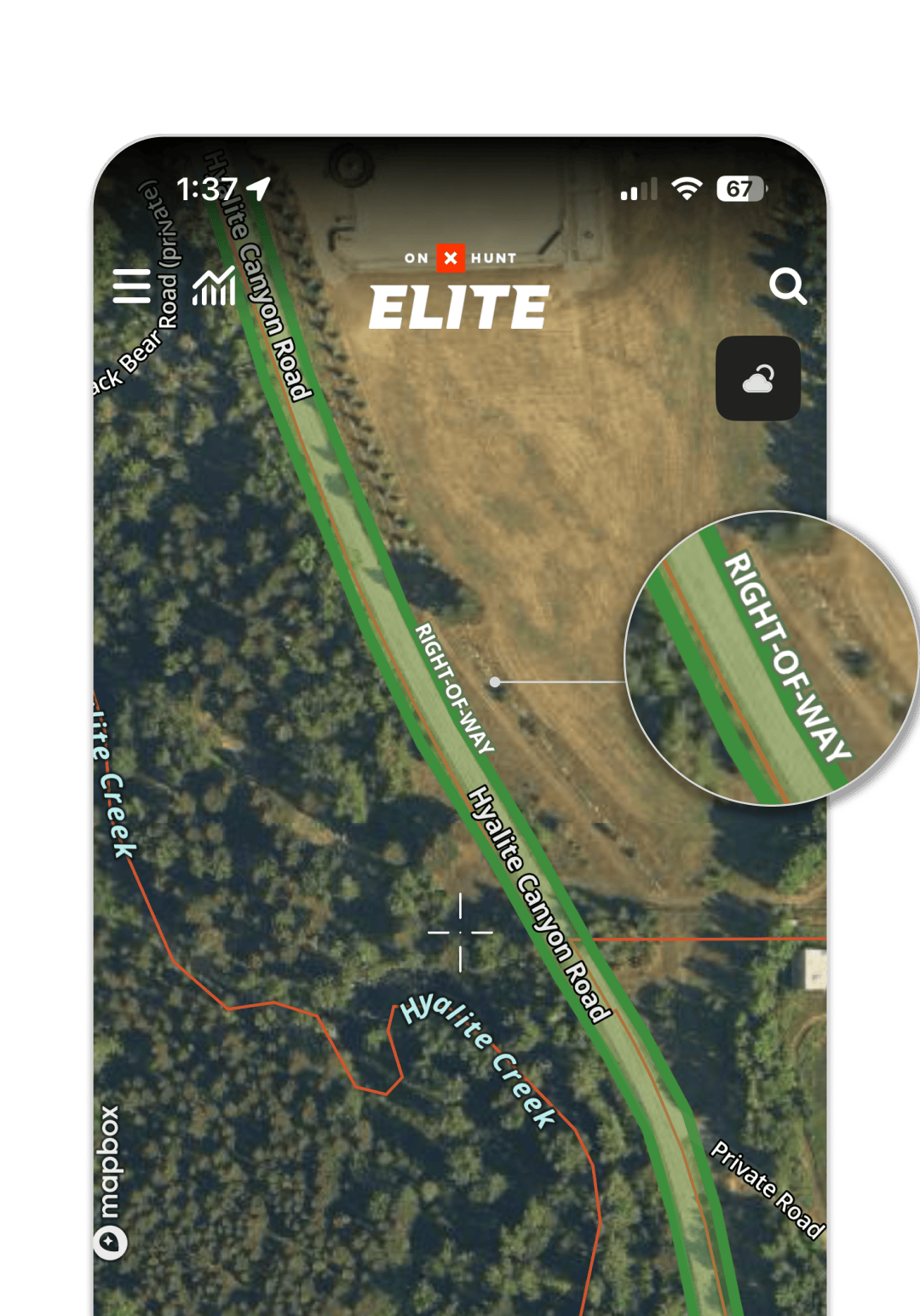
In onX Hunt, to see the federal agency easements, select Land & Access in your Layers tab. Within that, toggle on Public Access Easements. In onX Offroad, this information is automatically displayed. In both Apps, easements will appear color-coded according to the agency that manages them, and when you zoom in, you’ll see the label, “RIGHT-OF-WAY.” As the agencies built this dataset over the past few years, onX has been incorporating the data as it has become available. So far, we display 30,274 easements, but there are many more expected from the managing agencies over the coming years, so be on the lookout.
onX Hunt In-App Instructions
![]()
In onX Offroad, this information is automatically displayed.
Responsible Recreation Around Easements and Rights-of-Way
As adventurers, we have a responsibility to uphold good stewardship practices. Here are some things to remember when traveling across easements:
| Do | Don’t |
|---|---|
| Move slowly—reduce dust, wear and tear, and noise. | Don’t speed through as quickly as you can. |
| Stay on the easement. | Don’t deviate outside the easement for any reason. |
| Wave and smile at landowners. Be courteous and appreciative. | Don’t have a sense of entitlement to this access. |
| Turn your vehicle around if it’s muddy, park where it’s safe on a public road, and walk instead. | Don’t leave ruts in the road. |
| Use on-the-ground context cues, and be aware that some easements may not follow a clear road or trail. | Don’t assume the 30,000-foot view of the data is infallible. |
| Share this information with others in a respectful way. | Don’t make demands or escalate tension. |
| Notify the MAPLand Act data managers or the local office of the land management agency about any discrepancies you find on the ground, like a No Trespassing sign on an easement. | Don’t assume the sign reflects legal reality, nor assume it is automatically safe to proceed. |
| If an easement is blocked or impassible, report it to the managing agency. | Don’t assume the blockade is malicious, or damage any private property. |
| Continue through the easement efficiently. | Don’t linger, stop, take photos, or have lunch. |
| Leave gates how you find them: open if open, and closed if closed. | Don’t mess up a landowner’s livestock management. |
| Follow Tread Lightly! principles. | Don’t litter. |
For landowners: The addition of legal rights-of-way on the map could mean an uptick in traffic through previously quiet areas. If you feel as if recreators are traveling in the wrong, please review your property records and then notify the MAPLand Act data managers.

A Digital Future
As the agencies continue their digitization work, onX will keep adding new easements, road status information, and hunting and shooting regulations to our products so that our customers have the most up-to-date information. It’s a continued effort in collaboration with TRCP and the land management agencies, and we’re grateful for everyone’s work to increase public access to public land.